


This week's forecast
This week's forecast


Joined:
X days ago
# Posts:
X,XXX
Contributor Points:
X


This week's forecast From Space City Weather - Houston may see some not-so-cold November rain. Eric Berger · Monday, November 9, 2026 6:50 AM 👉In brief: *In today's post we discuss Monday's rain chances with an area of storms inbound from the southwest.
*We also look ahead to some of the region's coldest nights of the season and a pleasant weekend. 👉MONDAY - *Sunday's high temperature in Houston reached 66 degrees, our coolest daytime since mid-April.
*Today will be similar, with mostly cloudy skies helping to keep highs in the mid-60s.
*These clouds are being driven by a low pressure system in the mid- and upper-levels of the atmosphere, and this pattern should persist through tonight before the upper-level system slides off to the east.
*The main question today is whether the Houston region will see some rain.
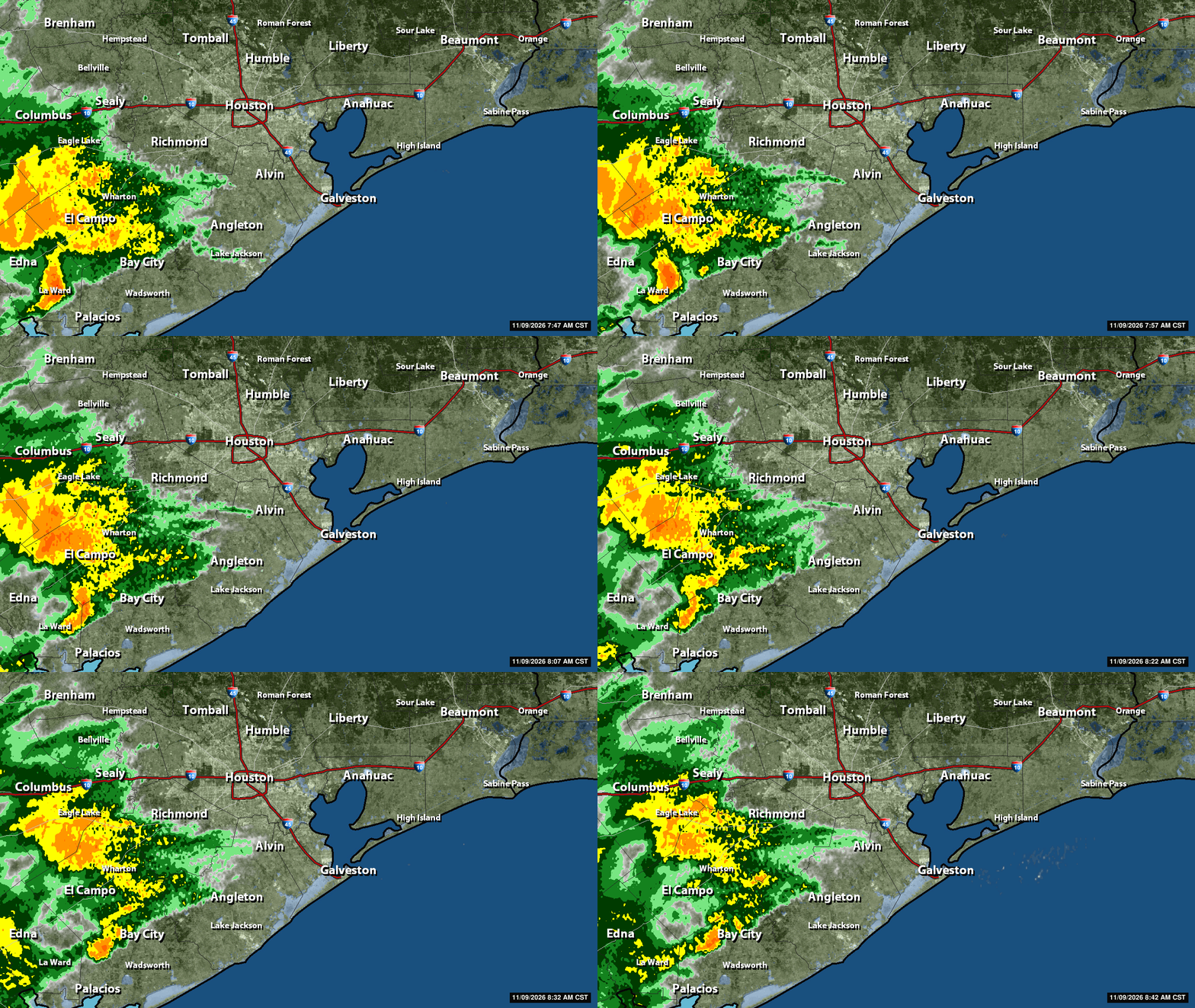
*This morning, around sunrise, there is a large area of showers and thunderstorms stretching from Victoria to El Campo, to the southwest of the Houston region.
*These showers are moving toward Houston, and should reach areas such as Sugar Land and Katy by mid-morning.
*The rains will gradually spread across the entire region later today, but they will lose some of their intensity as they get closer to the city.
*Overall most of the area will likely see one or two tenths of an inch of rain today (less for areas north and east of Houston), with isolated areas picking up more. 850AM radar - 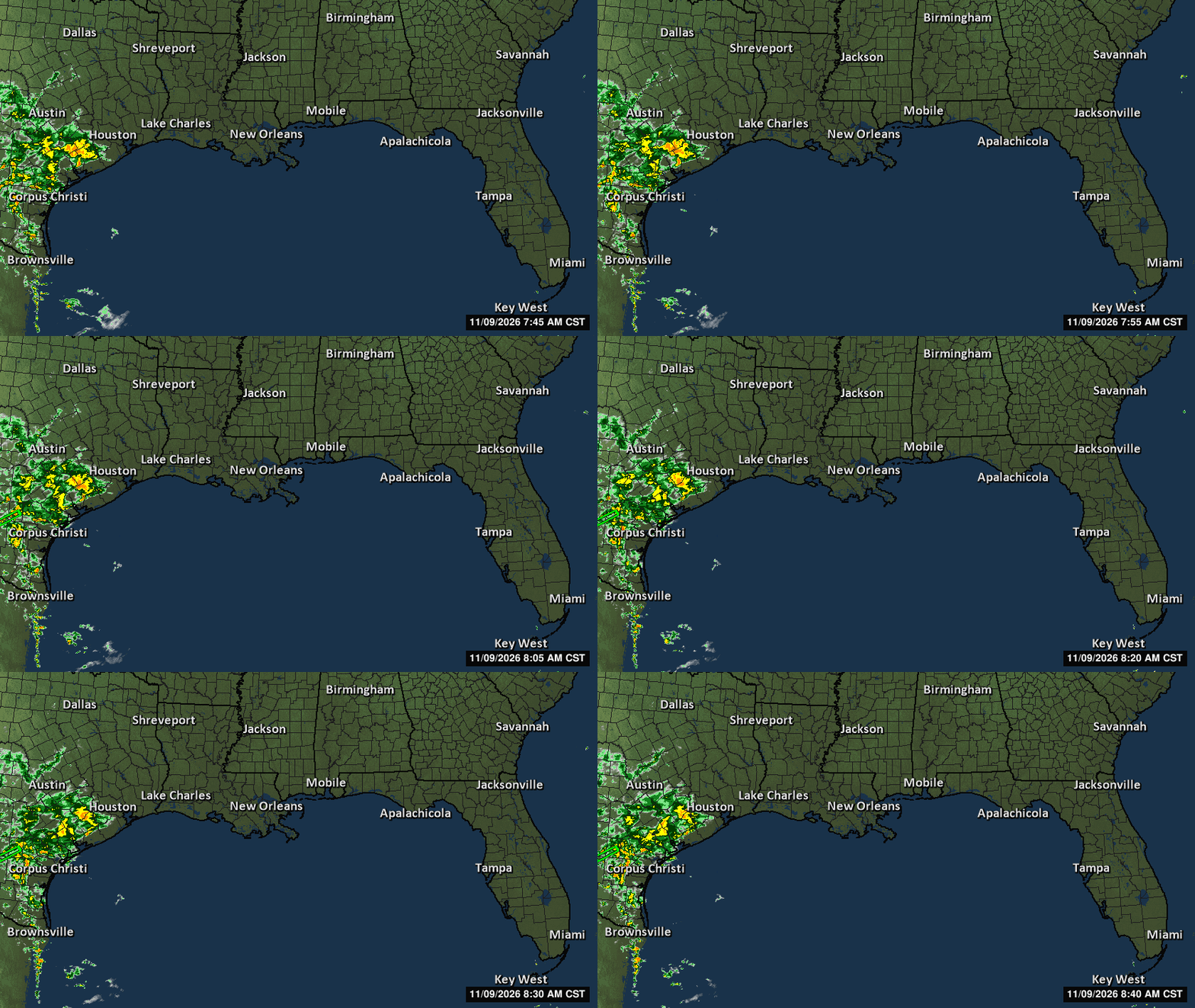
 *Light rain chances persist this evening.
*Low temperatures tonight will again drop into the upper 50s in Houston, with cooler conditions for inland areas. 👉TUESDAY - *This will be a partly sunny and warmer day, with highs in the mid-70s for most locations with very light northerly winds.
*There will be a slight chance of light rain on Tuesday and Tuesday night, with lows dropping into the lower 60s. 👉WEDNESDAY - *This slight chance of rain will persist into Veterans Day on Wednesday, but I'm hopeful it won't be too disruptive for remembrances.
*Skies will be mostly cloudy with highs likely in the upper 70s.
*Lows on Wednesday night will drop into the lower 60s.
*At some point on Wednesday night, probably after midnight, a cool front will push into the region.
*I don't think it will bring any precipitation with it. 👉THURSDAY and FRIDAY - *These should be mostly sunny days with high temperatures in the low- to mid-70s.
*The air will be quite dry, and on Thursday we may see some northerly wind gusts of about 20 mph before things calm down.
*Lows on Thursday and Friday nights will be chilly in Houston, with temperatures likely dropping into the low to mid-50s.
*Outlying areas should see some readings in the 40s. 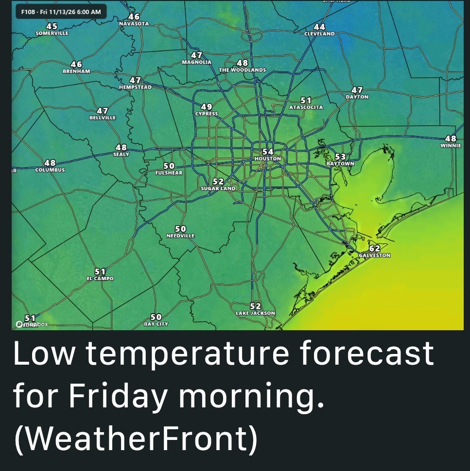 👉SATURDAY and SUNDAY - *The weekend should bring more mostly sunny skies with highs in the lower 70s, probably.
*We'll see a gradual warming trend as the onshore flow resumes.
*Nights will be several degrees warmer, but should still feel "cool" in the upper 50s.
*With the onshore flow we may start to see some lower-end rain chances on Sunday or Sunday night.
*We'll keep an eye on those rain chances to see how they develop. 👉NEXT WEEK - *Overall conditions look fairly mild next week.
*We probably are in a pattern where highs are in the 70s, and lows in the 50s or 60s, with nothing too extreme.
*Don't look now but we're only two weeks away from the start of Thanksgiving week.
Cbear and BELIEVE reacted *We also look ahead to some of the region's coldest nights of the season and a pleasant weekend.
*Today will be similar, with mostly cloudy skies helping to keep highs in the mid-60s.
*These clouds are being driven by a low pressure system in the mid- and upper-levels of the atmosphere, and this pattern should persist through tonight before the upper-level system slides off to the east.
*The main question today is whether the Houston region will see some rain.
*This morning, around sunrise, there is a large area of showers and thunderstorms stretching from Victoria to El Campo, to the southwest of the Houston region.
*These showers are moving toward Houston, and should reach areas such as Sugar Land and Katy by mid-morning.
*The rains will gradually spread across the entire region later today, but they will lose some of their intensity as they get closer to the city.
*Overall most of the area will likely see one or two tenths of an inch of rain today (less for areas north and east of Houston), with isolated areas picking up more.
*Low temperatures tonight will again drop into the upper 50s in Houston, with cooler conditions for inland areas.
*There will be a slight chance of light rain on Tuesday and Tuesday night, with lows dropping into the lower 60s.
*Skies will be mostly cloudy with highs likely in the upper 70s.
*Lows on Wednesday night will drop into the lower 60s.
*At some point on Wednesday night, probably after midnight, a cool front will push into the region.
*I don't think it will bring any precipitation with it.
*The air will be quite dry, and on Thursday we may see some northerly wind gusts of about 20 mph before things calm down.
*Lows on Thursday and Friday nights will be chilly in Houston, with temperatures likely dropping into the low to mid-50s.
*Outlying areas should see some readings in the 40s.
*We'll see a gradual warming trend as the onshore flow resumes.
*Nights will be several degrees warmer, but should still feel "cool" in the upper 50s.
*With the onshore flow we may start to see some lower-end rain chances on Sunday or Sunday night.
*We'll keep an eye on those rain chances to see how they develop.
*We probably are in a pattern where highs are in the 70s, and lows in the 50s or 60s, with nothing too extreme.
*Don't look now but we're only two weeks away from the start of Thanksgiving week.