


Wednesday forecast
Wednesday forecast


Joined:
X days ago
# Posts:
X,XXX
Contributor Points:
X


Wednesday forecast ➡️ Look for a repeat of yesterday with showers & thunderstorms moving north to south, from the coast. ➡️ Like yesterday, some areas will see very little rain & some areas will see higher totals with the heavier cells and the areas that see training cells (AKA storms that continue to move over the same area over and over again - like a train) 🚂 ...... From Space City Weather - Expect more showers and thunderstorms across the region today as an active pattern continues. ⚡️ Eric Berger · Wednesday, July 9, 2025 7:01 AM In brief:
*Houston will likely face additional showers and thunderstorms on Wednesday, with hit-or-miss coverage similar to what the region experienced on Tuesday.
*Looking ahead to the weekend, there is more rain in the forecast, although we don't expect excessive totals. Unsettled pattern continues - *Houston's weather will remain unsettled for a few more days as the region lies beyond the influence of high pressure.
*On Tuesday, the region saw widely variable rainfall totals, with some areas near Sugar Land picking up in excess of 4 inches, whereas most of Houston received less than 0.5 inch.
*I expect another similarly active day today before things quiet down a bit, perhaps, ahead of the weekend. (Speaking of
the weekend, it now appears we have ba healthy chance of showers on both Saturday and Sunday) 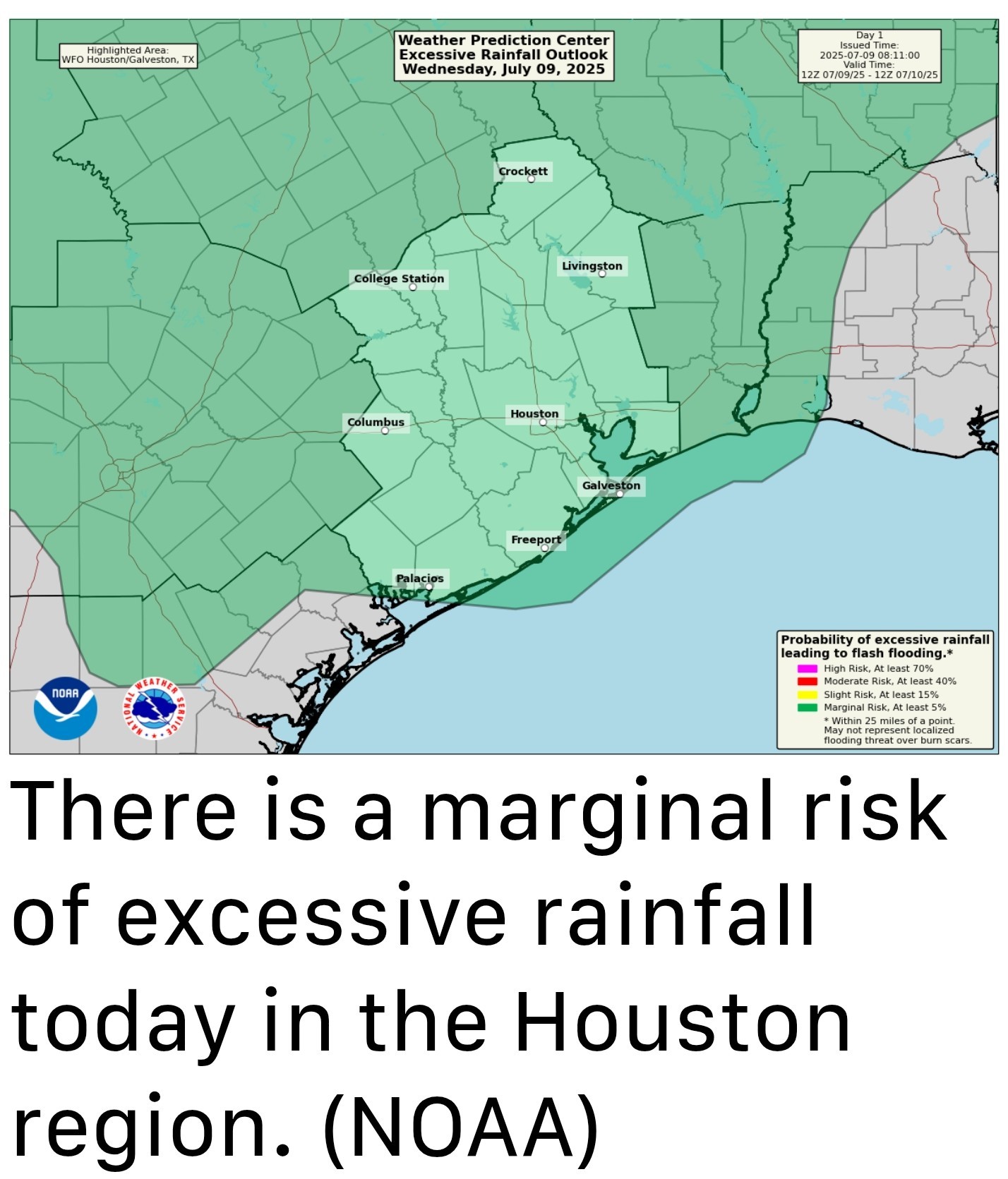 WEDNESDAY - *Today will be quite similar to Tuesday in that we see the development of showers and thunderstorms near the coast this morning (there is already activity offshore) that will spread inland today, through the afternoon and early evening hours before waning.
*Most of the region should pick up less than 0.5 inch, but there will be some locations that see in excess of that, and this may cause brief ponding on roadways.
*The upside of the clouds and rain is that temperatures will remain a bit lower than normal, with highs today likely to only reach about 90 degrees for most locations. Lows tonight should drop into the mid-70s. ..... THURSDAY and FRIDAY - *As a slug of slightly drier air moves into the region, we should see rain chances step back into the range of 30 to 40 percent daily, with a little bit more sunshine.
*This should allow high temps to reach the lower 90s for a couple of days. (The normal high for this time of year, in Houston, is 94 degrees).
*Friday may also be a bit windy, with southerly gusts perhaps reaching 20 mph. This is only notable because our winds have been fairly calm of late. SATURDAY and SUNDAY - *The weekend should see an increase in atmospheric moisture levels, and this will likely bring back better rain chances into the area.
*I'm not seeing any signal for widespread heavy rainfall, but both days should see a 60 percent chance (or so) of light to moderate showers.
*With the possibility of thunderstorms, you should definitely have a backup plan for any outdoor activities.
*These showers and clouds should limit high temperatures to around 90 degrees with overnight lows will be in the mid-70s. NEXT WEEK - *At some point next week we should see high temperatures start to increase, probably into the mid-90s.
*Rain chances, also, should start to diminish but I'm not ready to lock in such a forecast just yet.


*Houston will likely face additional showers and thunderstorms on Wednesday, with hit-or-miss coverage similar to what the region experienced on Tuesday.
*Looking ahead to the weekend, there is more rain in the forecast, although we don't expect excessive totals.
*On Tuesday, the region saw widely variable rainfall totals, with some areas near Sugar Land picking up in excess of 4 inches, whereas most of Houston received less than 0.5 inch.
*I expect another similarly active day today before things quiet down a bit, perhaps, ahead of the weekend. (Speaking of
the weekend, it now appears we have ba healthy chance of showers on both Saturday and Sunday)
*Most of the region should pick up less than 0.5 inch, but there will be some locations that see in excess of that, and this may cause brief ponding on roadways.
*The upside of the clouds and rain is that temperatures will remain a bit lower than normal, with highs today likely to only reach about 90 degrees for most locations. Lows tonight should drop into the mid-70s.
*This should allow high temps to reach the lower 90s for a couple of days. (The normal high for this time of year, in Houston, is 94 degrees).
*Friday may also be a bit windy, with southerly gusts perhaps reaching 20 mph. This is only notable because our winds have been fairly calm of late.
*I'm not seeing any signal for widespread heavy rainfall, but both days should see a 60 percent chance (or so) of light to moderate showers.
*With the possibility of thunderstorms, you should definitely have a backup plan for any outdoor activities.
*These showers and clouds should limit high temperatures to around 90 degrees with overnight lows will be in the mid-70s.
*Rain chances, also, should start to diminish but I'm not ready to lock in such a forecast just yet.
Replies:
Wednesday forecast ➡️ Look for a repeat of yesterday with showers & thunderstorms moving north to south, from the coast. ➡️ Like yesterday, some areas will see very little rain & some areas will see higher totals with the heavier cells and the areas that see training cells (AKA storms that continue to move over the same area over and over again - like a train) 🚂 ...... From Space City Weather - Expect more showers and thunderstorms across the region today as an active pattern continues. ⚡️ Eric Berger · Wednesday, July 9, 2025 7:01 AM In brief: *Houston will likely face additional showers and thunderstorms on Wednesday, with hit-or-miss coverage similar to what the region experienced on Tuesday. *Looking ahead to the weekend, there is more rain in the forecast, although we don't expect excessive totals. Unsettled pattern continues - *Houston's weather will remain unsettled for a few more days as the region lies beyond the influence of high pressure. *On Tuesday, the region saw widely variable rainfall totals, with some areas near Sugar Land picking up in excess of 4 inches, whereas most of Houston received less than 0.5 inch. *I expect another similarly active day today before things quiet down a bit, perhaps, ahead of the weekend. (Speaking of the weekend, it now appears we have ba healthy chance of showers on both Saturday and Sunday) WEDNESDAY - *Today will be quite similar to Tuesday in that we see the development of showers and thunderstorms near the coast this morning (there is already activity offshore) that will spread inland today, through the afternoon and early evening hours before waning. *Most of the region should pick up less than 0.5 inch, but there will be some locations that see in excess of that, and this may cause brief ponding on roadways. *The upside of the clouds and rain is that temperatures will remain a bit lower than normal, with highs today likely to only reach about 90 degrees for most locations. Lows tonight should drop into the mid-70s. ..... THURSDAY and FRIDAY - *As a slug of slightly drier air moves into the region, we should see rain chances step back into the range of 30 to 40 percent daily, with a little bit more sunshine. *This should allow high temps to reach the lower 90s for a couple of days. (The normal high for this time of year, in Houston, is 94 degrees). *Friday may also be a bit windy, with southerly gusts perhaps reaching 20 mph. This is only notable because our winds have been fairly calm of late. SATURDAY and SUNDAY - *The weekend should see an increase in atmospheric moisture levels, and this will likely bring back better rain chances into the area. *I'm not seeing any signal for widespread heavy rainfall, but both days should see a 60 percent chance (or so) of light to moderate showers. *With the possibility of thunderstorms, you should definitely have a backup plan for any outdoor activities. *These showers and clouds should limit high temperatures to around 90 degrees with overnight lows will be in the mid-70s. NEXT WEEK - *At some point next week we should see high temperatures start to increase, probably into the mid-90s. *Rain chances, also, should start to diminish but I'm not ready to lock in such a forecast just yet.
StormChaser : Shhhh.....we haven't hit 100 yet this year. Don't tell anybody! LOL~!
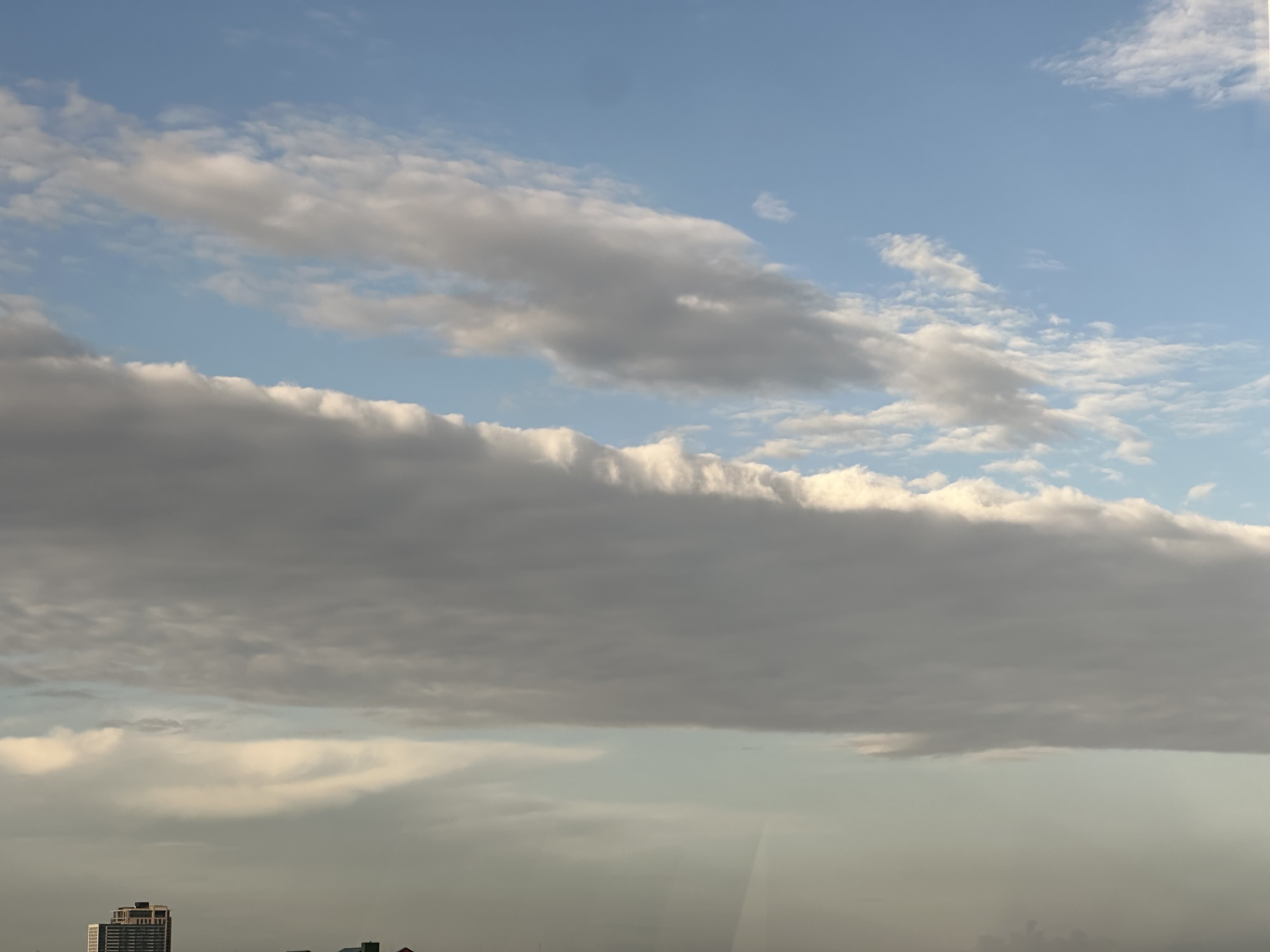 StormChaser : We had to go to Tomball yesterday and on 249 it rained like crazy! When we got back home, it had evidently rained at our house because we had 2.5" in the rain gauge! I thought this cloud was neat looking this morning.
cbear : It's been great so far I must say. Now with that said, end of July cane season begins in earnest through September. NOAA still expecting 60% chance of above normal cane season. Lots of yellow, orange and red X's coming.
StormChaser : We had to go to Tomball yesterday and on 249 it rained like crazy! When we got back home, it had evidently rained at our house because we had 2.5" in the rain gauge! I thought this cloud was neat looking this morning.
cbear : It's been great so far I must say. Now with that said, end of July cane season begins in earnest through September. NOAA still expecting 60% chance of above normal cane season. Lots of yellow, orange and red X's coming.
StormChaser : We had to go to Tomball yesterday and on 249 it rained like crazy! When we got back home, it had evidently rained at our house because we had 2.5" in the rain gauge! I thought this cloud was neat looking this morning.
KanKan : Cool! Is that what they call a "shelf" cloud I wonder?
cbear : It's been great so far I must say. Now with that said, end of July cane season begins in earnest through September. NOAA still expecting 60% chance of above normal cane season. Lots of yellow, orange and red X's coming.
 Ruger5 :
cbear : It's been great so far I must say. Now with that said, end of July cane season begins in earnest through September. NOAA still expecting 60% chance of above normal cane season. Lots of yellow, orange and red X's coming.
Ruger5 : Now you HUSH. « Back to Chat
Views: 402
# Replies: 8