


Weather update Tues AM (Wed/Thurs AM update)
Weather update Tues AM (Wed/Thurs AM update)


Joined:
X days ago
# Posts:
X,XXX
Contributor Points:
X


Weather update Tues AM (Wed/Thurs AM update) Weather update - Tues AM with Wed/Thurs AM update. From Jeff Lindner
1-21-25 500am Widespread light to at times moderate snow with accumulations ongoing across the region.
🌬️ Strong northerly winds are developing with recent gusts to 40mph at Hobby, Galveston, and Palacios.
🌡️ Temperatures are below freezing over the entire region with wind chills in the 10's.
❄️ After starting as sleet yesterday evening much of the precipitation has transitioned to snow since midnight although there is still some sleet mixing in closer to the coast. ❄️ Banding features have resulted in widely varying accumulations thus far with what appears to be a swath of 1-2 inches of snow from northern Waller County into northern Harris/southern Montgomery Counties including 2 inches at Pinehurst and 1 inch in Aldine.
❄️ Expect greater banding features to develop near sunrise along the I-10 corridor southward with increasing snowfall rates in that area. ❄️ Where some of these heavier bands persist 2-5 inches of snow will be possible in a short period of time. ❄️⏰ Snow will end from north to south later this morning into the early afternoon hours and some sun areas may see a little bit of sun resulting in some minor melting. 🚨 Temperatures tonight will be completely controlled by the location and amount of snow cover on the ground with areas of more snow being colder than areas with none or less. 🚨🌡️ Areas with snow cover will fall into the 10's tonight......potentially the mid 10's. 🚨🧊 Temperatures may warm into the upper 30's to near 40 on Wednesday allowing for more melting but much of the area will fall into the mid 20's on Thursday morning with a re-freeze of any melted water in "black ice". (Not good) 🚗
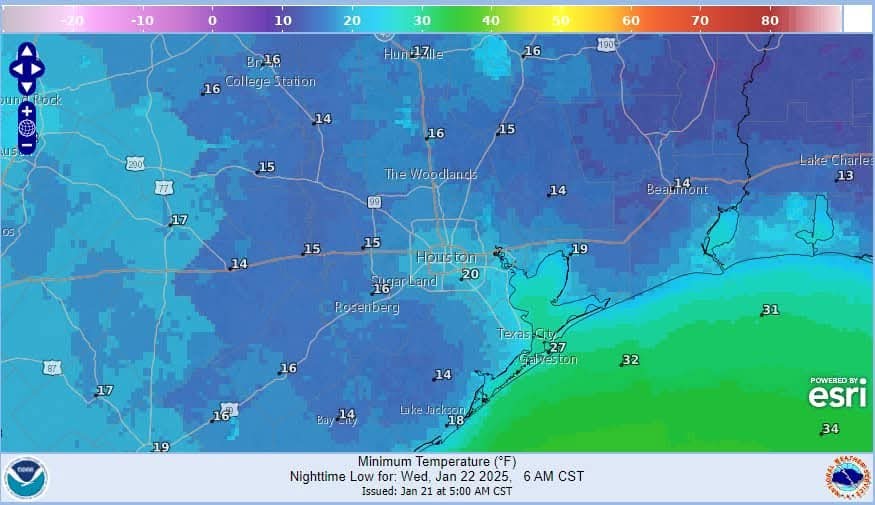
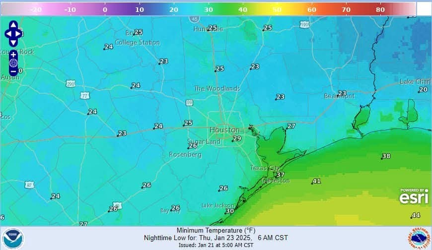 😲 Aside: First ever blizzard warning has been issued from Beaumont, TX to Lafayette, LA where currently heavy snow and winds gusting to 35mph is reducing visibilities to .25 to .50 of a mile.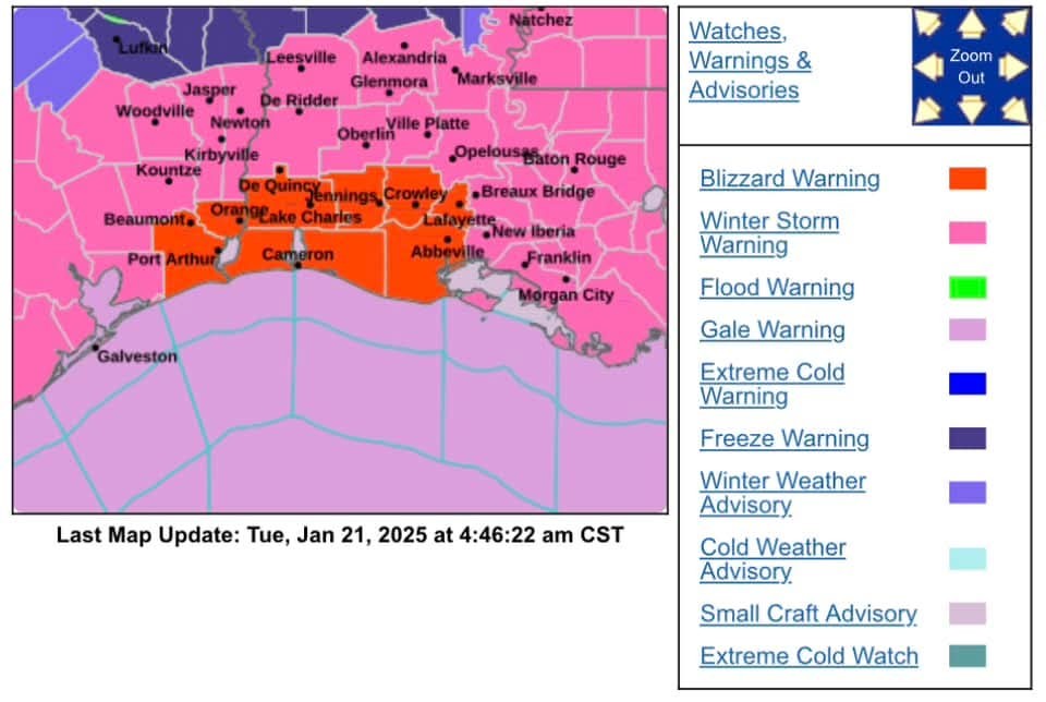


1-21-25 500am
🌬️ Strong northerly winds are developing with recent gusts to 40mph at Hobby, Galveston, and Palacios.
🌡️ Temperatures are below freezing over the entire region with wind chills in the 10's.
❄️ After starting as sleet yesterday evening much of the precipitation has transitioned to snow since midnight although there is still some sleet mixing in closer to the coast.
❄️ Expect greater banding features to develop near sunrise along the I-10 corridor southward with increasing snowfall rates in that area.
Discussion Summary:
"Winter Storm Update: Snow Accumulations and High Winds Expected Across Region with Blizzard Warning Issued"
"Winter Storm Update: Snow Accumulations and High Winds Expected Across Region with Blizzard Warning Issued"
Discussion Insights:
Ask a question about this discussion and an AI bot will try to give an answer.
Ask a question about this discussion and an AI bot will try to give an answer.
Replies:

|
615am The bulk of the snow showers have moved thru but there are still scattered snow showers that are moving our way from the south to north. Nothing crazy heavy but we're not 100% done yet. After the snow stops falling, the roads are going to stay messy. We will likely get to around the freezing mark today with the help of some sunshine but anything that melts will refreeze tonight which will make the roads as bad - if not worse - than today. 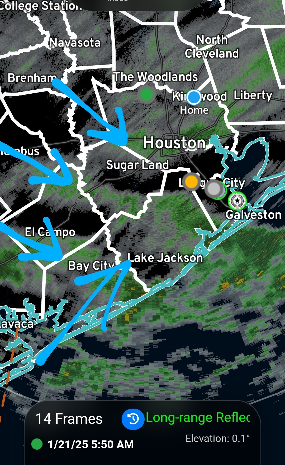
|
|
|
|
615am The bulk of the snow showers have moved thru but there are still scattered snow showers that are moving our way from the south to north. Nothing crazy heavy but we're not 100% done yet. After the snow stops falling, the roads are going to stay messy. We will likely get to around the freezing mark today with the help of some sunshine but anything that melts will refreeze tonight which will make the roads as bad - if not worse - than today.
StormChaser : Thank you! Didn't know about the blizzard in Louisiana!
StormChaser : Thank you! Didn't know about the blizzard in Louisiana!
LizBeth91 : Maybe it's a typo and they meant LIZZARD warning 
« Back to Chat
Views: 727
# Replies: 5