


Tuesday forecast (Space City 7am update)
Tuesday forecast (Space City 7am update)


Joined:
X days ago
# Posts:
X,XXX
Contributor Points:
X
Replies:


|


I've gotta drive home from work on I-45 from Dallas to home today, leaving Dallas around 1PM. Looks like it's going to be an interesting ride. Dang.
 Ticagro : Please be careful! Download a weather app that follows your location like MyRadar RadarScope. It will notify you of warnings based on your phone's GPS location.

StormChaser : Thank you! I'm wondering if I should work from home this afternoon.... I have "PTSD" from prior years getting stuck trying to get home from work. Everyone stay safe today!
 malpalface : Stay home!!!
|
|
StormChaser : Thank you! I'm wondering if I should work from home this afternoon.... I have "PTSD" from prior years getting stuck trying to get home from work. Everyone stay safe today!
malpalface : I honestly don't think flooding will be our biggest issue. North of here is under a watch, but we are not.
|
|
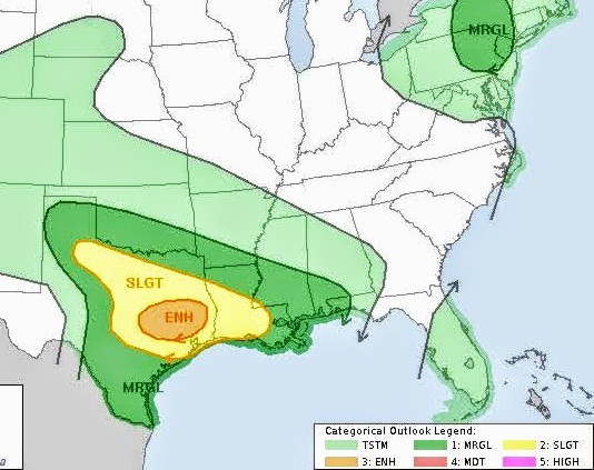
Tuesday forecast 🚨 Space City 7am update posted below in the comments. It goes over some specific timing for the area. ....... Good (early) morning. 🥱💤 It's only 4am but I can't sleep so I'm up looking at weather models. 🙃 Here's a look at today, which could become pretty dicey by mid-morning! Current radar across Texas: Impressive 👍 HRRR future scans: ❇️ 11AM: ❇️ Noon: ➡️ I expect several watches to be issued before all this comes thru including a severe thunderstorm watch and a tornado watch. A flood watch is also possible. (Watches are already posted in west Texas) ➡️ I think our biggest threat today is going to be hail & street flooding due to the intensity of these storms, our already saturated grounds and the slow movement of the system. Upgraded 3/5 outlook for SE TX: Tornado chances: Wind probability: ➡️ Current watches; 🔴 Red is severe thunderstorm watch 🟡 Yellow is tornado watch. ............. TIMING BY SPACE CITY: ❇️ Round one: *By late Tuesday morning a line of storms, very likely with severe storms embedded, will be nearing the College Station area. *This line should move into Montgomery County and points north by around noon, affecting the I-45 corridor (I'm concerned about areas including The Woodlands, Conroe, and Huntsville). *At this time, we think most of these storms will be along and north of Interstate 10, but again we cannot rule out impacts further south, and closer to the coast. ❇️ Round two: *Conditions may then calm down for a few hours this afternoon and early evening. *However, by around sunset, I expect another line of storms to approach the Houston region from the northwest. *I expect these to advance into the Houston metro area between 8 pm and midnight, but they may peter out before reaching the coast. ...... ❇️ I will try and keep the weather threads contained to 1 big thread today instead of a bunch of little ones. I will make sure the main weather topic is highlighted to find easily. I'll check back in later this morning. Stay safe today everyone! ⚡️
 StormChaser : I have to go to smallmart for a few things. I better git!!
|
|
malpalface : Me too. I've had to ditch my car along Kingwood Drive and my subdivision three times over the last several years due to high water. I have PTSD anytime when we get rain like this and I have to be out for it.
Tuesday forecast ? Space City 7am update posted below in the comments. It goes over some specific timing for the area. ....... Good (early) morning. ?? It's only 4am but I can't sleep so I'm up looking at weather models. ? Here's a look at today, which could become pretty dicey by mid-morning! Current radar across Texas: Impressive ? 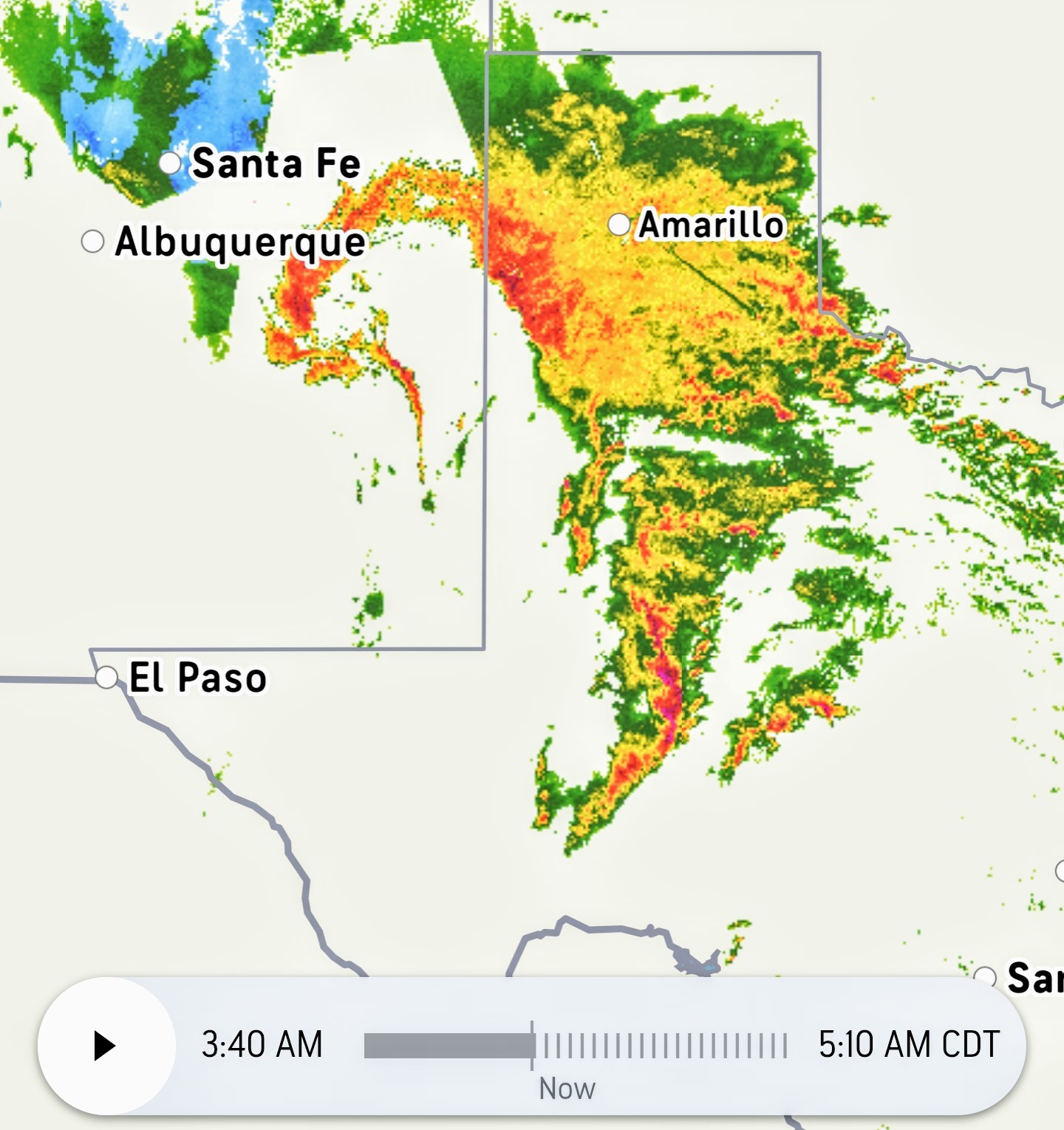 HRRR future scans: ❇️ 11AM:
 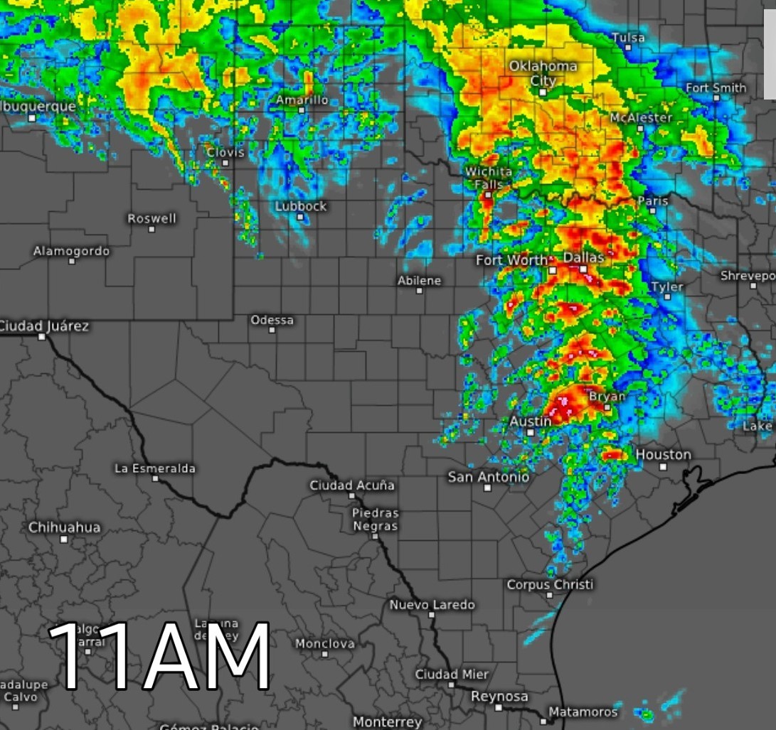 ❇️ Noon:
 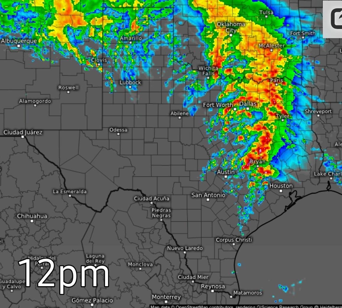 ➡️ I expect several watches to be issued before all this comes thru including a severe thunderstorm watch and a tornado watch. A flood watch is also possible. (Watches are already posted in west Texas) ➡️ I think our biggest threat today is going to be hail & street flooding due to the intensity of these storms, our already saturated grounds and the slow movement of the system. Upgraded 3/5 outlook for SE TX:
  Tornado chances:
 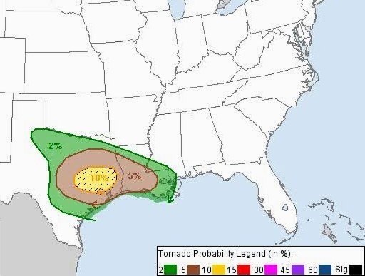 Wind probability:
 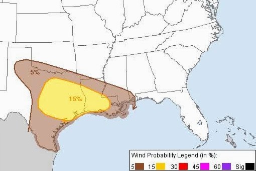 ➡️ Current watches; ? Red is severe thunderstorm watch
? Yellow is tornado watch. 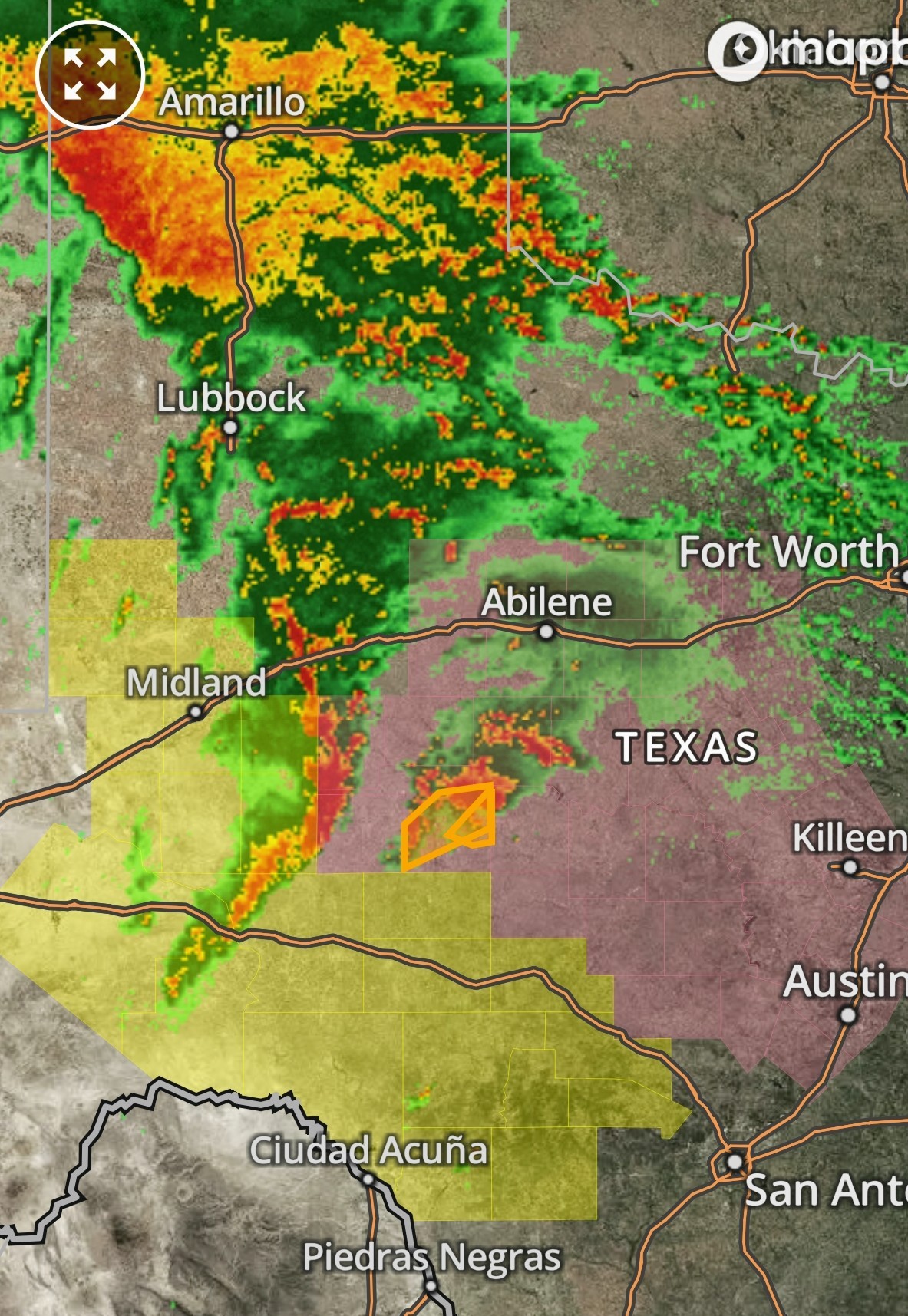 ............. TIMING BY SPACE CITY: ❇️ Round one:
*By late Tuesday morning a line of storms, very likely with severe storms embedded, will be nearing the College Station area.
*This line should move into Montgomery County and points north by around noon, affecting the I-45 corridor (I'm concerned about areas including The Woodlands, Conroe, and Huntsville).
*At this time, we think most of these storms will be along and north of Interstate 10, but again we cannot rule out impacts further south, and closer to the coast. ❇️ Round two:
*Conditions may then calm down for a few hours this afternoon and early evening.
*However, by around sunset, I expect another line of storms to approach the Houston region from the northwest.
*I expect these to advance into the Houston metro area between 8 pm and midnight, but they may peter out before reaching the coast. ...... ❇️ I will try and keep the weather threads contained to 1 big thread today instead of a bunch of little ones. I will make sure the main weather topic is highlighted to find easily. I'll check back in later this morning. Stay safe today everyone! ⚡️
? Yellow is tornado watch.
*By late Tuesday morning a line of storms, very likely with severe storms embedded, will be nearing the College Station area.
*This line should move into Montgomery County and points north by around noon, affecting the I-45 corridor (I'm concerned about areas including The Woodlands, Conroe, and Huntsville).
*At this time, we think most of these storms will be along and north of Interstate 10, but again we cannot rule out impacts further south, and closer to the coast.
*Conditions may then calm down for a few hours this afternoon and early evening.
*However, by around sunset, I expect another line of storms to approach the Houston region from the northwest.
*I expect these to advance into the Houston metro area between 8 pm and midnight, but they may peter out before reaching the coast.
 Joe tipped StormChaser 500 credits for a post in this forum discussion.
 Weathergirl5 :
 Me too! After waiting 4 hours, I left my car in North Woodland Hills and walked 1.8 miles through flood water to get home. I never want to relive that and I'm so glad I didn't get attacked my fire ants LOL
|
|
malpalface : Similar thing happened to me three different times. Twice on Kingwood Drive and once in Forest Cove. I had to go back for my car later
|
|
malpalface : Similar thing happened to me three different times. Twice on Kingwood Drive and once in Forest Cove. I had to go back for my car later
Weathergirl5 : Same happened to my husband in 2019. He had to abandon his truck at Walgreens on Kingwood Dr (near Green Oak) and walk home in water that was up to his waist at one point! Several water moccasins swam passed him. 😳
|
|
Noon update: Current radar has certainly become active in the last hour or so, especially along I35 between Austin and Dallas, heading east towards I45. 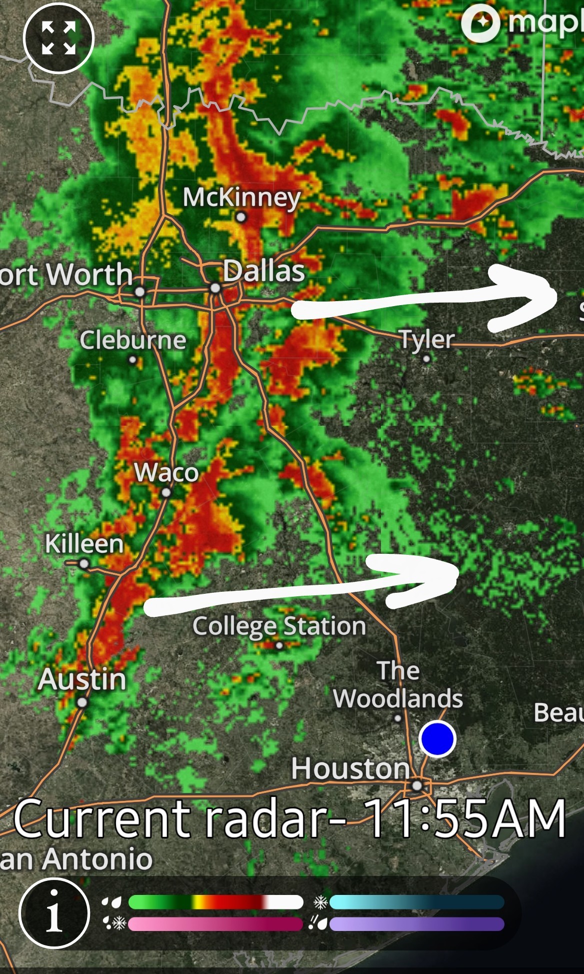 Here is the 4pm model. Supercells to our west will definitely be worth watching as the system gets closer to us. The atmosphere is prime for rotation, as seen by the tornado warnings starting to occur NW of College Station.
 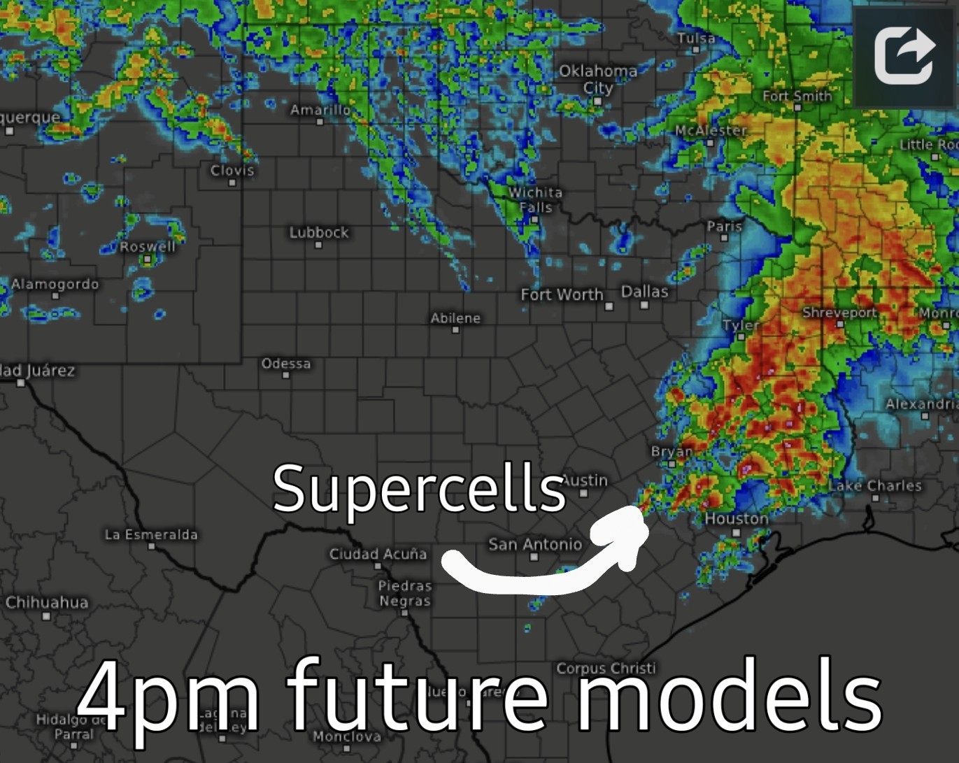 Def of a supercell: On the thunderstorm spectrum, supercells are the least common type of thunderstorm, but they have a high propensity to produce severe weather, including damaging winds, very large hail, and sometimes weak to violent tornadoes. What makes a supercell unique from all other thunderstorm types is that it contains a deep and persistent rotating updraft called a mesocyclone. If the environment is favorable, supercell thunderstorms can last for several hours.
|
|
StormChaser : I hope all the severe stuff does part like the Red Sea.
Thanks for keeping us updated.
|
|
StormChaser : Yes the May 2019 flood was one of the ones I was talking about. I was trying to get home from LSC.
|
|
120PM Update: ❇️ Timing right now looks to be 3-5pm for Kingwood. Storm chasers lining up along I35 and I45. NW of College Station is getting hammered right now. 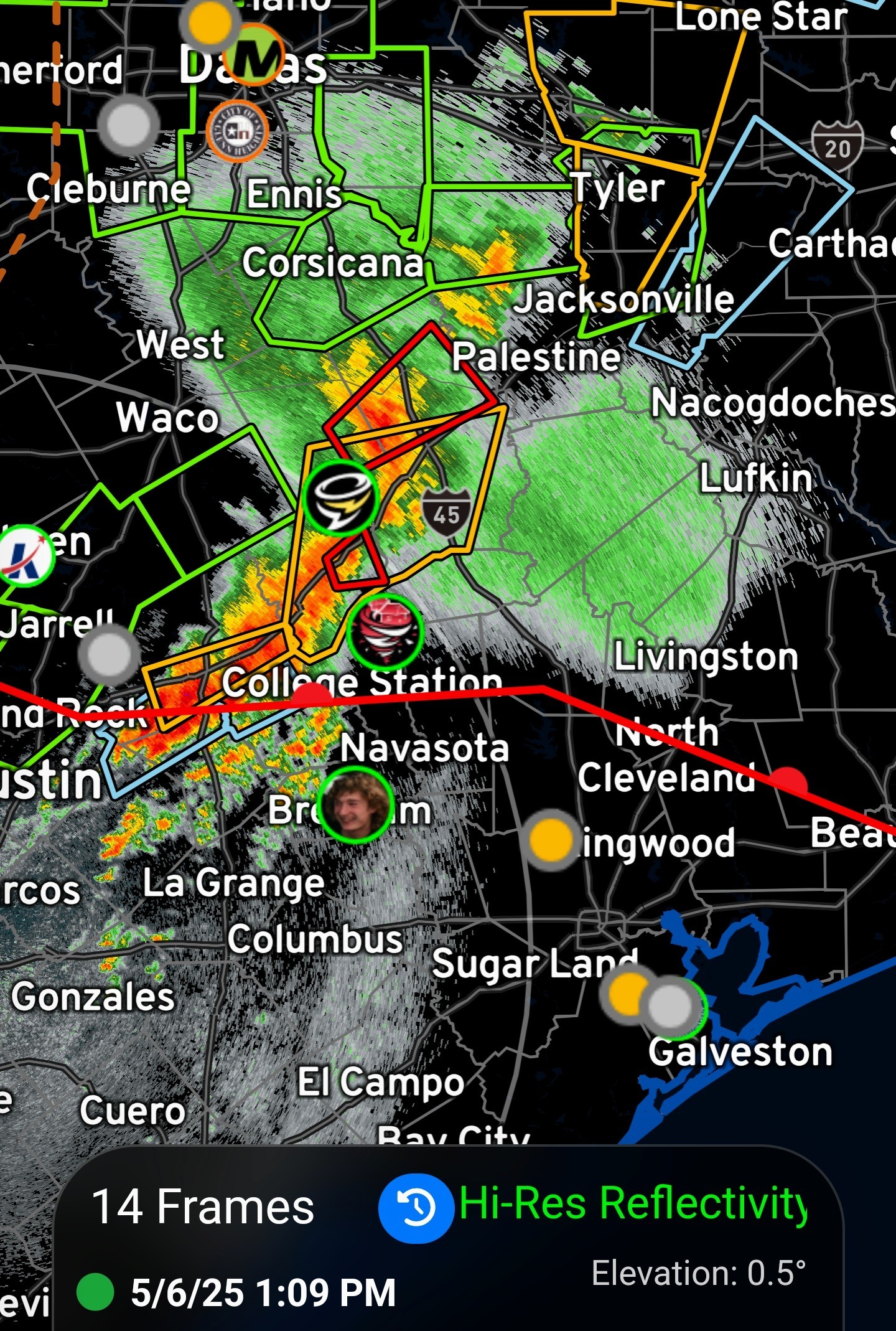
 Slow4x4 Conner is hanging out in Brenham, south of the dry line, slowly making his way east 👀
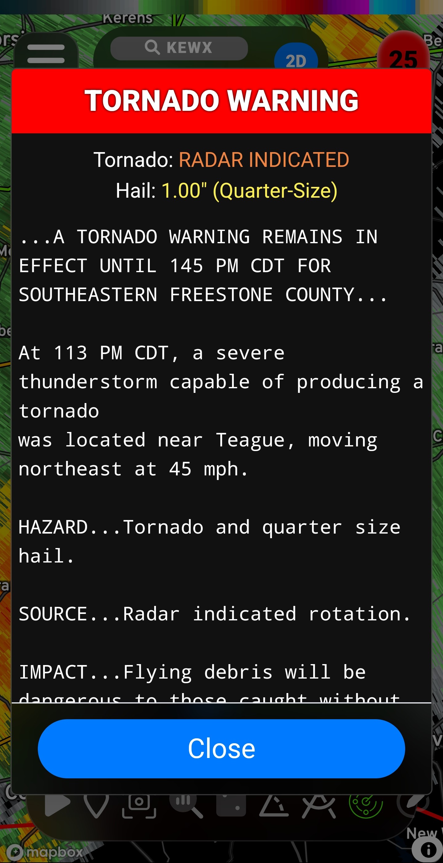
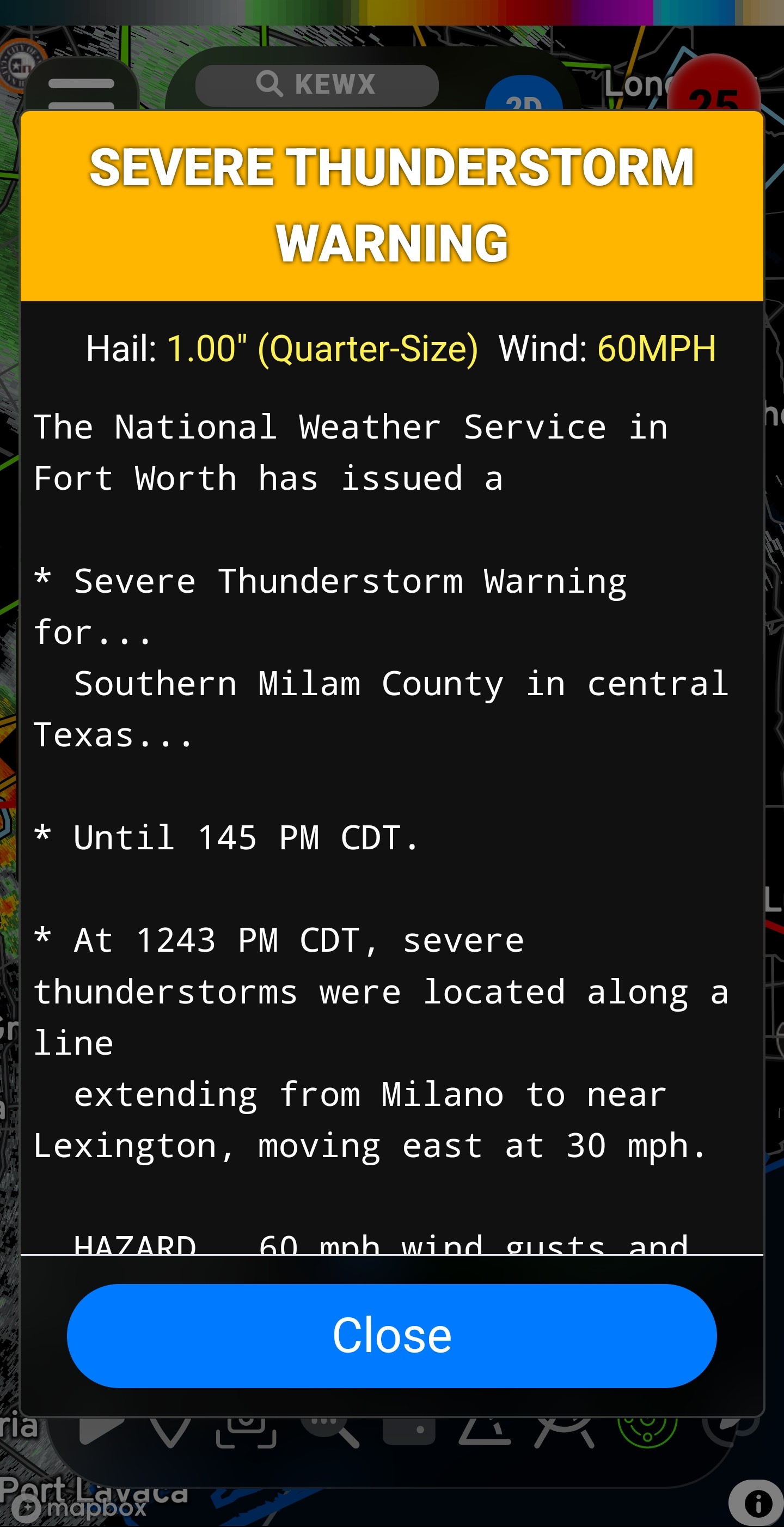
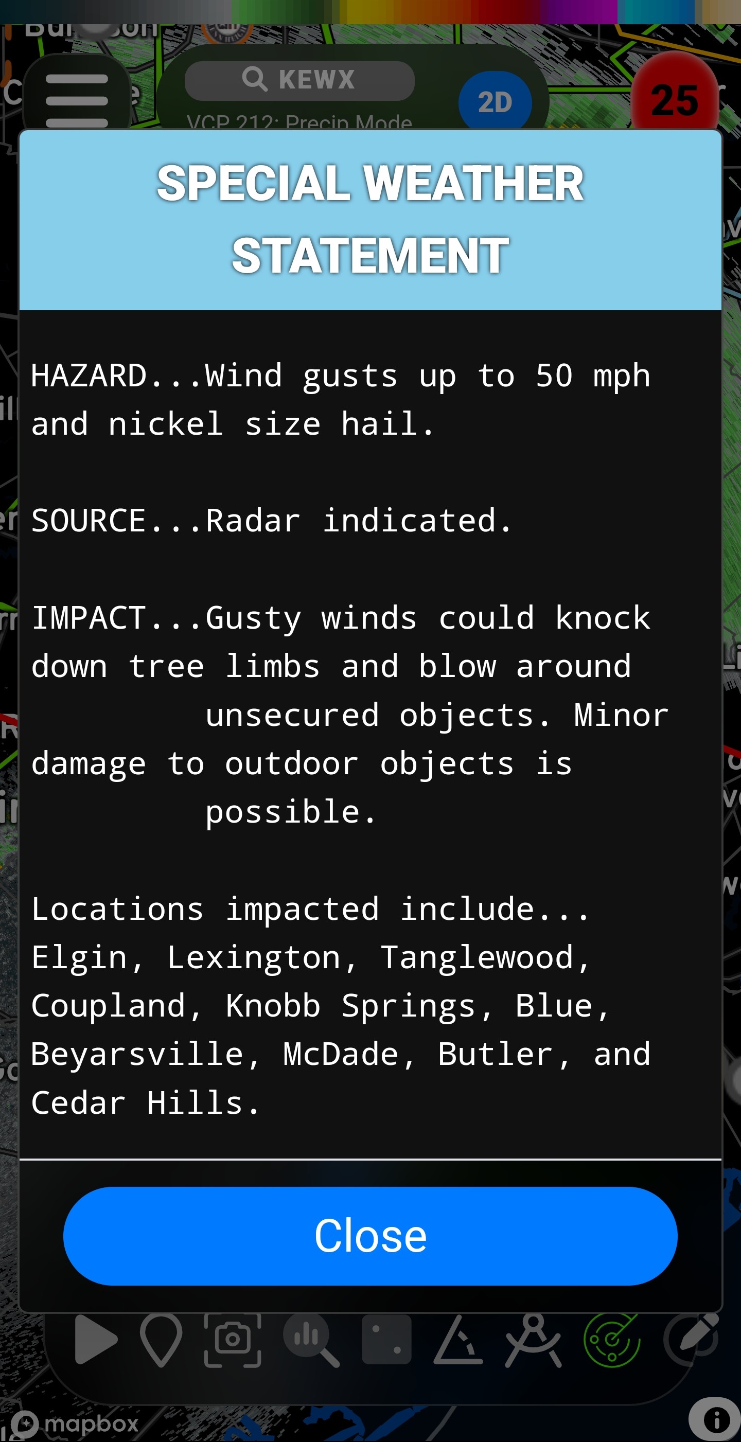
 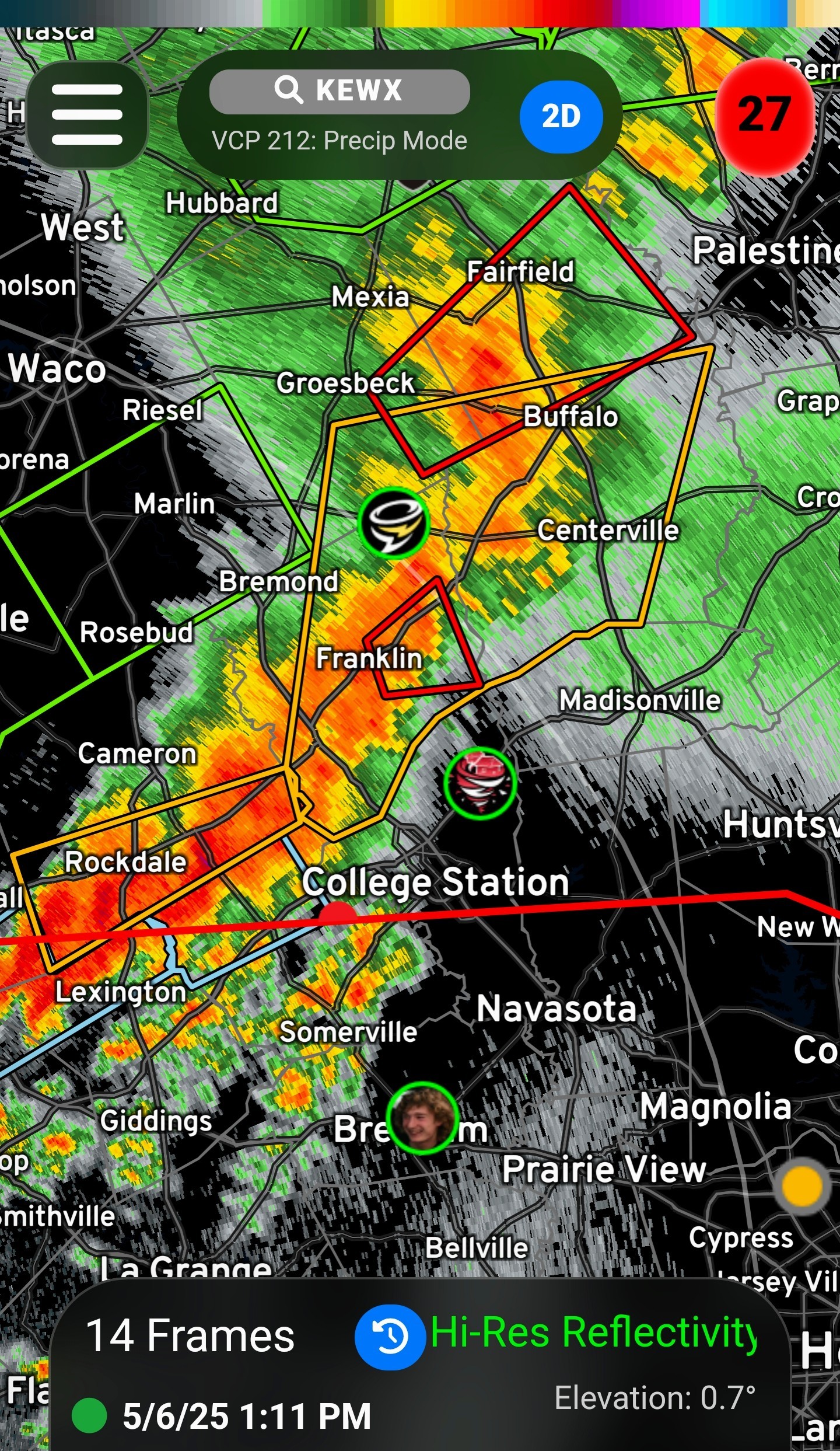 List of current warnings as of 1:20PM: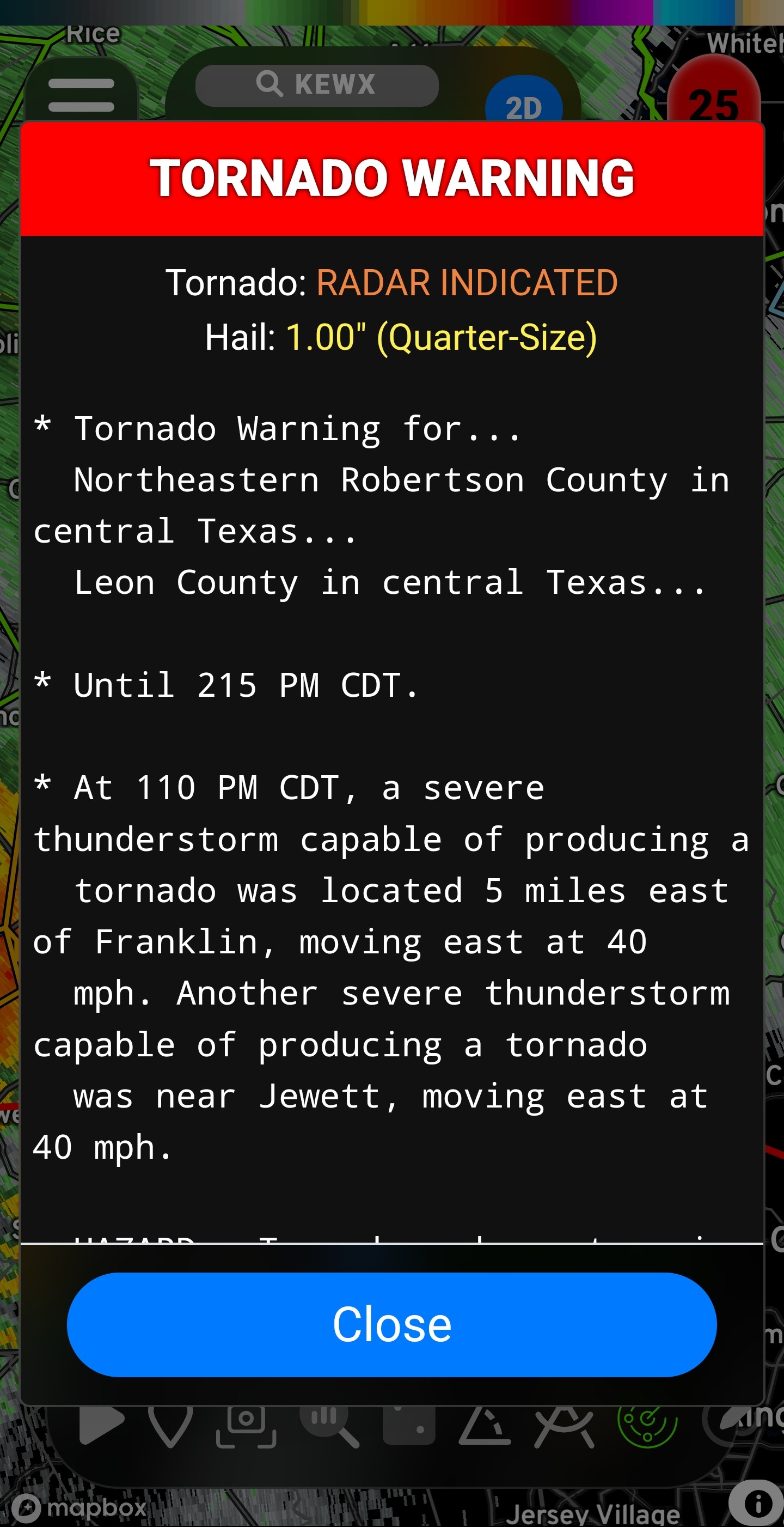
Slow4x4 Conner is hanging out in Brenham, south of the dry line, slowly making his way east 👀 « Back to Chat
Views: 1,691
# Replies: 44