


Tropics update - 7/23
Tropics update - 7/23


Joined:
X days ago
# Posts:
X,XXX
Contributor Points:
X


Tropics update - 7/23 The tropical disturbance we were tracking last week (Invest 93L) is making a comeback! 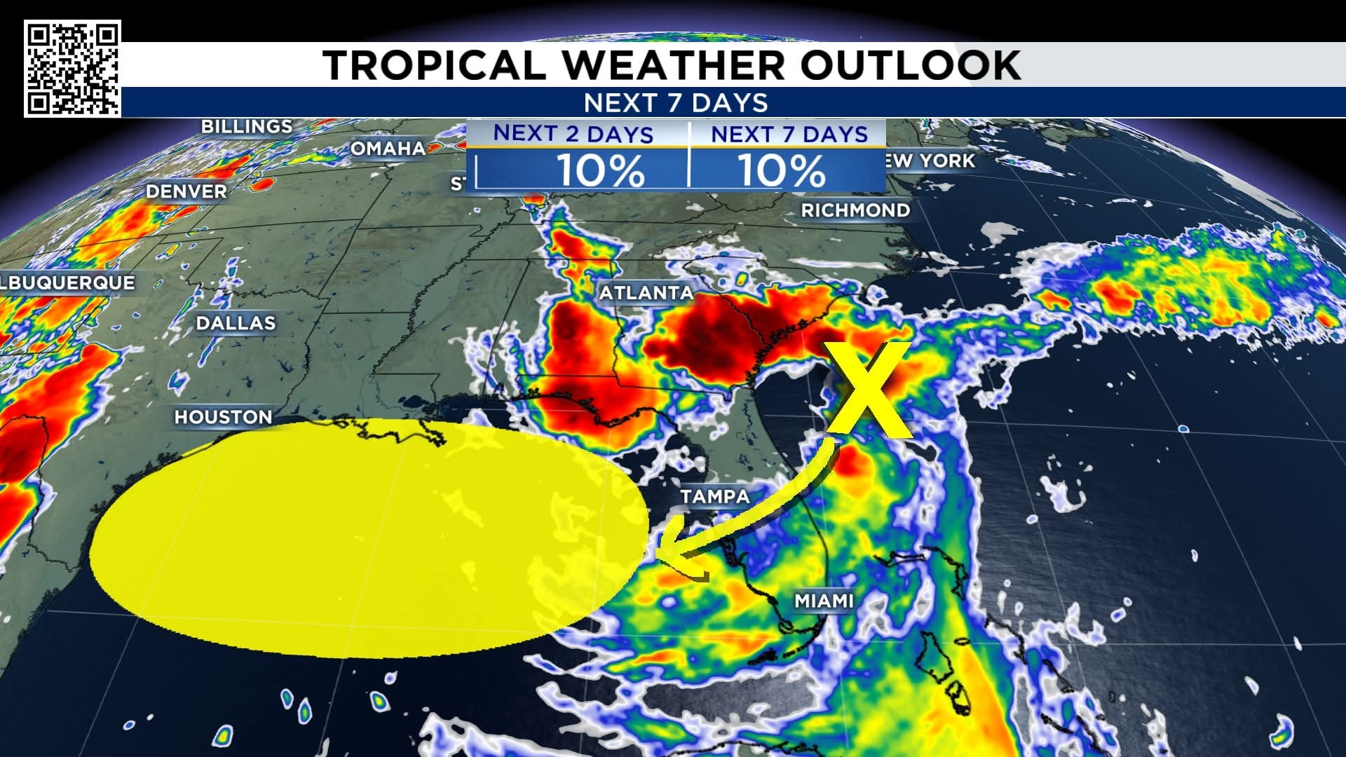
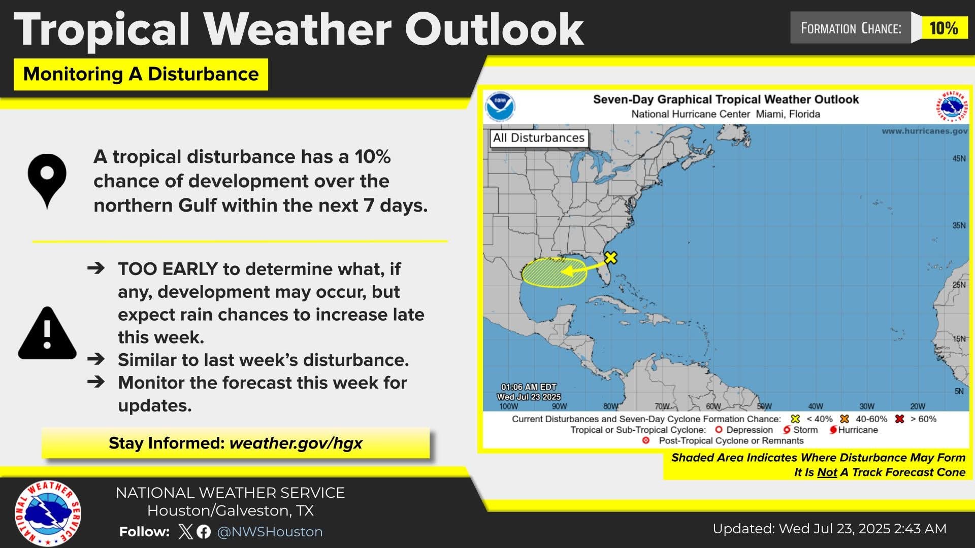 After moving ashore last week, and heading up to the Midwest, the disturbance has moved into the Atlantic and will head back into the Gulf on Wednesday. ➡️ Just like last time, the probabilities it develops are low, however, the moisture associated with it could bring downpours heavy enough FRIDAY to cause street flooding in parts of the Houston area.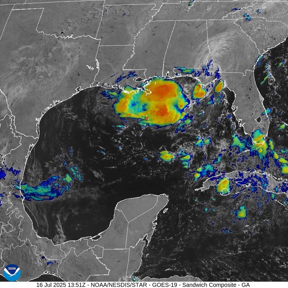


Gingersnap, LittleTexas and buffaloglenn + 8 more reacted Replies:
Go ahead and rain, just not on the weekend.
seem2 : Sadly, it is forecast for Friday and Saturday at this point. Sorry.
Tropics update - 7/23 The tropical disturbance we were tracking last week (Invest 93L) is making a comeback! After moving ashore last week, and heading up to the Midwest, the disturbance has moved into the Atlantic and will head back into the Gulf on Wednesday. ➡️ Just like last time, the probabilities it develops are low, however, the moisture associated with it could bring downpours heavy enough FRIDAY to cause street flooding in parts of the Houston area.
StormChaser : I remember a hurricane that did that to Florida. It made landfall around the panhandle and moved across out to the Atlantic and came back around and made a second landfall in nearly the same area! I wanna say "Ivan" maybe?
StormChaser : I remember a hurricane that did that to Florida. It made landfall around the panhandle and moved across out to the Atlantic and came back around and made a second landfall in nearly the same area! I wanna say "Ivan" maybe?
cbear : Yes that was Ivan in 2004.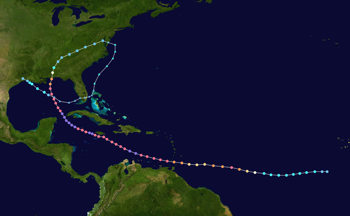
Update: Thurs 3AM Friday & Saturday - *We continue to see plenty of signs that the tropical wave moving across the Gulf will "make landfall" in Southeast Texas on Friday.
*No development is expected (though the NHC did tag it at 10% yesterday evening).
*However, it will nudge up our rain chances substantially on both Friday and Saturday, especially near the coast and east of Houston. 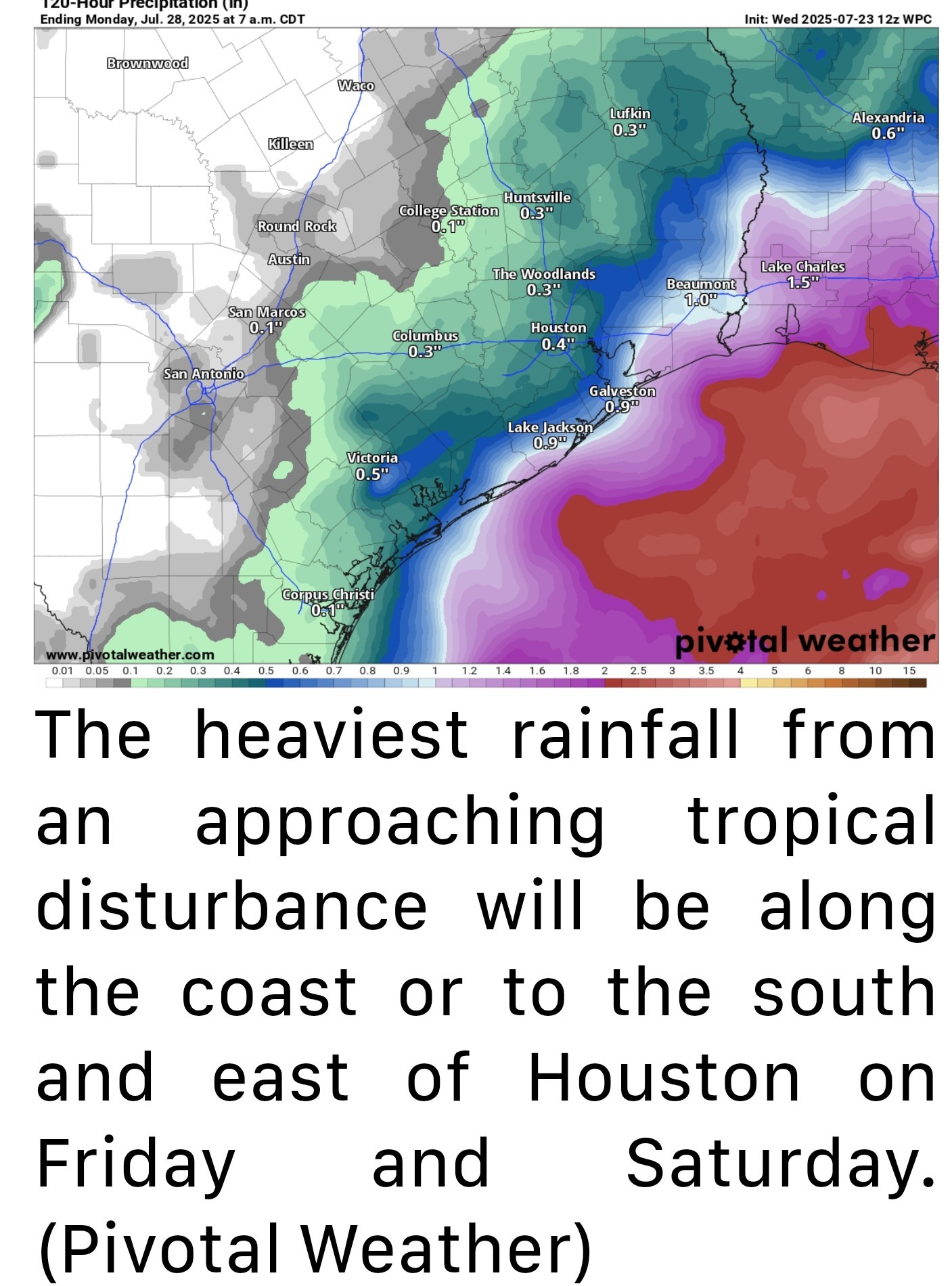 *Rain chances will also spread inland too but the best chance of some locally heavy rainfall will be south and east.
*I'm not sure I would go cancelling outdoor plans just yet. You may still be able to squeak some windows in of drier weather on those days, particularly away from the coast. But stay tuned.
*Temperatures will be held back due to clouds. Look for highs in the low 90s at best, possibly upper 80s in a couple spots, especially south and east. Sunday & Monday - *We should transition out of this pattern at the end of the weekend and on Monday.
*Look for highs to bounce back into the mid-90s or even a bit hotter by Monday.
sellbuy, CatalinaKitKat and golfshot reacted *No development is expected (though the NHC did tag it at 10% yesterday evening).
*However, it will nudge up our rain chances substantially on both Friday and Saturday, especially near the coast and east of Houston.
*I'm not sure I would go cancelling outdoor plans just yet. You may still be able to squeak some windows in of drier weather on those days, particularly away from the coast. But stay tuned.
*Temperatures will be held back due to clouds. Look for highs in the low 90s at best, possibly upper 80s in a couple spots, especially south and east.
*Look for highs to bounce back into the mid-90s or even a bit hotter by Monday.

StormChaser : I am hoping not heavy rain.
ForestFinds : That will likely happen closer to the coast tomorrow but chances are highest for heavier rain on Saturday. « Back to Chat
Views: 992
# Replies: 13