


Tornado watch
Tornado watch


Joined:
X days ago
# Posts:
X,XXX
Contributor Points:
X


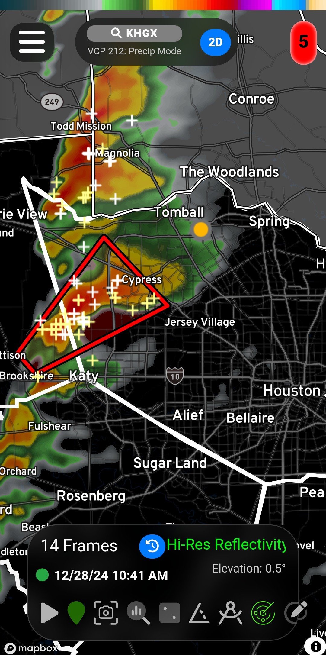
Tornado watch This doesn't include Harris but it likely will eventually. It includes Montgomery which is close enough. URGENT - IMMEDIATE BROADCAST REQUESTED
Tornado Watch Number 719
NWS Storm Prediction Center Norman OK
1015 AM CST Sat Dec 28 2024 The NWS Storm Prediction Center has issued a * Tornado Watch for portions of
Central and Southeast Texas * Effective this Saturday morning and afternoon from 1015 AM
until 500 PM CST. * Primary threats include...
A couple tornadoes possible
Scattered large hail likely with isolated very large hail events
to 2 inches in diameter possible
Scattered damaging wind gusts to 70 mph likely SUMMARY...Thunderstorms will intensify rapidly through the
afternoon, with a few severe storms expected. Large hail and
damaging winds are the main concerns, but a few tornadoes are also
possible later today as winds aloft strengthen. The tornado watch area is approximately along and 75 statute miles
east and west of a line from 65 miles east northeast of Waco TX to
40 miles south of College Station TX. For a complete depiction of
the watch see the associated watch outline update (WOUS64 KWNS
WOU9). PRECAUTIONARY/PREPAREDNESS ACTIONS... REMEMBER...A Tornado Watch means conditions are favorable for
tornadoes and severe thunderstorms in and close to the watch
area. Persons in these areas should be on the lookout for
threatening weather conditions and listen for later statements
and possible warnings. && OTHER WATCH INFORMATION...CONTINUE...WW 717...WW 718... AVIATION...Tornadoes and a few severe thunderstorms with hail
surface and aloft to 2 inches. Extreme turbulence and surface wind
gusts to 60 knots. A few cumulonimbi with maximum tops to 500. Mean
storm motion vector 23030. ...Hart ----- The National Weather Service has issued Tornado Watch 719 in
effect until 5 PM CST this afternoon for the following areas In Texas this watch includes 9 counties In southeast Texas Brazos Burleson Grimes
Liberty Madison Montgomery
San Jacinto Walker Washington This includes the cities of Brenham, Bryan, Caldwell, Cleveland,
Coldspring, College Station, Conroe, Dayton, Huntsville, Liberty,
Madisonville, Navasota, Shepherd, Somerville, and The Woodlands. 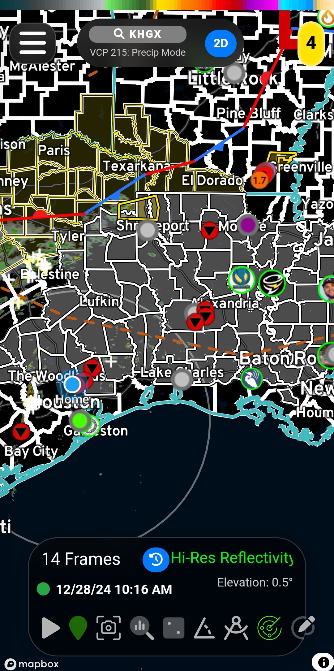


Tornado Watch Number 719
NWS Storm Prediction Center Norman OK
1015 AM CST Sat Dec 28 2024
Central and Southeast Texas
until 500 PM CST.
A couple tornadoes possible
Scattered large hail likely with isolated very large hail events
to 2 inches in diameter possible
Scattered damaging wind gusts to 70 mph likely
afternoon, with a few severe storms expected. Large hail and
damaging winds are the main concerns, but a few tornadoes are also
possible later today as winds aloft strengthen.
east and west of a line from 65 miles east northeast of Waco TX to
40 miles south of College Station TX. For a complete depiction of
the watch see the associated watch outline update (WOUS64 KWNS
WOU9).
tornadoes and severe thunderstorms in and close to the watch
area. Persons in these areas should be on the lookout for
threatening weather conditions and listen for later statements
and possible warnings.
surface and aloft to 2 inches. Extreme turbulence and surface wind
gusts to 60 knots. A few cumulonimbi with maximum tops to 500. Mean
storm motion vector 23030.
effect until 5 PM CST this afternoon for the following areas
Liberty Madison Montgomery
San Jacinto Walker Washington
Coldspring, College Station, Conroe, Dayton, Huntsville, Liberty,
Madisonville, Navasota, Shepherd, Somerville, and The Woodlands.
Discussion Summary:
Tornado Watch Issued for Central and Southeast Texas, Including Montgomery County
Tornado Watch Issued for Central and Southeast Texas, Including Montgomery County
Discussion Insights:
Ask a question about this discussion and an AI bot will try to give an answer.
Ask a question about this discussion and an AI bot will try to give an answer.
Replies:

|


Hope everyone stays safe. Keep your phone charged.....we know Kingwood! LOL!
« Back to Chat
Views: 720
# Replies: 2