


Thursday forecast
Thursday forecast


Joined:
X days ago
# Posts:
X,XXX
Contributor Points:
X


Thursday forecast After Houston's hottest day of the year, rain chances start to increase. Eric Berger · Thursday, July 31, 2025 7:23 AM In brief: *Houston's high temperature hit 101 degrees Wednesday with modestly drier air.
*Now, as tropical moisture moves into the region, we will see increasing rain chances heading into the weekend.
*Looking ahead to August, the start of the month appears to be fairly mild as August goes in these parts. At least it's a dry heat - Houston's high temperature reached 101 degrees on Wednesday at Bush Intercontinental Airport. This was aided in part by high pressure, but also unusually dry air. During the mid- to late-morning hours in the city, the dewpoint fell into the 50s, which made the heat feel a little (emphasis on a little) more tolerable. Anyway, drier air warms more efficiently than air with higher levels of moisture, so that helped turn a hot day into a sizzling one. Moisture has already begun to increase in the atmosphere, so that will set the stage for slightly cooler, but more humid weather with rising rain chances as we get closer to the weekend. THURSDAY FORECAST - *Speaking of rain chances, showers have developed this morning on the eastern side of Galveston Bay, in places such as Anahuac and Bolivar Peninsula.
*I expect these storms to hang together and move into the southern half of the region (generally south of I-10) later this morning.
*Additional light to moderate showers will be possible later today, but overall chances are probably only about 30 percent.
*An increase in clouds and atmospheric moisture levels should hold high temperatures in the upper 90s for most locations today. FRIDAY - *This will be another day with partly to mostly sunny skies, and high temperatures in the mid to upper 90s for most locations.
*There will be scattered showers throughout the day, and an increasing risk of some stronger showers Friday afternoon or evening.
*Again, I think these will be fairly scattered in nature, but we cannot rule out a few thunderstorms if you are out an about on a Friday night.
*Overnight temperatures, otherwise, remain warm and muggy. SATURDAY AND SUNDAY - *Even though skies should remain partly to mostly sunny this weekend, we will see our best rain chances on Saturday and Sunday.
*Most of the area should see intermittent light to moderate showers on Saturday, and Sunday will also likely see half the region recording some precipitation.
*Overall accumulations look fairly modest, in the 0.25 to 0.5 inch range for most, but there may well be some bullseyes with 2-plus inches of rainfall.
*While it is unlikely, we cannot entirely rule out some isolated street flooding.
*Highs look to be in the low- to mid-90s on both days.


Wiseowl, peppermintstick and muffy + 1 more reacted *Now, as tropical moisture moves into the region, we will see increasing rain chances heading into the weekend.
*Looking ahead to August, the start of the month appears to be fairly mild as August goes in these parts.
*I expect these storms to hang together and move into the southern half of the region (generally south of I-10) later this morning.
*Additional light to moderate showers will be possible later today, but overall chances are probably only about 30 percent.
*An increase in clouds and atmospheric moisture levels should hold high temperatures in the upper 90s for most locations today.
*There will be scattered showers throughout the day, and an increasing risk of some stronger showers Friday afternoon or evening.
*Again, I think these will be fairly scattered in nature, but we cannot rule out a few thunderstorms if you are out an about on a Friday night.
*Overnight temperatures, otherwise, remain warm and muggy.
*Most of the area should see intermittent light to moderate showers on Saturday, and Sunday will also likely see half the region recording some precipitation.
*Overall accumulations look fairly modest, in the 0.25 to 0.5 inch range for most, but there may well be some bullseyes with 2-plus inches of rainfall.
*While it is unlikely, we cannot entirely rule out some isolated street flooding.
*Highs look to be in the low- to mid-90s on both days.
Replies:
 StormChaser :
 Thank you for the information. Glad to see we'll be getting some more rain, but hopefully no street flooding.
3pm A few light showers to our NE are heading in this direction. 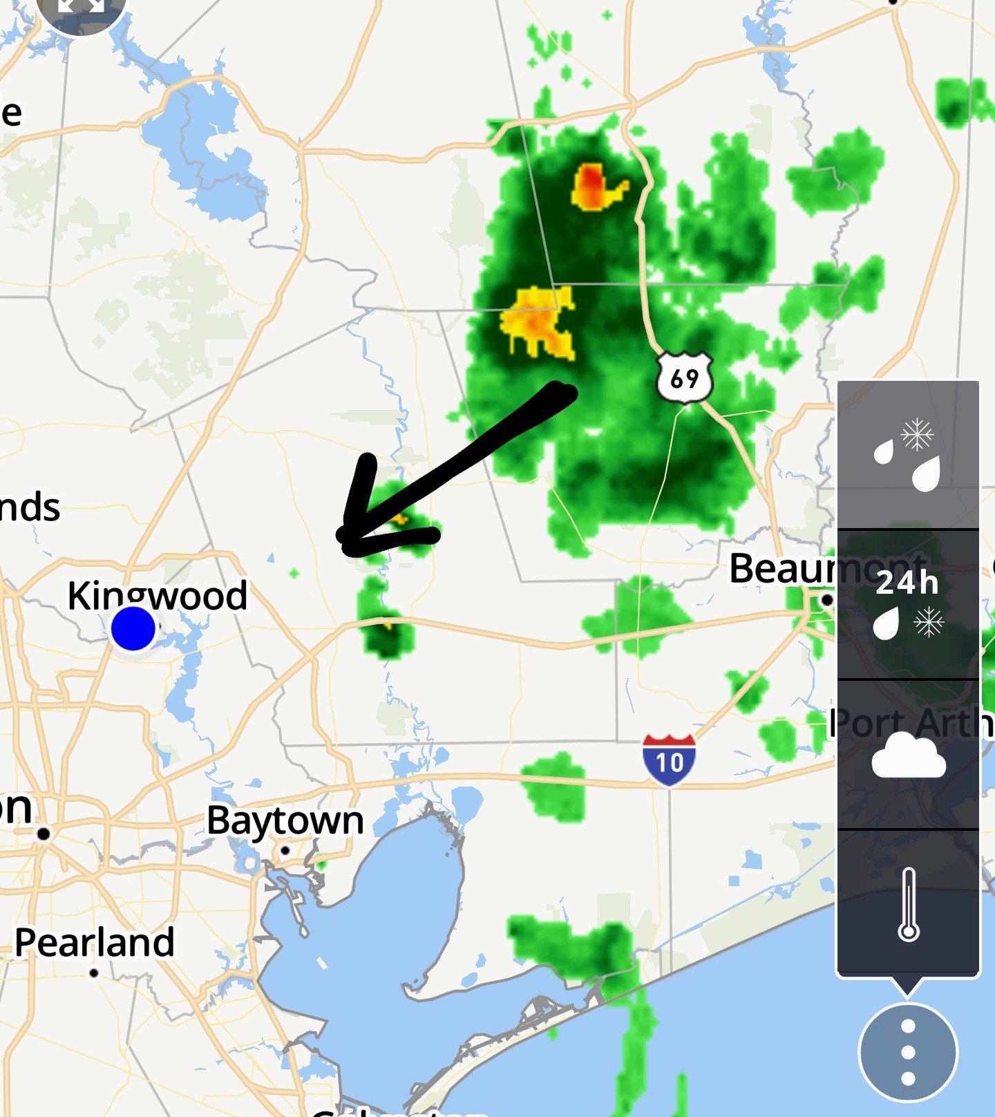 We could still see some scattered thunderstorms late this afternoon.
peppermintstick and SteveT reacted
3pm A few light showers to our NE are heading in this direction. We could still see some scattered thunderstorms late this afternoon.
 StormChaser : Come to mama !!
 « Back to Chat
Views: 277
# Replies: 3