


Storms possible tomorrow night
Storms possible tomorrow night


Joined:
X days ago
# Posts:
X,XXX
Contributor Points:
X


Storms possible tomorrow night *Storms possible Sunday night with the arrival of a cold front.
*40+ mph winds after the front swings through! 😬
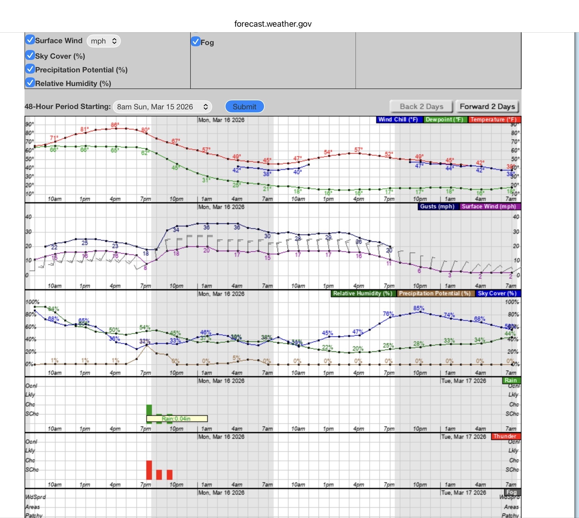
*Chilly start to the week. Sunday night and Monday - Here's where the forecast gets a little wild. *The cold front hits the area in the evening hours Sunday, after highs in the mid-80s.
*It will probably carry a broken line of thunderstorms.
*We don't currently expect any severe weather from this, but it's possible some strong storms occur, especially in northeast Harris or Liberty County.
*The area is in a marginal risk (level 1/5) for severe storms but the front is going to arrive with some oomph. 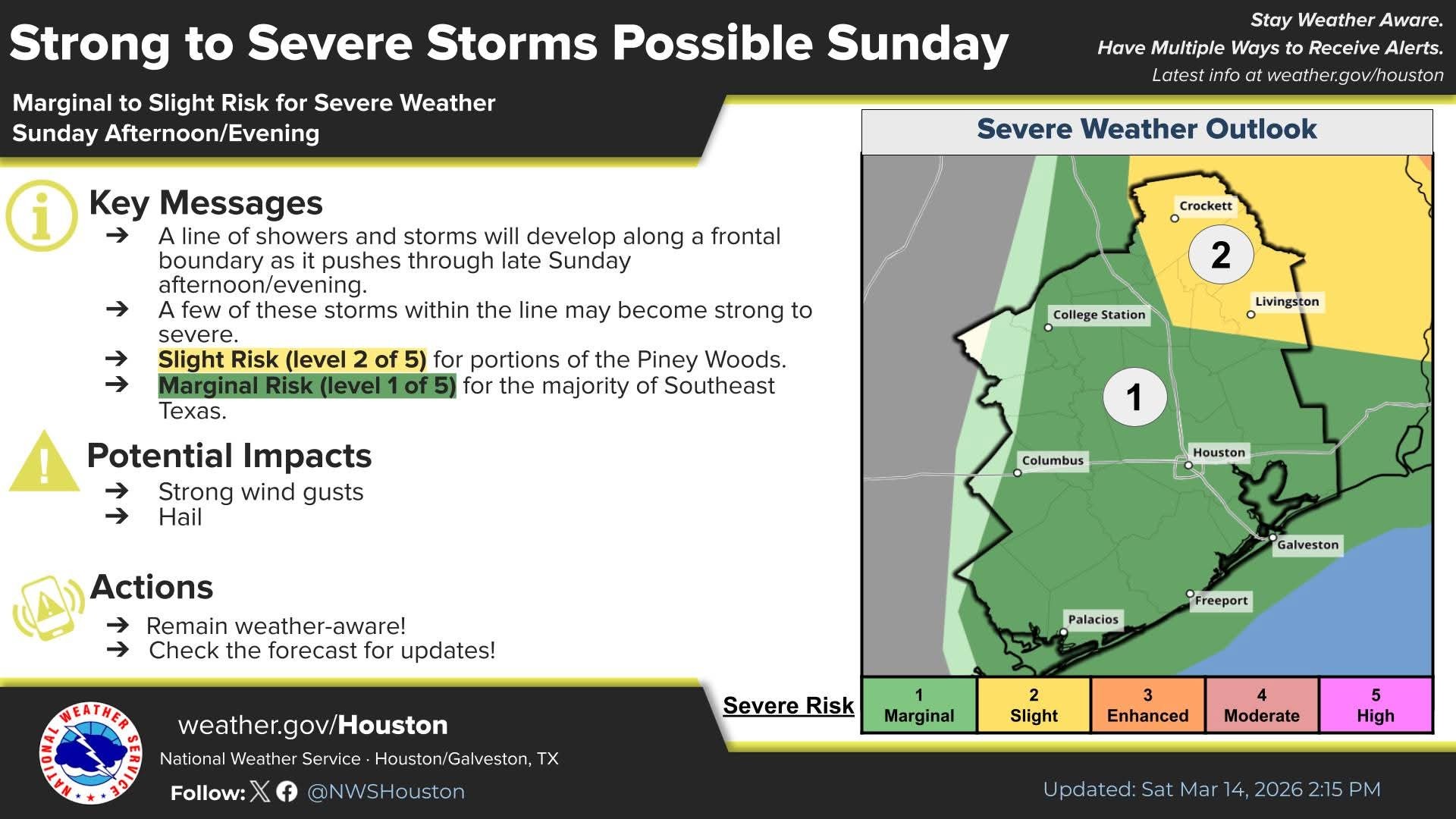 *As winds flip around to come out of the north, they could gust over 40 mph for a few hours Sunday evening.
*Temperatures will also drop about 30 to 40 degrees from highs in the 80s to lows in the 40s. *We try not to be too preachy on the blog here, but this is one of those times where we'll strongly encourage you to secure any loose outdoor objects, as these may be our strongest post-frontal winds since October, or even since last March.
*Those wind gusts will keep up into Monday morning, though slowly back off their peak levels, still probably 30 to 40 mph though.
*After Noon on Monday, winds should more rapidly drop off into the 20s mph. 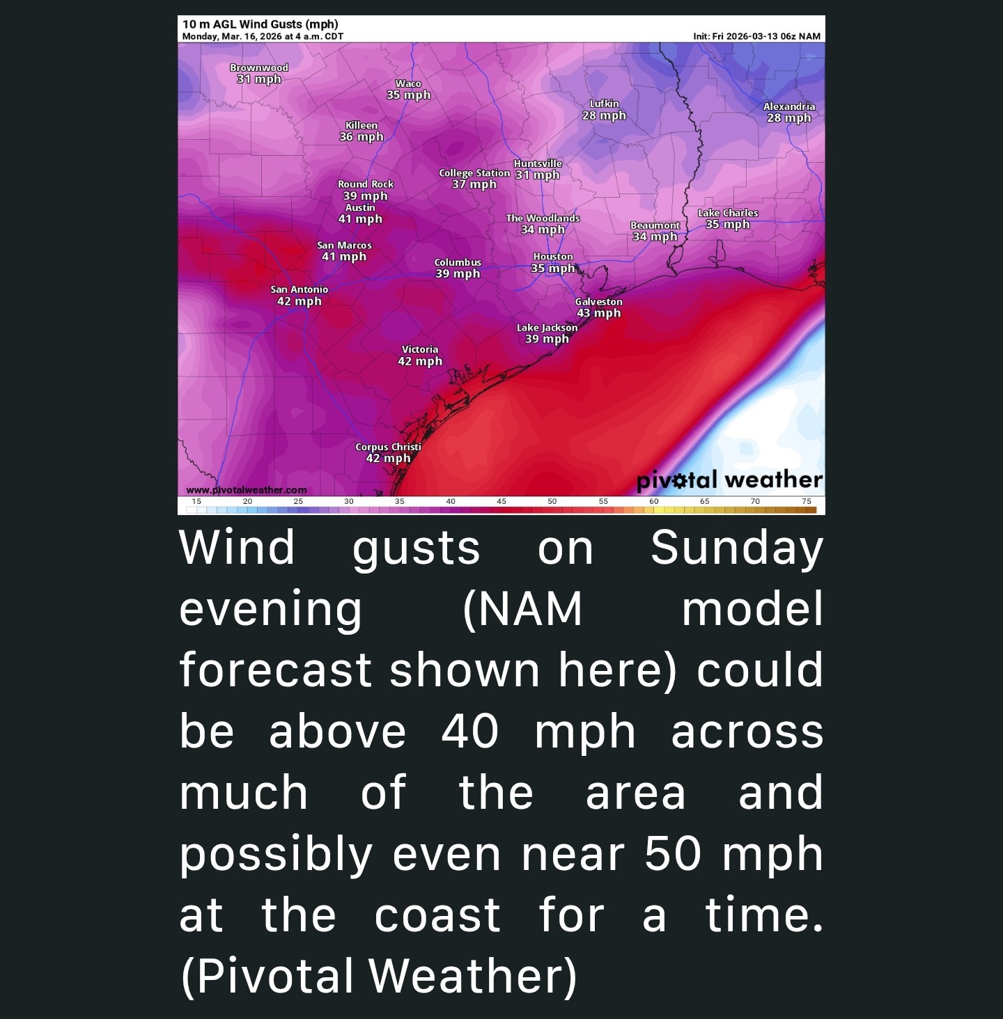 *We are probably not getting out of the mid to upper-50s on Monday, even with sunshine.
*Monday night will be cold with lows in the 30s and low-40s.


cbear, Orangeapple and buffaloglenn + 8 more reacted *40+ mph winds after the front swings through! 😬
*Chilly start to the week.
*It will probably carry a broken line of thunderstorms.
*We don't currently expect any severe weather from this, but it's possible some strong storms occur, especially in northeast Harris or Liberty County.
*The area is in a marginal risk (level 1/5) for severe storms but the front is going to arrive with some oomph.
*Temperatures will also drop about 30 to 40 degrees from highs in the 80s to lows in the 40s.
*Those wind gusts will keep up into Monday morning, though slowly back off their peak levels, still probably 30 to 40 mph though.
*After Noon on Monday, winds should more rapidly drop off into the 20s mph.
*Monday night will be cold with lows in the 30s and low-40s.
Replies:
 StormChaser :
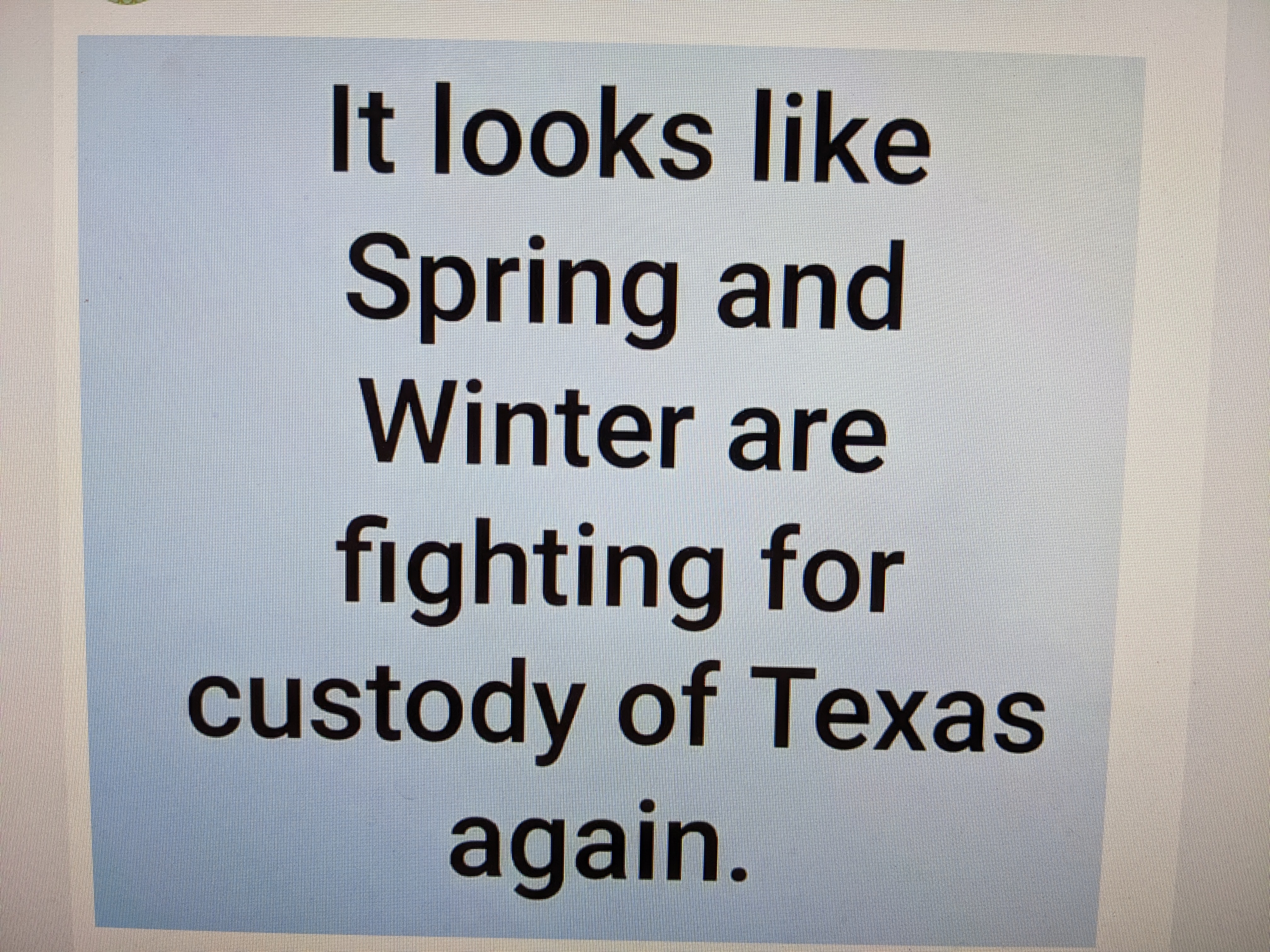
 Thank you for the update. The weather is confused about what season it is.

|
StormChaser : Thank you for the update, I guess this is winter's last stand. Looking forward to mild temps before it starts getting too hot.
Kittle I think I'm confused about what season it is. 
|
|
We're going to be at the tail end of this line. TBD if we'll see severe weather or not. Areas east of here are expecting a tornado outbreak with the front. ➡ First off, the synoptic winds will be very strong, even without storms. These could be gusting over 50 mph and cause minor damage, especially over areas unfortunate enough to have already dealt with severe weather, or even ice storms two months ago. Level 3 Areas: Expect an intense squall line in the late afternoon through after dark hours. Widespread damaging winds will be the main mode with this - gusting over 70MPH in addition to QLCS tornado potential. There is a at least a chance for a rogue supercell or two ahead of this line. If this occurs, tornado chances could go up. For the smaller area around Alabama, this chance appears greater. Level 2 Areas: Outside of the main QLCS zone, but will still catch enough of it that there could be instances of damaging winds. The line might not even have thunder and lightning with it! Just a skinny, fast moving band of showers producing severe gusts. A rogue QLCS spinup is always possible, but less likely here due to lower instability north, and displaced from the best flow south. Level 1 Areas: Given the extreme wind shear that will be developing with this system, we can't rule out severe wind gusts with any activity, though the lack of instability and/or storm timing would typically suggest not much will happen. Insane-o shear can make up for it! 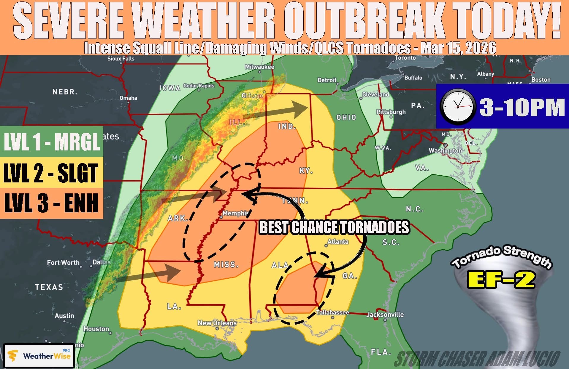
Orangeapple, cbear and wmubronco + 2 more reacted

|
|
Storms possible tomorrow night *Storms possible Sunday night with the arrival of a cold front. *40+ mph winds after the front swings through! 😬 *Chilly start to the week. Sunday night and Monday - Here's where the forecast gets a little wild. *The cold front hits the area in the evening hours Sunday, after highs in the mid-80s. *It will probably carry a broken line of thunderstorms. *We don't currently expect any severe weather from this, but it's possible some strong storms occur, especially in northeast Harris or Liberty County. *The area is in a marginal risk (level 1/5) for severe storms but the front is going to arrive with some oomph. *As winds flip around to come out of the north, they could gust over 40 mph for a few hours Sunday evening. *Temperatures will also drop about 30 to 40 degrees from highs in the 80s to lows in the 40s. *We try not to be too preachy on the blog here, but this is one of those times where we'll strongly encourage you to secure any loose outdoor objects, as these may be our strongest post-frontal winds since October, or even since last March. *Those wind gusts will keep up into Monday morning, though slowly back off their peak levels, still probably 30 to 40 mph though. *After Noon on Monday, winds should more rapidly drop off into the 20s mph. *We are probably not getting out of the mid to upper-50s on Monday, even with sunshine. *Monday night will be cold with lows in the 30s and low-40s.
 StormChaser : Kittle :
 @CatalinaKitKat :
Cantaffordthis : BigBruno : Annie : Zokomo : Orangeapple : « Back to Chat
Views: 461
# Replies: 10