


Space City Sunday forecast
Space City Sunday forecast


Joined:
X days ago
# Posts:
X,XXX
Contributor Points:
X


Space City Sunday forecast ⚡️I think severe weather is possible but not very likely.
🌬 The biggest issue is going to be the wind overnight tonight & tomorrow; 40+ mph tonight & 30+ mph all day Monday.
🔦 We're definitely going to have electricity issues. No way around it with those winds. (Also, make sure you secure any outdoor items that could fly away)
🥶 Temperatures drastically change by tomorrow morning.
🔥 A fire weather watch will also be in place tomorrow - high winds, drought & low humidity are the perfect combo so keep that in mind. ............ From Space City Weather This evening's cold front will hit like a ton of bricks. Eric Berger · Sunday, March 15, 2026 8:03 AM In brief: *We're interrupting your Sunday morning to bring an updated forecast for the arrival time of a strong cold front this evening.
*Not much has changed since our forecast on Friday, but we want people to be aware of what is coming in terms of wind. WHAT to expect and WHEN to expect it - *Today will be a warm one, with high temperatures in the mid-80s, partly to mostly sunny skies, and a decent amount of humidity.
*Yes, it's a little warm for March, but otherwise nothing out of the ordinary. ⏰️ TIMING -- However a fast-moving front this evening will bring a rapid change. ➡️ In terms of timing, I expect the front to probably reach areas such as Katy and The Woodlands between 5 and 7 pm CT.
➡️ Central Houston - including Sugar Land and Baytown - between 6 and 8 pm.
➡️ Galveston by 7 to 9 pm this evening. ❓️ WHAT -- *There will be a brief possibility of showers and thunderstorms
*There is a slight chance of some of these becoming severe, but for most of us probably not.
*This front will be moving so the showers will not last long.
*There has been some internet chatter about a derecho, but we don't have any expectations for that kind of event. Wind forecast: 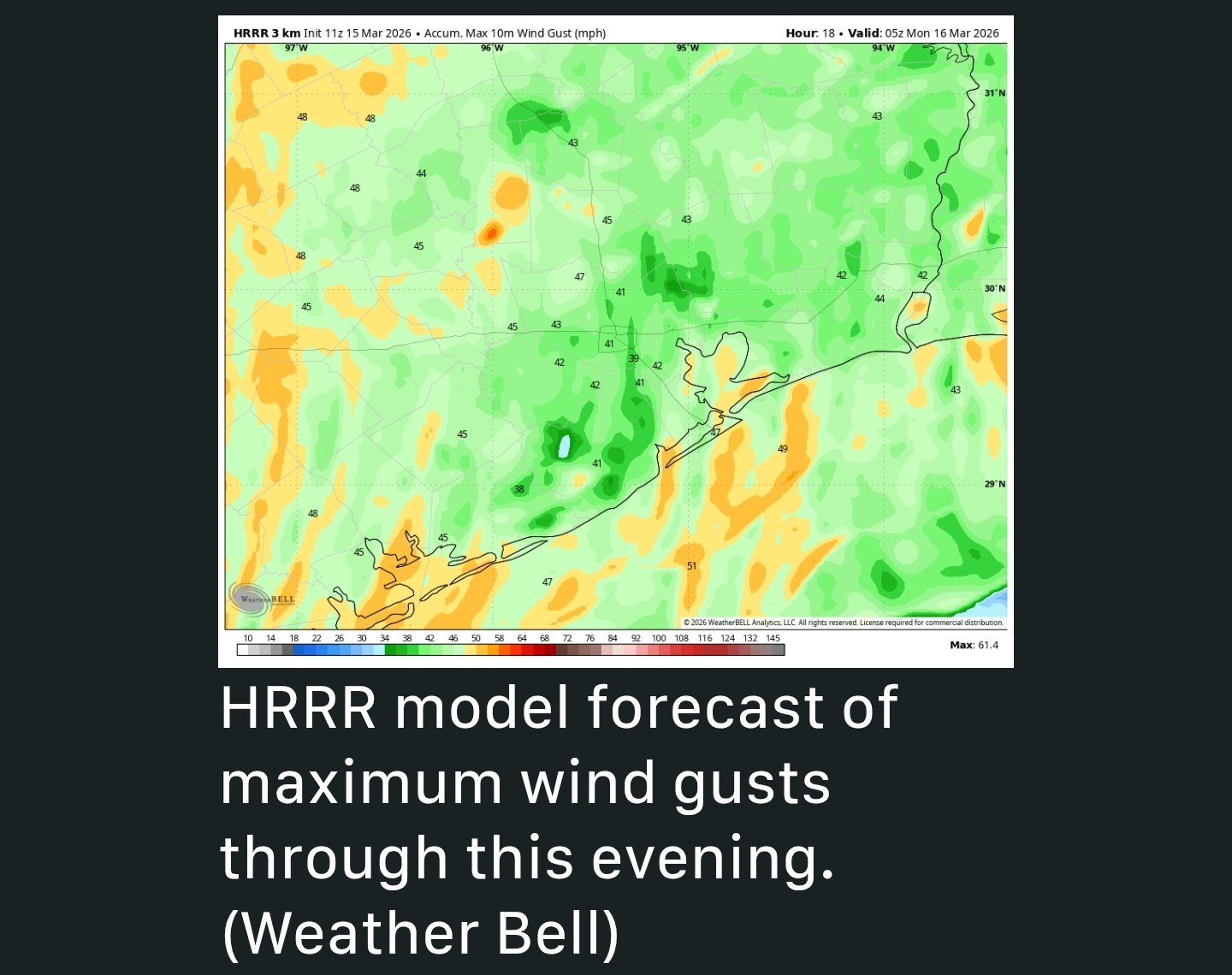 🌬 WINDS -- What will be immediately perceptible is an abrupt wind shift, from a southerly flow to strong gusts from the north. ➡️ Wind gusts behind the front will be up to 45 mph across Houston, and this is strong enough to blow things around.
➡️ It is advisable to secure loose objects and really take care driving.
➡️ The strongest wind gusts will persist OVERNIGHT before settling down a little bit on Monday morning (to maybe around 30 mph). 👉 AFTERWARDS -- *This won't be a "Blue Norther" type front with temperatures dropping sharply immediately.
*I expect them to fall 5 to 10 degrees after the front's passage, and then steadily drop with temperatures in the low 50s by midnight, to around 40 degrees by Monday morning.
*With the wind chill, it will be very cold on Monday morning, possibly feeling like it's about 30 degrees outside.
*You'll definitely want to bundle up. We'll be back at that time with a full weather update for you later.


CatalinaKitKat, SummerSneeze and peppermintstick + 3 more reacted 🌬 The biggest issue is going to be the wind overnight tonight & tomorrow; 40+ mph tonight & 30+ mph all day Monday.
🔦 We're definitely going to have electricity issues. No way around it with those winds. (Also, make sure you secure any outdoor items that could fly away)
🥶 Temperatures drastically change by tomorrow morning.
🔥 A fire weather watch will also be in place tomorrow - high winds, drought & low humidity are the perfect combo so keep that in mind.
*Not much has changed since our forecast on Friday, but we want people to be aware of what is coming in terms of wind.
*Yes, it's a little warm for March, but otherwise nothing out of the ordinary.
➡️ Central Houston - including Sugar Land and Baytown - between 6 and 8 pm.
➡️ Galveston by 7 to 9 pm this evening.
*There is a slight chance of some of these becoming severe, but for most of us probably not.
*This front will be moving so the showers will not last long.
*There has been some internet chatter about a derecho, but we don't have any expectations for that kind of event.
➡️ It is advisable to secure loose objects and really take care driving.
➡️ The strongest wind gusts will persist OVERNIGHT before settling down a little bit on Monday morning (to maybe around 30 mph).
*I expect them to fall 5 to 10 degrees after the front's passage, and then steadily drop with temperatures in the low 50s by midnight, to around 40 degrees by Monday morning.
*With the wind chill, it will be very cold on Monday morning, possibly feeling like it's about 30 degrees outside.
*You'll definitely want to bundle up.
Replies:
StormChaser: gotta love Texas weather.

|
AlertMCTX: 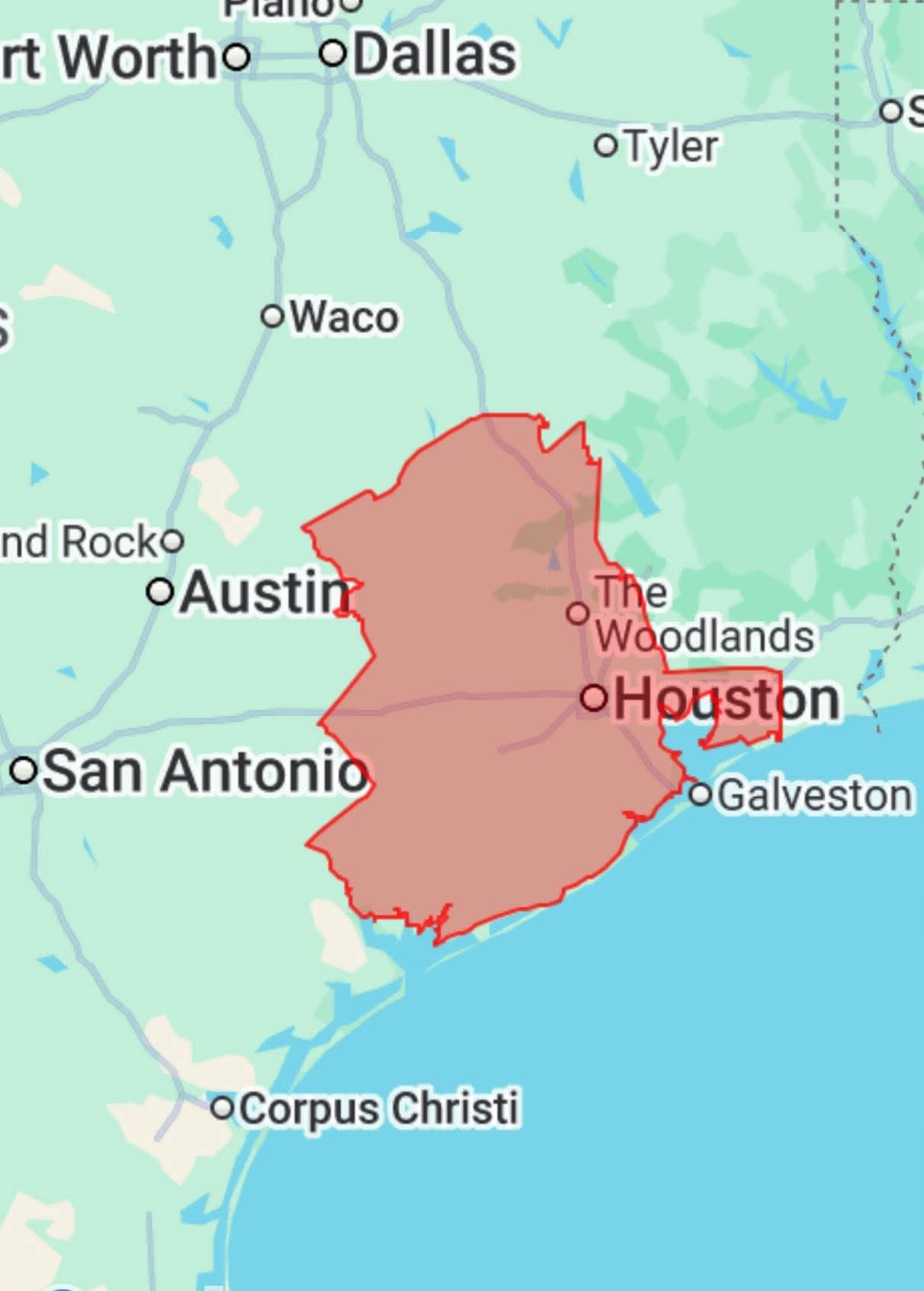 Fire Weather Watch
Fire Weather Watch issued March 15 at 6:01AM CDT until March 16 at 7:00PM CDT by NWS Houston/Galveston TX ...FIRE WEATHER WATCH IN EFFECT FROM MONDAY MORNING THROUGH
MONDAY EVENING FOR WIND AND LOW RELATIVE HUMIDITY FOR PORTIONS OF
SOUTHEAST TEXAS, PRIMARILY ALONG AND WEST OF THE I-45 CORRIDOR
AND ALONG THE COAST... * WINDS...North 15 to 25 mph with gusts up to 35 mph. * RELATIVE HUMIDITY...As low as 15 percent. * IMPACTS...Any fires that develop will be capable of spreading
rapidly. Outdoor burning is not recommended. Obey all local
burn restrictions and burn bans.
peppermintstick and cbear reacted Fire Weather Watch issued March 15 at 6:01AM CDT until March 16 at 7:00PM CDT by NWS Houston/Galveston TX
MONDAY EVENING FOR WIND AND LOW RELATIVE HUMIDITY FOR PORTIONS OF
SOUTHEAST TEXAS, PRIMARILY ALONG AND WEST OF THE I-45 CORRIDOR
AND ALONG THE COAST...
rapidly. Outdoor burning is not recommended. Obey all local
burn restrictions and burn bans.
|
|
WIND ADVISORY REMAINS IN EFFECT FROM 7 AM SUNDAY TO 7 PM CDT
MONDAY... * WHAT...Northwest winds 15 to 25 mph with gusts up to 40 mph expected. * WHERE...Portions of north central and northwest Louisiana and east and northeast Texas. * WHEN...From 7 AM Sunday to 7 PM CDT Monday. * IMPACTS...Gusty winds will blow around unsecured objects. Tree limbs could be blown down and a few power outages may result. PRECAUTIONARY/PREPAREDNESS ACTIONS... Winds this strong can make driving difficult, especially for high profile vehicles. Use extra caution.
peppermintstick reacted MONDAY...
|
|

Space City Sunday forecast ⚡️I think severe weather is possible but not very likely. 🌬 The biggest issue is going to be the wind overnight tonight & tomorrow; 40+ mph tonight & 30+ mph all day Monday. 🔦 We're definitely going to have electricity issues. No way around it with those winds. (Also, make sure you secure any outdoor items that could fly away) 🥶 Temperatures drastically change by tomorrow morning. 🔥 A fire weather watch will also be in place tomorrow - high winds, drought & low humidity are the perfect combo so keep that in mind. ............ From Space City Weather This evening's cold front will hit like a ton of bricks. Eric Berger · Sunday, March 15, 2026 8:03 AM In brief: *We're interrupting your Sunday morning to bring an updated forecast for the arrival time of a strong cold front this evening. *Not much has changed since our forecast on Friday, but we want people to be aware of what is coming in terms of wind. WHAT to expect and WHEN to expect it - *Today will be a warm one, with high temperatures in the mid-80s, partly to mostly sunny skies, and a decent amount of humidity. *Yes, it's a little warm for March, but otherwise nothing out of the ordinary. ⏰️ TIMING -- However a fast-moving front this evening will bring a rapid change. ➡️ In terms of timing, I expect the front to probably reach areas such as Katy and The Woodlands between 5 and 7 pm CT. ➡️ Central Houston - including Sugar Land and Baytown - between 6 and 8 pm. ➡️ Galveston by 7 to 9 pm this evening. ❓️ WHAT -- *There will be a brief possibility of showers and thunderstorms *There is a slight chance of some of these becoming severe, but for most of us probably not. *This front will be moving so the showers will not last long. *There has been some internet chatter about a derecho, but we don't have any expectations for that kind of event. Wind forecast: 🌬 WINDS -- What will be immediately perceptible is an abrupt wind shift, from a southerly flow to strong gusts from the north. ➡️ Wind gusts behind the front will be up to 45 mph across Houston, and this is strong enough to blow things around. ➡️ It is advisable to secure loose objects and really take care driving. ➡️ The strongest wind gusts will persist OVERNIGHT before settling down a little bit on Monday morning (to maybe around 30 mph). 👉 AFTERWARDS -- *This won't be a "Blue Norther" type front with temperatures dropping sharply immediately. *I expect them to fall 5 to 10 degrees after the front's passage, and then steadily drop with temperatures in the low 50s by midnight, to around 40 degrees by Monday morning. *With the wind chill, it will be very cold on Monday morning, possibly feeling like it's about 30 degrees outside. *You'll definitely want to bundle up. We'll be back at that time with a full weather update for you later.
StormChaser : Gammyof2 : I wonder about the amount of rain. My allergies are a bit rough this morning so a good washing of the air would be welcomed.
|
|
StormChaser : Gammyof2 : I wonder about the amount of rain. My allergies are a bit rough this morning so a good washing of the air would be welcomed.
cbear : Mine have been awful for about a week with all the pollen out there. This will likely make it worse. 🤦♀️
|
|
cbear : Mine have been awful for about a week with all the pollen out there. This will likely make it worse. 🤦♀️
 StormChaser : Ugh. You know it is bad when.....you get in your car ( that is parked in the garage) and it still has lots of pollen on it!!
|
|
StormChaser : I am ready for some cooler temperatures in the morning and evening. Highs in the 70's during the day is perfect too. I can do without much rain as my yard is still wet in some areas from last week's rain. Thank you for the forecast.
|
|
3pm radar 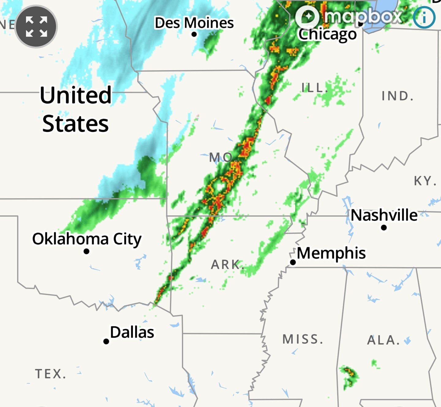 Tornado watch to our NE
 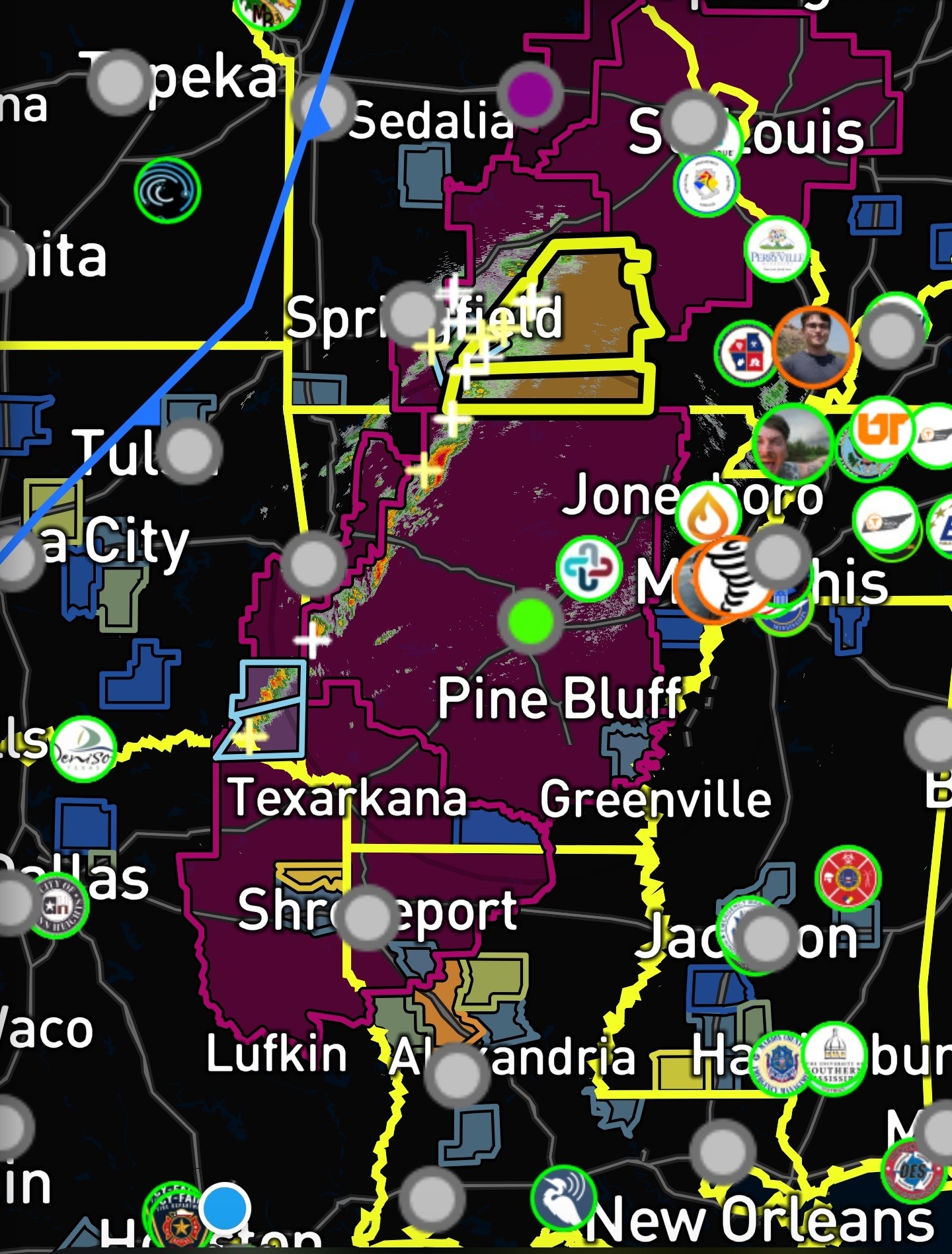 Power outages along the front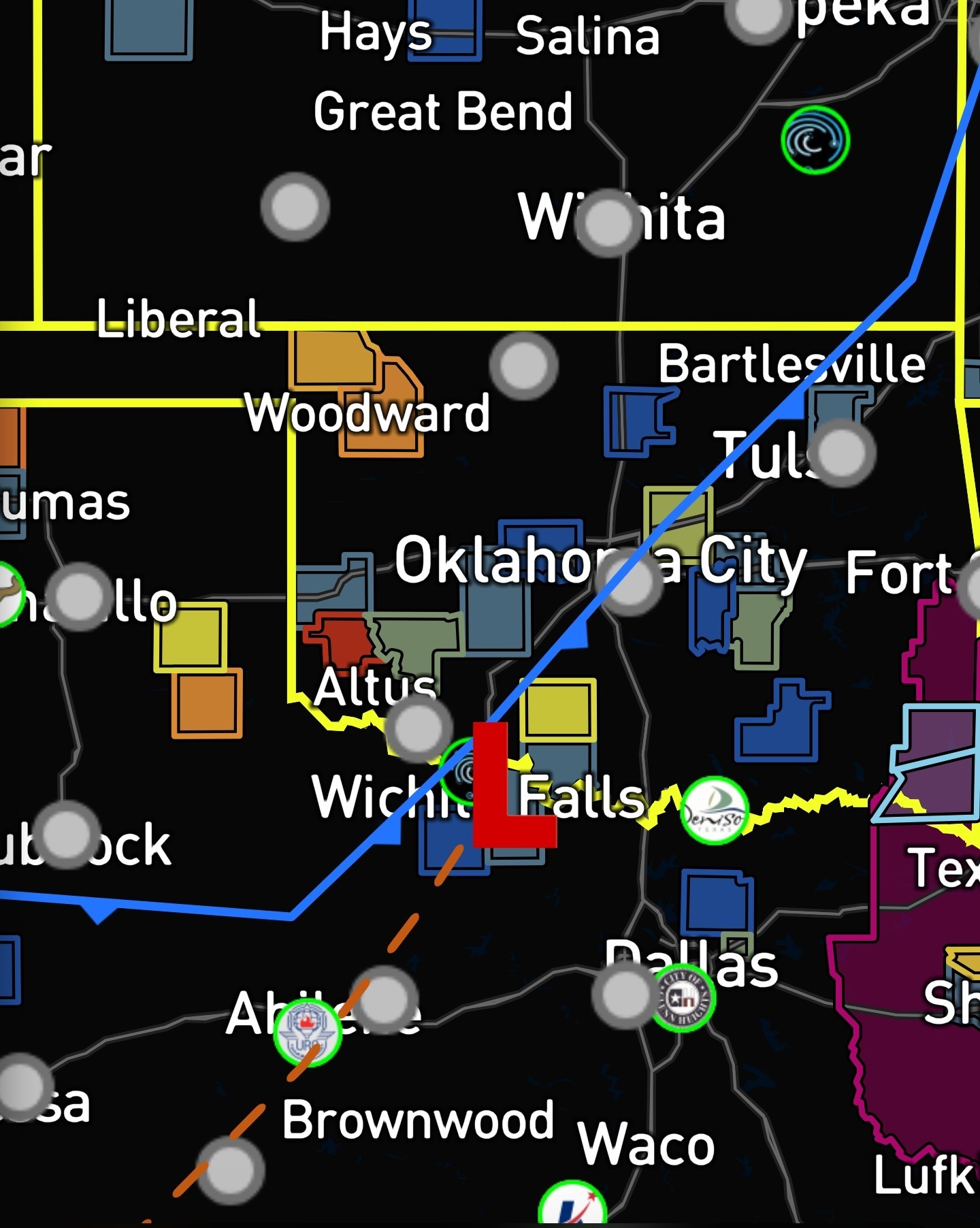
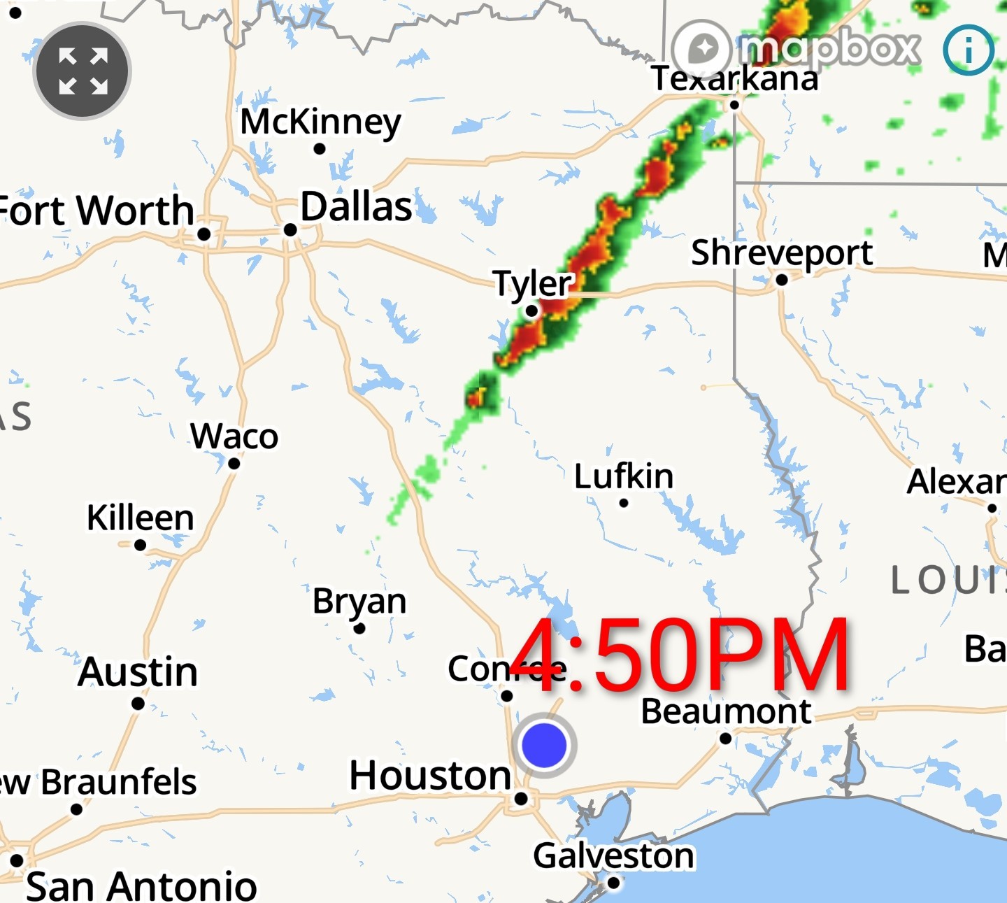
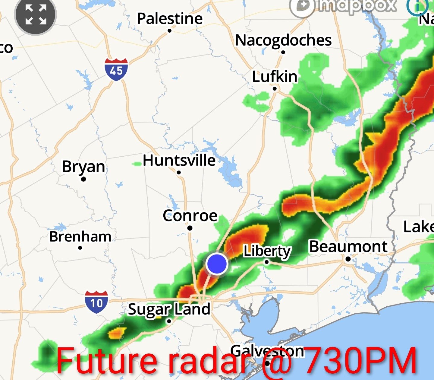
|
|
5:55PM current radar 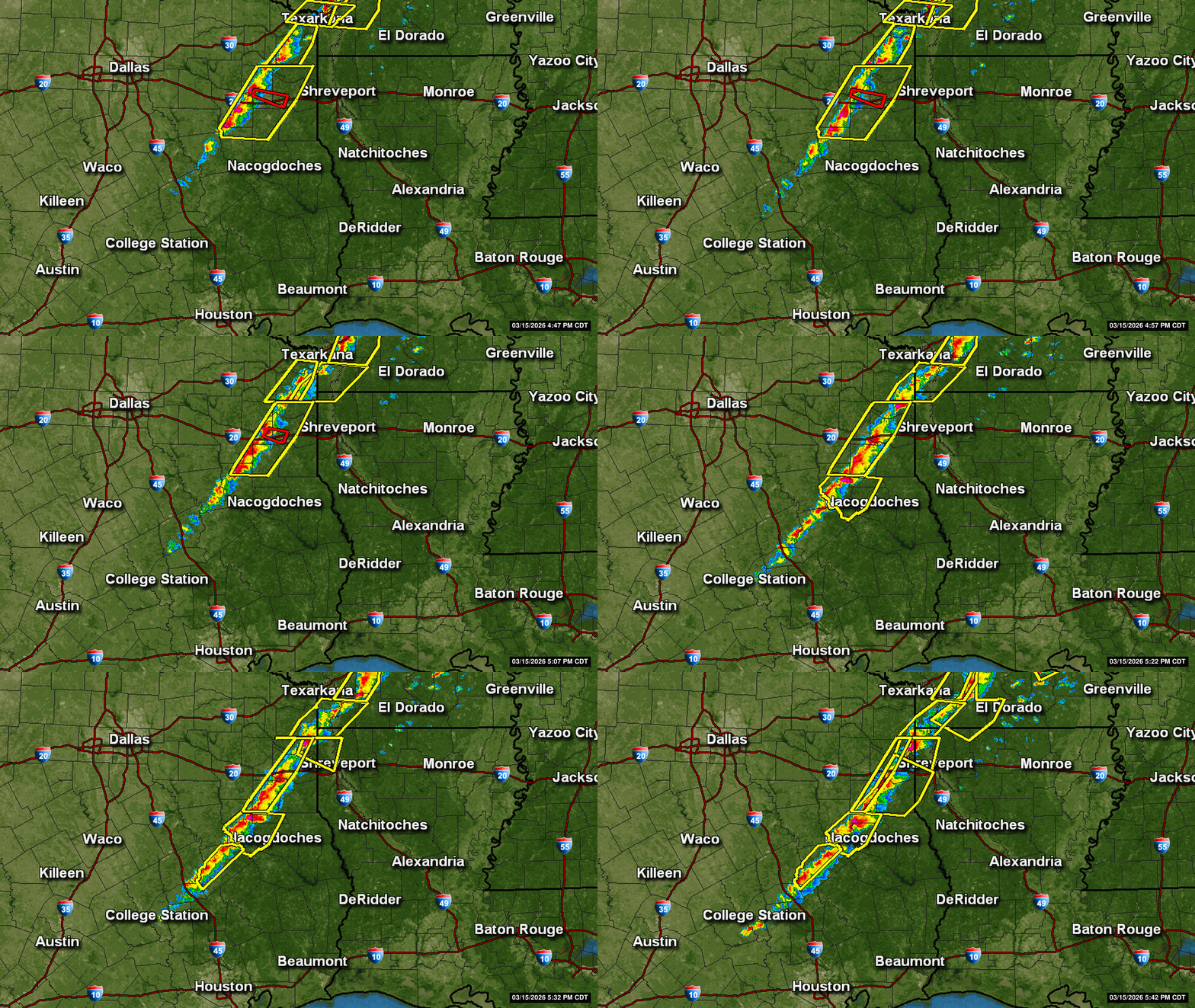
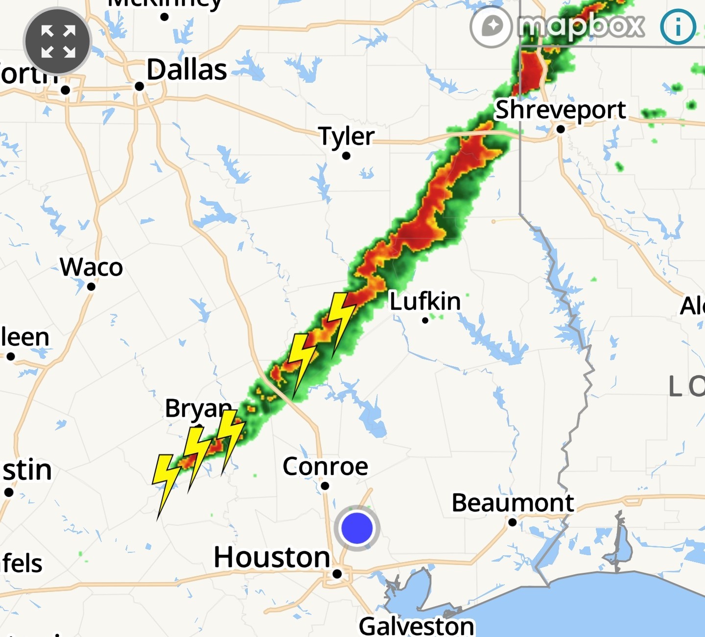 Severe Thunderstorm warnings all along the line & major power outages:
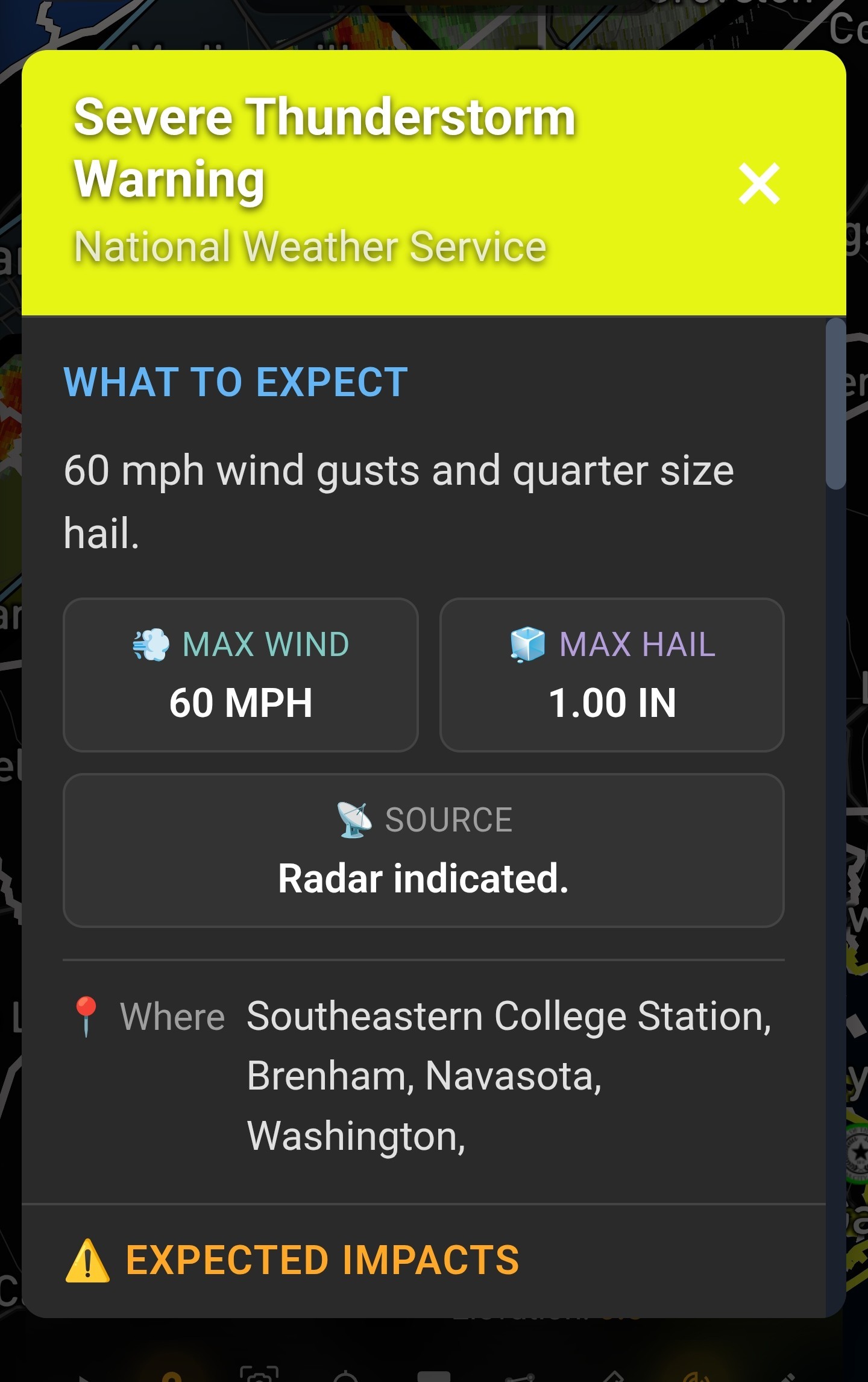
 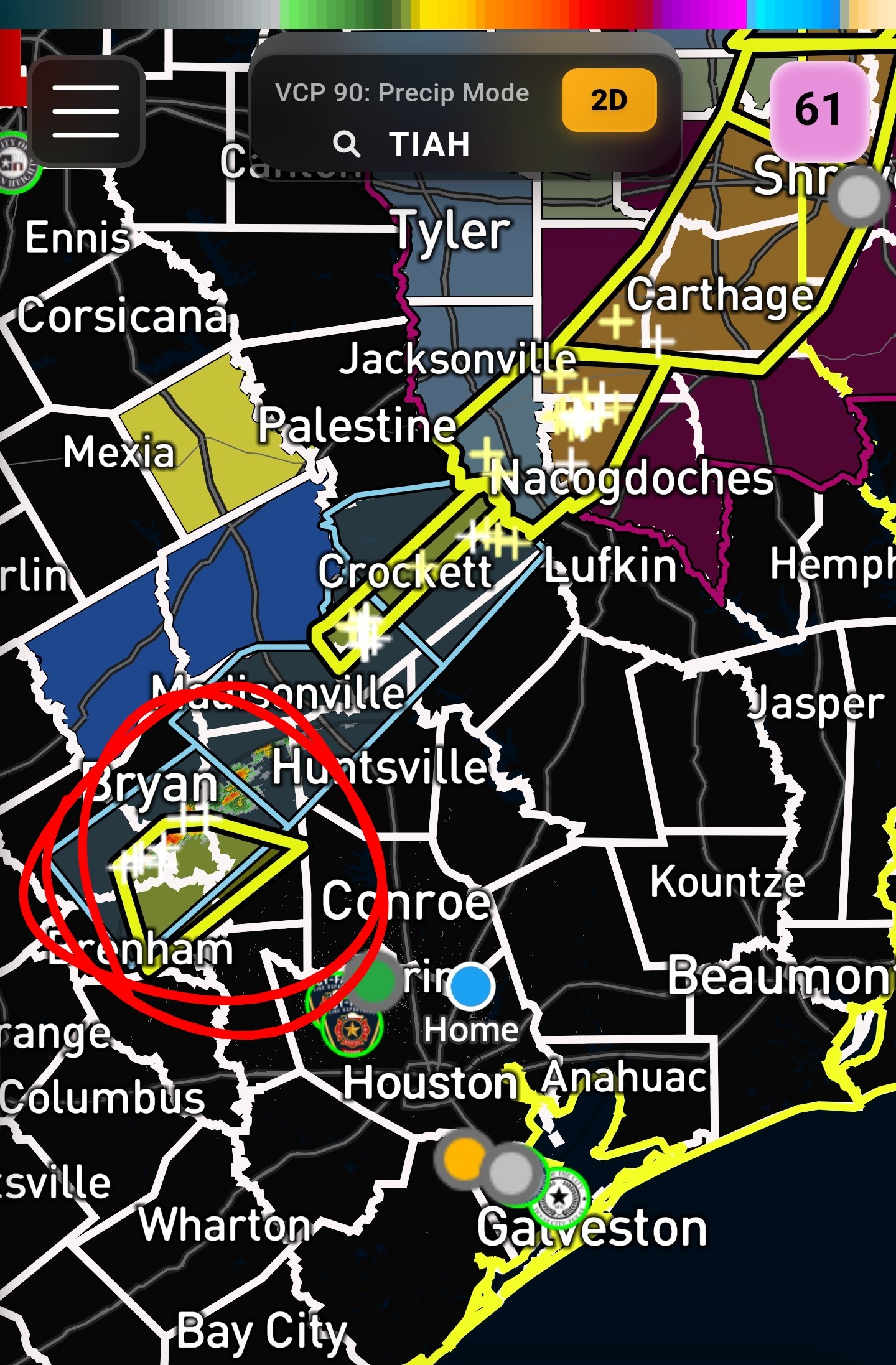 College Station:
« Back to Chat
Views: 431
# Replies: 14