


Space City: Friday storm forecast
Space City: Friday storm forecast


Joined:
X days ago
# Posts:
X,XXX
Contributor Points:
X


Space City: Friday storm forecast ⚠️ Look for severe weather watches to be issued later this morning, for the afternoon & evening hours. We'll likely see a severe thunderstorm watch and maybe even a tornado watch as well. We'll see. ➡️ From Space City Weather: Strong to severe storms await Houston later Friday. Matt Lanza · Friday, May 2, 2025 6:57 AM In brief:
*Strong to severe thunderstorms are likely this afternoon and evening in the Houston area, especially north of I-10.
*Hail and strong wind gusts are the main concerns.
*Heavy rain is also likely in spots, so a stage 1 flood alert has been posted.
*After today, we get some quiet, if not absolutely beautiful weather this weekend. TODAY/TONIGHT: So, let's get this out of the way first: This morning looks fine. No issues. 👍 *Starting this afternoon, probably not long after lunchtime, numerous showers and thunderstorms are likely to begin developing north of I-10.
*The environment over Houston looks conducive for virtually any storm to become strong to severe today. ⚡️
*As such, we are now in an enhanced risk (3/5) of severe weather this afternoon and evening. 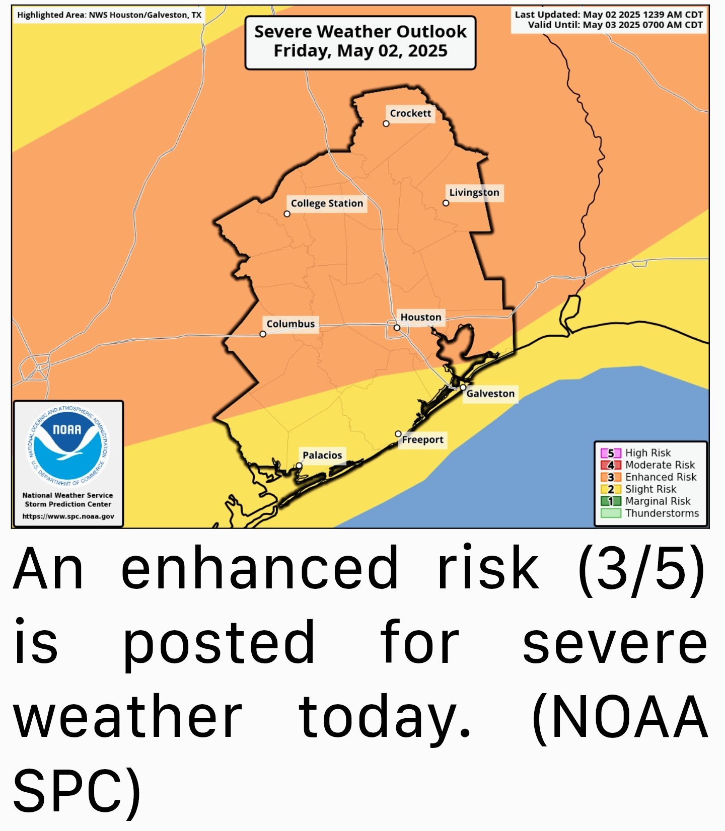 *The two main threats today will be pockets of strong wind gusts in excess of 40-50 mph and the potential for hail. 🧊
*An isolated tornado cannot be entirely ruled out, but the bigger risks are damaging wind and hail today. 🌪
*The evolution of storms today will probably be individual cells eventually congealing into a line that lingers for a bit over much of the Houston area, again focused near or north of I-10.
*The severe storm threat should begin to wane after sunset, but additional thunderstorms are likely, especially south of I-10 overnight. So, almost everyone should get a chance to participate today with the nastier storms north this afternoon and evening and less intense storms south this evening and overnight. *In addition to the hail and wind, these storms could produce torrential rainfall, with totals of up to 3 or 4 inches possible in isolated pockets. ⛈️☔️
*Street flooding could easily crop up with storms like this, so, with that in mind, we are issuing a Stage 1 flood alert for this afternoon and evening across the area, mainly north of I-10. 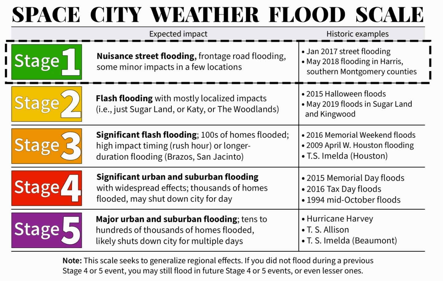 *There are always fail modes on days like this, and it could be that we end up with heavy rain and generic thunderstorms more so than severe weather.
*Nevertheless, the environment today is definitely prime for some strong to severe storms, particularly between 1 PM and 8 PM 🕘 so you'll want to remain tuned into what's happening. Eric will have the latest for you around midday with a fresh update & we'll follow with further updates as needed thereafter. I will update as needed when watches and warnings get posted. ⚠️⛔️
*********************
*Strong to severe thunderstorms are likely this afternoon and evening in the Houston area, especially north of I-10.
*Hail and strong wind gusts are the main concerns.
*Heavy rain is also likely in spots, so a stage 1 flood alert has been posted.
*After today, we get some quiet, if not absolutely beautiful weather this weekend.
*The environment over Houston looks conducive for virtually any storm to become strong to severe today. ⚡️
*As such, we are now in an enhanced risk (3/5) of severe weather this afternoon and evening.
*An isolated tornado cannot be entirely ruled out, but the bigger risks are damaging wind and hail today. 🌪
*The evolution of storms today will probably be individual cells eventually congealing into a line that lingers for a bit over much of the Houston area, again focused near or north of I-10.
*The severe storm threat should begin to wane after sunset, but additional thunderstorms are likely, especially south of I-10 overnight.
*Street flooding could easily crop up with storms like this, so, with that in mind, we are issuing a Stage 1 flood alert for this afternoon and evening across the area, mainly north of I-10.
*Nevertheless, the environment today is definitely prime for some strong to severe storms, particularly between 1 PM and 8 PM 🕘 so you'll want to remain tuned into what's happening.