


Severe Thunderstorm watch
Severe Thunderstorm watch


Joined:
X days ago
# Posts:
X,XXX
Contributor Points:
X
Replies:


StormChaser: That new Severe thunderstorm warning looks to be pointed right at us.
 jonesjones12 : I just posted that lol. Looks like I spoke too damn soon!
StormChaser : looks like a small storm above the Woodlands right now...
 LittleTexas : I just posted the info on this thread
 StormChaser :
 I was looking at where it was going. Kinda looked like we might get a splash, but my hourly forecast shows same weather as currently. Do you see anything more?
StormChaser : I was looking at where it was going. Kinda looked like we might get a splash, but my hourly forecast shows same weather as currently. Do you see anything more?
LittleTexas : It looks like its going to go west of us but things change quickly..... 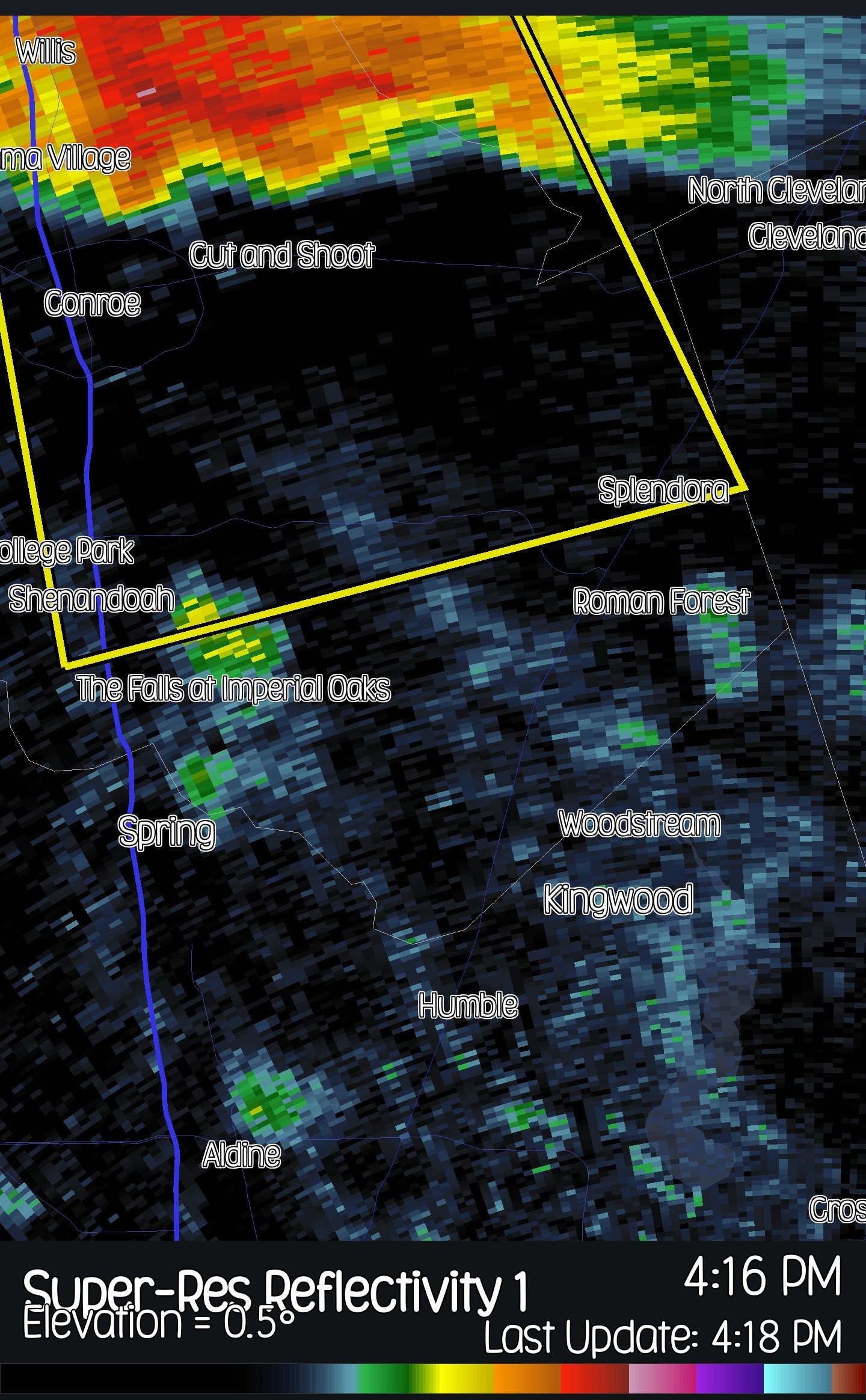
So far, it appears to be attached to the low-pressure surface trough. Which it would start to turn more south, putting Kingwood on the clean side.
435pm severe thunderstorm warning -- The cell looks to be loosing steam when looking at the last radar scans. Its still sinking south and still looks to go to our west at this time. 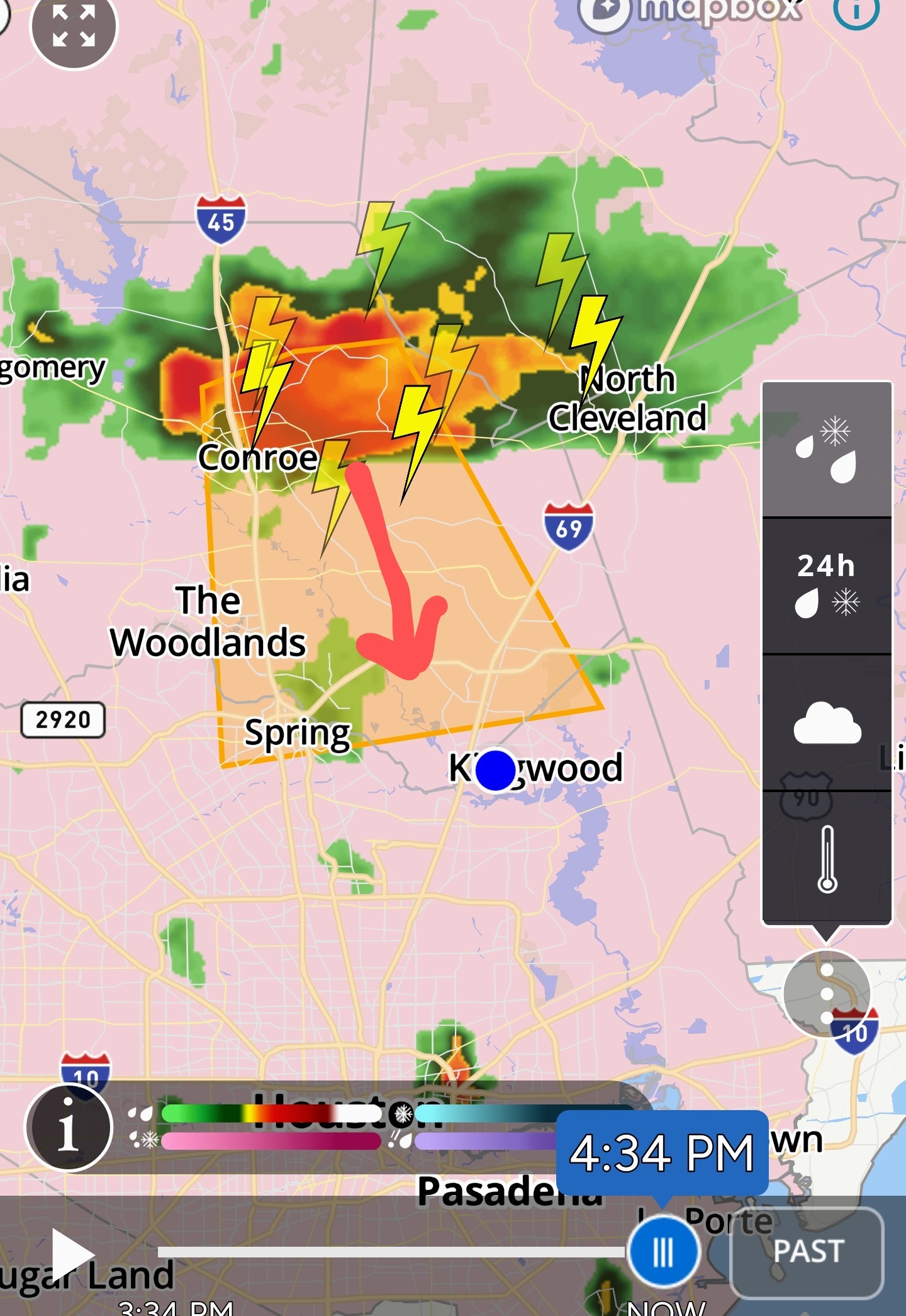
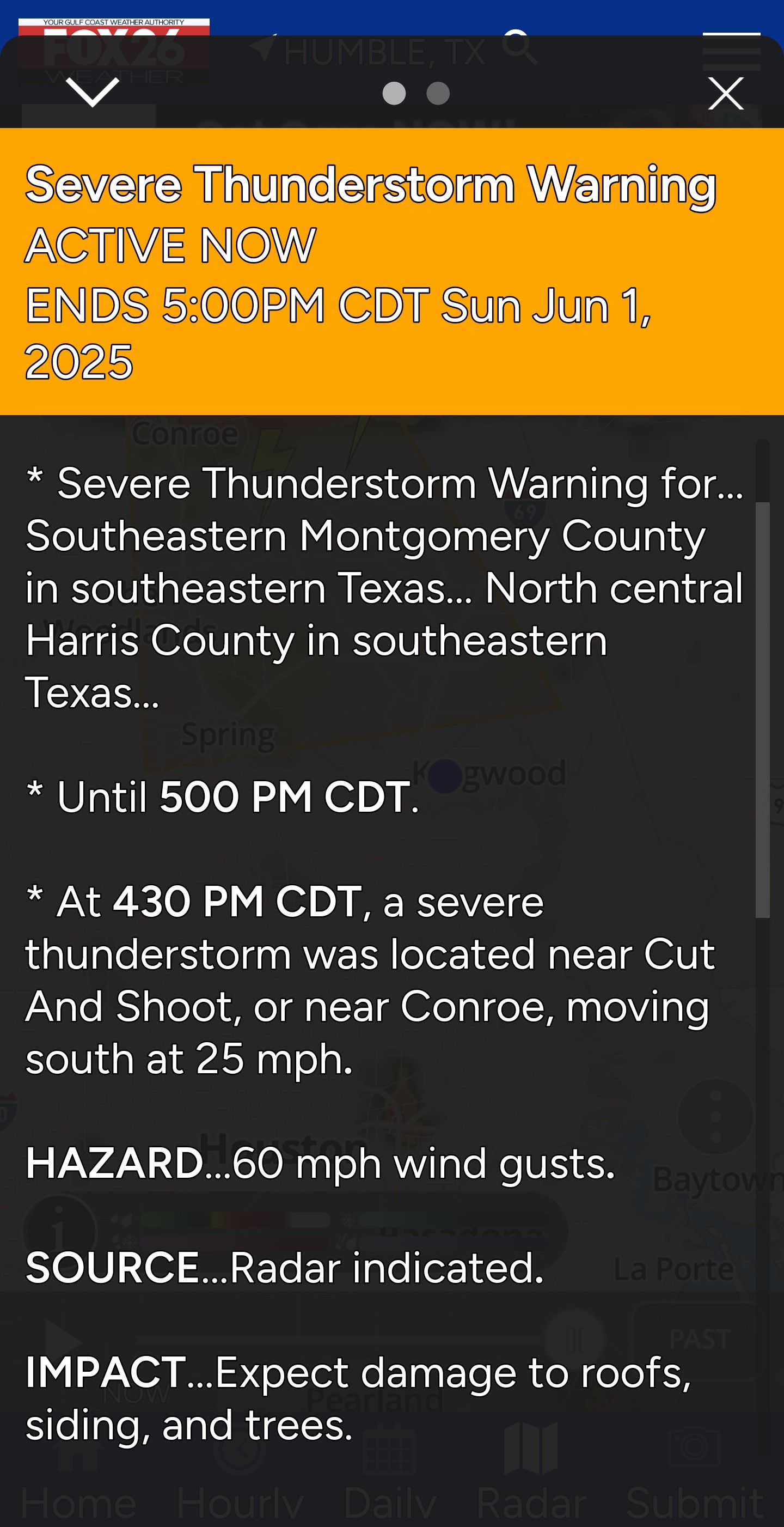
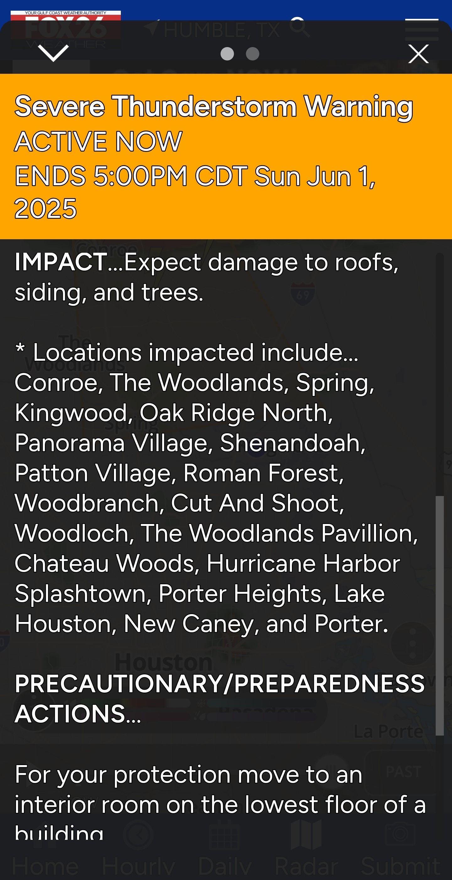
Severe Thunderstorm watch Severe Thunderstorm watch until 10pm tonight. *Our atmosphere is prime for severe weather - Like Austin last week. We definitely need to keep an eye on the alerts as they come in. (I'll post them as they do 🚨 I'm thinking 3pm-8pm will be very busy for us. Severe Thunderstorm Watch issued June 1 at 1:42PM CDT until June 1 at 10:00PM CDT by NWS Houston/Galveston TX The National Weather Service has issued Severe Thunderstorm Watch 352 in effect until 10 PM CDT this evening for the following areas In Texas this watch includes 16 counties In southeast Texas Austin Brazos Burleson Fort Bend Grimes Harris Houston Liberty Madison Montgomery Polk San Jacinto Trinity Walker Waller Washington This includes the cities of Bellville, Brenham, Brookshire, Bryan, Caldwell, Cleveland, Coldspring, College Station, Conroe, Corrigan, Crockett, Dayton, First Colony, Groveton, Hempstead, Houston, Huntsville, Liberty, Livingston, Madisonville, Mission Bend, Missouri City, Navasota, Pecan Grove, Prairie View, Rosenberg, Sealy, Shepherd, Somerville, Sugar Land, The Woodlands, Trinity, and Waller.
StormChaser : Apparently impacting woodlands area right now
Special Weather Statement 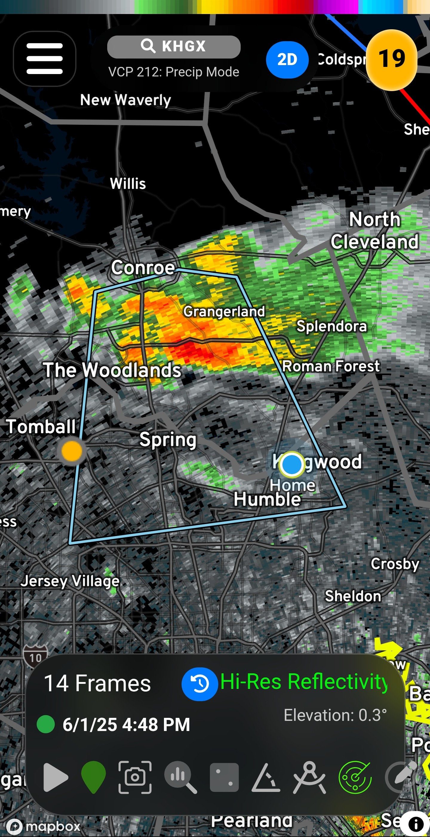 At 447 PM CDT, Doppler radar was tracking a strong thunderstorm over Woodloch, or near The Woodlands, moving south at 25 mph. HAZARD...Wind gusts up to 40 mph and pea size hail. SOURCE...Radar indicated. IMPACT...Gusty winds could knock down tree limbs and blow around unsecured objects. Minor hail damage to vegetation is possible. Locations impacted include... Southeastern Conroe, Humble, The Woodlands, Spring, Kingwood, Greater Greenspoint, Oak Ridge North, Shenandoah, Woodloch, Bush Intercontinental Airport, The Woodlands Pavillion, Hooks Airport, Chateau Woods, Willowbrook, Hurricane Harbor Splashtown, Porter Heights, Lake Houston, northern Atascocita, and Porter. PRECAUTIONARY/PREPAREDNESS ACTIONS... If outdoors, consider seeking shelter inside a building. This storm may intensify, so be certain to monitor local radio stations and available television stations for additional information and possible warnings from the National Weather Service. A Severe Thunderstorm Watch remains in effect until 1000 PM CDT for southeastern Texas.
5PM - Still Severe warned but running out of fuel fast! 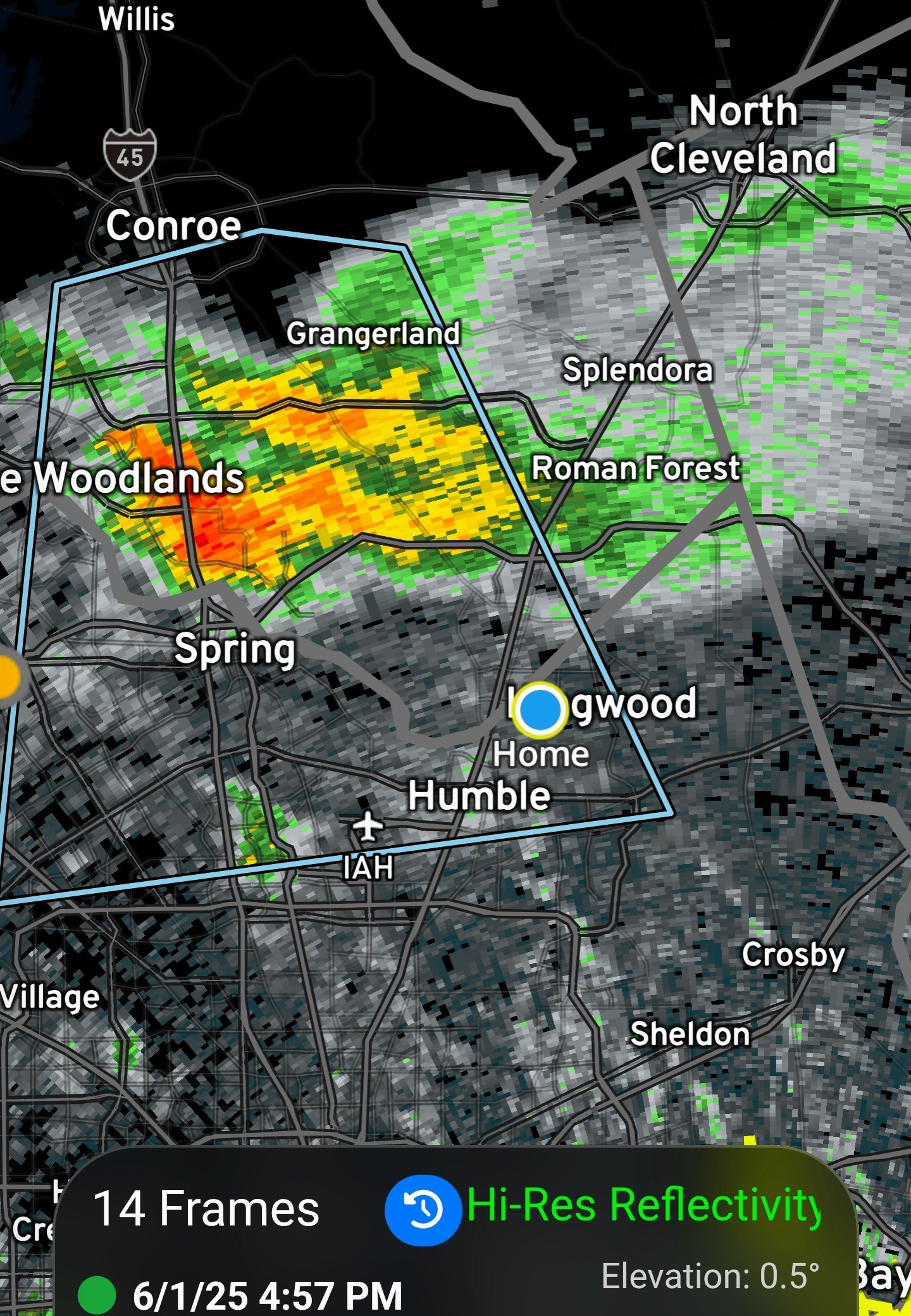
I called the south turn and the dying out. One more win for the Satellite and the RAP.
I called the south turn and the dying out. One more win for the Satellite and the RAP.
 Slow4x4 : No rain at all?
Slow4x4 : No rain at all?
 cbear : stretched out cloud top should drop a very small amount for Kingwood.
 « Back to Chat
Views: 5,115
# Replies: 41