


Severe Thunderstorm watch
Severe Thunderstorm watch


Joined:
X days ago
# Posts:
X,XXX
Contributor Points:
X


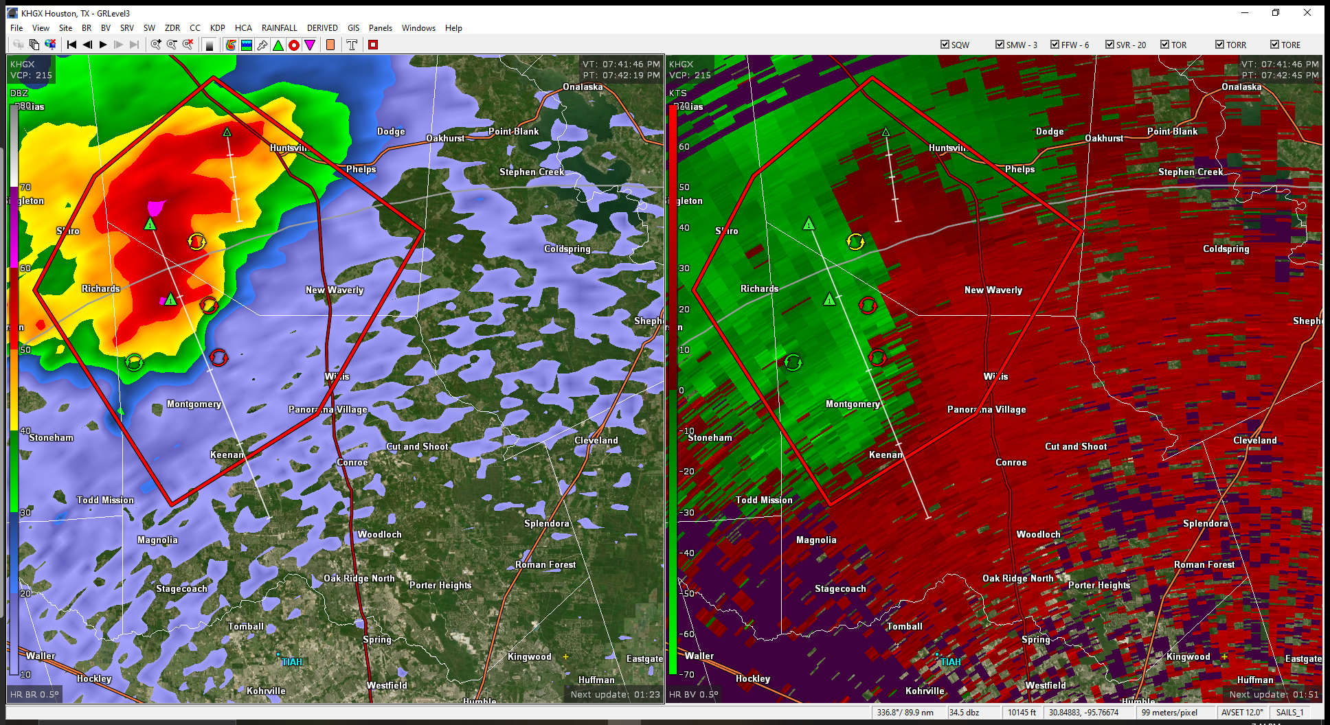
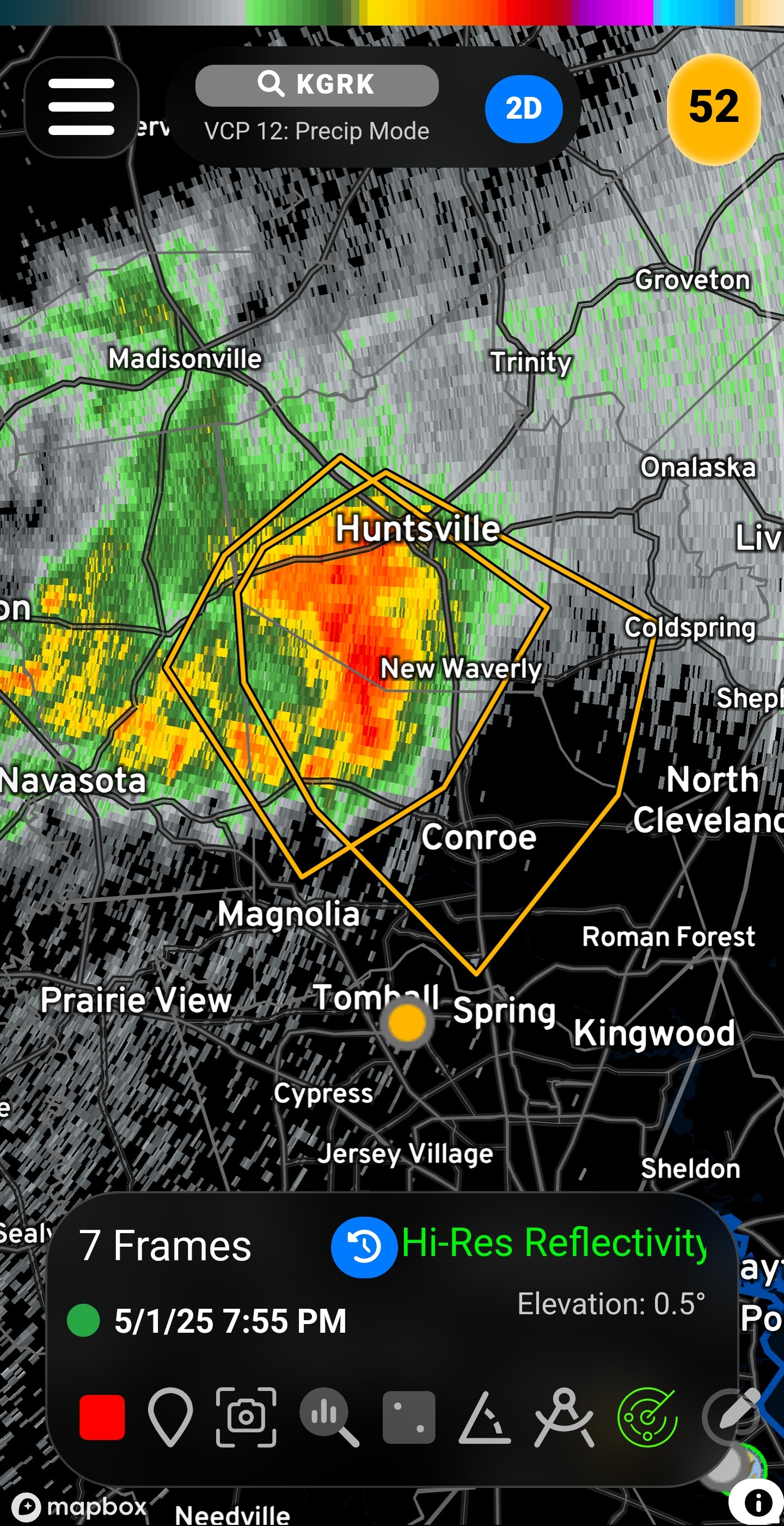
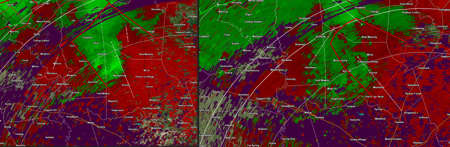
Severe Thunderstorm watch to our north - Thurs. 730pm *Update in the comments* There is a nasty thunderstorm to our northwest that has triggered a Severe Thunderstorm Watch that includes Montgomery County. (Not Harris) 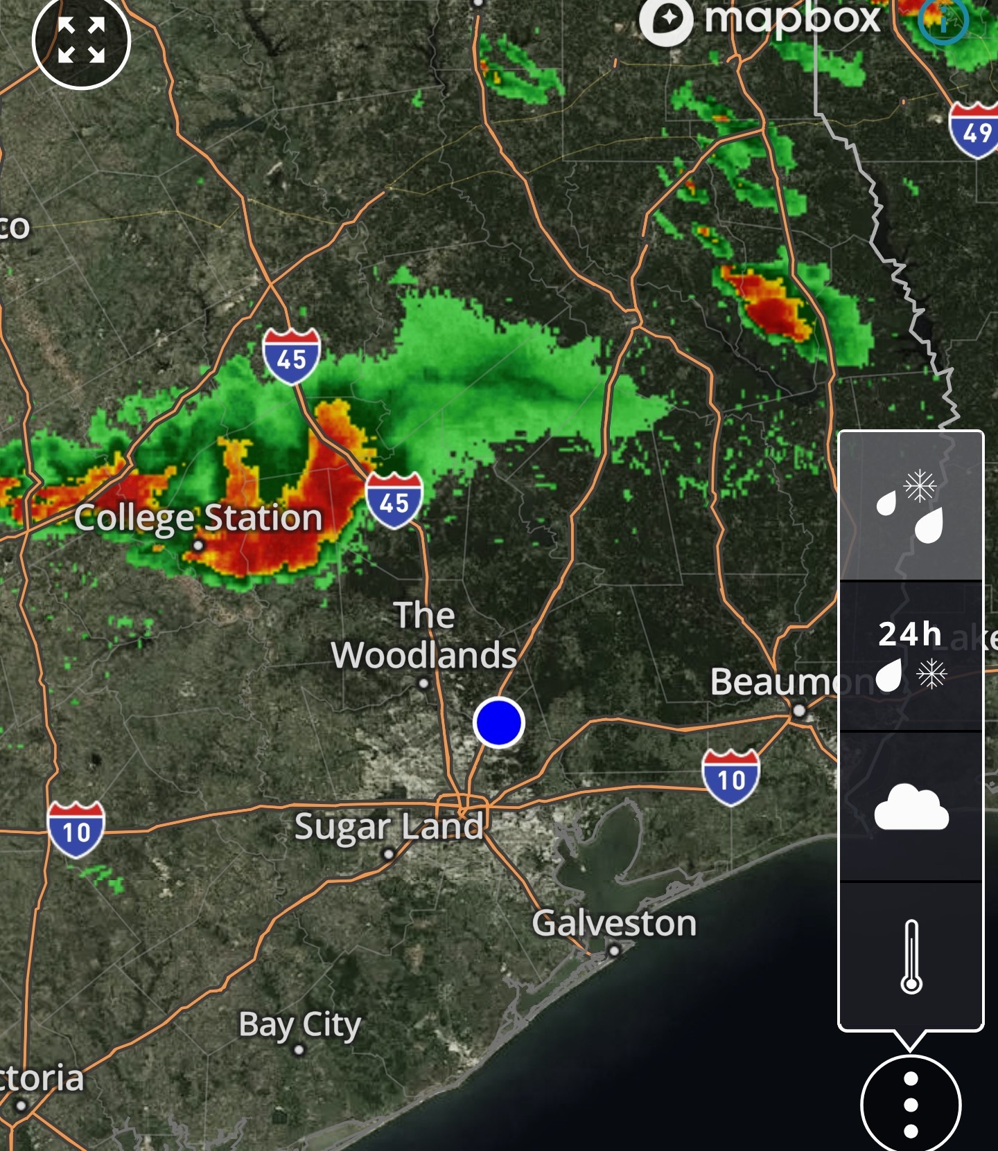 This cell is part of a boundary that is essentially moving east to west right now with the individual cells staying pretty much stationary along the line. This looks as though it will stay to our north - but - it will be close. The line has started to bow out a bit to the southeast (towards Harris Co) so I'm not 100% convinced just yet. We'll likely hear it soon either way as it has quite a bit of lightning and thunder within in it.
 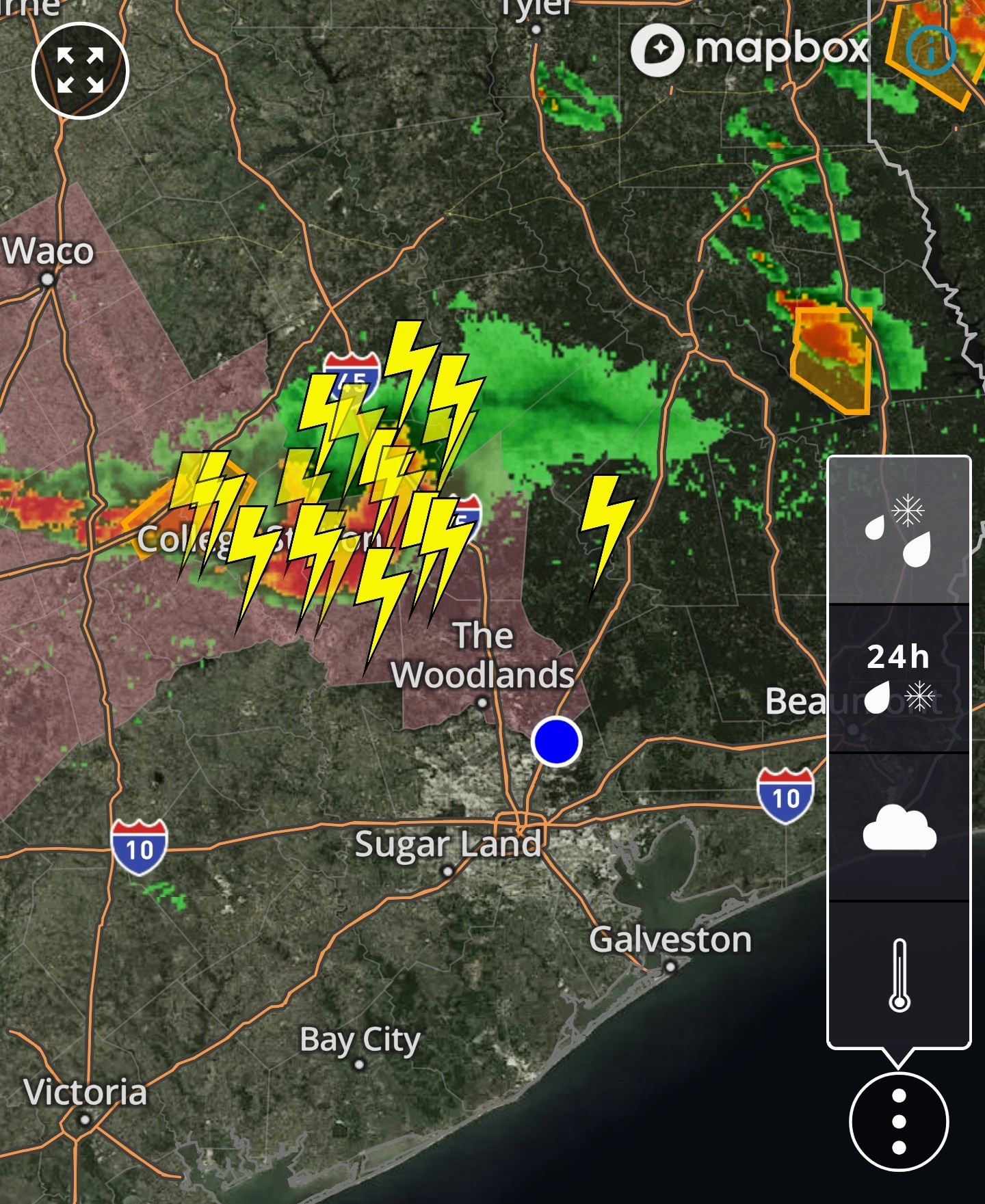 This is definitely a precursor to what tomorrow has in store. We could see some nasty storms tomorrow around here so stay tuned for the AM forecast! ⚡️


Replies:


|
|
|
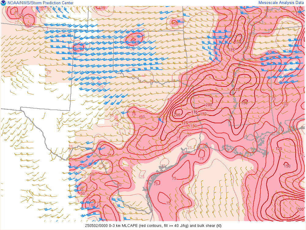 StormChaser : Yeppers, I like that it's fighting strong east wind shear and the lapse rates are falling flat, and we are in capped air.
|
|

Severe Thunderstorm watch to our north - Thurs. 730pm There is a nasty thunderstorm to our northwest that has triggered a Severe Thunderstorm Watch that includes Montgomery County. (Not Harris) This cell is part of a boundary that is essentially moving east to west right now with the individual cells staying pretty much stationary along the line. This looks as though it will stay to our north - but - it will be close. The line has started to bow out a bit to the southeast (towards Harris Co) so I'm not 100% convinced just yet. We'll likely hear it soon either way as it has quite a bit of lightning and thunder within in it. This is definitely a precursor to what tomorrow has in store. We could see some nasty storms tomorrow around here so stay tuned for the AM forecast! ⚡️
StormChaser : I do want some rain but not severe weather. 
|
|
Severe Thunderstorm watch to our north - Thurs. 730pm There is a nasty thunderstorm to our northwest that has triggered a Severe Thunderstorm Watch that includes Montgomery County. (Not Harris) This cell is part of a boundary that is essentially moving east to west right now with the individual cells staying pretty much stationary along the line. This looks as though it will stay to our north - but - it will be close. The line has started to bow out a bit to the southeast (towards Harris Co) so I'm not 100% convinced just yet. We'll likely hear it soon either way as it has quite a bit of lightning and thunder within in it. This is definitely a precursor to what tomorrow has in store. We could see some nasty storms tomorrow around here so stay tuned for the AM forecast! ⚡️
StormChaser : I do want some rain but not severe weather.
I had my Starlink booted up, and now I'm back inside
|
|
StormChaser : Yeppers, I like that it's fighting strong east wind shear and the lapse rates are falling flat, and we are in capped air.
Slow4x4 : Its fighting to hang on though, even with our cap. Tomorrow could be pretty interesting around here. 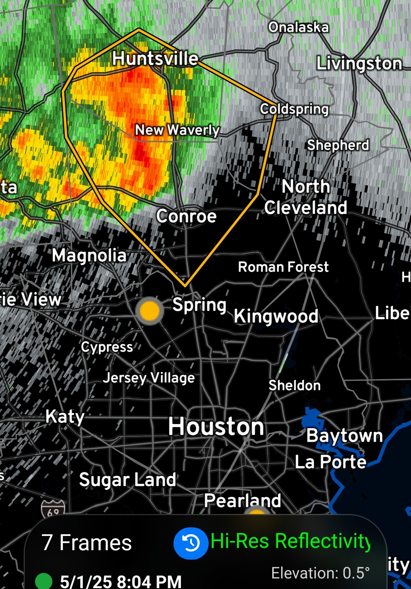
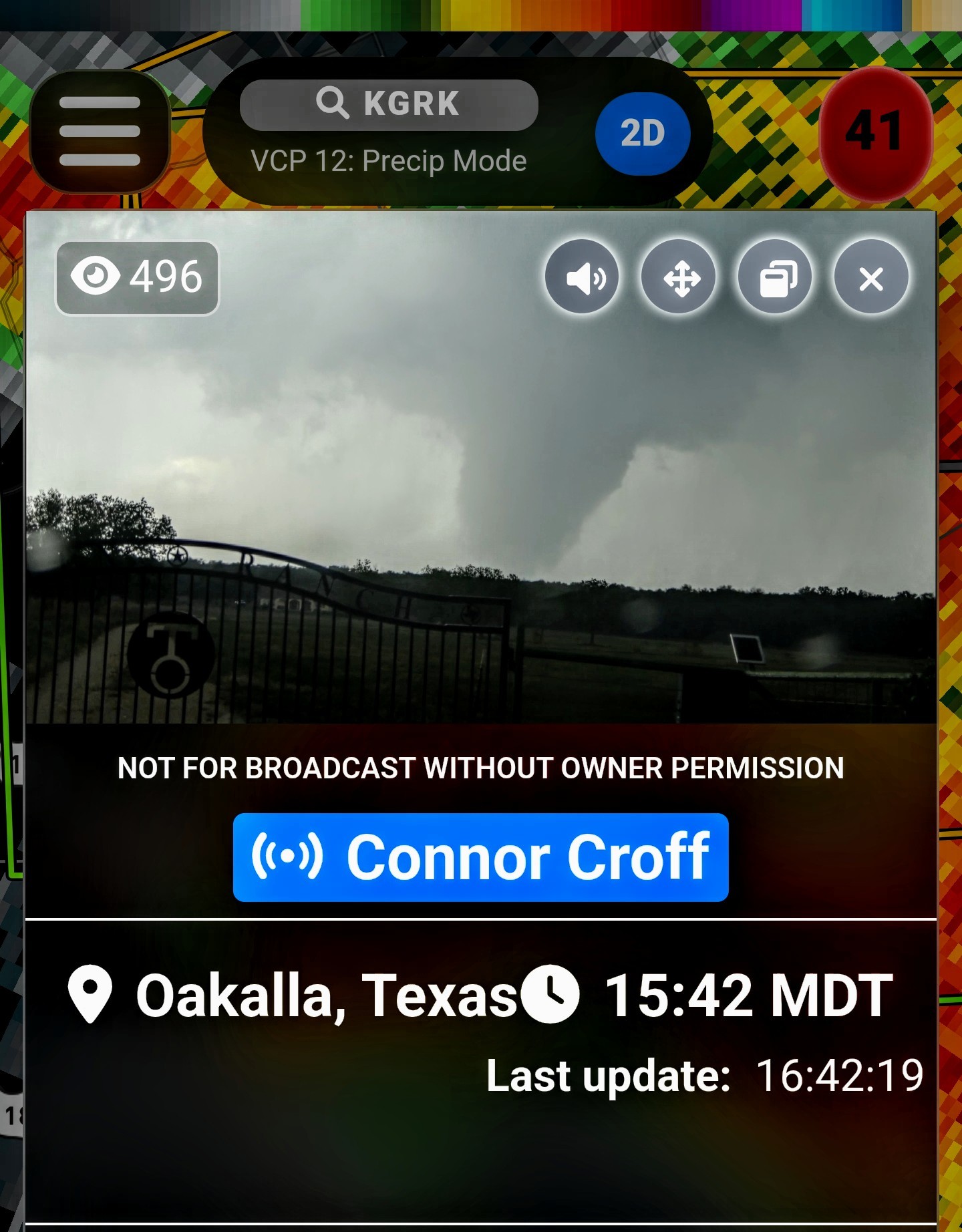 StormChaser : Connor Croff is becoming a legend; he's 200+ tornadoes over Reed for the last two years.
|
|
StormChaser : Connor Croff is becoming a legend; he's 200+ tornadoes over Reed for the last two years.
Slow4x4 : I've been watching him for a long time. He's a beast. 🌪
StormChaser : Looks like maybe a late in the day thing, for us? We're not in the hail zone, etc, for the crunchy part. We can use the rain. I know you will keep us posted, thank you!
|
|
Slow4x4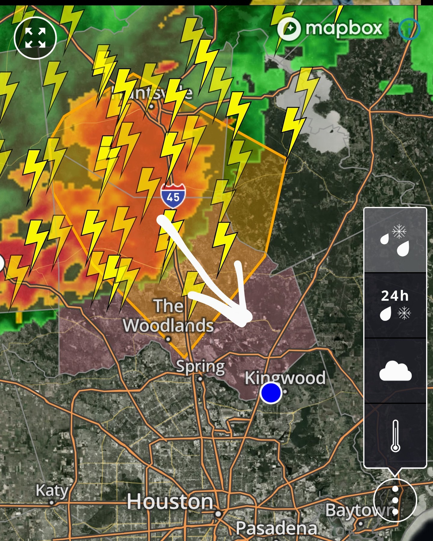
|
|
StormChaser : Looks like maybe a late in the day thing, for us? We're not in the hail zone, etc, for the crunchy part. We can use the rain. I know you will keep us posted, thank you!
LittleTexas : 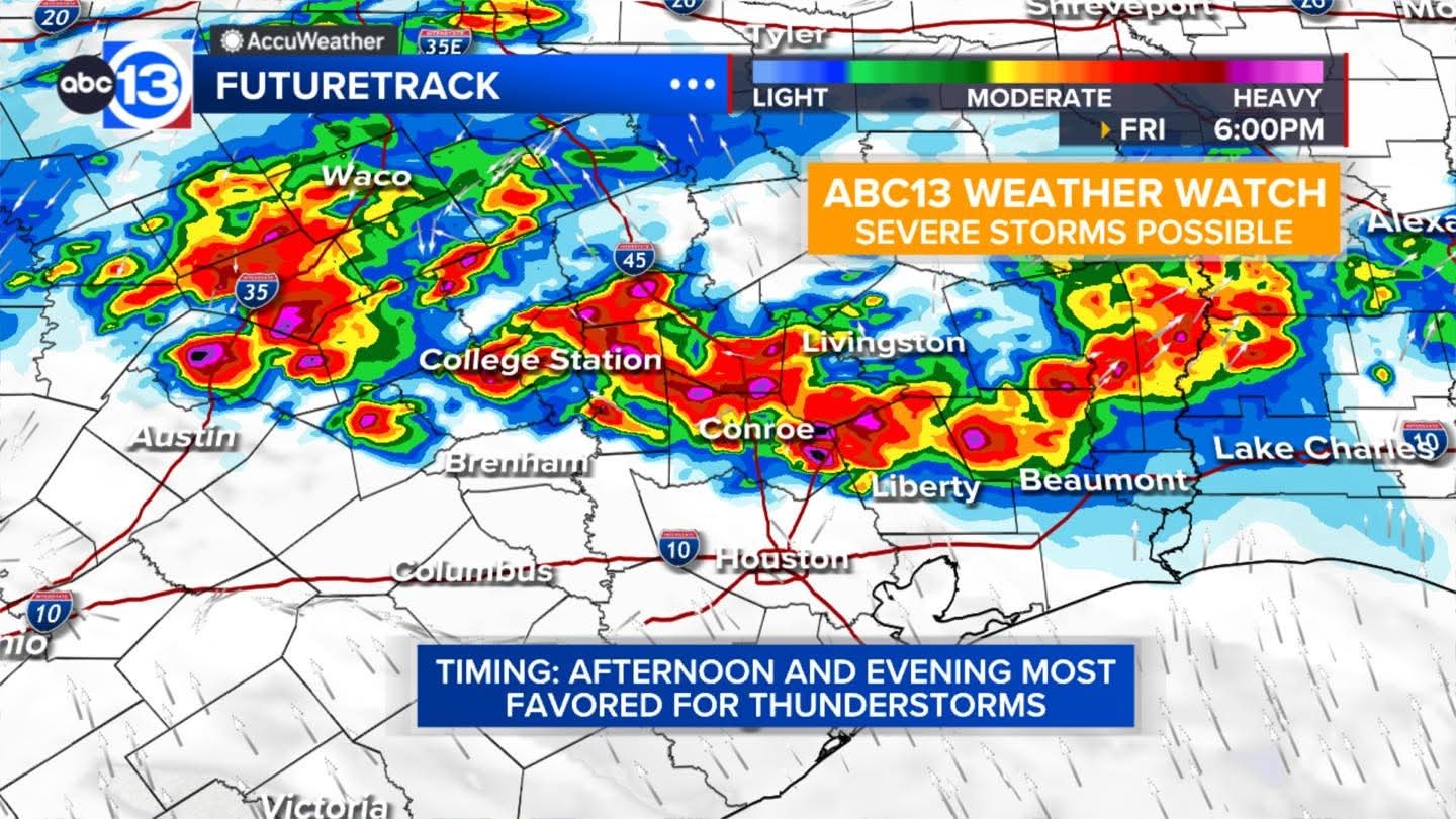
« Back to Chat
Views: 2,580
# Replies: 29