


Severe Thunderstorm watch until 8pm.
Severe Thunderstorm watch until 8pm.


Joined:
X days ago
# Posts:
X,XXX
Contributor Points:
X


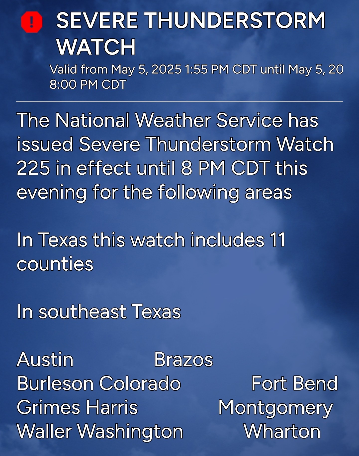
Severe Thunderstorm watch until 8pm. Looks like the HRRR was right! A Severe Thunderstorm watch has just been issued for Harris county until 8pm tonight. This includes Kingwood and these storms could contain hail and high winds so be careful out there. Timing looks to be after 3pm as the storms are still off to our west. 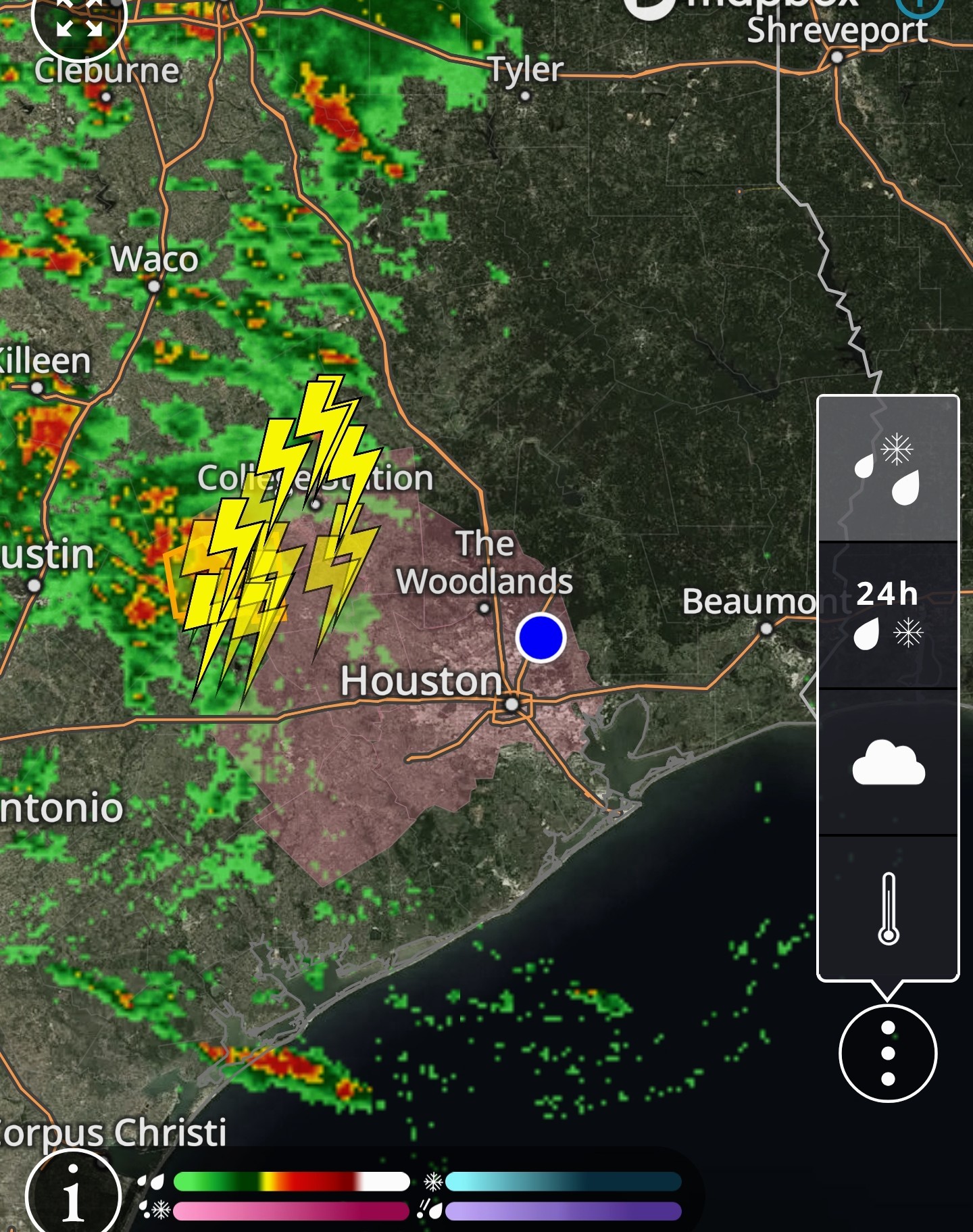


Replies:

|
StormChaser : Thank you for this information, as well as your earlier post. Glad that it will be after 3pm, when my kid gets out of school, but hope I don't get caught out in it on my way home from work.
 StormChaser :
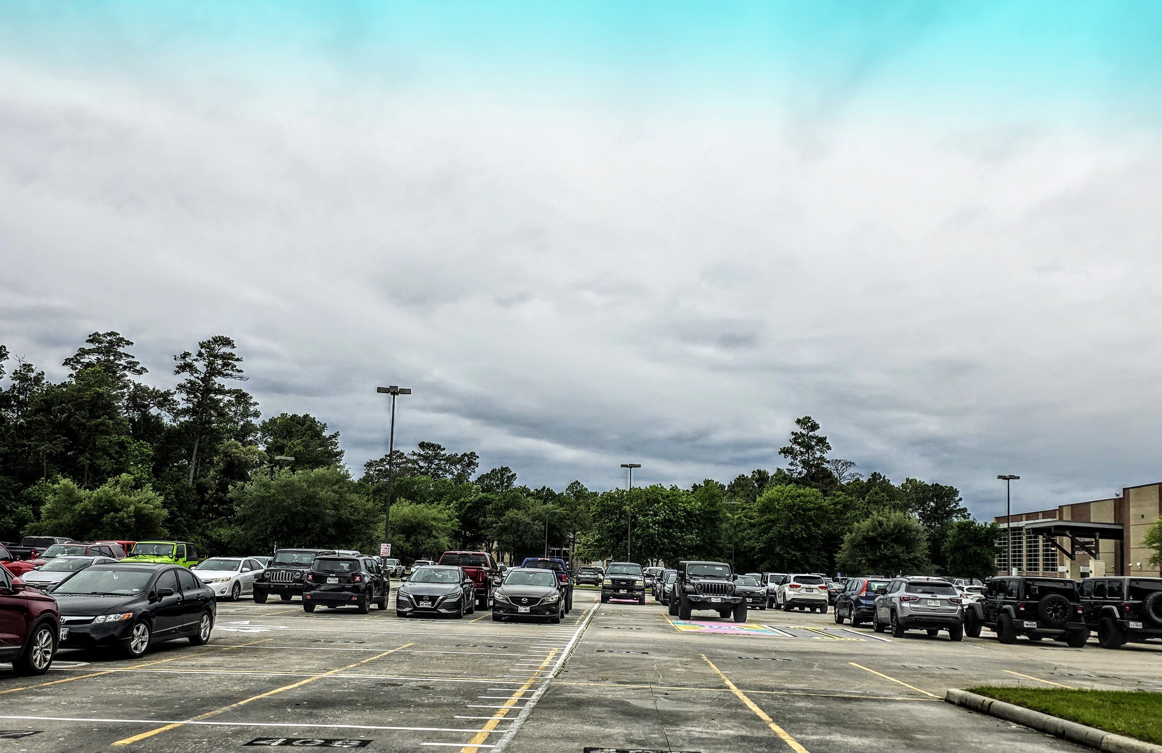
 just back from errands; def cooler and cloudy, and a little more humid/feels like rain. But, still nice break from the high temps!
|
|
StormChaser : Thank you for this information, as well as your earlier post. Glad that it will be after 3pm, when my kid gets out of school, but hope I don't get caught out in it on my way home from work.
|
|
StormChaser : Ok, thanks again. I would rather get caught out in it myself, than have my kiddo ride his bike home in the rain. I'll definitely be giving him a ride tomorrow morning, and arranging a pick up for him, though.
|
|
OMEGA setups are so cool on satellite
Slow4x4 : This omega block pattern should give all of Texas a decent severe setup tomorrow and Wednesday.
StormChaser : Slow4x4 : This omega block pattern should give all of Texas a decent severe setup tomorrow and Wednesday. You going to chase?
|
|
|
|
DadGumIt! STOP IT!! I need my yard mowed. Will it ever not rain for a few days so it can dry out & get mowed?
|
|
Here's a post from Space City Weather concerning this afternoon and evening: Eric Berger · Monday, May 5, 2025 3:46 PM In brief:
*Storms are firing up to the west of Houston this afternoon, and the region will face an unsettled pattern through Wednesday morning, at least. This post describes our latest thinking on timing and impacts from these storms. *Some fairly strong thunderstorms have developed near Brenham, and they are part of a system that is slowly moving to the east, and therefore toward the Houston metro area.
*I have some doubts about how much of this activity is going to hold together later this afternoon, but it is possible that some parts of the Houston region, including Montgomery County, will experience thunderstorms later this afternoon, or this evening, before midnight. After this we should experience a reprieve over night. Update on tomorrow & Wednesday: spacecityweather.com /some-showers-and-th understorms-are-poss ible-this-eveni
*Storms are firing up to the west of Houston this afternoon, and the region will face an unsettled pattern through Wednesday morning, at least.
*I have some doubts about how much of this activity is going to hold together later this afternoon, but it is possible that some parts of the Houston region, including Montgomery County, will experience thunderstorms later this afternoon, or this evening, before midnight.
|
|
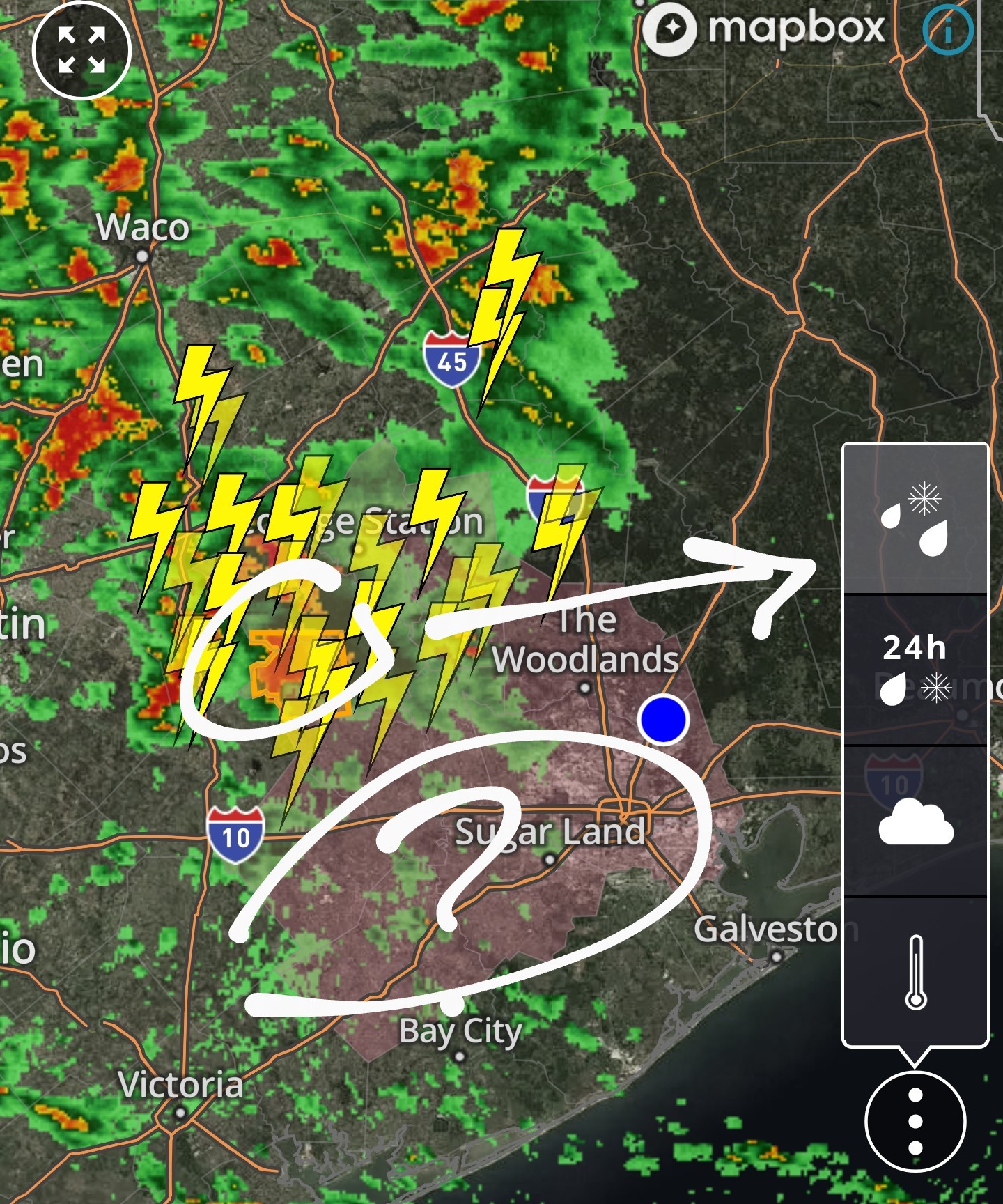
5pm update: 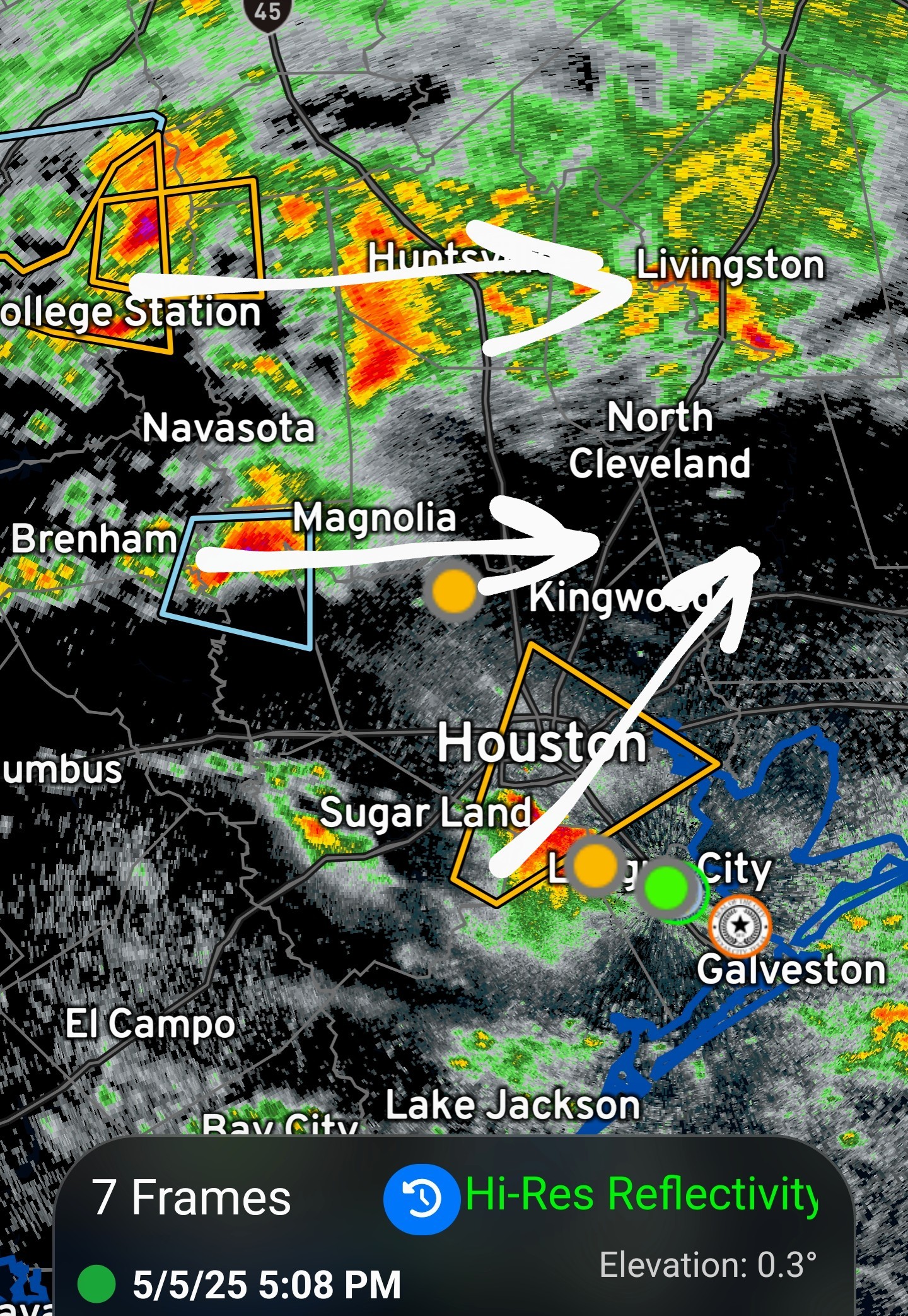 Number 1: The severe cell to our due west has split in 2 cells, one area going north (that area will miss us in KW) and the other part of the cell has stayed on an eastward path. I am unsure if we will be effected by this severe storm as it may go north, go south or dissipate altogether before it gets here. This cell is currently dropping quarter sized hail. If it does stay together, timing would be around 7pm for that cell. Number 2: The severe cell southwest of Houston is moving northeast quickly at 40+ mph. On this current track, it should miss us just to the east. This cell is currently dropping 1 inch hail. Also, there is a chance that these 2 areas merge and form a larger area of severe weather. If that happens, it would likely occur over central Harris County, or east of there, so its too soon to tell if that would effect us either.
Severe Thunderstorm watch until 8pm. Looks like the HRRR was right! A Severe Thunderstorm watch has just been issued for Harris county until 8pm tonight. This includes Kingwood and these storms could contain hail and high winds so be careful out there. Timing looks to be after 3pm as the storms are still off to our west.
 Joe tipped StormChaser 100 credits for a post in this forum discussion.
|
|
5:45pm update: 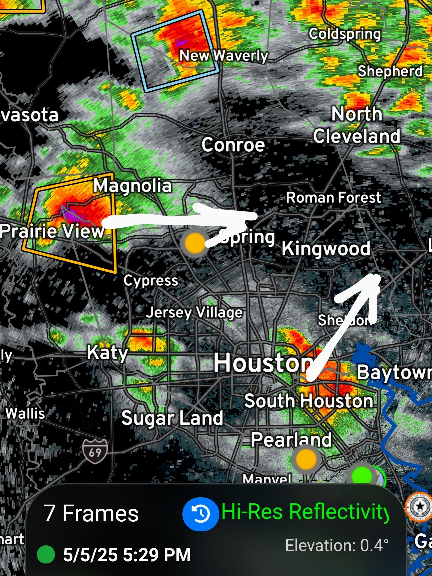 OK so here's what I'm seeing. Area Number 1 (north side) The severe cell to our due west has stayed on its eastward path and is currently entering Magnolia. I'm still unsure if we will be effected by this severe storm, as it may go slightly north, go slightly south, or dissipate altogether before it gets here. This cell is currently dropping quarter sized hail with 60mph winds. It also has a hook attempting to form at 290 and FM2920, which means it could drop a tornado if the rotation continues. If it does stay together, timing would be around 7pm for Kingwood. ..... Number 2 (south side) The severe cell southwest of Houston is moving northeast quickly at 40+ mph and should miss us well to the east. If it expands a bit, the western edge might clip us so I'm watching it, but this cell is no longer severe warned at this time.
« Back to Chat
Views: 1,592
# Replies: 29