


One for the record books
One for the record books


Joined:
X days ago
# Posts:
X,XXX
Contributor Points:
X


One for the record books This is the MASSIVE wedge tornado that was on the ground from west of the Dickinson area all the way to southeast Louisiana! This photo was taken just west of Port Arthur: 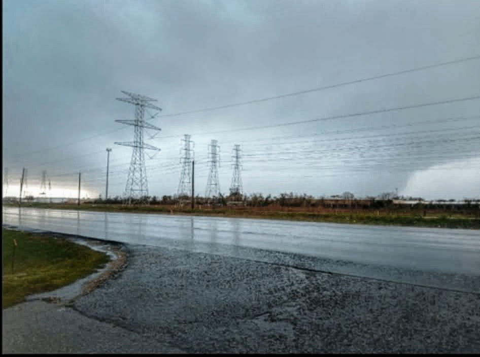 There are reports of it being close to a mile wide at times. It missed Port Arthur by 1 MILE to their south. That would have been CATASTROPHIC for them. Depending on damage, this will likely be rated EF3 or EF4.....maybe even a 5. (It would be the first in 10+ years) The rating is based on structural damage, not wind speeds, so the ratings will be based on damage that the National Weather Service will come out & survey. I'm sure we'll see a mixed bag of ratings depending where it was. It definitely strengthened when it came off east side of Galveston Bay, south of Anahuac. Either way, this is incredible for Texas and even more incredible for the Houston area. It's the most impressive tornadic radar data I've ever seen in SE Texas.


Discussion Summary:
Massive Wedge Tornado Causes Devastation in Southeast Texas and Louisiana
Massive Wedge Tornado Causes Devastation in Southeast Texas and Louisiana
Discussion Insights:
Ask a question about this discussion and an AI bot will try to give an answer.
Ask a question about this discussion and an AI bot will try to give an answer.
Replies:

I have never heard of an E4-5 hitting SE TX. We had E3s near Waco occasionally as I was growing up. And we had E4-5s in Ohio for sure but not often. I'm glad you all are safe

|
I have never heard of an E4-5 hitting SE TX. We had E3s near Waco occasionally as I was growing up. And we had E4-5s in Ohio for sure but not often. I'm glad you all are safe
Labslady : Channelview actually had a mile wide EF4 in 1992 - so it's not completely unheard of - but it's definitely incredibly rare.
|
|

One for the record books This is the MASSIVE wedge tornado that was on the ground from west of the Dickinson area all the way to southeast Louisiana! This photo was taken just west of Port Arthur: There are reports of it being close to a mile wide at times. It missed Port Arthur by 1 MILE to their south. That would have been CATASTROPHIC for them. Depending on damage, this will likely be rated EF3 or EF4.....maybe even a 5. (It would be the first in 10+ years) The rating is based on structural damage, not wind speeds, so the ratings will be based on damage that the National Weather Service will come out & survey. I'm sure we'll see a mixed bag of ratings depending where it was. It definitely strengthened when it came off east side of Galveston Bay, south of Anahuac. Either way, this is incredible for Texas and even more incredible for the Houston area. It's the most impressive tornadic radar data I've ever seen in SE Texas.
StormChaser : W O W ! That thing is massive!!!!
StormChaser : we bought our 1st house in Channelview after that tornado. When we bought it, only the exterior walls were standing and there was a tree empaled into the bathtub of the master bath. We got it dirt cheap and then designed the interior ourselves. That tornado destroyed the entire neighborhood of Sterling Green South. « Back to Chat
Views: 1,663
# Replies: 6