


Hurricane Erin - Update: Cat 5
Hurricane Erin - Update: Cat 5


Joined:
X days ago
# Posts:
X,XXX
Contributor Points:
X


Hurricane Erin Saturday 11AM update: Erin has exploded into a cat 5 storm with 150 mph winds with gusts to 175mph. No, this is not "rare" 🙄 It's called rapid intensification. This storm is in a perfect environment for strengthening. ........ SAT 3:30am - Hurricane Erin has a well defined open eye now. 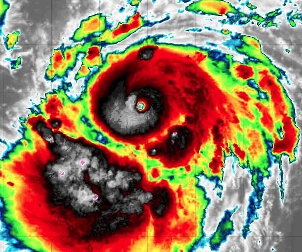
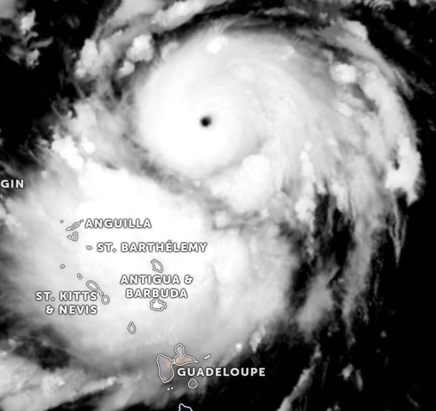 It is just 5mph shy of becoming a major category 3 hurricane. That will likely happen sometime today. (If it hasn't already) This is still not expected to affect land.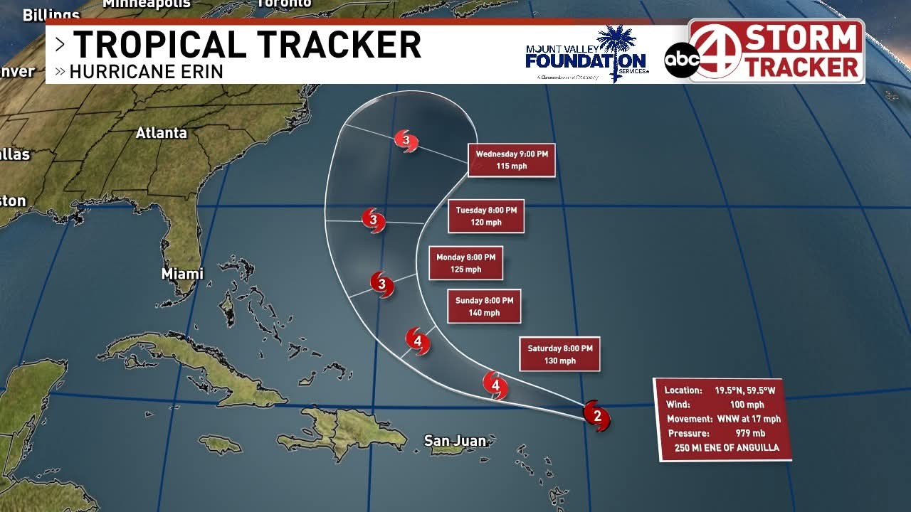


Joe, LittleTexas and HappyHerself + 19 more reacted Replies:
Hurricane Erin SAT 3:30am - Hurricane Erin has a well defined open eye now. It is just 5mph shy of becoming a major category 3 hurricane. That will likely happen sometime today. (If it hasn't already) This is still not expected to affect land.
 RolloTomaso tipped StormChaser 100 credits for a post in this forum discussion.
 StormChaser :
 Good morning. Thanks for being our resident meterologist! Thankfully
Erin isn't westbound.
@BillHouston : Omg are you a Spader fan? Just saw the pic. He is the finest character actor of them all! He was riveting as Raymond Reddington in BlackList. I grieved when the series ended. Now that was some great writing and actors. Perfect casting
BillHouston and StormChaser reacted
StormChaser : This is exactly why I do not cruise in hurricane season. It will be rough sailing out there.
StormChaser : What is happening to keep Erin away from our east coast?
sebastian2 :
HURRICANE ERIN REACHES CAT 5 STRENGTH. No, this is not "rare" 🙄 It's called rapid intensification. This storm is in a perfect environment for strengthening. 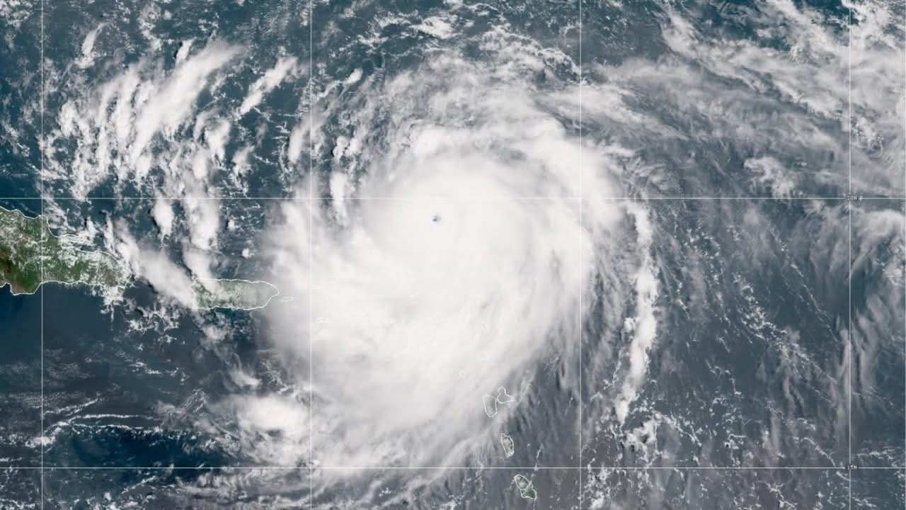 BREAKING: Hurricane Erin explodes into Category 5 monster storm with 160 mph winds. The first major hurricane of 2025 season
Donnawisdom, HappyHerself and cbear reacted
HURRICANE ERIN REACHES CAT 5 STRENGTH. BREAKING: Hurricane Erin explodes into Category 5 monster storm with 160 mph winds. The first major hurricane of 2025 season
StormChaser : Thankfully....last model run shows East US and Bermuda being spared the brunt of it. Can you imagine being on the rather small Island of Bermuda and looking a Cat 5 in the face! YIKES!!
StormChaser : Thankfully....last model run shows East US and Bermuda being spared the brunt of it. Can you imagine being on the rather small Island of Bermuda and looking a Cat 5 in the face! YIKES!!
cbear : Yup it should go right up between Bermuda and the east coast.
MAJOR HURRICANE ERIN UPDATE
5:45 PM SATURDAY 8-16-2025 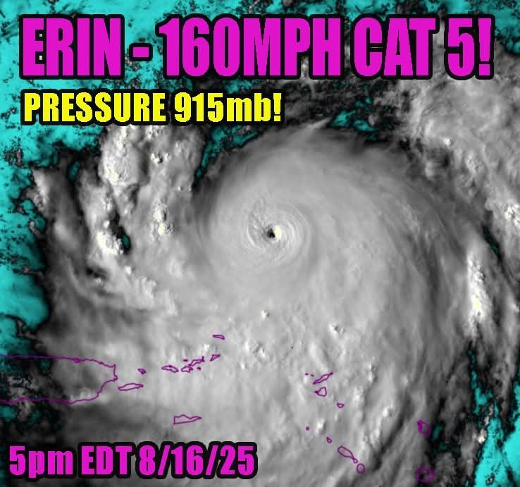
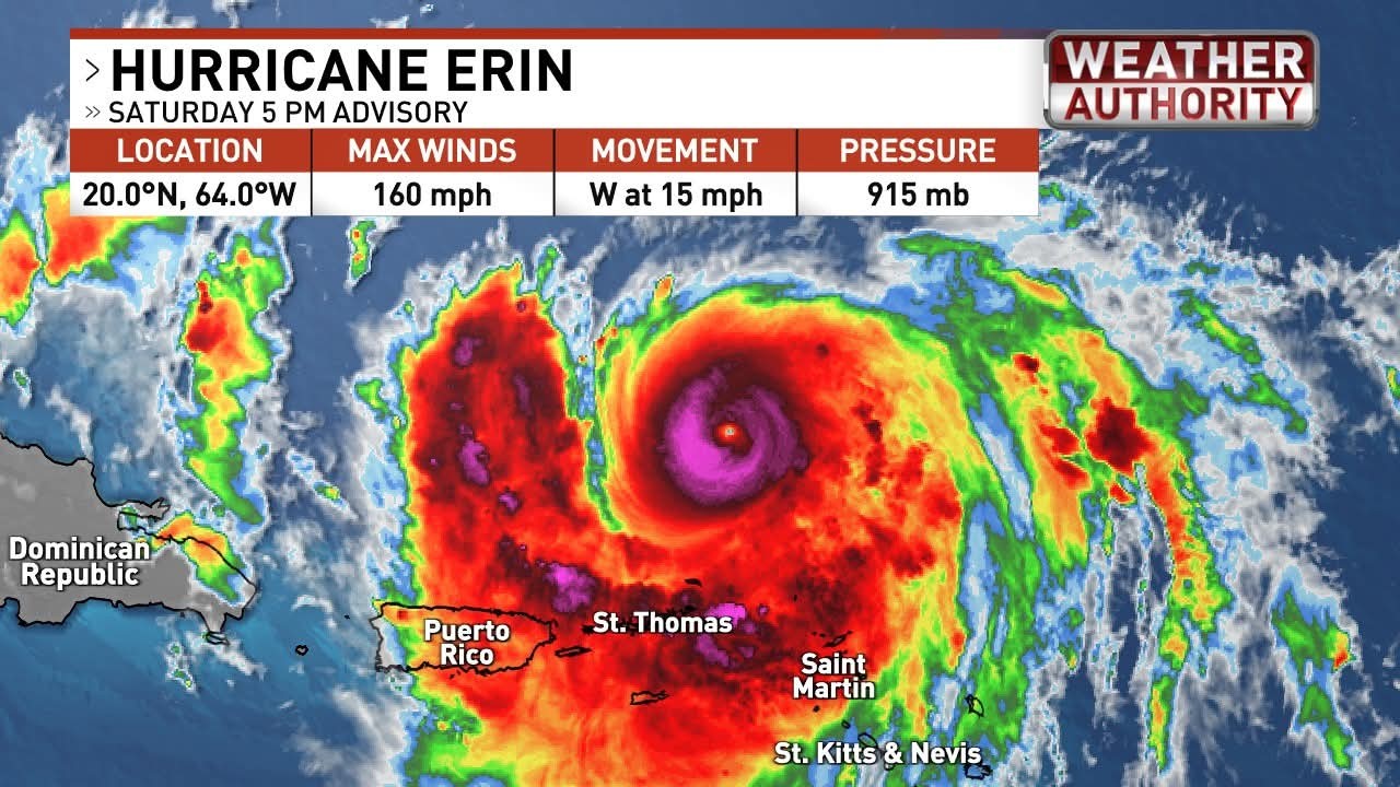 Pressure is down to 915mb in category 5 Erin! I believe this is the 19th strongest hurricane on record. The symmetry and perfect alignment of atmospheric conditions to birth these beasts will never not be extraordinary. ERIN'S INTENSITY
It's been an astonishing 27.5 hours for Erin. What started as a tropical storm with 70 mph winds at 8 a.m. Friday exploded into a Category 5 hurricane with 160 mph winds by 11:20 a.m. Saturday. That puts Erin in the history books as one of the fastest-strengthening Atlantic hurricanes on record. After Sunday, increasing wind shear will begin a gradual weakening trend. But don't let that fool you. Erin will likely grow in size, possibly doubling or even tripling its current footprint. ERIN'S TRACK
The forecast philosophy hasn't changed. Count your blessings that this storm is very likely to thread the needle between the U.S. East Coast and Bermuda, sparing land from major impacts. Still, the storm's sheer energy will be transferred into the ocean, driving powerful swells that will send large, breaking waves and dangerous rip currents toward our beaches starting Sunday, continuing Monday, and peaking Tuesday through Thursday. Swimming will be dangerous, and some beaches may close the water entirely. Minor coastal flooding during high tide isn't out of the question, but that sure beats a direct hit.
HappyHerself reacted 5:45 PM SATURDAY 8-16-2025
It's been an astonishing 27.5 hours for Erin. What started as a tropical storm with 70 mph winds at 8 a.m. Friday exploded into a Category 5 hurricane with 160 mph winds by 11:20 a.m. Saturday. That puts Erin in the history books as one of the fastest-strengthening Atlantic hurricanes on record. After Sunday, increasing wind shear will begin a gradual weakening trend. But don't let that fool you. Erin will likely grow in size, possibly doubling or even tripling its current footprint.
The forecast philosophy hasn't changed. Count your blessings that this storm is very likely to thread the needle between the U.S. East Coast and Bermuda, sparing land from major impacts. Still, the storm's sheer energy will be transferred into the ocean, driving powerful swells that will send large, breaking waves and dangerous rip currents toward our beaches starting Sunday, continuing Monday, and peaking Tuesday through Thursday. Swimming will be dangerous, and some beaches may close the water entirely. Minor coastal flooding during high tide isn't out of the question, but that sure beats a direct hit.
« Back to Chat
Views: 1,190
# Replies: 30