


Friday forecast
Friday forecast


Joined:
X days ago
# Posts:
X,XXX
Contributor Points:
X


Friday forecast Showers today and tomorrow from the remnants of Invest 93L and then the 🔥 is on! ................... From Space City Weather - After today, it seems that Houston's rain chances will go slip sliding away. Matt Lanza · Friday, July 18, 2025 6:53 AM In brief: *Invest 93L is kaput, and now we will look for some heavier downpours in spots today.
*Rain chances begin to dwindle on Saturday and Sunday as a hotter, less unsettled pattern establishes over our region for much of next week. TODAY - *Our best chance of rain will come today. *The radar as of early Friday morning shows widespread rain north of Liberty and in Louisiana.
*Additional, more isolated thunderstorms are popping up along I-10 near Beaumont and on the Bolivar Peninsula. 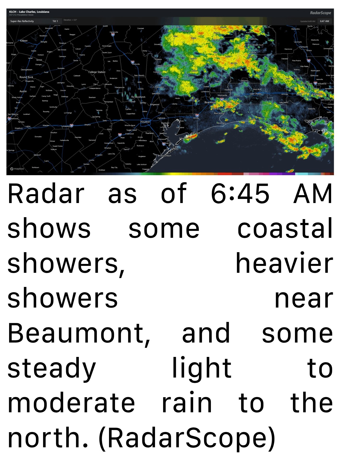 *As we go through today, a lot of that steadier rain north of I-10 will probably dissipate.
*Even some of the thunderstorms this morning may fizzle but a new round of scattered thunderstorms is likely this afternoon.
*For the most part, this will be like any other summer afternoon in Houston.
*Available atmospheric moisture will be a bit higher than usual though, so just be on the lookout for a downpour or two that could briefly flood streets in some parts of the city. Storms should fade after sunset. SATURDAY - *There should be a somewhat decent lingering shower chance here, but for the most part, any added moisture from the Invest 93L (RIP) would be exiting.
*I wouldn't be floored to see a couple heavier downpours in the area though.
*Look for highs in the mid-90s. SUNDAY THROUGH TUESDAY - *We've had very few days this summer that carried virtually zero rain chance.
*It would appear that Sunday through Tuesday carry good chances for that to be the case,
*Another bout of Saharan dust could come our way Monday and Tuesday.
*For now, I'll say mid-90s, but if the Saharan dust is minimal Monday and Tuesday, we do have a decent shot at upper-90s on those days in some parts of the area. 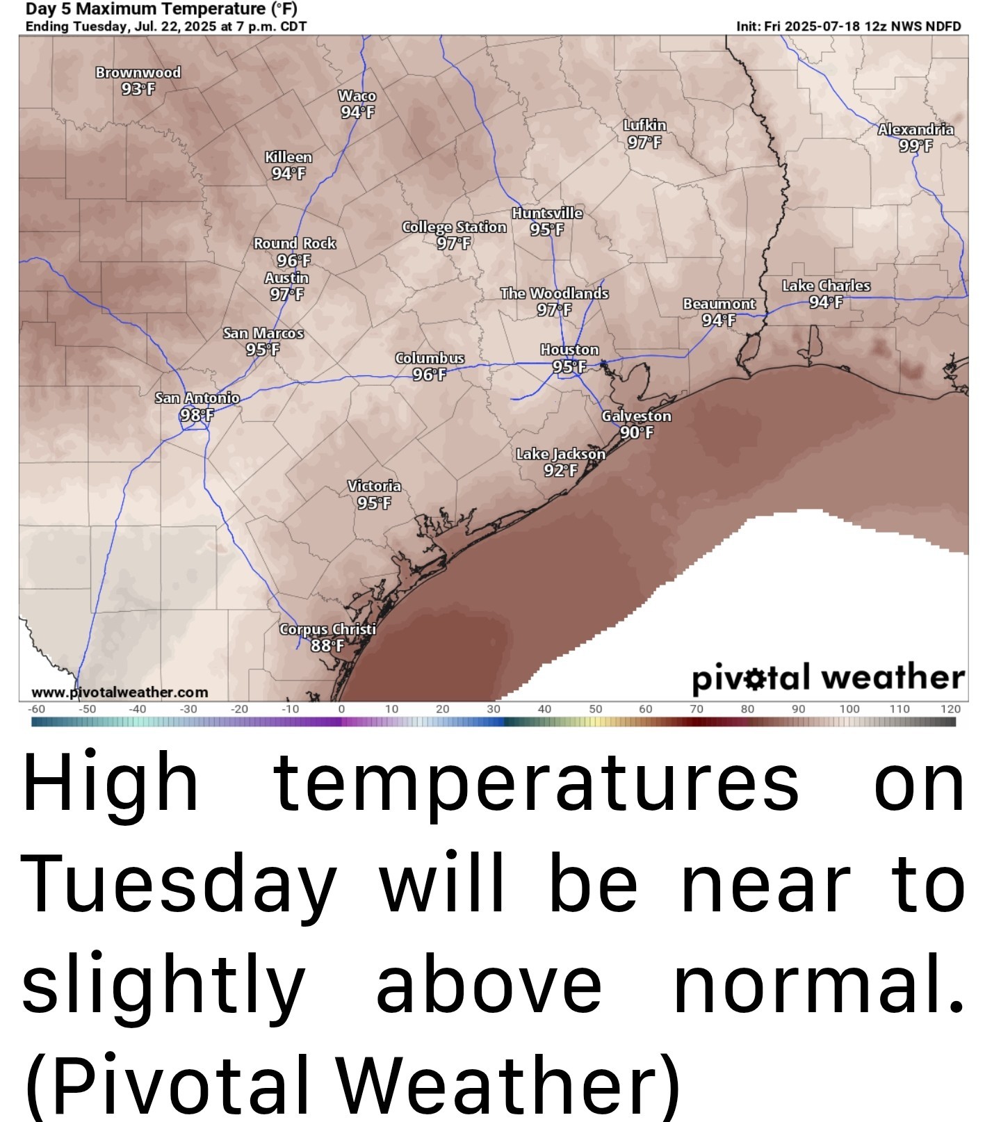 LATE NEXT WEEK - *The heat should stay cooking for later next week, with highs in the mid to upper-90s continuing.
*We may even see a stronger surge of heat later next weekend or the week of the 28th.
*Rain chances may pick back up a little by Friday or next weekend. Overall, it looks fairly dry next week across the region.


*Rain chances begin to dwindle on Saturday and Sunday as a hotter, less unsettled pattern establishes over our region for much of next week.
*Additional, more isolated thunderstorms are popping up along I-10 near Beaumont and on the Bolivar Peninsula.
*Even some of the thunderstorms this morning may fizzle but a new round of scattered thunderstorms is likely this afternoon.
*For the most part, this will be like any other summer afternoon in Houston.
*Available atmospheric moisture will be a bit higher than usual though, so just be on the lookout for a downpour or two that could briefly flood streets in some parts of the city.
*I wouldn't be floored to see a couple heavier downpours in the area though.
*Look for highs in the mid-90s.
*It would appear that Sunday through Tuesday carry good chances for that to be the case,
*Another bout of Saharan dust could come our way Monday and Tuesday.
*For now, I'll say mid-90s, but if the Saharan dust is minimal Monday and Tuesday, we do have a decent shot at upper-90s on those days in some parts of the area.
*We may even see a stronger surge of heat later next weekend or the week of the 28th.
*Rain chances may pick back up a little by Friday or next weekend.
Replies:
I hope we get a good rain out of this system.
StormChaser : I have a special weekend planned, so I certainly hope the rain doesn't interfere with it. Thanks for sharing! 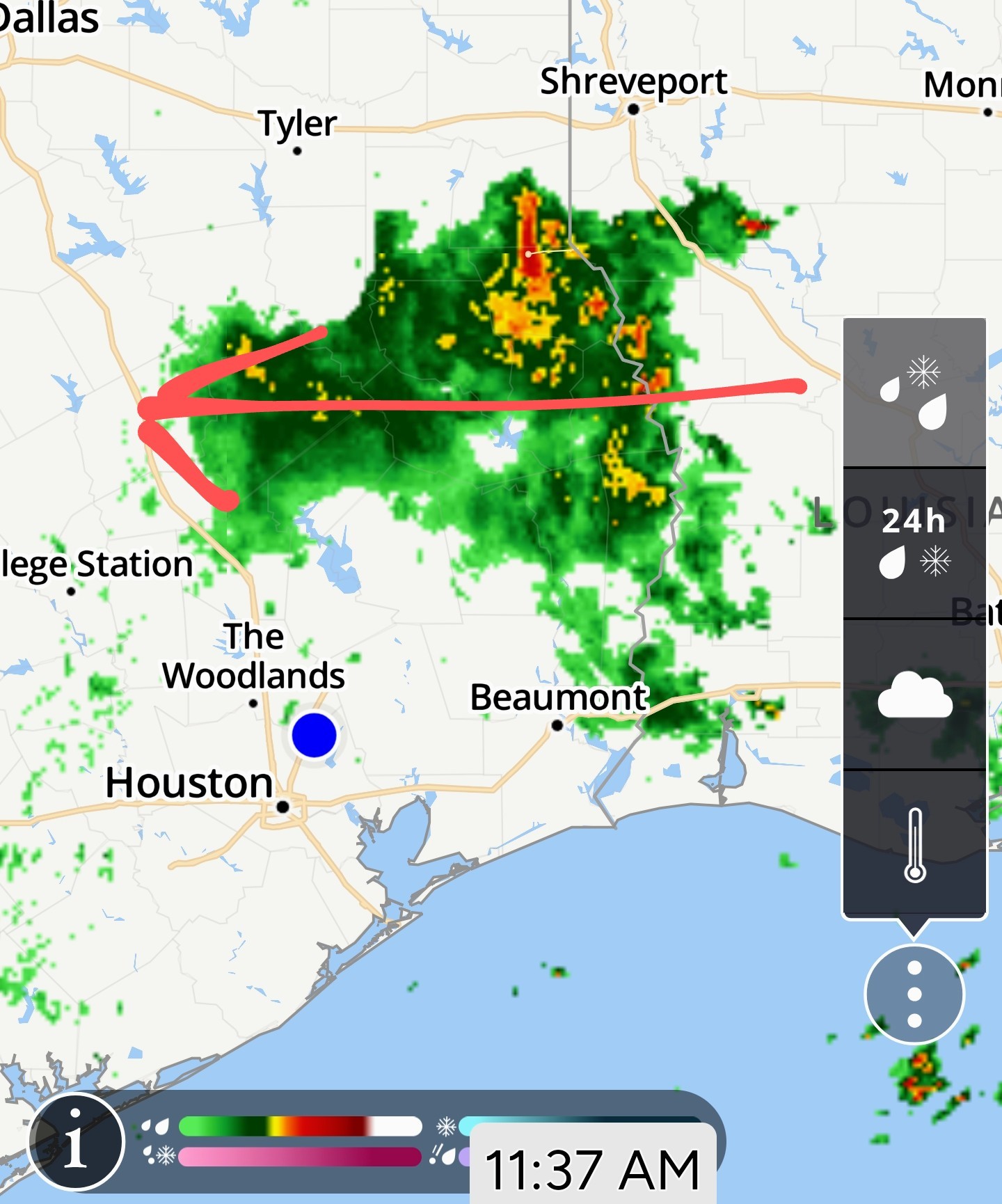
A few showers have started to pop up in the area. It looks like we have our best chance of rain today between now and sundown. 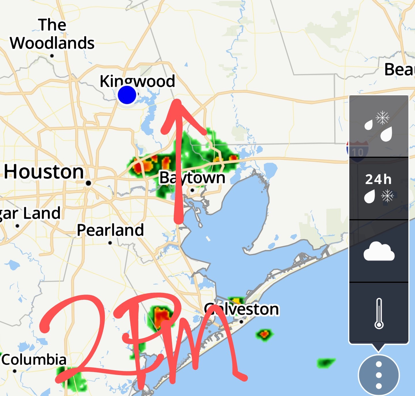
« Back to Chat
Views: 421
# Replies: 4