


Friday forecast (Grab an umbrella)
Friday forecast (Grab an umbrella)


Joined:
X days ago
# Posts:
X,XXX
Contributor Points:
X


Friday forecast (Grab an umbrella) Today, we could see a repeat of yesterday, so keep that in mind this afternoon! ⚡️And this weekend is looking wet as well, especially Sunday. From Space City Weather- The sky may open up on parts of the Houston area again today with more pop up storms expected. Matt Lanza · Friday, June 27, 2025 7:30 AM In brief:
*Another round of localized heavy rain, street flooding, and lightning will be possible this afternoon somewhere near or just northwest of Highway 59/I-69 in Houston.
*Slightly less coverage for Saturday, then more numerous showers and storms come at us Sunday and Monday before we dry out and heat up. *If you live inside the Beltway on the north and west side of Houston, you probably got walloped yesterday. 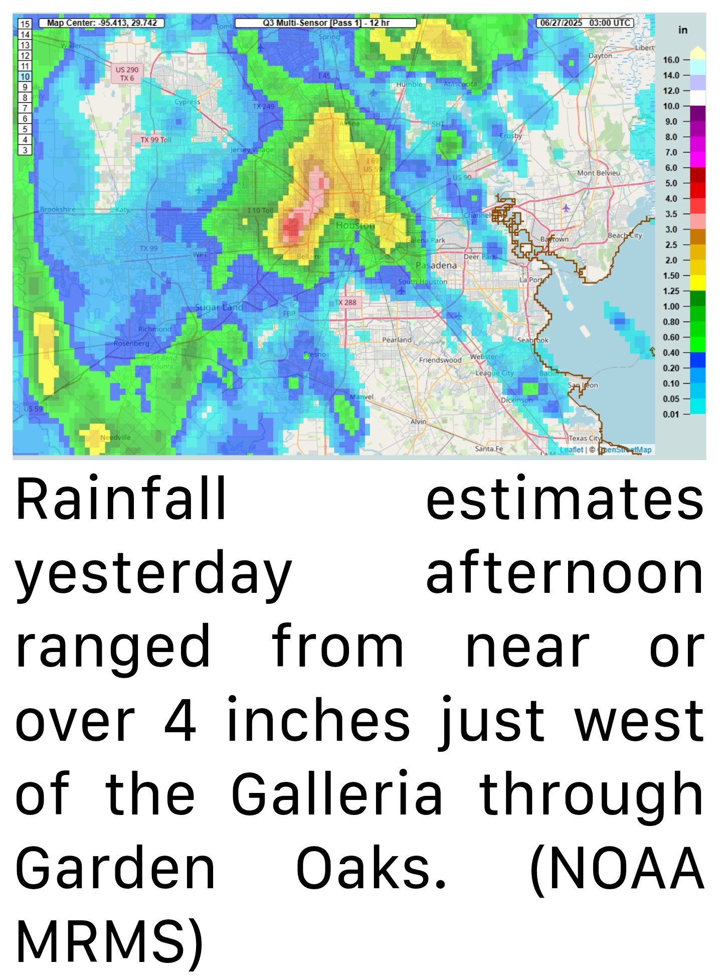 *Over 4 inches of rain was recorded at Ella and White Oak Bayou.
*Rain totals north of 3 inches fell in a pretty broad area between The Villages and Garden Oaks.
*Many other locations saw 1 to 3 inches of rain.
*Outside the Beltway, it went quiet until you got up to about Kingwood (always, Kingwood) and down into Fort Bend County.
*Yesterday was just one of those days where boundary collisions ruled the day. A few storms popped up, steering winds were weak, and basically atmospheric bumper cars ensued until we exhausted the instability in the area. TODAY - *We don't expect a carbon copy today, however I would not be shocked to see a generally similar setup play out across the area.
*We're already seeing some downpours in Liberty and Chambers Counties this morning.
*As the morning goes on and the sea breeze starts entering the mix, migrating inland with peak instability, we'll likely see storms fire up near Highway 59/I-69. 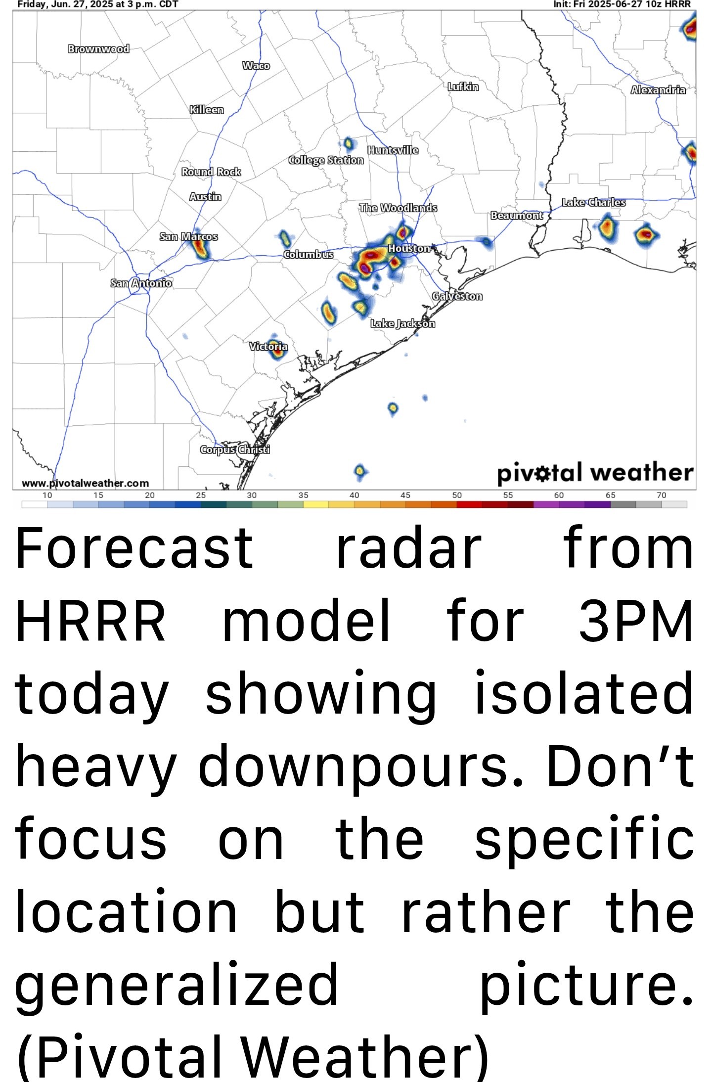 *A few places could again see multi-inch per hour rain rates that could cause street flooding.
*We're holding off on a Stage 1 flood alert today, but I will admit it's a close call.
*Just use caution in any storms today, as you should in summer. WEEKEND - *I think things will ease up a bit on Saturday. There will be showers and isolated thunderstorms around & there may be locally heavy downpours for a short time in any given spot.
*Overall, the intensity and coverage of storms may be lower tomorrow than it has been to close the week out. *Unfortunately, the same does not hold true for Sunday, which should see more numerous, if not widespread showers and thunderstorms across the region.
*Storms could begin firing up as early as mid-morning and continue through the day, migrating generally north and west as the day progresses.
*Have an umbrella handy both days, but have a good indoor backup plan available on Sunday.
*Temperatures should top out in the lower to mid-90s on Saturday and low-90s or even upper-80s on Sunday.

*Another round of localized heavy rain, street flooding, and lightning will be possible this afternoon somewhere near or just northwest of Highway 59/I-69 in Houston.
*Slightly less coverage for Saturday, then more numerous showers and storms come at us Sunday and Monday before we dry out and heat up.
*Rain totals north of 3 inches fell in a pretty broad area between The Villages and Garden Oaks.
*Many other locations saw 1 to 3 inches of rain.
*Outside the Beltway, it went quiet until you got up to about Kingwood (always, Kingwood) and down into Fort Bend County.
*Yesterday was just one of those days where boundary collisions ruled the day. A few storms popped up, steering winds were weak, and basically atmospheric bumper cars ensued until we exhausted the instability in the area.
*We're already seeing some downpours in Liberty and Chambers Counties this morning.
*As the morning goes on and the sea breeze starts entering the mix, migrating inland with peak instability, we'll likely see storms fire up near Highway 59/I-69.
*We're holding off on a Stage 1 flood alert today, but I will admit it's a close call.
*Just use caution in any storms today, as you should in summer.
*Overall, the intensity and coverage of storms may be lower tomorrow than it has been to close the week out.
*Storms could begin firing up as early as mid-morning and continue through the day, migrating generally north and west as the day progresses.
*Have an umbrella handy both days, but have a good indoor backup plan available on Sunday.
*Temperatures should top out in the lower to mid-90s on Saturday and low-90s or even upper-80s on Sunday.
Replies:

Friday forecast (Grab an umbrella) Today, we could see a repeat of yesterday, so keep that in mind this afternoon! ⚡️And this weekend is looking wet as well, especially Sunday. From Space City Weather- The sky may open up on parts of the Houston area again today with more pop up storms expected. Matt Lanza · Friday, June 27, 2025 7:30 AM In brief: *Another round of localized heavy rain, street flooding, and lightning will be possible this afternoon somewhere near or just northwest of Highway 59/I-69 in Houston. *Slightly less coverage for Saturday, then more numerous showers and storms come at us Sunday and Monday before we dry out and heat up. *If you live inside the Beltway on the north and west side of Houston, you probably got walloped yesterday. *Over 4 inches of rain was recorded at Ella and White Oak Bayou. *Rain totals north of 3 inches fell in a pretty broad area between The Villages and Garden Oaks. *Many other locations saw 1 to 3 inches of rain. *Outside the Beltway, it went quiet until you got up to about Kingwood (always, Kingwood) and down into Fort Bend County. *Yesterday was just one of those days where boundary collisions ruled the day. A few storms popped up, steering winds were weak, and basically atmospheric bumper cars ensued until we exhausted the instability in the area. TODAY - *We don't expect a carbon copy today, however I would not be shocked to see a generally similar setup play out across the area. *We're already seeing some downpours in Liberty and Chambers Counties this morning. *As the morning goes on and the sea breeze starts entering the mix, migrating inland with peak instability, we'll likely see storms fire up near Highway 59/I-69. *A few places could again see multi-inch per hour rain rates that could cause street flooding. *We're holding off on a Stage 1 flood alert today, but I will admit it's a close call. *Just use caution in any storms today, as you should in summer. WEEKEND - *I think things will ease up a bit on Saturday. There will be showers and isolated thunderstorms around & there may be locally heavy downpours for a short time in any given spot. *Overall, the intensity and coverage of storms may be lower tomorrow than it has been to close the week out. *Unfortunately, the same does not hold true for Sunday, which should see more numerous, if not widespread showers and thunderstorms across the region. *Storms could begin firing up as early as mid-morning and continue through the day, migrating generally north and west as the day progresses. *Have an umbrella handy both days, but have a good indoor backup plan available on Sunday. *Temperatures should top out in the lower to mid-90s on Saturday and low-90s or even upper-80s on Sunday.
StormChaser : And I bet that after this rainy spell......enter drought. Seems like that has been the Summe pattern in Houston for the last few years. Drought, flood repeat. How much did you get in Trailwood yesterday do you think?
StormChaser : And I bet that after this rainy spell......enter drought. Seems like that has been the Summe pattern in Houston for the last few years. Drought, flood repeat. How much did you get in Trailwood yesterday do you think?
cbear : Yeah we are getting ready to have a dry spell so we need all the rain we can get.
cbear : Yeah we are getting ready to have a dry spell so we need all the rain we can get. We ended up receiving 2" of rain here in Trailwood & most of that fell in about 20 minutes.
StormChaser : My rain barrel is full and I am thankful. I am saving that water for the pool as it will need to be topped off again in about a week or so.
11:20AM Cell just popped up to our SE, heading our way. 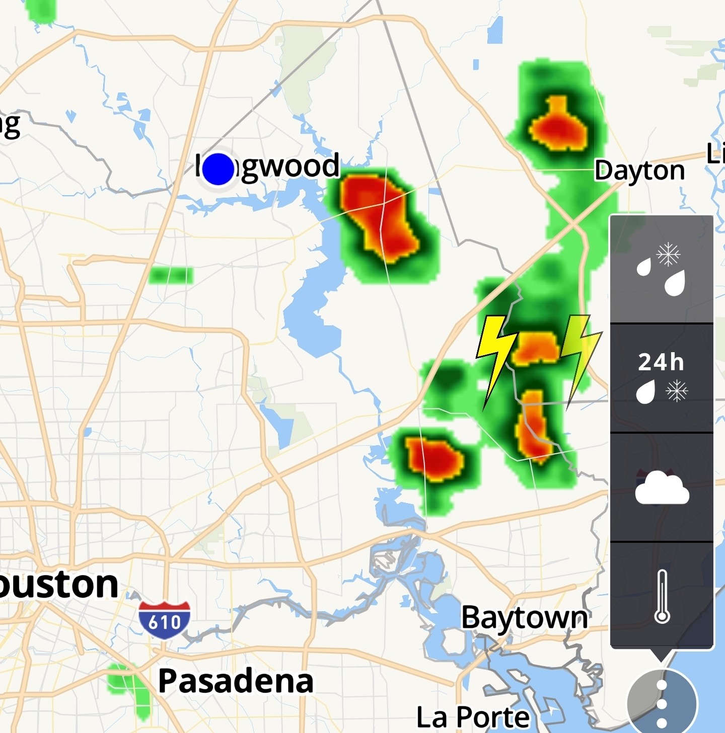
12:10PM Cell missed us to the east. These are slow movers so whoever gets rain today is likely going to get a lot. It's a similar setup to yesterday, but more isolated with more action earlier in the day. If these early day storms explode it might zap the atmosphere for any afternoon storms. We'll have to wait and see. 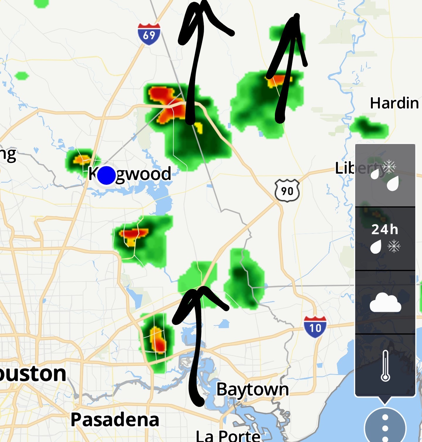
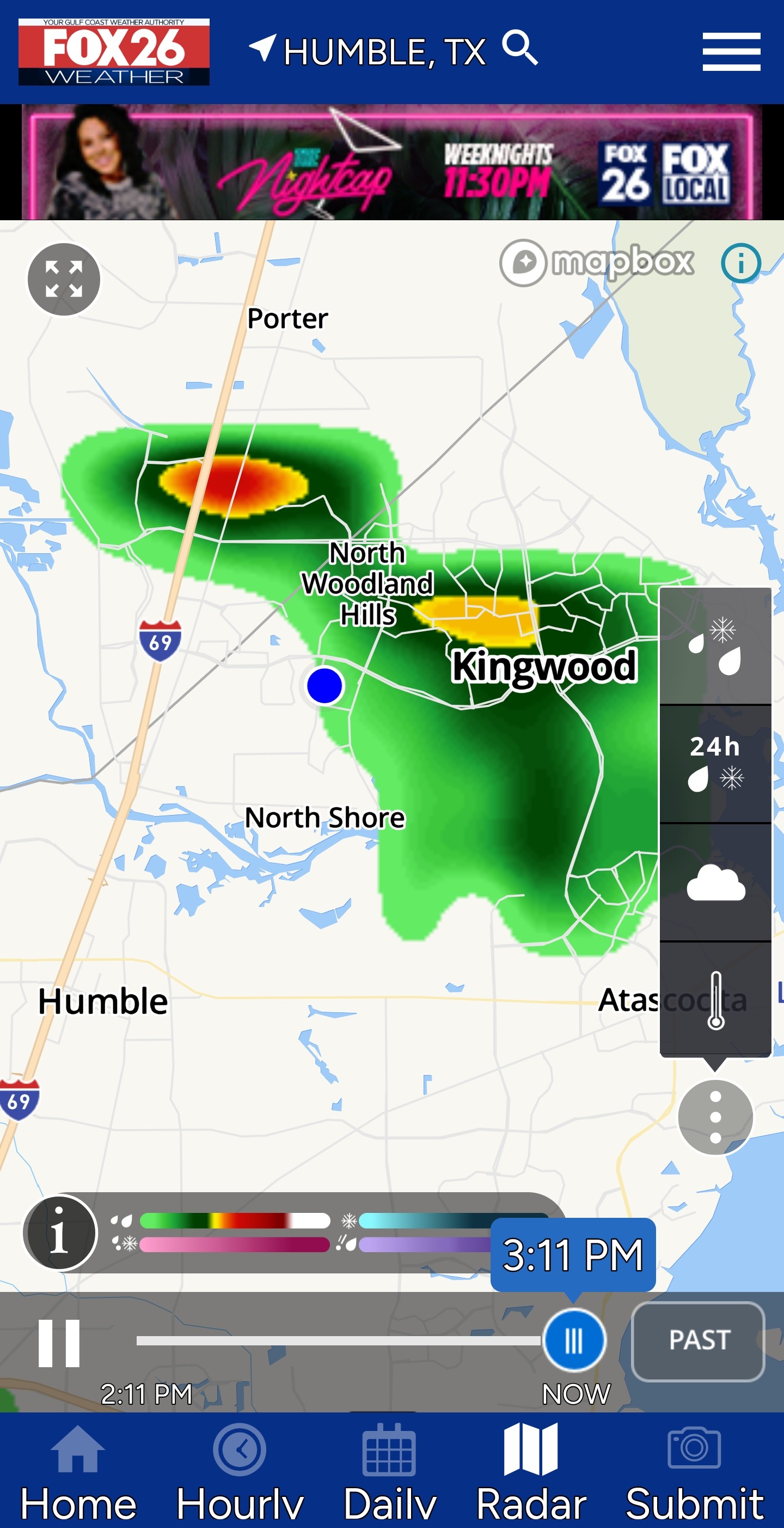
This is headed AWAY from Kingwood. HAZARD...Wind gusts up to 40 mph and pea size hail. 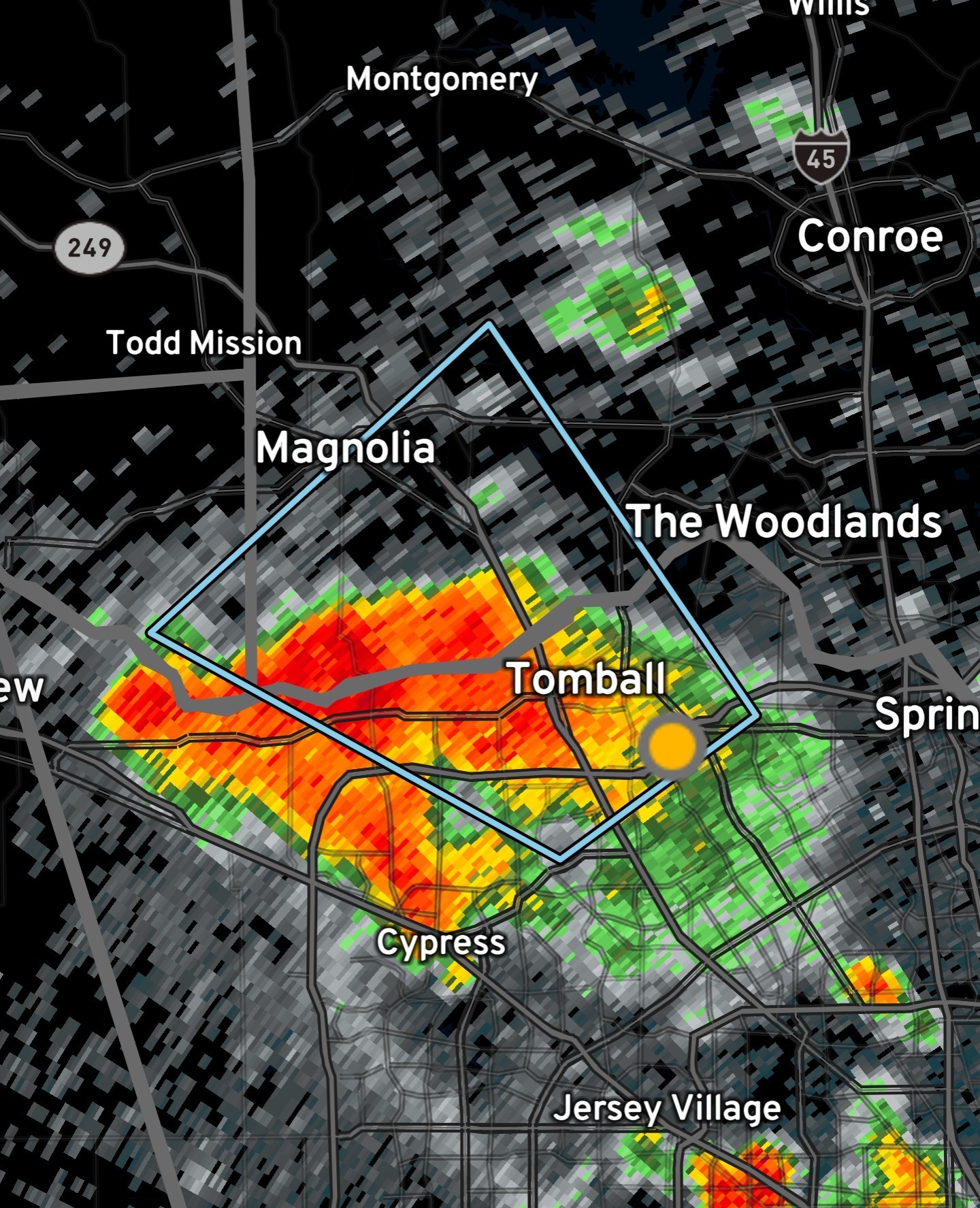
« Back to Chat
Views: 418
# Replies: 7