


Current radar - Noon
Current radar - Noon


Joined:
X days ago
# Posts:
X,XXX
Contributor Points:
X


Current radar - Noon Strong storms moving in from the west. Tornado watch issued until tonight. Second round expected after 7pm. 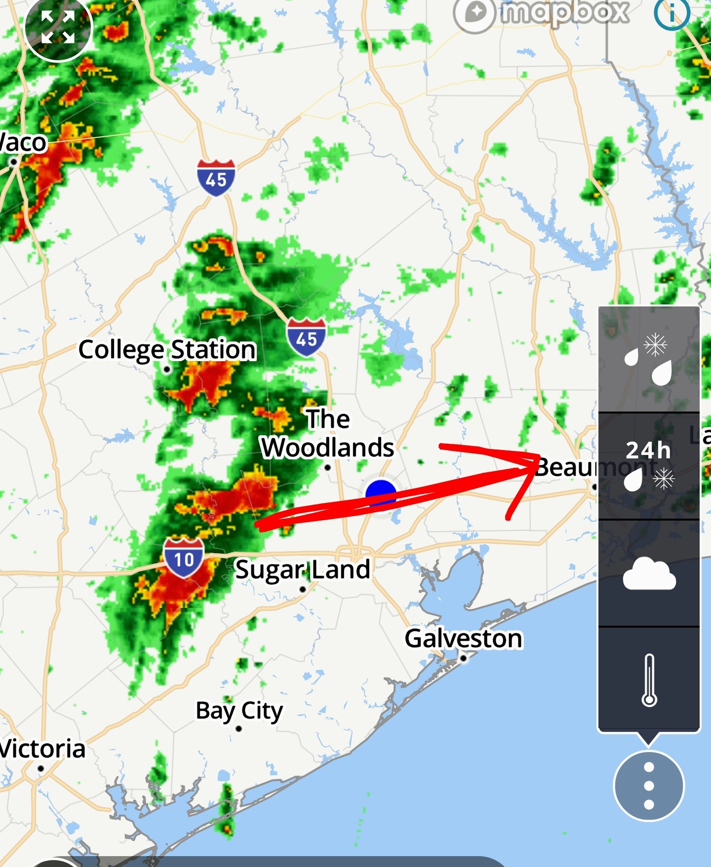


buffaloglenn, Joe and Txbutterfly + 8 more reacted Replies:
my dog just told me we should go under the bed.
ZMAN : Would love to see a pic of you and the dog under the bed...lol! 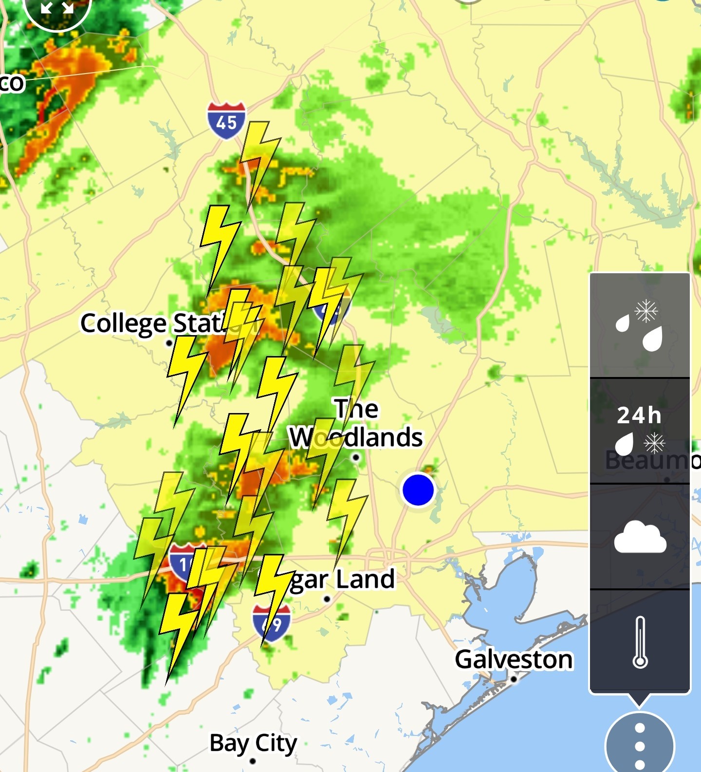
ZMAN Oh he's about to drag you under there!
 StormChaser : Huh....rained earlier at my house in HR2 and now it looks like it is a bit lighter outside! Rrrrrr.
Rotation located in Waller area right now. This cell is west of us & moving east.
SummerSneeze, Joe and Kittle + 2 more reacted
Rotation located Waller area right now. This cell is west of us & moving east.
 StormChaser : Yikes!!! Thanks for keeping us weather aware friend!!
I hope it hits my youngest kid's room. That would mean two tornadoes hit him today. 🤦🏼♀️
GiggleMugs, Lulu45 and Grimmie + 6 more reacted
StormChaser : Thanks for all the updates. I wish we could just get rain without all the severe threats.
StormChaser : Thanks for all the updates. I wish we could just get rain without all the severe threats.
peppermintstick : Feast or famine. 😉
ZMAN : Hope you cleaned all the dust bunnies out. Looking foreword to pics.
12:35PM Special Weather Statement
National Weather Service At 1231 PM CST, Doppler radar was tracking a strong thunderstorm near
Simonton, or 7 miles southwest of Brookshire, moving northeast at 25
mph. HAZARD...Pea size hail. SOURCE...Radar indicated. IMPACT...Minor hail damage to vegetation is possible. Locations impacted include...
Katy, Sealy, Brookshire, southwestern Addicks Park Ten, northwestern Eldridge / West Oaks, Spring Branch West, Hockley, Wallis, Fulshear, Simonton, San Felipe, Pattison, Cinco Ranch, northern Weston Lakes, Addicks, and Memorial. 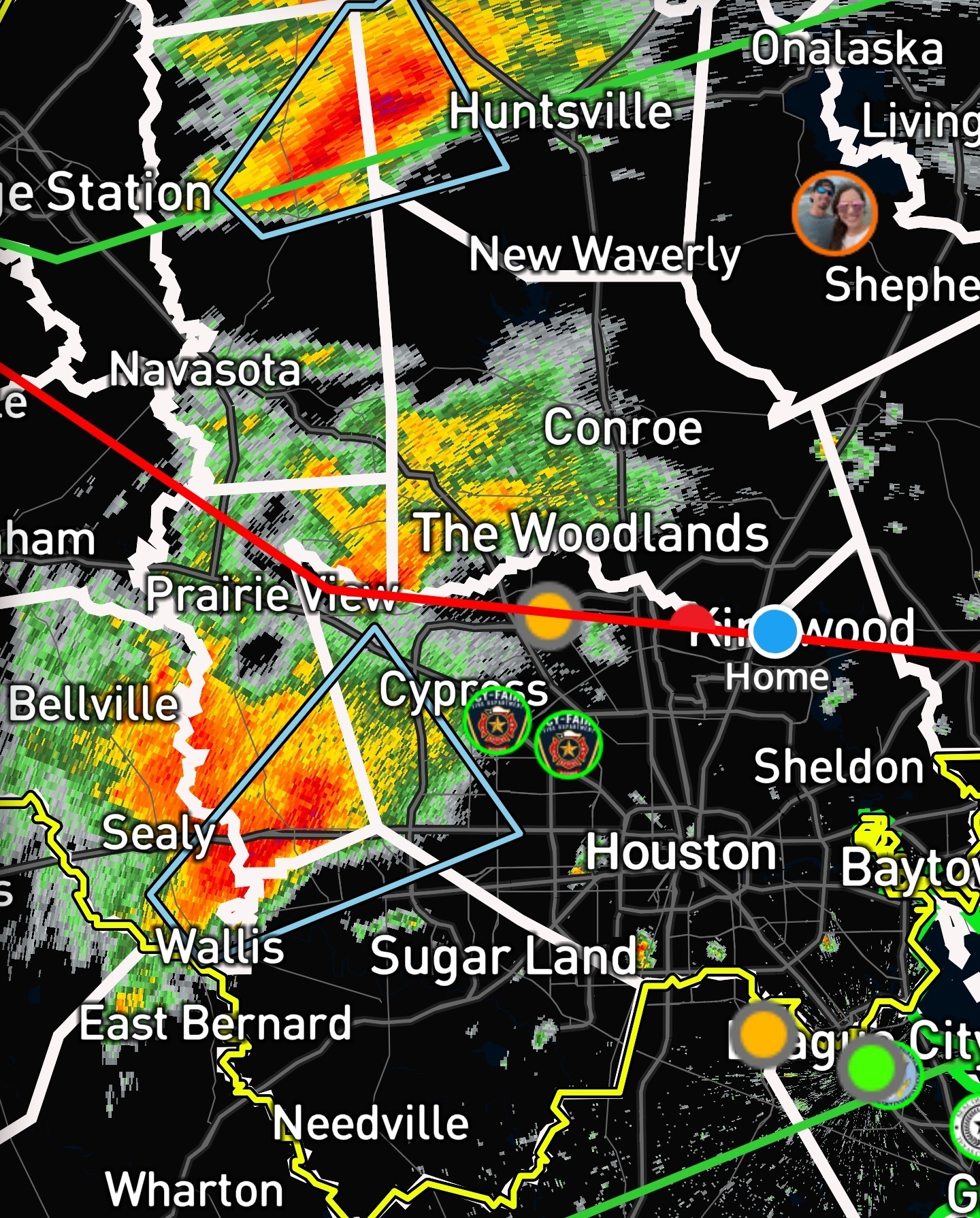
RolloTomaso and cbear reacted National Weather Service
Simonton, or 7 miles southwest of Brookshire, moving northeast at 25
mph.
Katy, Sealy, Brookshire, southwestern Addicks Park Ten, northwestern Eldridge / West Oaks, Spring Branch West, Hockley, Wallis, Fulshear, Simonton, San Felipe, Pattison, Cinco Ranch, northern Weston Lakes, Addicks, and Memorial.
« Back to Chat
Views: 1,593
# Replies: 69