


Cold front + NYE forecast
Cold front + NYE forecast


Joined:
X days ago
# Posts:
X,XXX
Contributor Points:
X


Cold front + NYE forecast Three more days of unseasonable warmth Eric Berger · Friday, December 26, 2025 7:32 AM In brief: Merry Christmas, everyone. We hope the holiday was wonderful for you. We've got three more days before a strong front arrives and then we're watching for the possibility of a light freeze in parts of Houston. FRIDAY and SATURDAY - Really, these days will just be more of the same. *We can expect high temperatures ranging from the upper 70s to low 80s with plenty of humidity.
*Nights will be warm and muggy with lows falling only into the upper 60s for most locations.
*Winds, generally, will be light from the south.
*We'll have a mix of clouds and sunshine. And that's about it. 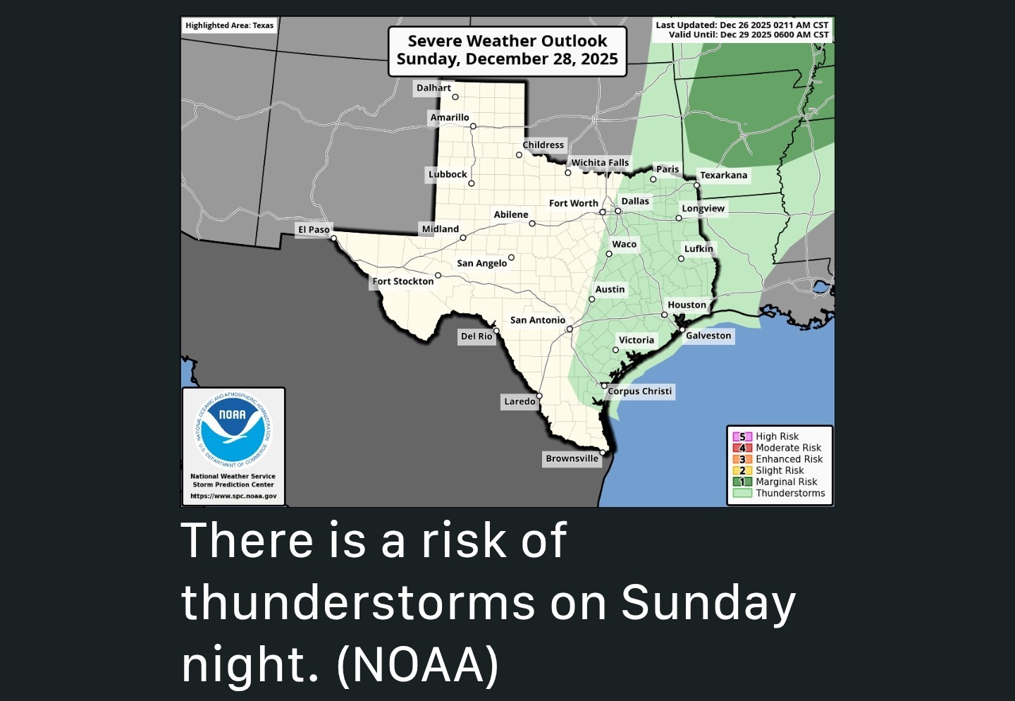 SUNDAY - *This will be another warm day. In fact, with compression ahead of the front, we might see highs pushing into the low 80s for much of the region.
*Cooler temperatures will eventually arrive on Sunday evening, or during the overnight hours.
*When you wake up on Monday morning, temperatures will be much colder, likely in the 40s.
*Speaking of the frontal passage, there may be some brief, light to moderate showers on Sunday night with its passage along with a few thunderstorms. (They should not last long as the front pushes through) 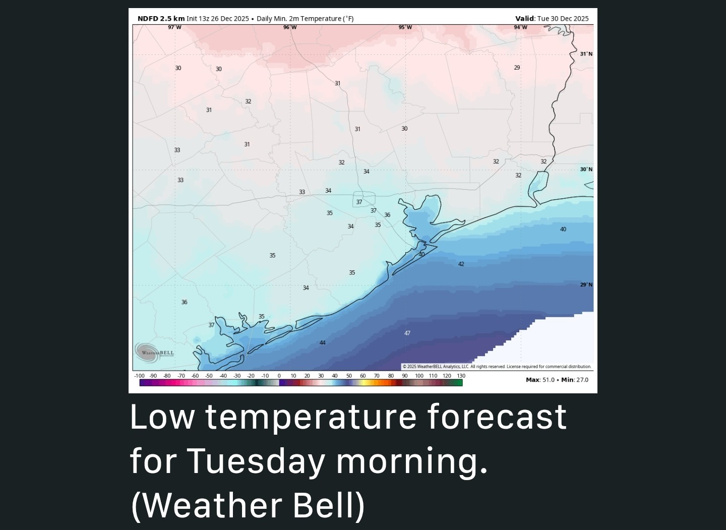 NEXT WEEK - Monday and Tuesday will be sharply colder. *Daytime temperatures on both days will likely peak at around 50 degrees, and conditions on Monday should feel even chillier due to fairly gusty winds.
*Both days should see partly to mostly sunny skies.
*We're closely watching for the possibility of a light freeze in Houston, which will depend on a variety of factors including winds, clouds and just how cold a narrow wedge of air near the surface can get on Tuesday and Wednesday mornings.
*For now, I'll predict that most of metro Houston lands just above freezing, in the ballpark of 33 to 36 degrees.
*It should be fairly close, tho and you should be prepared for the possibility of sub-freezing temperatures similar to what we experienced 10 days ago.
*A freeze is more likely for areas outside of Houston's urban core, and away from the coast. NEW YEARS - *Highs on New Year's Eve should reach about 60 degrees but lows that night will drop into the 40s.
*I'm not concerned about rains or winds but conditions will still be fairly chilly if you're outside as you ring in the new year.
*We should be around 70 degrees for highs to end next week with mild nights probably somewhere in the 50s.
peppermintstick, FlipZ and CatalinaKitKat + 1 more reacted *Nights will be warm and muggy with lows falling only into the upper 60s for most locations.
*Winds, generally, will be light from the south.
*We'll have a mix of clouds and sunshine.
*Cooler temperatures will eventually arrive on Sunday evening, or during the overnight hours.
*When you wake up on Monday morning, temperatures will be much colder, likely in the 40s.
*Speaking of the frontal passage, there may be some brief, light to moderate showers on Sunday night with its passage along with a few thunderstorms. (They should not last long as the front pushes through)
*Both days should see partly to mostly sunny skies.
*We're closely watching for the possibility of a light freeze in Houston, which will depend on a variety of factors including winds, clouds and just how cold a narrow wedge of air near the surface can get on Tuesday and Wednesday mornings.
*For now, I'll predict that most of metro Houston lands just above freezing, in the ballpark of 33 to 36 degrees.
*It should be fairly close, tho and you should be prepared for the possibility of sub-freezing temperatures similar to what we experienced 10 days ago.
*A freeze is more likely for areas outside of Houston's urban core, and away from the coast.
*I'm not concerned about rains or winds but conditions will still be fairly chilly if you're outside as you ring in the new year.
*We should be around 70 degrees for highs to end next week with mild nights probably somewhere in the 50s.