


Changes in Beryl - SAT 4AM (PG 7)
Changes in Beryl - SAT 4AM (PG 7)

This discussion has been locked.

Joined:
X days ago
# Posts:
X,XXX
Contributor Points:
X
Discussion Summary:
Hurricane Beryl Shifts Northward and Expected to Make Landfall in Texas, Impacting Houston Area
Hurricane Beryl Shifts Northward and Expected to Make Landfall in Texas, Impacting Houston Area
Discussion Insights:
Ask a question about this discussion and an AI bot will try to give an answer.
Ask a question about this discussion and an AI bot will try to give an answer.
Replies:


|

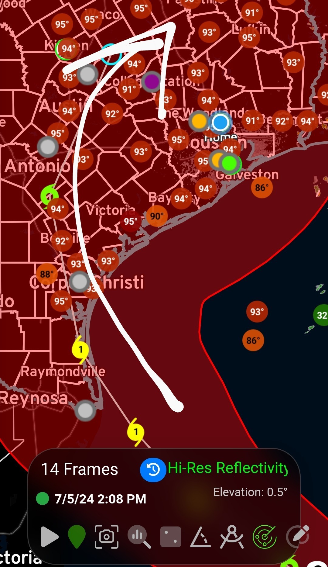
Question StormChaser…..nobody expected this much of a northerly turn……I hoped for, but expected nothing. As of this moment it's expected to make landfall into Corpus - but what it continues North throughout the day? Either way we get dirty side of something…….and that's better than the alternative. This thing is sure keeping weather guys guessing. They say small storms are harder to track. Wirery little fuks. 🤨
 Ruger5 :
Continue to monitor trends today and tomorrow. Make whatever preps you feel comfortable making or you feel are warranted. Current forecasts keep most meaningful impacts beyond localized flash flooding away from us. Coastal residents prepare for at least minor to moderate tidal flooding."
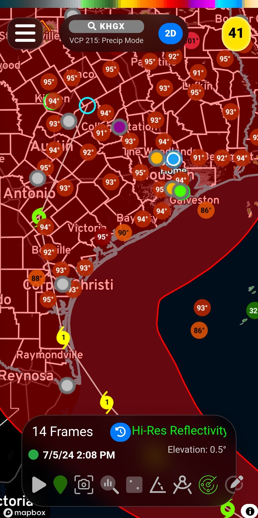
Hopefully they are starting to lower the Lakes at Conroe and Lake Houston.
 fudgiesmom2 : They have not.
|
|
StormChaser : I don't like this shift north. If it continues to shift north on every update, we could be in trouble.
 Weathergirl5 :
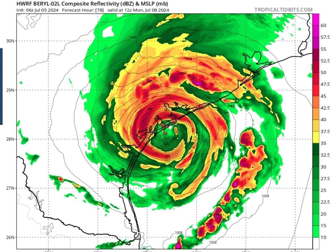
*While this is not a forecast, it does show a possible bad scenario for an intensifying Hurricane Beryl with farther right track. This would be a mega disaster for Texas. Now is the time to prepare.
|
|


 StormChaser :
Yep that is what concerns me. Reminds me a bit of Harvey --in that when it was down near the Yucatan, it was projected to go way south of Houston but with each update, it crept more north towards Houston. NOT to say this is Harvey before people jump to conclusions, I am simply comparing similar tracks...
Weathergirl5 : Yeah and it seems like with each update it's doing just that. Of course landfall is still projected somewhere near Corpus, but it was projected to be a Mexico landfall for several days, then it was Brownsville, now it's Corpus. Reed Timmer is headed up to Port Lavaca! ............,. From Reed Timmer, who is headed to Texas: NOT A FORECAST: *The HWRF model shows a major Hurricane Beryl at landfall near Port Lavaca, Texas on Monday morning. *While this is not a forecast, it does show a possible bad scenario for an intensifying Hurricane Beryl with farther right track. This would be a mega disaster for Texas. Now is the time to prepare. HWRF model:
StormChaser : Very well explained!
|
|
Alright guys - new trends and models are out and they are pretty important. â— This is NOT a concrete forecast but I felt I needed to post because if it comes to fruition, Houston could be in trouble. *These trends show it will take the northern track, have more time over the Gulf, and then a landfall near Galveston as a possible Cat 2 storm. (Maybe even a 3) *They also show it slowing down. I know this is not what we want to hear. *New EURO model is esp concerning. This is what I was worried about earlier this week. EURO Model: 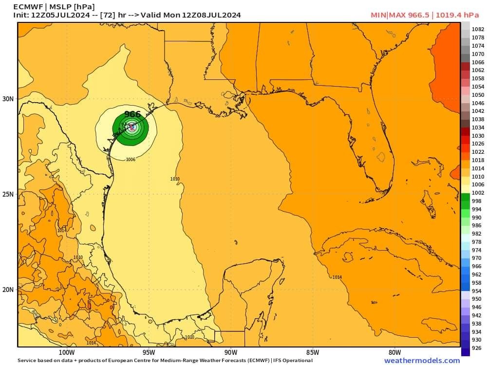 ICON model:
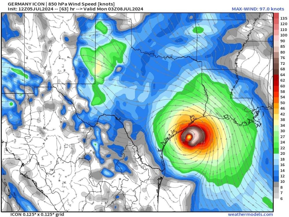 GFS Model is starting to follow to the Euro and icon.
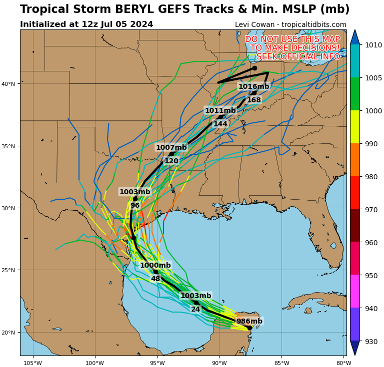 Landfall predictions:
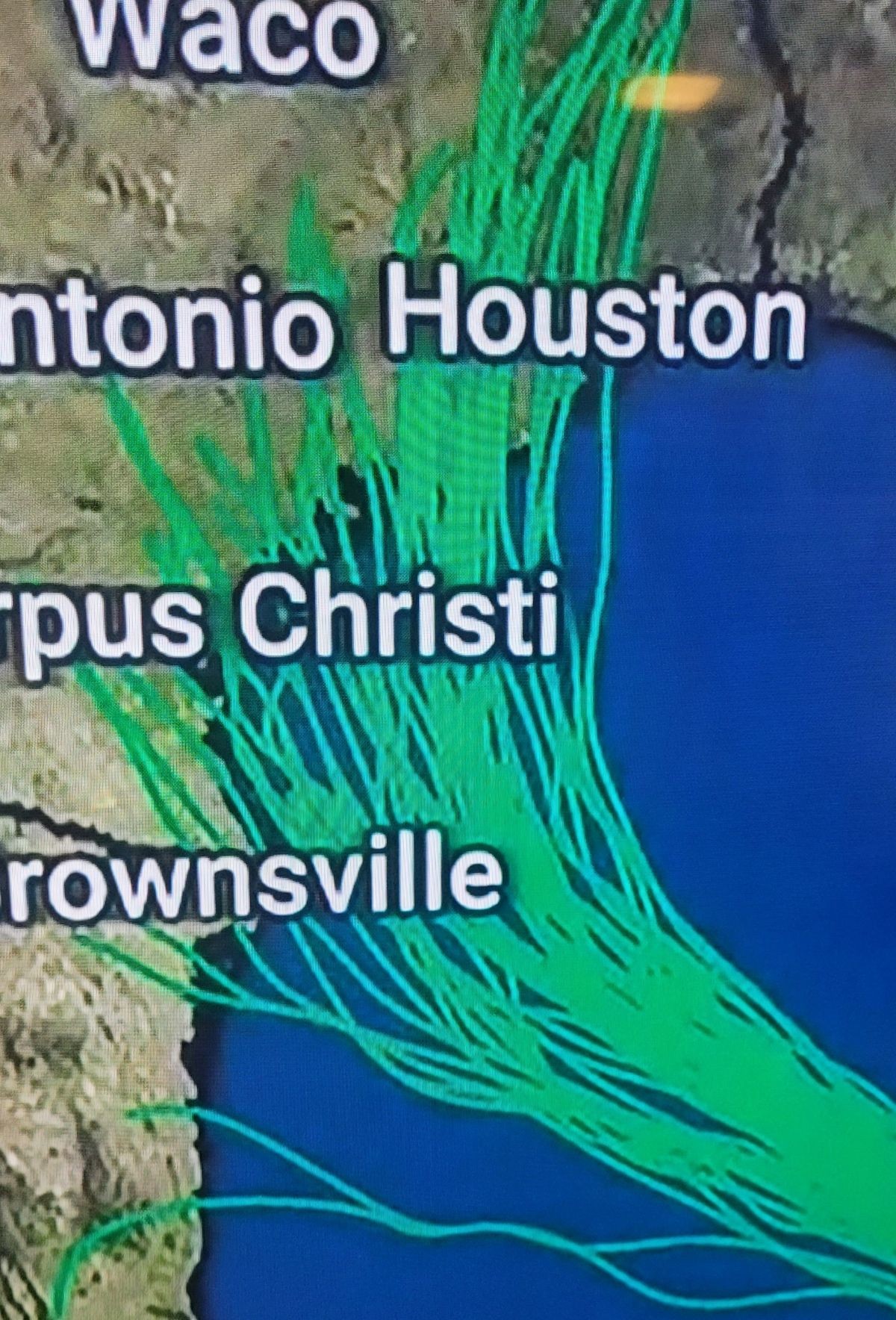 I Will BE UPDATING OFTEN FROM NOW ON.
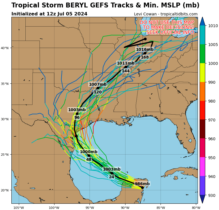
Here's Levi Conan's post about Beryl today. He always goes into great detail in easy to understand language. It all depends where Beryl pops out at in the Yucatán Peninsula- he didn't say anything about a Cat 2 or 3 intensity.
So yes y'all do need to remain vigilant. Levi also has many different model runs on his site that you can watch. It's interesting to see how different models have different outcomes. Tomorrow they will tighten up and a more accurate forecast will happen www.tropicaltidbits. com/
So yes y'all do need to remain vigilant. Levi also has many different model runs on his site that you can watch. It's interesting to see how different models have different outcomes. Tomorrow they will tighten up and a more accurate forecast will happen
Weathergirl5 : Yeah and it seems like with each update it's doing just that. Of course landfall is still projected somewhere near Corpus, but it was projected to be a Mexico landfall for several days, then it was Brownsville, now it's Corpus. Reed Timmer is headed up to Port Lavaca! ............,. From Reed Timmer, who is headed to Texas: NOT A FORECAST: *The HWRF model shows a major Hurricane Beryl at landfall near Port Lavaca, Texas on Monday morning. *While this is not a forecast, it does show a possible bad scenario for an intensifying Hurricane Beryl with farther right track. This would be a mega disaster for Texas. Now is the time to prepare. HWRF model:
StormChaser : but where is jim cantore?!?! LOL!!!!
StormChaser : but where is jim cantore?!?! LOL!!!!
 yankeejessica :
 Lol, probably in one of the planes sprinkling Adderall into the clouds and yelling, "Make up your ****ing mind!"
 Brat : LMMMMAAAOOO!!!!!
|
|
4PM FRI BERYL UPDATE This is very concerning guys and exactly what I was afraid of. With each update, it gets pushed further east towards us. How far East is now the question. South = less time over the water and a weaker storm. (Corpus)
North = longer time over the Gulf and a stronger storm. (Matagorda/Galveston) NEW | BERYL TRACK SHIFTS FURTHER NORTH | 4pm update from NOAA NWS National Hurricane Center: *Latest advisory now shows a possible landfall closer to Matagorda Bay followed by a northeast turn into Southeast Texas. *There are some models indicating a landfall further east closer to Galveston but we will have to watch and see. 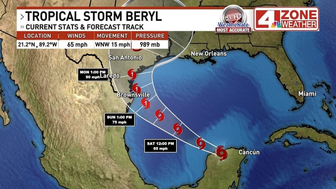 ......... These are some of the models that are starting to trend, which is worrisome: Model: Global High-Resolution Atmospheric Forecasting System
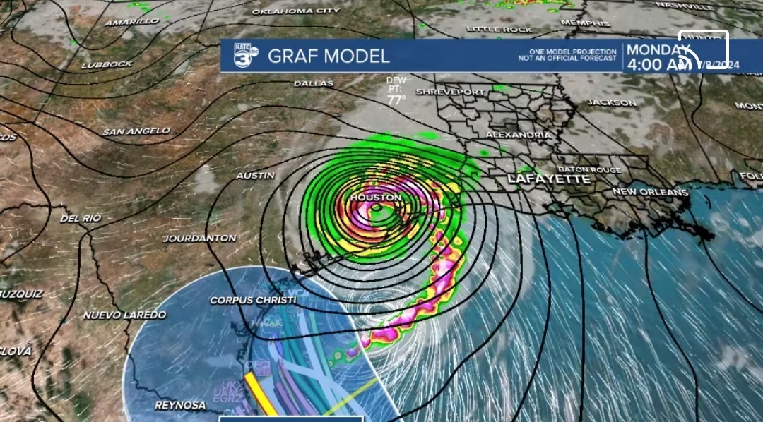 ICON:
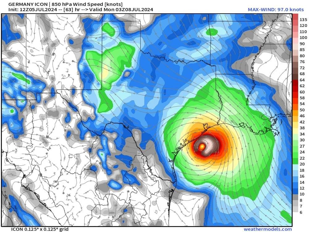 Hurricane WATCHES are up for the Texas and Mexico coast.
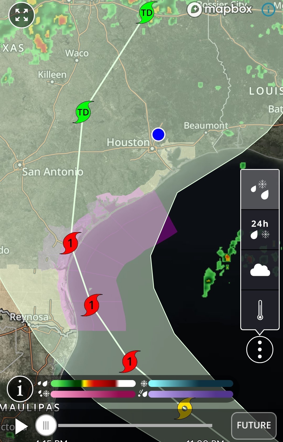 www.nhc.noaa.gov/gra phics_at2.shtml?star t#contents *This is the 4pm Friday July 5 Update - Next update at 10pm
North = longer time over the Gulf and a stronger storm. (Matagorda/Galveston)
|
|
I wanted to add this to the above post (from Reed Timmer) He does believe it will move more to the north before landfall as a Cat 2 hurricane. HURRICANE WATCH has been issued from Brownsville to Sargent, Texas! Further intensification is expected! Texas impacts southwest of Houston very likely. Stronger hurricane, life-threatening flooding and tornado outbreak expected Galveston needs to be on guard. 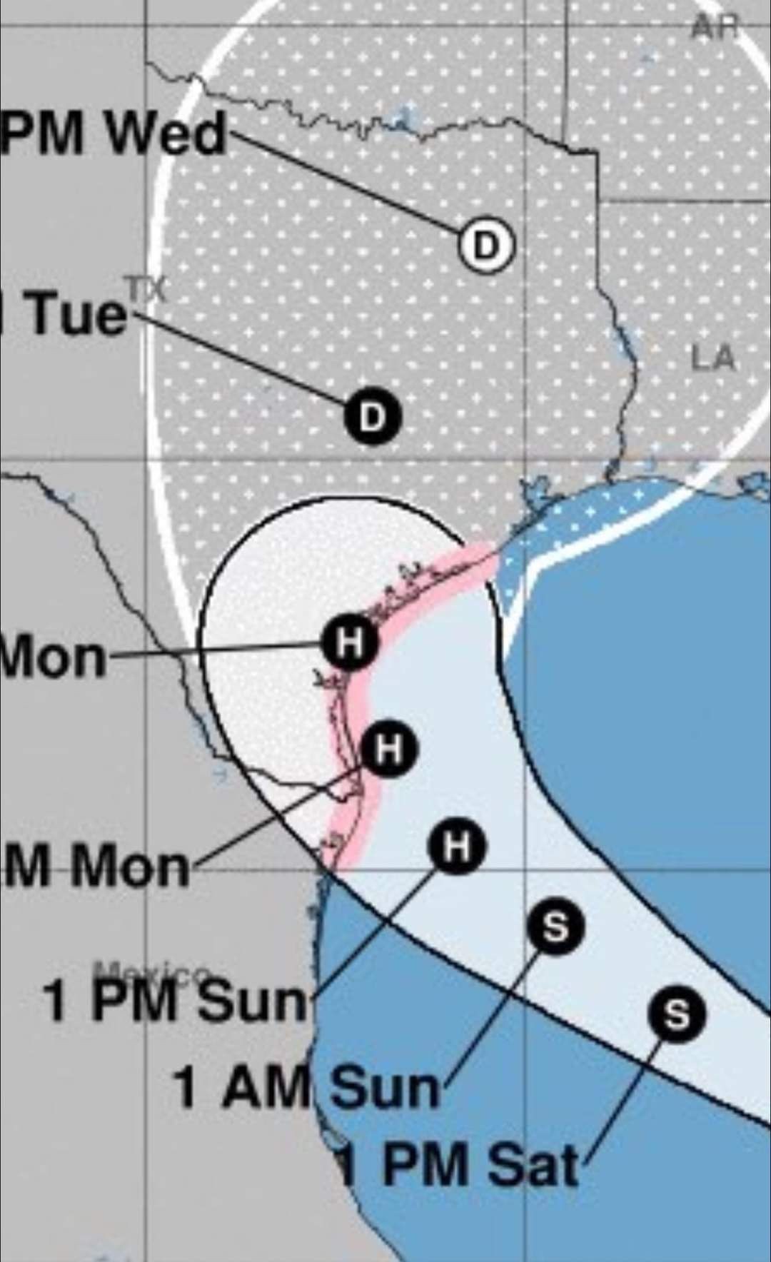
This discussion has been locked.
« Back to ChatViews: 8,173
# Replies: 102