


Big storms to our north
Big storms to our north


Joined:
X days ago
# Posts:
X,XXX
Contributor Points:
X


Big storms to our north 🚨 These Storms will stay to our north and miss us in SE Texas. Big time storms north of us! There is a tornado watch for all of the areas in yellow. There have already been multiple tornadoes produced around DFW this complex plus very large hail. This will continue to move east but it will do so very slowly and drop and ton of rain. If a rouge cell makes it's way down here, I'll give y'all the heads up! (The watch goes all the way to Montgomery County so it's always possible) 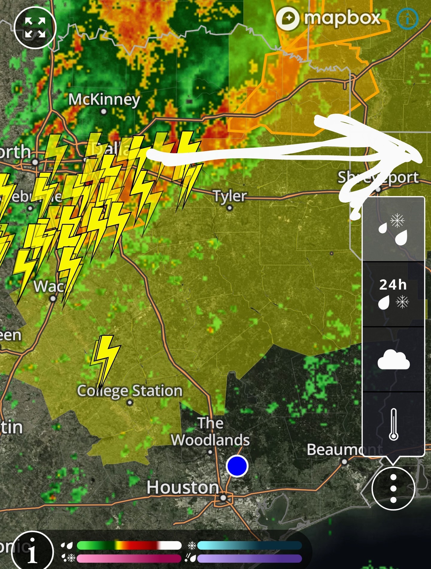


Replies:

|
Oof. Those are some nasty storms! Large hail and damaging winds and flash flooding in areas. 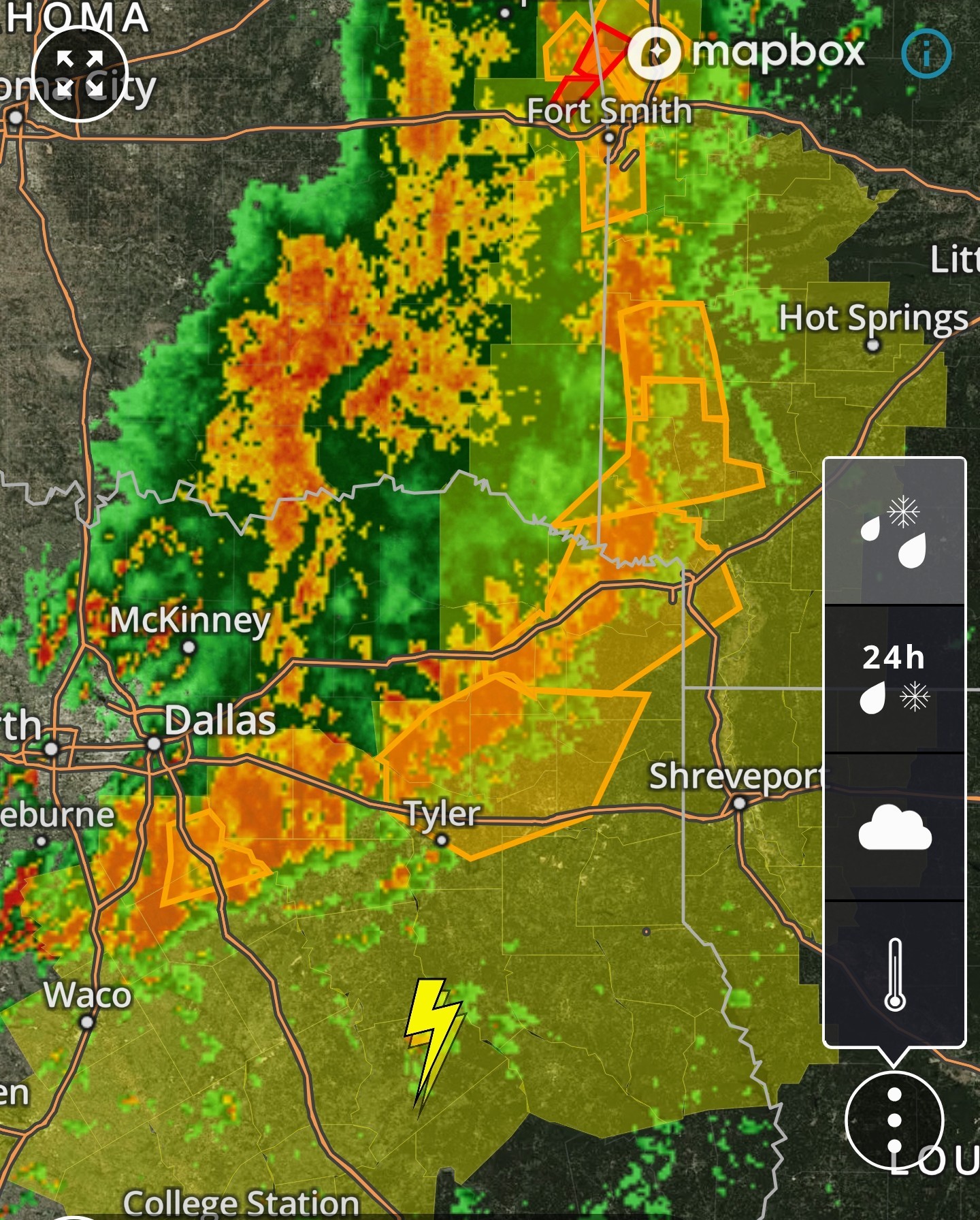
|
|
Big storms to our north 🚨 These Storms will stay to our north and miss us in SE Texas. Big time storms north of us! There is a tornado watch for all of the areas in yellow. There have already been multiple tornadoes produced around DFW this complex plus very large hail. This will continue to move east but it will do so very slowly and drop and ton of rain. If a rouge cell makes it's way down here, I'll give y'all the heads up! (The watch goes all the way to Montgomery County so it's always possible)
StormChaser : Guess I will go charge my phone.
|
|
 StormChaser :
 Wishing we could get some heavy rain sans tornadoes, don't need those. Prayers no major damages result!🙏
Oof. Those are some nasty storms! Large hail and damaging winds and flash flooding in areas.
teatime tipped StormChaser 100 credits for a post in this forum discussion.
|
|
StormChaser : Guess I will go charge my phone.
cbear : Nah they are staying north. Tomorrow is a different story. We could definitely see a line of storms tomorrow afternoon.
I need to know about Saturday in Montgomery
Sister is sitting at IAH waiting on her flight to rake off to Dallas. Glad it is not me, not a good flyer.
StormChaser : I did not see your post this morning, and was surprised when there was a pretty good sprinkle of rain, when I was shopping in Humble, earlier today!
|
|
cbear : Nah they are staying north. Tomorrow is a different story. We could definitely see a line of storms tomorrow afternoon.
StormChaser : Yes well, you know that the power goes out in Kingwood "when a squirrel farts"! LOL~! I love that saying that you shared!
|
|
Forecast: today & Friday AM storms missed us but this goes into detail about storm chances the next 2 days. Thursday (today): *If you're wondering about those storms on Wednesday night, they essentially remained north of Highway 105, with only a smattering of rain making it down into the Houston metro area.
*Plenty of moisture remains in the atmosphere so we may see a few showers and thunderstorms today in Houston, but I expect most of us to stay dry.
*As skies clear out this afternoon, it should be rather warm day, with a few inland locations probably reaching 90 degrees this afternoon.
*Winds will be from the south at 10 mph, gusting perhaps to 20 mph.
*Lows tonight only fall into the low 70s for most locations. Friday and Friday night: *In terms of temperatures and humidity, I expect Friday to be similar to Thursday, however I do expect to see less sunshine.
*The big thing to watch is the possibility (likelihood, really) of showers and thunderstorms on Friday afternoon, evening, and overnight.
*As a front approaches Houston, we are likely to see a mass of showers and thunderstorms develop north of Interstate 10 by Friday afternoon or early evening.
*We cannot rule out some hail or damaging winds with these storms.
*Although I believe the formation of tornadoes is unlikely, I cannot say none will occur.
*Later on Friday evening, or perhaps around midnight, these storms should march southward toward the coast before the whole thing moves offshore some time on Saturday morning.
*Because we are still nearly 48 hours from all of this, we are just coming into the range of high resolution modeling. However I want people to be aware that the region could see 0.5 to 2 inches of rain on Friday evening and night, with the possibility of thunderstorms.
*If you have plans for Friday night, this is definitely something to take into account. 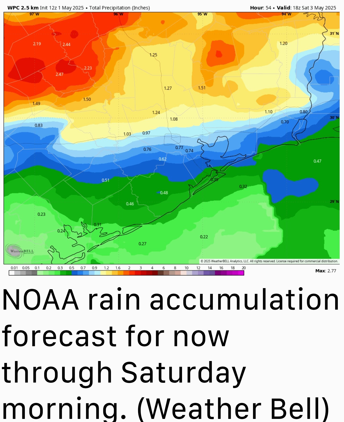 Saturday: *Rain chances will likely end on Saturday morning, and we should see some clearing skies during the afternoon hours.
*High temperatures will likely reach about 80 degrees for most locations, with some modestly drier air.
*Lows on Saturday night will depend on how far you live from the coast, with areas south of I-10 maybe reaching 65 or the lower 60s, whereas some areas further inland have a chance to reach the upper 50s. It should, in any case, feel pretty nice.
*Plenty of moisture remains in the atmosphere so we may see a few showers and thunderstorms today in Houston, but I expect most of us to stay dry.
*As skies clear out this afternoon, it should be rather warm day, with a few inland locations probably reaching 90 degrees this afternoon.
*Winds will be from the south at 10 mph, gusting perhaps to 20 mph.
*Lows tonight only fall into the low 70s for most locations.
*The big thing to watch is the possibility (likelihood, really) of showers and thunderstorms on Friday afternoon, evening, and overnight.
*As a front approaches Houston, we are likely to see a mass of showers and thunderstorms develop north of Interstate 10 by Friday afternoon or early evening.
*We cannot rule out some hail or damaging winds with these storms.
*Although I believe the formation of tornadoes is unlikely, I cannot say none will occur.
*Later on Friday evening, or perhaps around midnight, these storms should march southward toward the coast before the whole thing moves offshore some time on Saturday morning.
*Because we are still nearly 48 hours from all of this, we are just coming into the range of high resolution modeling. However I want people to be aware that the region could see 0.5 to 2 inches of rain on Friday evening and night, with the possibility of thunderstorms.
*If you have plans for Friday night, this is definitely something to take into account.
*High temperatures will likely reach about 80 degrees for most locations, with some modestly drier air.
*Lows on Saturday night will depend on how far you live from the coast, with areas south of I-10 maybe reaching 65 or the lower 60s, whereas some areas further inland have a chance to reach the upper 50s. It should, in any case, feel pretty nice.
|
|
 StormChaser :
 Yes I hope we get good steady rain without the lighting etc. I do hope it holds off today until I play golf.
Despite last night's storms turning out to be a nothingburger for most of us, things are beginning to look far more impressive to our far west and south for possible interaction tonight/tomorrow: 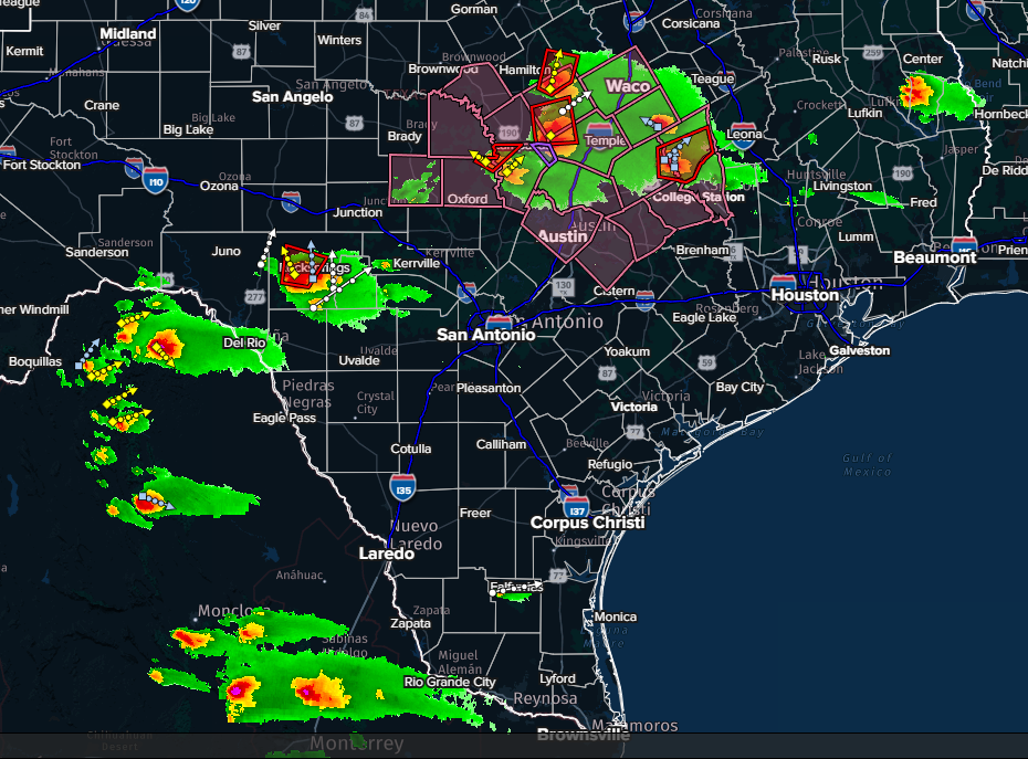
« Back to Chat
Views: 884
# Replies: 16