


This week's forecast
This week's forecast


Joined:
X days ago
# Posts:
X,XXX
Contributor Points:
X


This week's forecast From Space City Weather: A fairly typical January week arrives in Houston for a change. Matt Lanza · Monday, January 12, 2026 8:15 AM In brief: *Houston's weather will behave more typical of January this week with temperatures both a little cooler and a little warmer than normal at times.
*It looks to remain on the quieter side of things overall. MONDAY (TODAY) *We have a fair bit of middle and upper level cloud cover passing through the region today, so it'll be one of those "sunny in name only" days.
*Look for intervals of sun and clouds.
*Temperatures should manage about 58 to 61 degrees this afternoon on average.
*Winds will be on the lighter side. TEXANS GAME FORECAST - *For those of y'all watching or going to the Texans game in Pittsburgh tonight, it looks chilly and breezy.
*If you watched the games in Philly or New England yesterday, you saw the winds and their impacts.
*In Pittsburgh, winds will be lightening up this evening, with temperatures falling from the mid to upper 30s to the low or mid 30s during the game. GO TEXANS! TUESDAY - *This is our first kinda-sorta interesting weather day this week.
*The overall picture is straightforward: We'll continue with these higher clouds.
*Temperatures should be a couple degrees cooler tomorrow as cloud cover may be more prevalent.
*We will probably either squeeze out a couple showers or some virga (rain that evaporates before reaching the ground).
*With the cooler temperatures, and relatively drier air, even with temperatures in the 50s, I would not be at all shocked if someone tags us on social media saying they see sleet/ice pellets at their house, particularly closer to Sealy or the Brazos Valley. There would be zero impacts, but I'm just noting it. WEDNESDAY - *Ahead of our next front, we warm up on Wednesday with temperatures deep into the 60s and perhaps a bit more sunshine.
*A cool front hits the area on Wednesday evening so winds may pick up a little bit overnight (20-30 mph or so).
*Otherwise, the front should come through with minimal impacts. 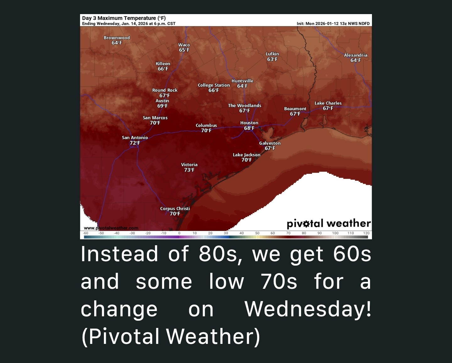 Thursday INTO THE WEEKEND - *We'll cool off a bit on Thursday behind the front with highs probably in the 50s across the area and sunshine!
*Friday looks delightful, with more sun and highs in the 60s.
*Another front hits the area on Saturday.
*There's a little uncertainty on whether or not we can squeeze out a few rain drops or (again) ice pellets with this as it passes through. Even if we do, any precip would be very, very light.
*Temperatures should again cool down with highs near 60 or in the 50s Saturday & then low 60s on Sunday. Overall, this looks like fine, mostly typical January weather for Houston after what has been quite a warm stretch.


golfshot, CatalinaKitKat and GiggleMugs + 4 more reacted *It looks to remain on the quieter side of things overall.
*Look for intervals of sun and clouds.
*Temperatures should manage about 58 to 61 degrees this afternoon on average.
*Winds will be on the lighter side.
*If you watched the games in Philly or New England yesterday, you saw the winds and their impacts.
*In Pittsburgh, winds will be lightening up this evening, with temperatures falling from the mid to upper 30s to the low or mid 30s during the game.
*The overall picture is straightforward: We'll continue with these higher clouds.
*Temperatures should be a couple degrees cooler tomorrow as cloud cover may be more prevalent.
*We will probably either squeeze out a couple showers or some virga (rain that evaporates before reaching the ground).
*With the cooler temperatures, and relatively drier air, even with temperatures in the 50s, I would not be at all shocked if someone tags us on social media saying they see sleet/ice pellets at their house, particularly closer to Sealy or the Brazos Valley.
*A cool front hits the area on Wednesday evening so winds may pick up a little bit overnight (20-30 mph or so).
*Otherwise, the front should come through with minimal impacts.
*Friday looks delightful, with more sun and highs in the 60s.
*Another front hits the area on Saturday.
*There's a little uncertainty on whether or not we can squeeze out a few rain drops or (again) ice pellets with this as it passes through. Even if we do, any precip would be very, very light.
*Temperatures should again cool down with highs near 60 or in the 50s Saturday & then low 60s on Sunday.
Replies:

|

This week's forecast From Space City Weather: A fairly typical January week arrives in Houston for a change. Matt Lanza · Monday, January 12, 2026 8:15 AM In brief: *Houston's weather will behave more typical of January this week with temperatures both a little cooler and a little warmer than normal at times. *It looks to remain on the quieter side of things overall. MONDAY (TODAY) *We have a fair bit of middle and upper level cloud cover passing through the region today, so it'll be one of those "sunny in name only" days. *Look for intervals of sun and clouds. *Temperatures should manage about 58 to 61 degrees this afternoon on average. *Winds will be on the lighter side. TEXANS GAME FORECAST - *For those of y'all watching or going to the Texans game in Pittsburgh tonight, it looks chilly and breezy. *If you watched the games in Philly or New England yesterday, you saw the winds and their impacts. *In Pittsburgh, winds will be lightening up this evening, with temperatures falling from the mid to upper 30s to the low or mid 30s during the game. GO TEXANS! TUESDAY - *This is our first kinda-sorta interesting weather day this week. *The overall picture is straightforward: We'll continue with these higher clouds. *Temperatures should be a couple degrees cooler tomorrow as cloud cover may be more prevalent. *We will probably either squeeze out a couple showers or some virga (rain that evaporates before reaching the ground). *With the cooler temperatures, and relatively drier air, even with temperatures in the 50s, I would not be at all shocked if someone tags us on social media saying they see sleet/ice pellets at their house, particularly closer to Sealy or the Brazos Valley. There would be zero impacts, but I'm just noting it. WEDNESDAY - *Ahead of our next front, we warm up on Wednesday with temperatures deep into the 60s and perhaps a bit more sunshine. *A cool front hits the area on Wednesday evening so winds may pick up a little bit overnight (20-30 mph or so). *Otherwise, the front should come through with minimal impacts. Thursday INTO THE WEEKEND - *We'll cool off a bit on Thursday behind the front with highs probably in the 50s across the area and sunshine! *Friday looks delightful, with more sun and highs in the 60s. *Another front hits the area on Saturday. *There's a little uncertainty on whether or not we can squeeze out a few rain drops or (again) ice pellets with this as it passes through. Even if we do, any precip would be very, very light. *Temperatures should again cool down with highs near 60 or in the 50s Saturday & then low 60s on Sunday. Overall, this looks like fine, mostly typical January weather for Houston after what has been quite a warm stretch.
StormChaser : Goodness.....when will we ever get another good chance for rain?
 teatime :
 Wingsofwonder :
Not at all, its why I love this plant. I do nothing, God takes good care of it for me ❤️ if it needs attention, it will die in my care. Surprised my kids made it to adulthood 😅
|
|
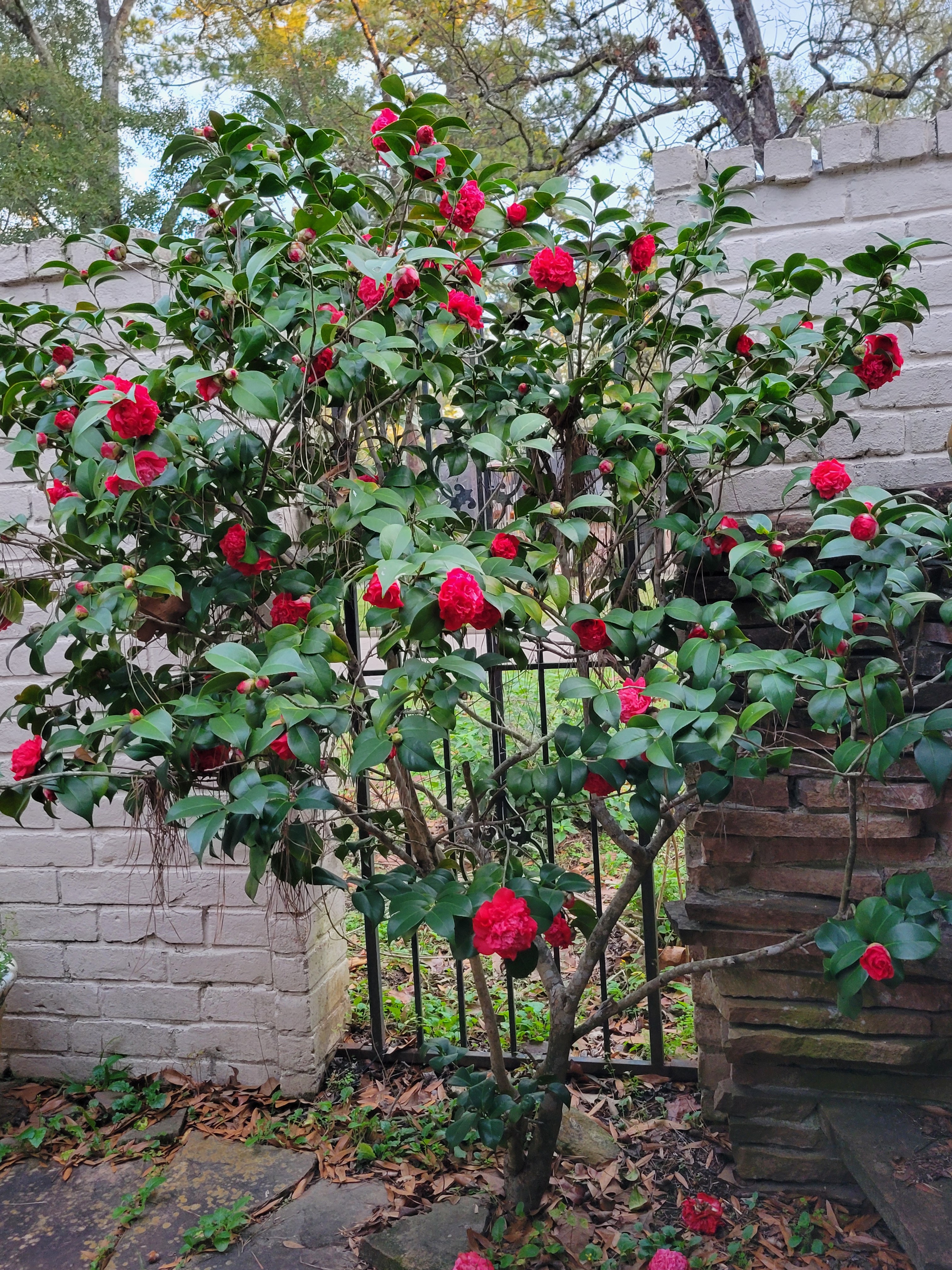
teatime : This is enough real winter for me. 😀 I dont want the temps below 50 thats too cold for me. But my camilia bush only blooms when it gets cold, and it is beautiful right now.
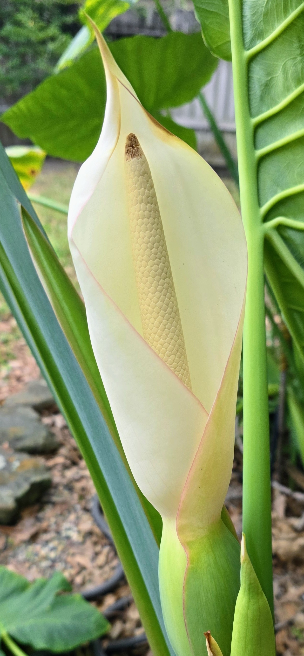
Txbutterfly : All my outdoor plants are so confused lol. 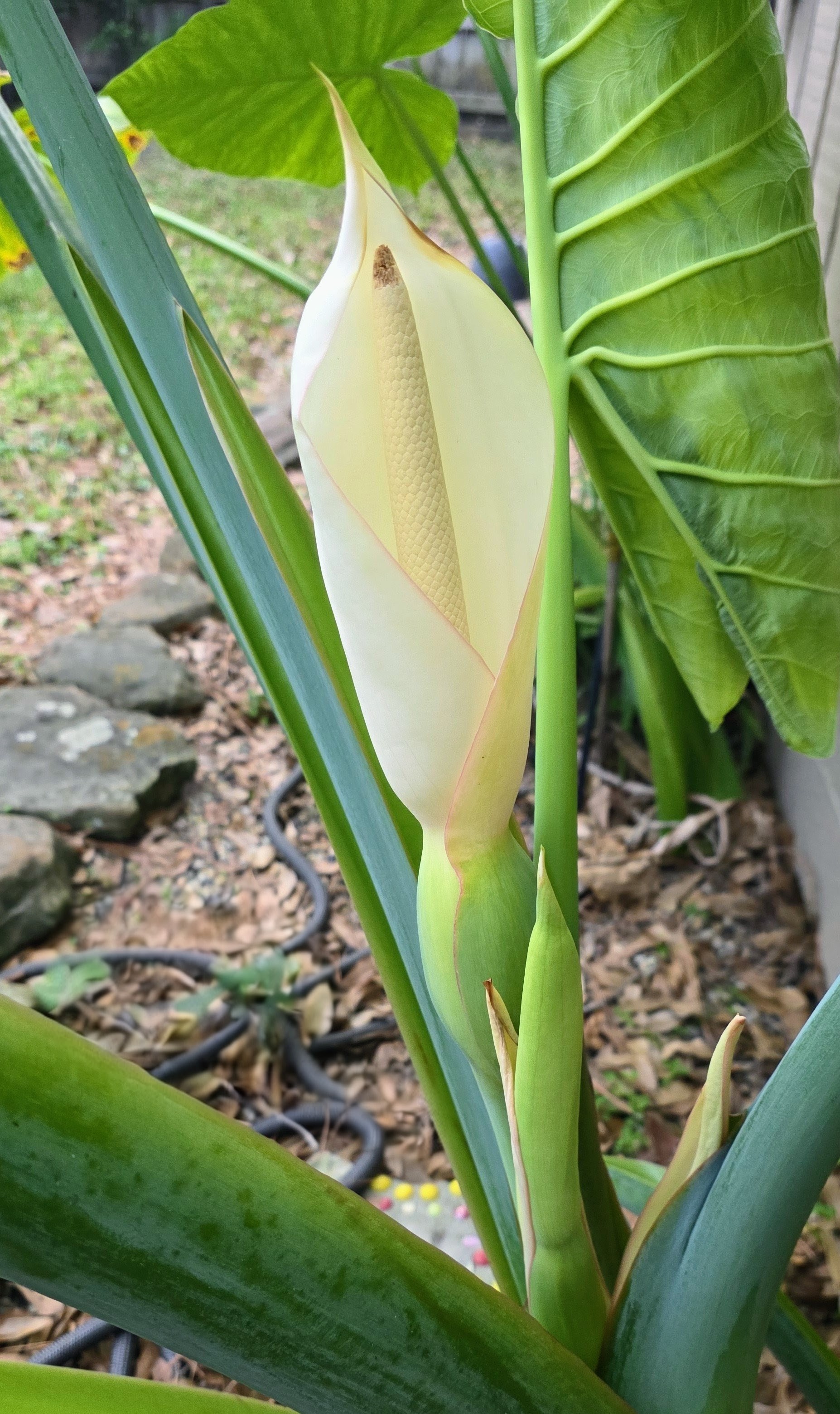
|
|
Txbutterfly : All of my plants are blooming too! Some that I didnt even know that flowered! I just love that we haven't had a hard freeze! Happy Monday! « Back to Chat
Views: 248
# Replies: 7