


Special Weather Statement
Special Weather Statement


Joined:
X days ago
# Posts:
X,XXX
Contributor Points:
X


Special Weather Statement I'll post Weather warnings we get here. This one doesn't include us yet but it's just to our west. 5:15PM Special Weather Statement National Weather Service At 438 PM CST, Doppler radar was tracking a cluster of strong thunderstorms along a line extending from 6 miles northeast of Pinehurst to near Cypress. Movement was northeast at 15 mph. HAZARD...Wind gusts up to 40 mph. SOURCE...Radar indicated. IMPACT...Gusty winds could knock down tree limbs and blow around unsecured objects. Locations impacted include... Southern Conroe, Tomball, Jersey Village, Aldine, The Woodlands, Greater Greenspoint, Spring, northern Addicks Park Ten, Oak Ridge North, Shenandoah, Cut And Shoot, Woodloch, Bush Intercontinental Airport, The Woodlands Pavillion, Chateau Woods, Willowbrook, Hooks Airport, Cypress, Hurricane Harbor Splashtown, and Porter Heights. PRECAUTIONARY/PREPAREDNESS ACTIONS... If outdoors, consider seeking shelter inside a building. Heavy rainfall is also occurring with these storms and may lead to localized flooding. Do not drive your vehicle through flooded roadways. These storms may intensify, so be certain to monitor local radio stations and available television stations for additional information and possible warnings from the National Weather Service. 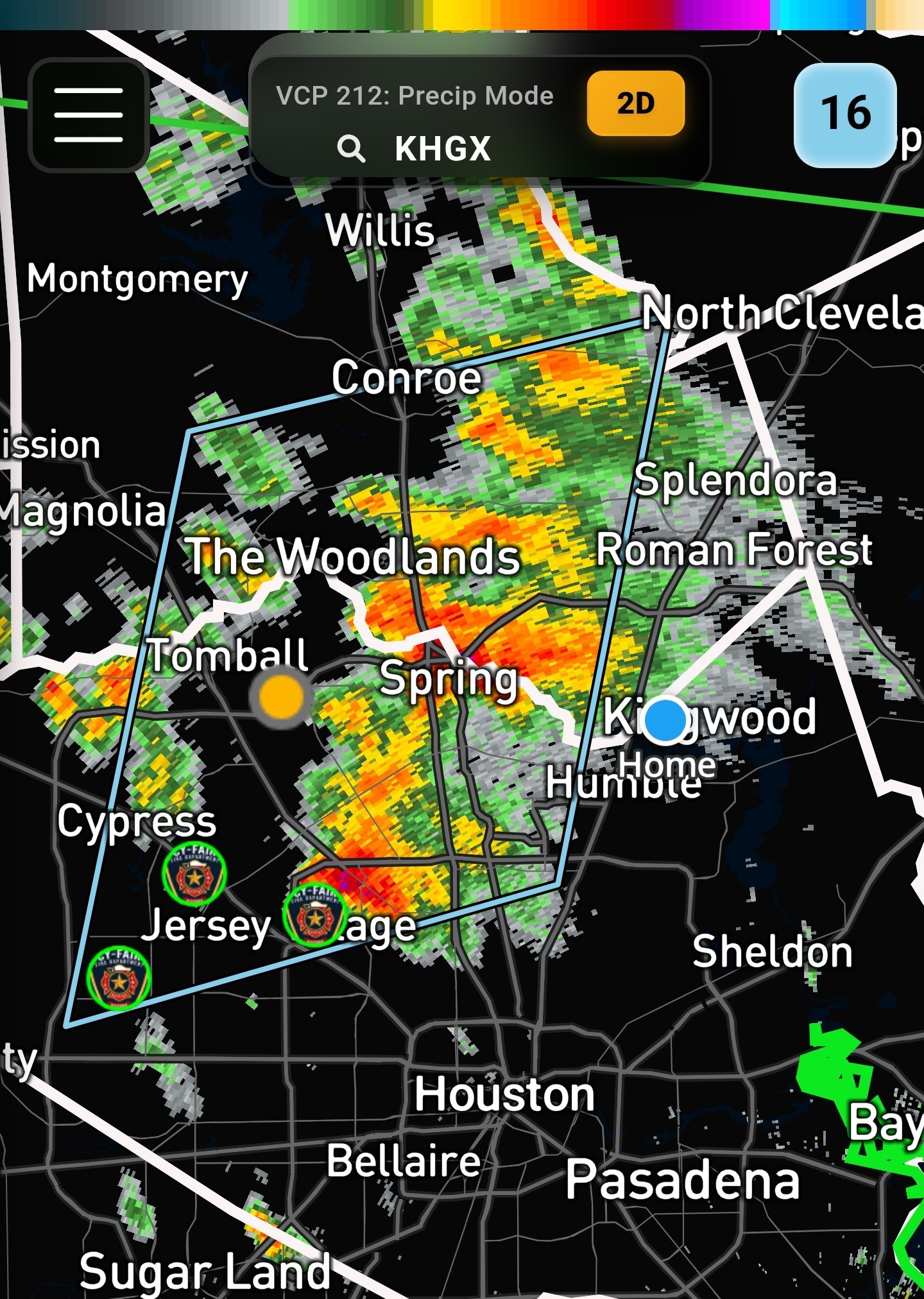


CaffeineFree, Fireba11 and Aggie89 + 10 more reacted Replies:
Special Weather Statement I'm post Weather warnings we get here. This one doesn't include us yet but it's just to our west. 5:15PM Special Weather Statement National Weather Service At 438 PM CST, Doppler radar was tracking a cluster of strong thunderstorms along a line extending from 6 miles northeast of Pinehurst to near Cypress. Movement was northeast at 15 mph. HAZARD...Wind gusts up to 40 mph. SOURCE...Radar indicated. IMPACT...Gusty winds could knock down tree limbs and blow around unsecured objects. Locations impacted include... Southern Conroe, Tomball, Jersey Village, Aldine, The Woodlands, Greater Greenspoint, Spring, northern Addicks Park Ten, Oak Ridge North, Shenandoah, Cut And Shoot, Woodloch, Bush Intercontinental Airport, The Woodlands Pavillion, Chateau Woods, Willowbrook, Hooks Airport, Cypress, Hurricane Harbor Splashtown, and Porter Heights. PRECAUTIONARY/PREPAREDNESS ACTIONS... If outdoors, consider seeking shelter inside a building. Heavy rainfall is also occurring with these storms and may lead to localized flooding. Do not drive your vehicle through flooded roadways. These storms may intensify, so be certain to monitor local radio stations and available television stations for additional information and possible warnings from the National Weather Service.
StormChaser : Thanks. I already made a cup of coffee and put it in the frig. If I wake up to no power...I have some caffeine! Getting used to the drill. 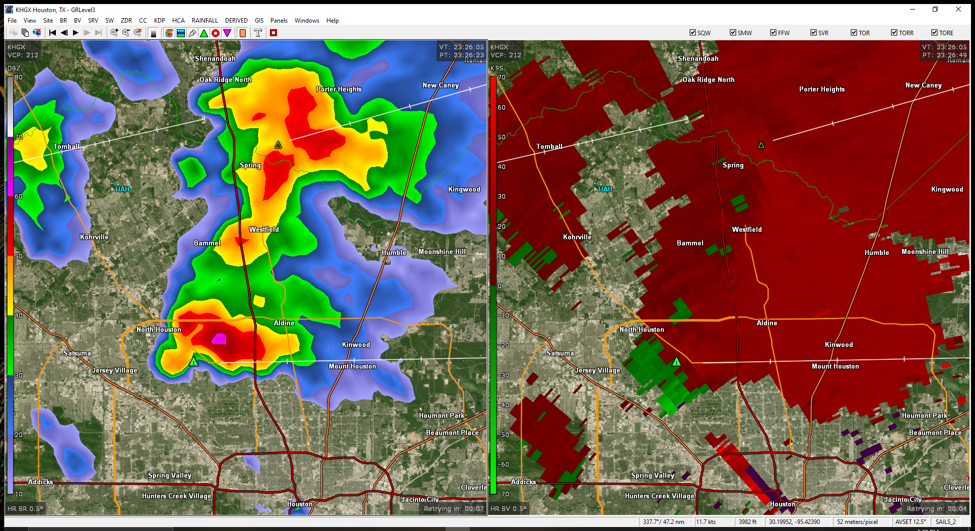
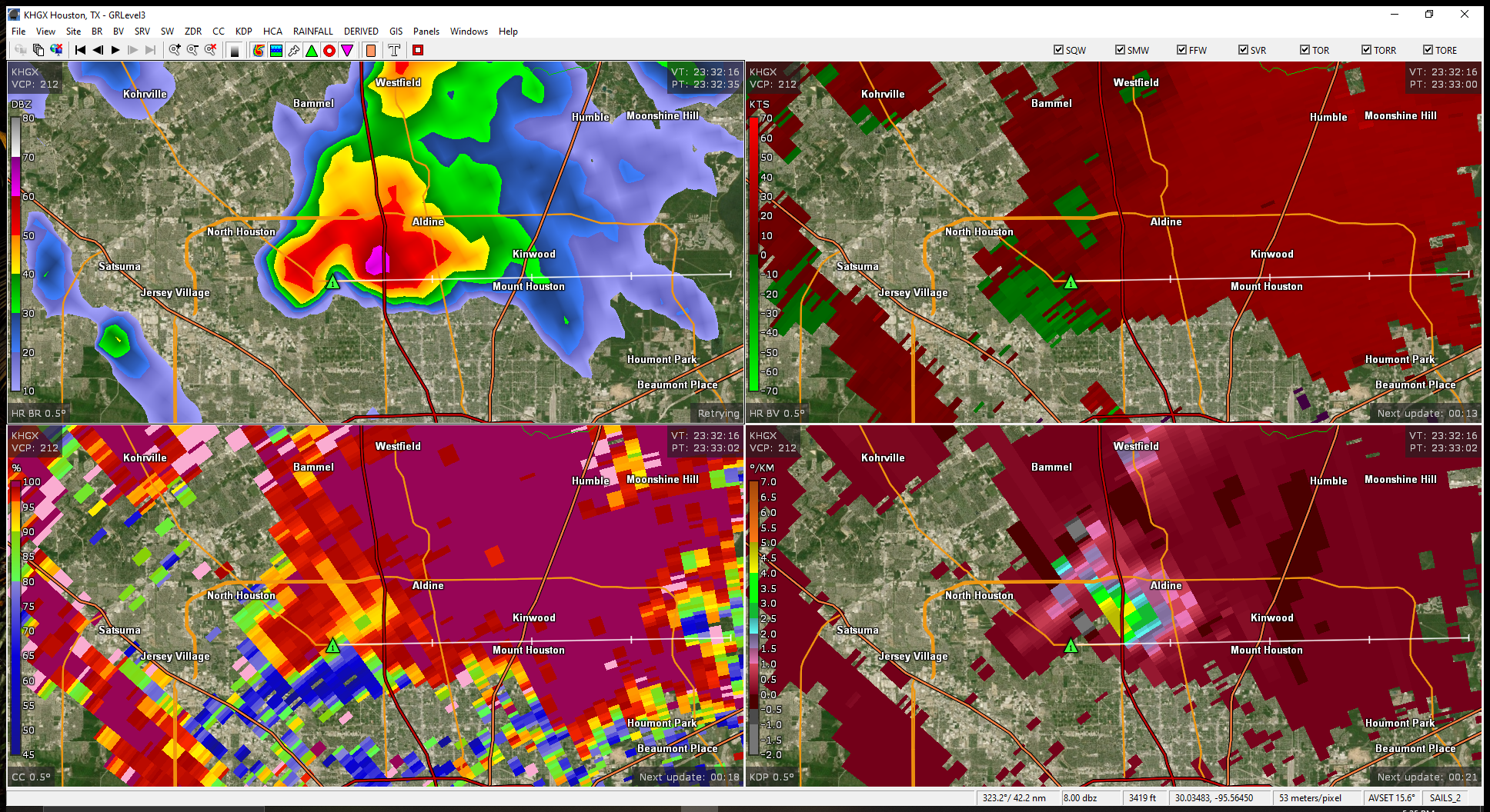
Nice hook with lots of dust and a hail core out in front.
Slow4x4 : Yeah that cell just south of the Beltway has a decent hook on it.
Special Weather StatementNational Weather Service Minor hail damage to vegetation is possible. At 527 PM CST, Doppler radar was tracking a cluster of strong thunderstorms near Spring, moving east at 35 mph. HAZARD...Wind gusts up to 40 mph and pea size hail. SOURCE...Radar indicated. IMPACT...Gusty winds could knock down tree limbs and blow around unsecured objects. Minor hail damage to vegetation is possible. Locations impacted include... Humble, Aldine, Kingwood, Greater Greenspoint, Spring, The Woodlands, northwestern Northside / Northline, Oak Ridge North, Splendora, Patton Village, Roman Forest, Woodbranch, Plum Grove, Bush Intercontinental Airport, Chateau Woods, Hidden Valley, Atascocita, Lake Houston, Hurricane Harbor Splashtown, and Porter Heights. PRECAUTIONARY/PREPAREDNESS ACTIONS... If outdoors, consider seeking shelter inside a building. 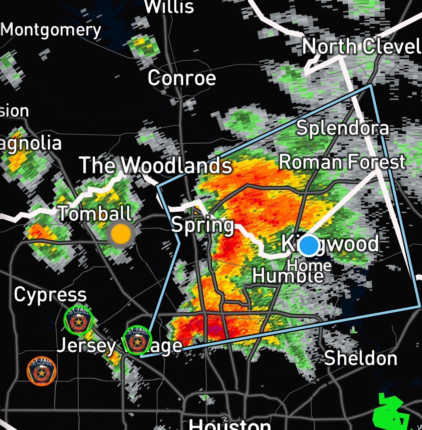
Orangeapple, buffaloglenn and cbear reacted
Special Weather StatementNational Weather Service Minor hail damage to vegetation is possible. At 527 PM CST, Doppler radar was tracking a cluster of strong thunderstorms near Spring, moving east at 35 mph. HAZARD...Wind gusts up to 40 mph and pea size hail. SOURCE...Radar indicated. IMPACT...Gusty winds could knock down tree limbs and blow around unsecured objects. Minor hail damage to vegetation is possible. Locations impacted include... Humble, Aldine, Kingwood, Greater Greenspoint, Spring, The Woodlands, northwestern Northside / Northline, Oak Ridge North, Splendora, Patton Village, Roman Forest, Woodbranch, Plum Grove, Bush Intercontinental Airport, Chateau Woods, Hidden Valley, Atascocita, Lake Houston, Hurricane Harbor Splashtown, and Porter Heights. PRECAUTIONARY/PREPAREDNESS ACTIONS... If outdoors, consider seeking shelter inside a building.
StormChaser : This looks ugly! 


StormChaser : Thanks. I already made a cup of coffee and put it in the frig. If I wake up to no power...I have some caffeine! Getting used to the drill.
cbear : 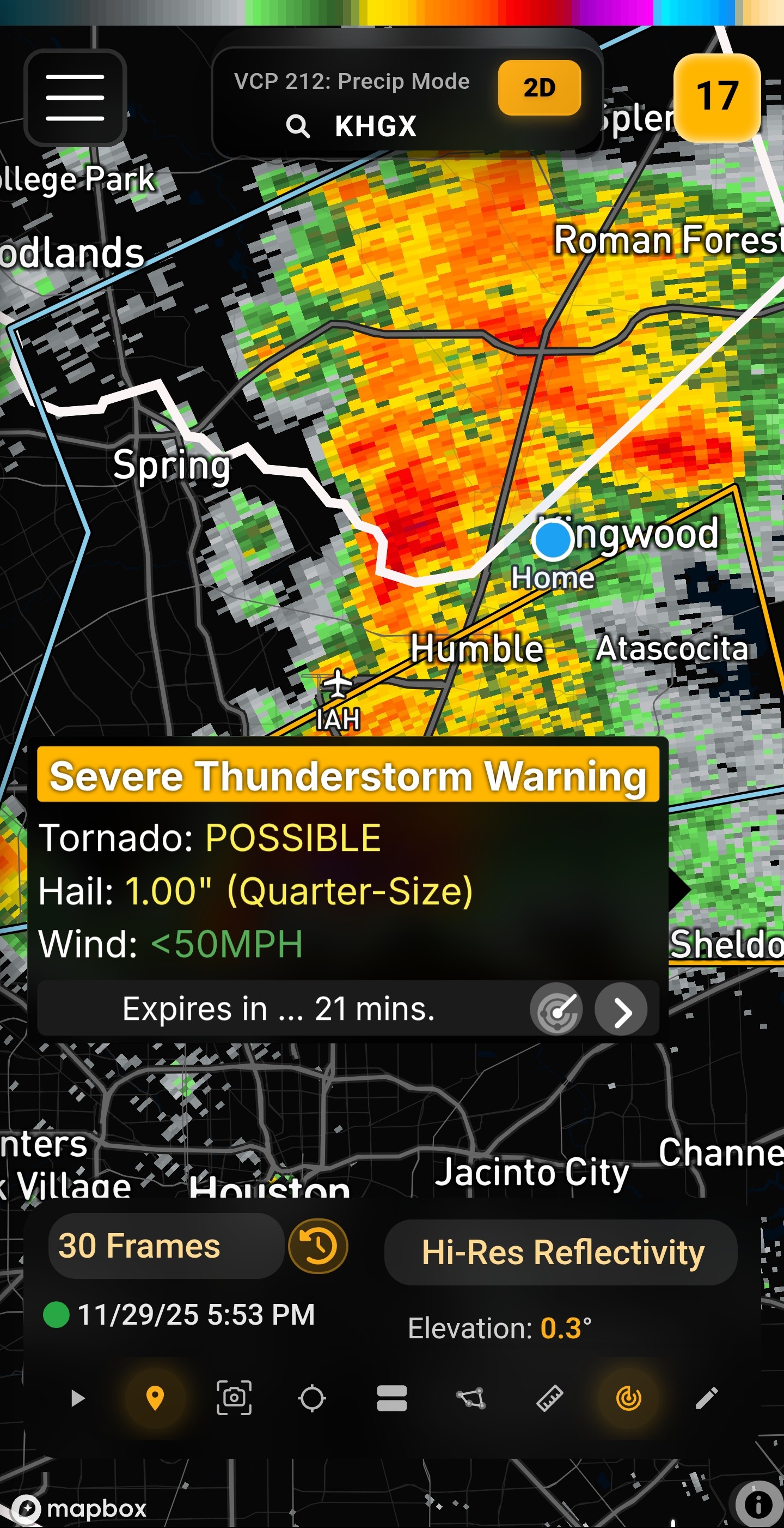
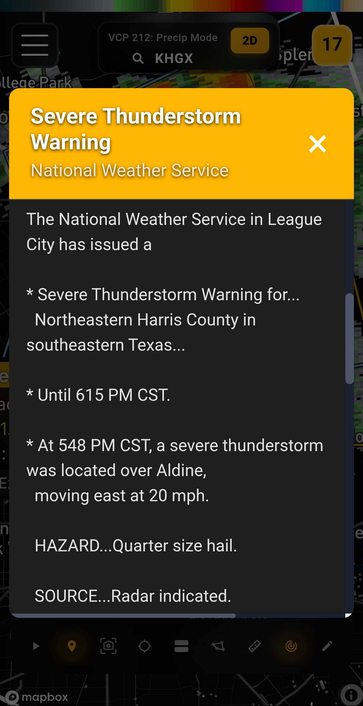
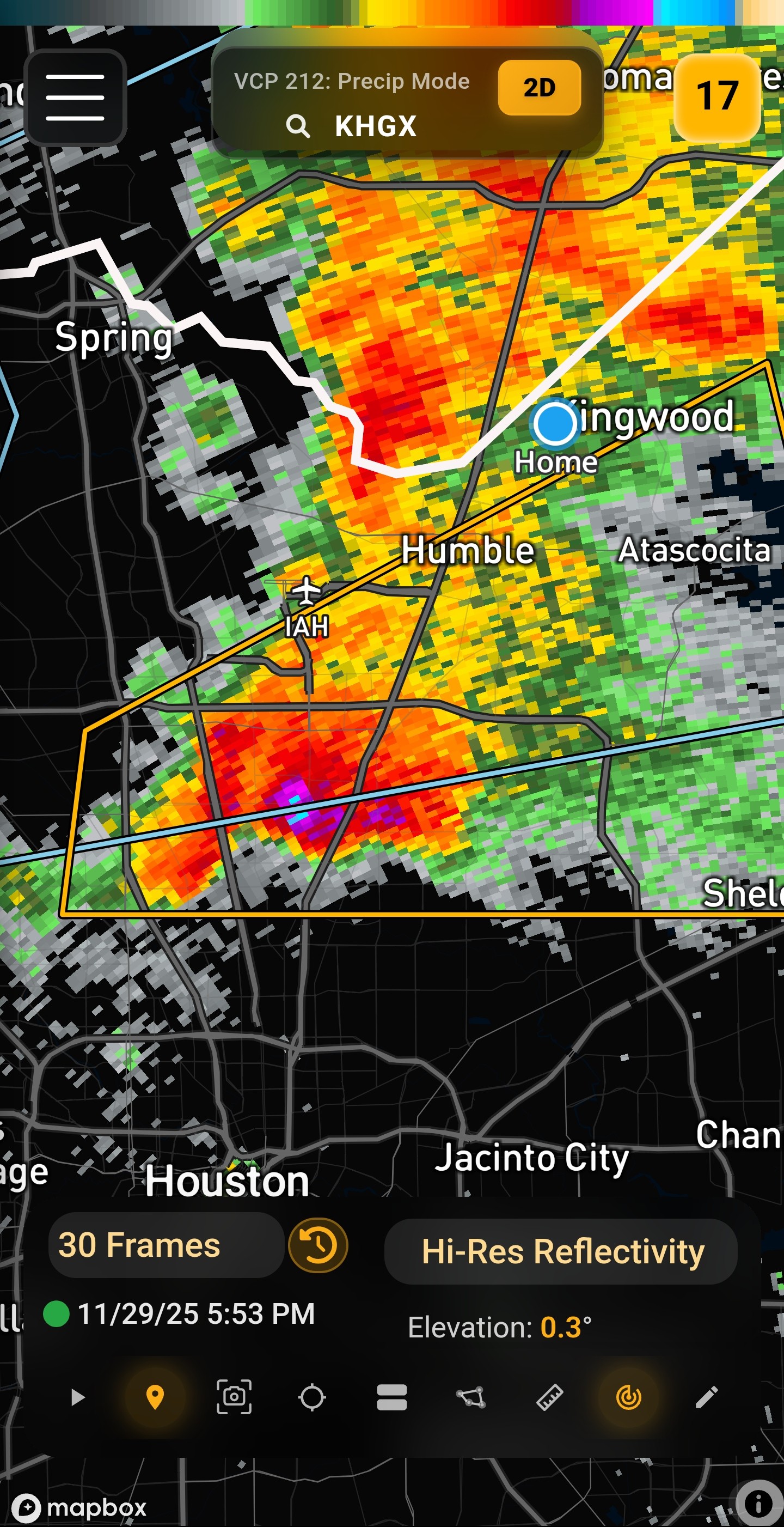 mccringleberry: the radar is showing VIL, which adds up all the water and hail inside a storm.
The brighter the colors, the stronger the updraft and the more water/hail is suspended in the cloud. It's a way to spot heavy rain cores or possible hail
 luv2eatsushi
620PM The bubble strikes again. Looks like the areas off NP will see rain from this cell but it's already north of me in Trailwood Next round still due later this evening. 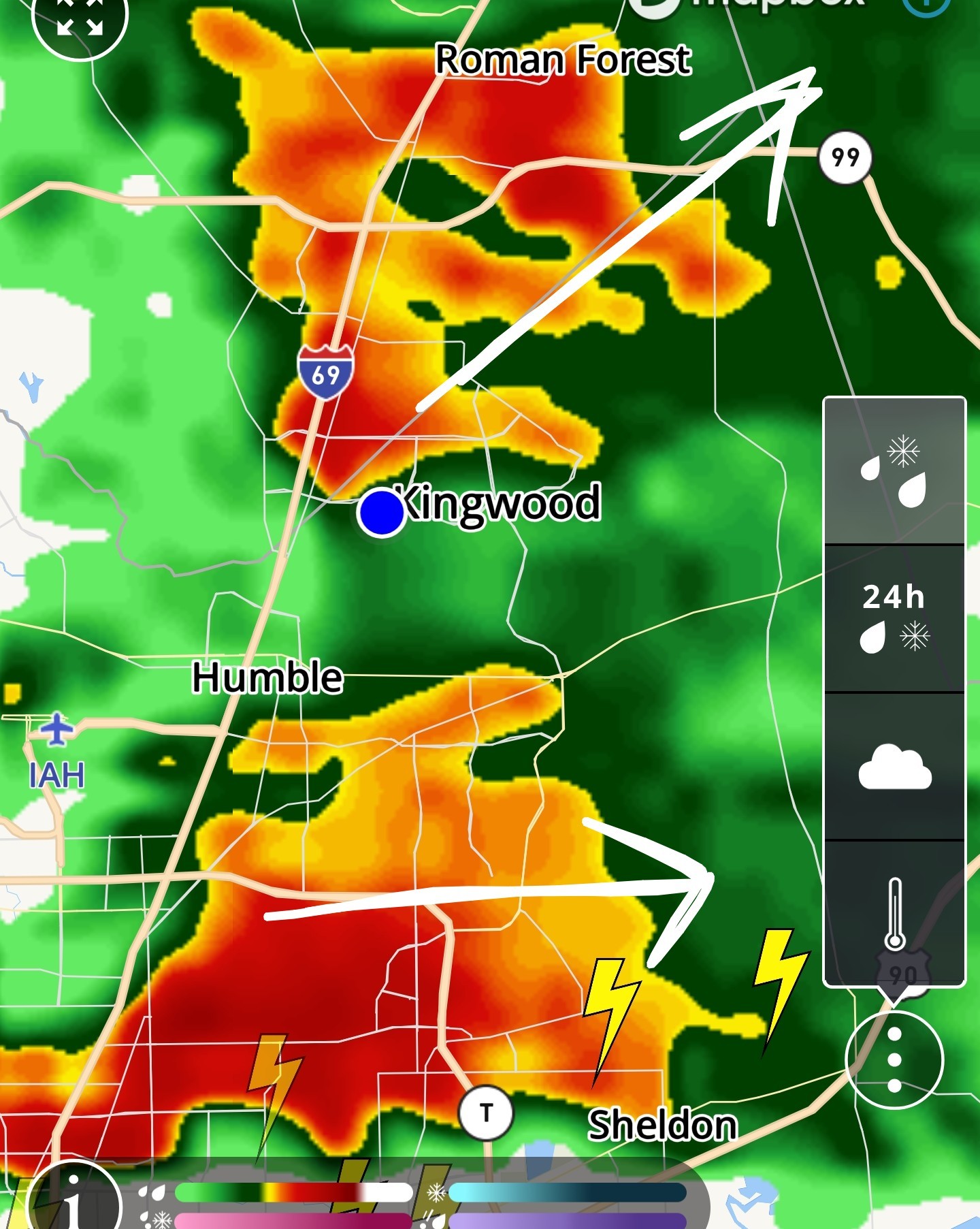
« Back to Chat
Views: 1,169
# Replies: 22