


This week's forecast
This week's forecast


Joined:
X days ago
# Posts:
X,XXX
Contributor Points:
X


This week's forecast A mostly rain-free week ahead with lower humidity & slightly cooler temperatures with highs in the upper 80s/low 90s. From Space City Weather Houston receives a fine, early season front but summer is not done with us yet. Eric Berger · Monday, September 8, 2025 7:04 AM In brief:
*In today's post we talk about the region's flirtations will fall, and we are going to have a couple of very fine days with cooler nights.
*After this, a warmer and somewhat more humid pattern returns though we are beyond the worst of summer. 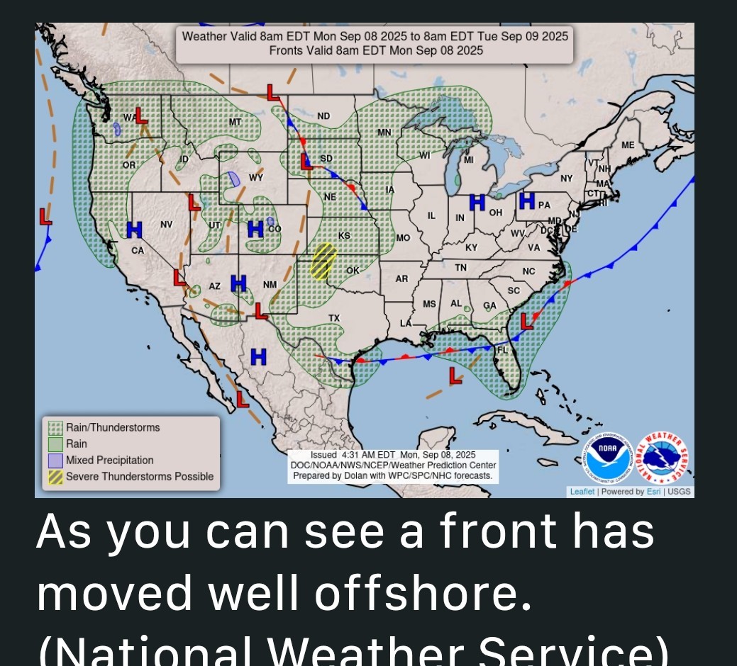 Fall's first front - *A decent front has pushed offshore, and we are seeing rather dry air move into the region.
*As as result humidity will feel decently low today and Tuesday.
*The big question for me is, will we hit 65 degrees tonight? It's going to be close. That is our arbitrary definition of the first fall-like weather in the city.
*Since the city's official station moved to Bush Intercontinental Airport in 1969, the average date of the first 65-degree (or cooler) night has been September 12, so we're close to that time of year.
*Regardless, it will feel notably cooler tonight than we have experienced since May 12. 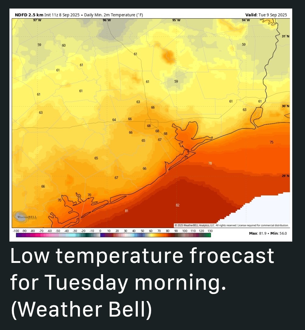 Monday - *Today will be sunny and warm with a high temperature in the upper 80s to 90 degrees for the metro area, with a northeast wind of about 10 mph.
*I highly recommend planning to spend this evening outdoors because it is going to be lovely, with mild temperatures and drier air.
*Seriously, this is porch weather. I don't have a great handle on how low temperatures will go tonight but I think Houston will fall into the upper 60s with inland areas dropping into the lower 60s to upper 50s. Tuesday - *This will be another day with reasonably dry air.
*Expect sunny skies and highs around 90 degrees.
*As winds shift to come from the east, humdity will start to come up a little. Still, I expect Houston to see lows around 70 degrees with inland areas dropping into the 60s on Tuesday night. Wednesday, Thursday, and Friday - *We return to a more summer-like pattern for the rest of the week as high pressure starts to build.
*However, since we're now approaching mid-September, this means highs generally in the low to mid 90s, with nights in the mid-70s.
*Dewpoints will be high, but not opppressively so. So hot? Yes, but super hot, Saturday and Sunday - *The weekend looks the same: Sunny skies, highs in the low- to mid 90s with a fair but not exessive amount of humidity.
*Rain chances appear to be close to zero through the weekend. Next week - *This pattern of highs in the low to mid 90s should persist into next week as late summer holds on.
*Some rain chances may finally return to the forecast about 10 days from now. The Atlantic tropics - *Things are surprisingly quiet right now for September, with zero threats in the Atlantic.
*We only have a few weeks left of "prime time" for storms in Texas.
*Tomorrow I'll take a look at what may happen during that time. 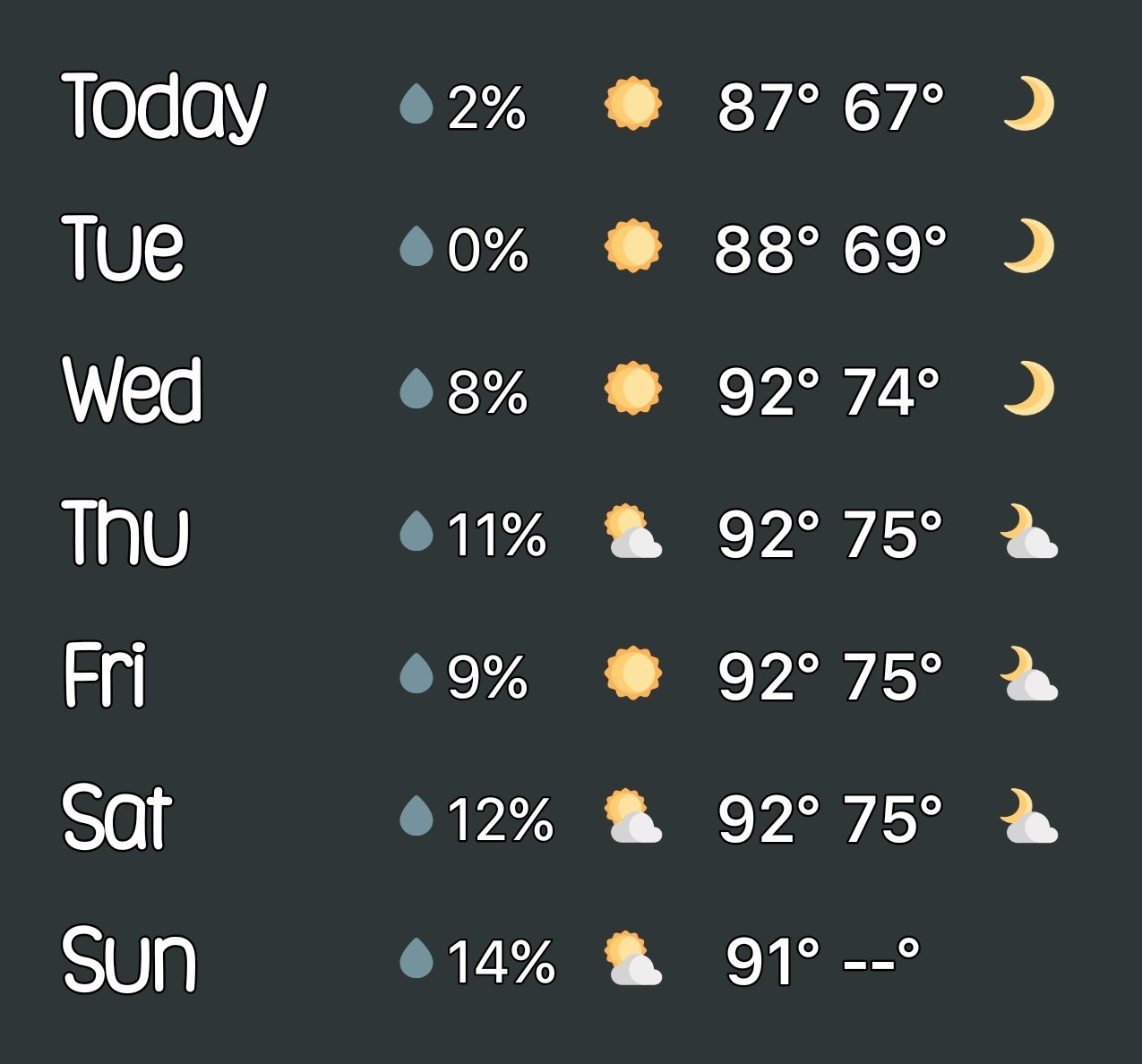


golfshot, teatime and Bloom + 2 more reacted *In today's post we talk about the region's flirtations will fall, and we are going to have a couple of very fine days with cooler nights.
*After this, a warmer and somewhat more humid pattern returns though we are beyond the worst of summer.
*As as result humidity will feel decently low today and Tuesday.
*The big question for me is, will we hit 65 degrees tonight? It's going to be close. That is our arbitrary definition of the first fall-like weather in the city.
*Since the city's official station moved to Bush Intercontinental Airport in 1969, the average date of the first 65-degree (or cooler) night has been September 12, so we're close to that time of year.
*Regardless, it will feel notably cooler tonight than we have experienced since May 12.
*I highly recommend planning to spend this evening outdoors because it is going to be lovely, with mild temperatures and drier air.
*Seriously, this is porch weather. I don't have a great handle on how low temperatures will go tonight but I think Houston will fall into the upper 60s with inland areas dropping into the lower 60s to upper 50s.
*Expect sunny skies and highs around 90 degrees.
*As winds shift to come from the east, humdity will start to come up a little. Still, I expect Houston to see lows around 70 degrees with inland areas dropping into the 60s on Tuesday night.
*However, since we're now approaching mid-September, this means highs generally in the low to mid 90s, with nights in the mid-70s.
*Dewpoints will be high, but not opppressively so. So hot? Yes, but super hot,
*Rain chances appear to be close to zero through the weekend.
*Some rain chances may finally return to the forecast about 10 days from now.
*We only have a few weeks left of "prime time" for storms in Texas.
*Tomorrow I'll take a look at what may happen during that time.
Replies:
« Back to Chat
Views: 295
# Replies: 2