


This week's forecast
This week's forecast


Joined:
X days ago
# Posts:
X,XXX
Contributor Points:
X


This week's forecast Watch for storms today from the north. There is a chance they will go west of us but we'll see. Also, a bit about hurricane season heating up as we enter into August. .... From Space City Weather: As Houston faces typical August weather, the Atlantic tropics start to heat up. Eric Berger · Monday, August 4, 2025 6:58 AM In brief: *Houston will see a decent chance of some showers and thunderstorms today, but beyond this we should remain hot and mostly sunny, as is often the case in August.
*Also, typical for August is an increase in tropical activity across the Atlantic. Which is what we are presently seeing. RIGHT ON CUE, THE TROPICS HEAT UP: After a flurry of tropical storms in late June and early July, the atlantic tropics were rather quiet for the last three weeks. That has changed over the weekend with the formation of the fourth named storm in the Atlantic (Dexter, which is not a threat to land), and development of a couple of additional "blobs" to watch. 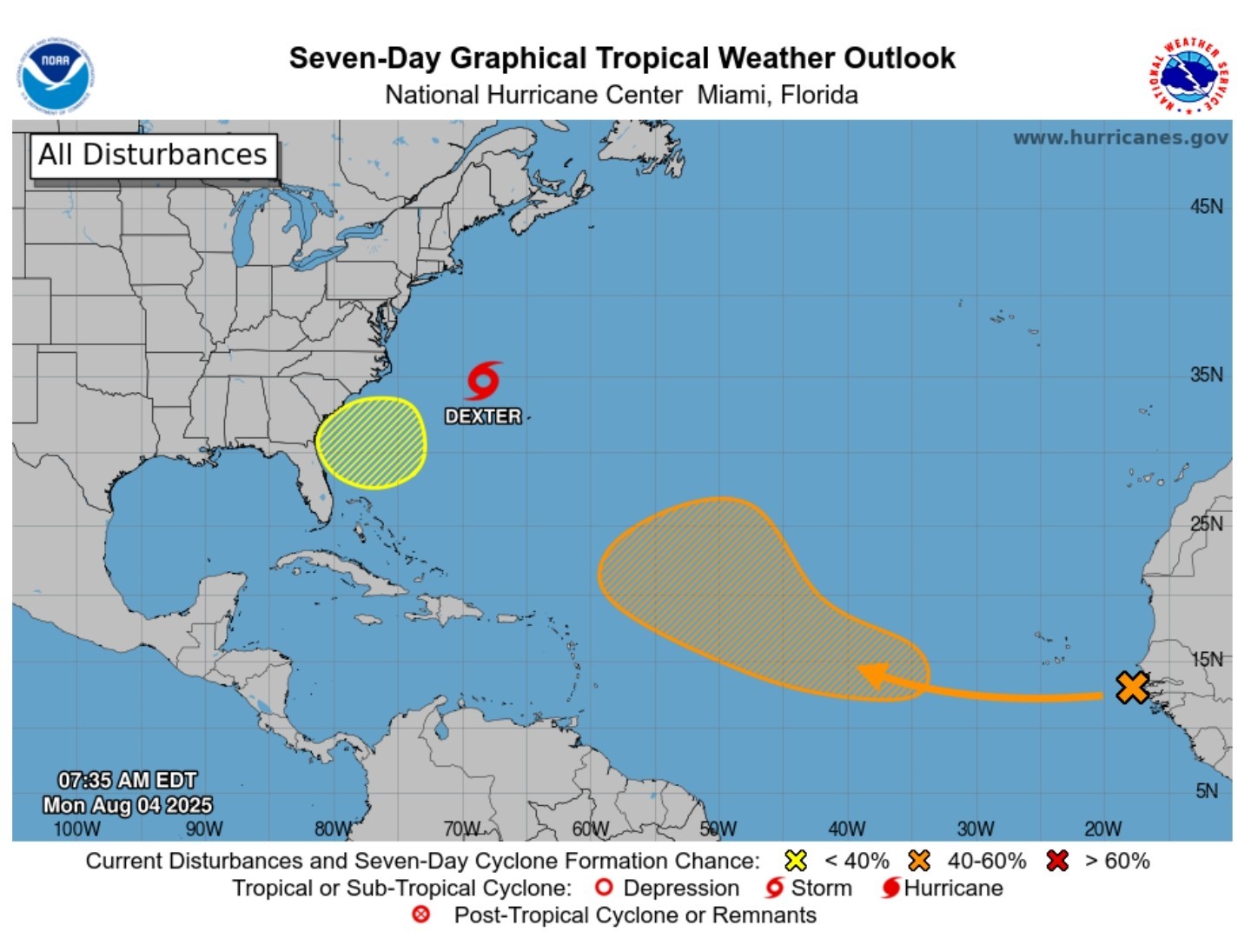 First of all, some numbers. Dexter is the fourth named storm this season, and in some sense we are ahead of schedule. Historically, the "D" storm forms on August 15th. This makes it sounds like it has been a busy hurricane season, but measured by a more accurate barometer, we have seen a slow start. Our preferred measuring stick for seasonal activity is "accumulated cyclone energy," which factors in both the duration and intensity of tropical storms. By this metric we are running at about 20 percent of normal levels.
 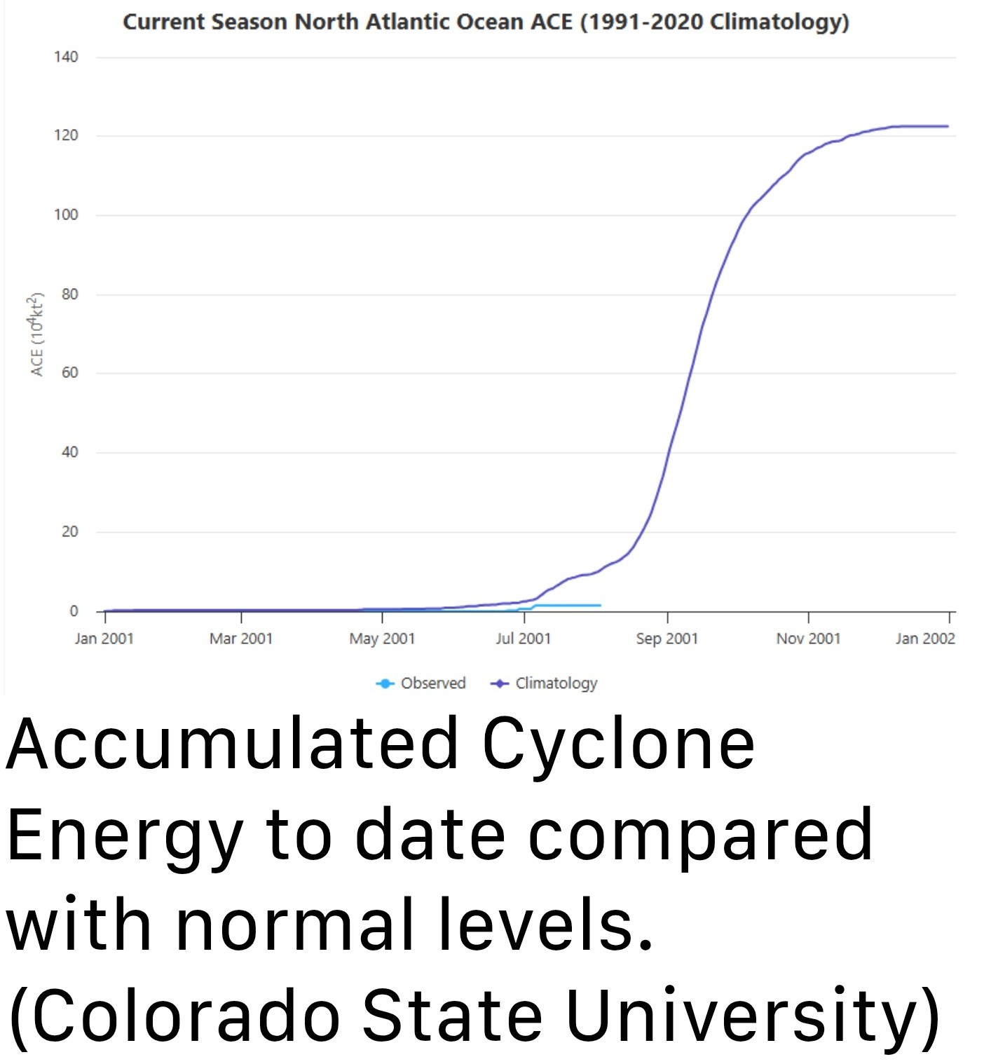 The graphic above highlights two things. One, we are off to a relatively slow start this year. But more importantly, we remain very early in the game. The vast majority of the Atlantic season's activity remains ahead of us, with August and September as typically the busiest months. So yes, it's nice to have had a quiet start to the tropics season in Houston. But it does not mean a whole lot. When we look at the tropical forecast for the next week or so, there are no distinct threats to the Gulf of Mexico. And I don't want you to focus on any specific storms. However, what is clear is that we are entering prime time for the Atlantic season, and the background conditions (including the upper air pattern) are starting to become much more supportive of tropical storms and hurricanes. Bottom line: we really need to pay attention to this stuff for the next eight weeks or so. We will cover every conceivable threat to Texas here, and be sure and check out The Eyewall for coverage of storms across the tropical Atlantic. MONDAY - *Showers and thunderstorms have developed offshore this morning, and I think we'll see a healthy chance of similar storms developing over inland areas this afternoon.
*The overall pattern is not supportive of widespread storms, but I do think there will be some scattered but impactful activity this afternoon and early evening in the metro area, with perhaps slightly higher chances west of I-45.
*Some areas may pick up 1 inch of rain or more, with most of the region staying dry.
*Otherwise, expect mostly sunny skies this afternoon with high temperatures generally in the low to mid 90s.
*Winds will be light outside of thunderstorms from the east.
*Lows tonight will only drop into the upper 70s. TUESDAY, WEDNESDAY, and THURSDAY - A fairly robust ridge of high pressure will build over the southwestern United States this week, but Houston will fall on the eastern periphery. Essentially, this means that we will see typical August weather, with mostly sunny skies, highs generally in the mid-90s (with some upper 90s for far inland areas possible), and a low-end chance of showers during the afternoon along the sea breeze. Nights will be warm and muggy. As Augusts go, things could certainly be worse at what is typically the very hottest time of year in Houston. FRIDAY, SATURDAY, and SUNDAY - Not a whole lot changes as we head into the weekend. Skies remain mostly sunny, and I think most of us will continue to see daytime highs in the mid-90s. Rain chances remain low, but at about 30 percent daily, are definitely not zero thanks to the sea breeze. I don't see much of a change in this pattern any time soon.


asasolid2r, RolloTomaso and teatime + 7 more reacted *Also, typical for August is an increase in tropical activity across the Atlantic. Which is what we are presently seeing.
*The overall pattern is not supportive of widespread storms, but I do think there will be some scattered but impactful activity this afternoon and early evening in the metro area, with perhaps slightly higher chances west of I-45.
*Some areas may pick up 1 inch of rain or more, with most of the region staying dry.
*Otherwise, expect mostly sunny skies this afternoon with high temperatures generally in the low to mid 90s.
*Winds will be light outside of thunderstorms from the east.
*Lows tonight will only drop into the upper 70s.
Replies:
As far as today goes...... Right now, future models are in a bit of a disagreement on how today plays out. Current radar - 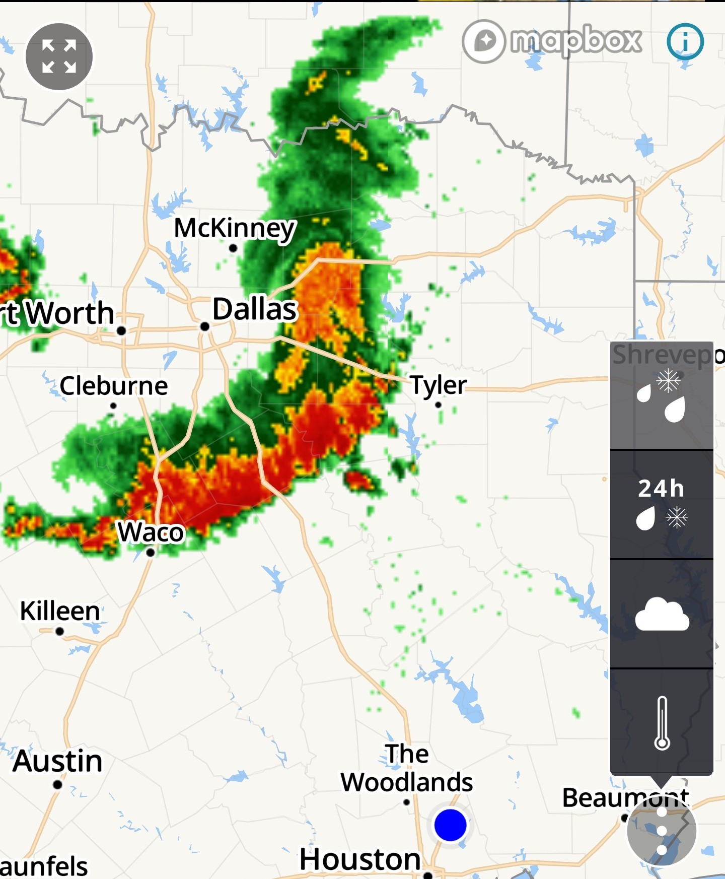 It looks likely that the line will either: 1. Split in two as it heads south.
Or
2. Move west as it heads south. Either way, the line looks to eventually regenerate and make its way thru SE Texas mid day. Timing: Timing is dependent on what the line does. These storms were originally forecasted to come thru Houston late this afternoon but new models show an earlier time frame of around 3pm. If the line does not split, we're looking at a noon-ish time frame. (But I do believe it will split) Heavy rainfall, frequent lightning, gusty winds, & maybe some small hail will all be possible with these storms. (You know what that means - keep your stuff charged) I'll update later as needed. 
RolloTomaso, teatime and Picasso13 + 4 more reacted Or
2. Move west as it heads south.
8AM: So far the line has still not split. Models are still in disagreement on the forecast. *If it doesn't split, look for the line of storms to roll thru around 11am.
*If it does split, it will be closer to mid afternoon. 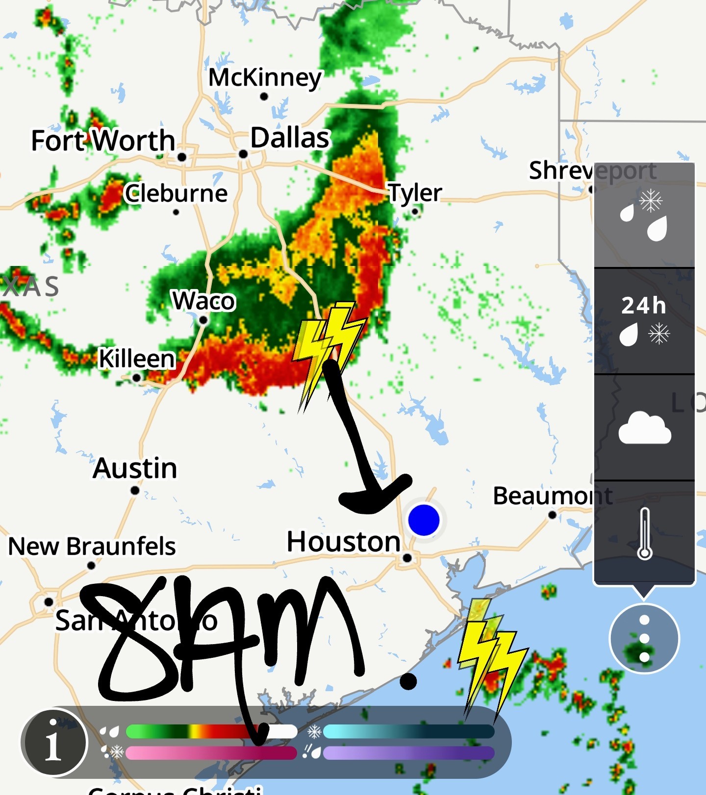
RolloTomaso, teatime and Picasso13 + 2 more reacted *If it does split, it will be closer to mid afternoon.
955AM Line didn't split but most of the storms will be off to the west. We are still about to be the east side of the line in the next 60-90 minutes. It shouldn't be anything too intense. 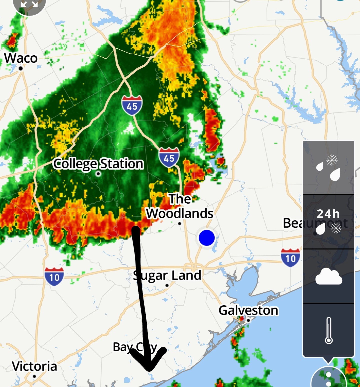
RolloTomaso, teatime and Picasso13 + 2 more reacted
We might even be right in the middle of a left-right split
RolloTomaso, peppermintstick and StormChaser reacted
955AM Line didn't split but most of the storms will be off to the west. We are still about to be the east side of the line in the next 60-90 minutes. It shouldn't be anything too intense.
 StormChaser : This will be my cat in 60-90 minutes from now!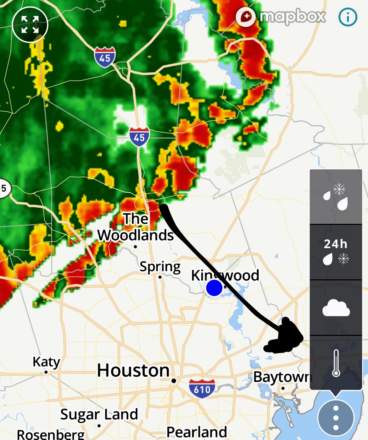
We might even be right in the middle of a left-right split
Slow4x4 : I was just looking at that. Its entirely possible but its getting close.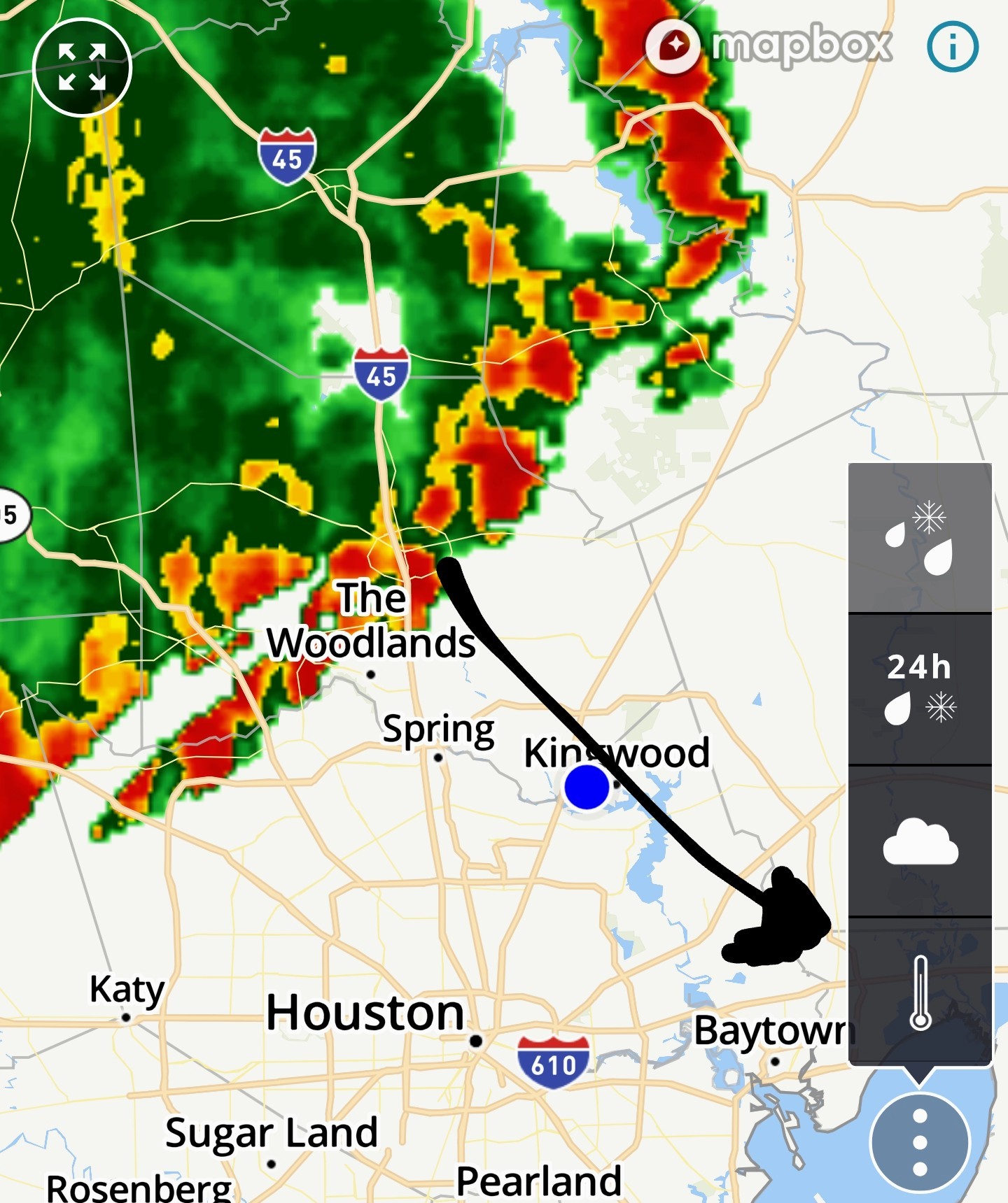
StormChaser : I guess I missed the window of getting to HEB this morning.
cbear : Its definitely getting here on the early side of the time line.
cbear : Its definitely getting here on the early side of the time line.
StormChaser : Right!~ I thought it would be after about 1 pm.
Thank you for your constant information on our weather. By chance, are you a meteorologist or is this just an area of interest for you?
RolloTomaso, cbear and StormChaser reacted 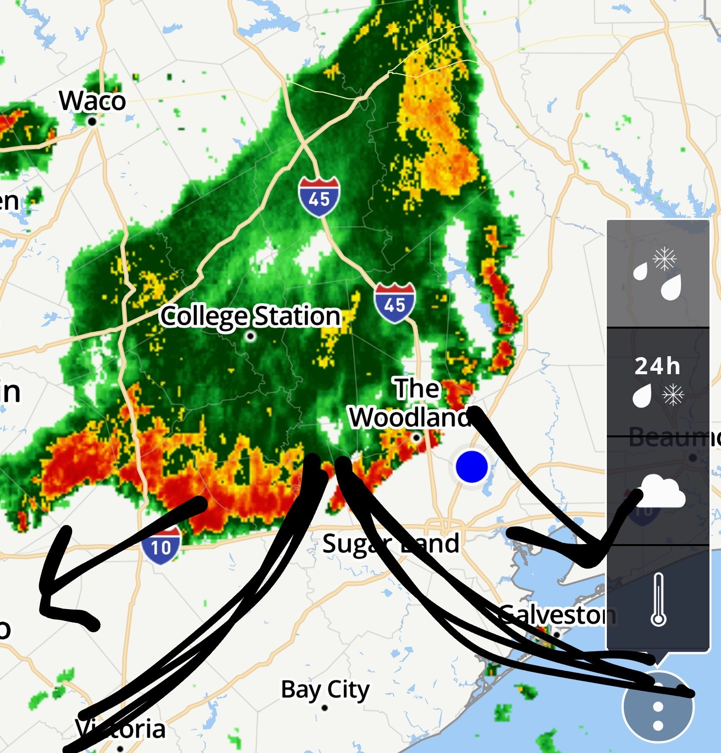
🚨 Severe weather alert: 10:02AM Severe storms with a history of damaging 60 MPH winds are moving toward Houston from the northwest. Get ready for it in Todd Mission, Tomball, Conroe, the Woodlands
RolloTomaso, Picasso13 and cbear reacted
Thank you for your constant information on our weather. By chance, are you a meteorologist or is this just an area of interest for you?
Picasso13 : Thank you!
🚨 Severe weather alert: 10:02AM Severe storms with a history of damaging 60 MPH winds are moving toward Houston from the northwest. Get ready for it in Todd Mission, Tomball, Conroe, the Woodlands
StormChaser : Have you been watching these waves coming off of Africa? I was wondering what you think of some of the YT channels about weather. I like Brian Shields of "Mr. Weatherman". « Back to Chat
Views: 971
# Replies: 33