


Space City - Invest 93L forecast
Space City - Invest 93L forecast


Joined:
X days ago
# Posts:
X,XXX
Contributor Points:
X


Space City - Invest 93L forecast Here's an update on the tropics and the impact on our weekend weather. FRIDAY - *An increase in atmospheric moisture related to the tropical disturbance in the Gulf will bring a better chance of rain on Friday.
*These rains should be concentrated most heavily over Louisiana, and there is likely to be sharp gradient to the west approaching Houston.
*That is to say, there will be a line west of which rain is unlikely. ➡️ Where will that line be? Interstate 45 is a decent guess, but the line could also be closer to Beaumont. *The map below shows the best guess from NOAA's Weather Prediction Center.
*My sense is that areas along and east of Interstate 45 have a decent chance to pick up 0.5 to 1 inch of rain on Friday, with lesser amounts to the west.
*This forecast is very much written in pencil right now.
*Any winds and surge from the tropical system should not be impactful in the greater Houston region.
*Expect highs of around 90 degrees with mostly cloudy skies. 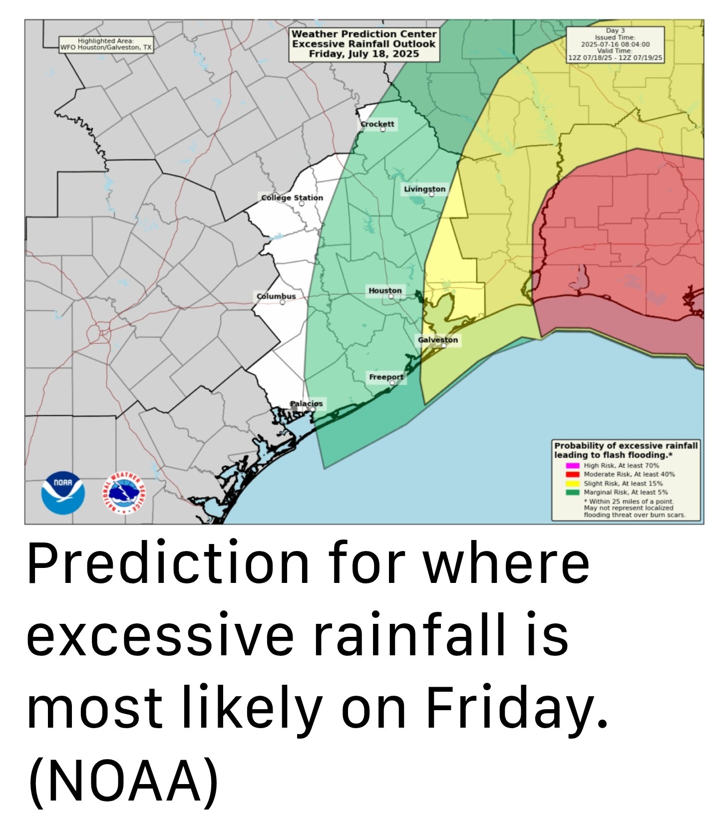 SATURDAY and SUNDAY - *A decent chance of showers will linger into Saturday, perhaps about 40 percent, but this day should bring partly sunny skies back into the forecast with highs in the lower 90s.
*By Sunday, high pressure should be taking hold, so rain chances should reach closer to zero, with mostly sunny skies and high temperatures in the mid-90s. NEXT WEEK - *Most of next week looks hot and sunny, with highs in the mid to upper 90s.
*Rain chances will be quite low for much of the week.
*An upper air pattern could change toward the end of the week to bring precipitation back into the forecast. We shall see. INVEST 93L - So what really is happening with the tropical system? Not a whole lot. *The 'center' has crossed the Florida peninsula, but it remains close to the Florida Panhandle this morning & this proximity to land will not help with any efforts to develop.
*Over the next day or so the center should remain very close to the northern Gulf coast, limiting development.
*There is a non-zero chance that some sort of center organizes further south today, and this would allow for more strengthening. (However that appears fairly unlikely)
*The low pressure system will likely continue to track more or less west before moving into Louisiana on Thursday night or Friday, bringing an high chance of rain.
*The National Hurricane Center continues to indicate there is a 40 percent chance of a tropical depression or weak tropical storm forming before landfall. *Some of the models that were advertising extreme rainfall totals in southern Louisiana have backed off some.
*However, this is still a favorable setup for heavy rainfall so flooding along and south of Interstate 10 in Louisiana is a distinct possibility. 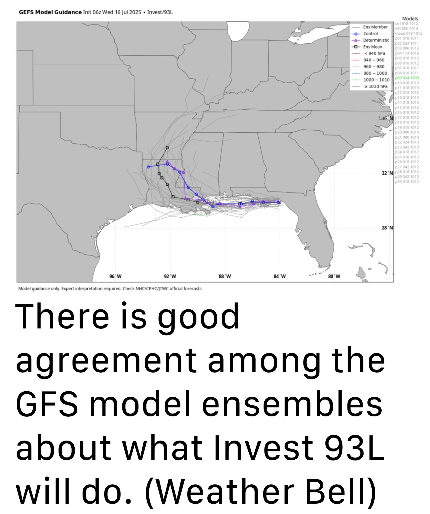 *As ever with tropical systems there is inherent unpredictability, especially with systems that have yet to develop a well-defined center of circulation.
*BUT - time is running out for Invest 93L to surprise us.

*These rains should be concentrated most heavily over Louisiana, and there is likely to be sharp gradient to the west approaching Houston.
*That is to say, there will be a line west of which rain is unlikely.
*My sense is that areas along and east of Interstate 45 have a decent chance to pick up 0.5 to 1 inch of rain on Friday, with lesser amounts to the west.
*This forecast is very much written in pencil right now.
*Any winds and surge from the tropical system should not be impactful in the greater Houston region.
*Expect highs of around 90 degrees with mostly cloudy skies.
*By Sunday, high pressure should be taking hold, so rain chances should reach closer to zero, with mostly sunny skies and high temperatures in the mid-90s.
*Rain chances will be quite low for much of the week.
*An upper air pattern could change toward the end of the week to bring precipitation back into the forecast.
*Over the next day or so the center should remain very close to the northern Gulf coast, limiting development.
*There is a non-zero chance that some sort of center organizes further south today, and this would allow for more strengthening. (However that appears fairly unlikely)
*The low pressure system will likely continue to track more or less west before moving into Louisiana on Thursday night or Friday, bringing an high chance of rain.
*The National Hurricane Center continues to indicate there is a 40 percent chance of a tropical depression or weak tropical storm forming before landfall.
*However, this is still a favorable setup for heavy rainfall so flooding along and south of Interstate 10 in Louisiana is a distinct possibility.
*BUT - time is running out for Invest 93L to surprise us.
Replies:
« Back to Chat
Views: 450
# Replies: 1