


Tuesday forecast
Tuesday forecast


Joined:
X days ago
# Posts:
X,XXX
Contributor Points:
X


Tuesday forecast Yet another day of high rain chances. ☔️ Timing is anywhere from late morning through early evening. Watch for a line of storms to start at the coast and move its way north throughout the day. Nothing looks to be too severe but these individual cells have a lot of lightning and they can drop a lot of rain in a short amount of time so keep that in mind. As usual, not everyone will see rain today, but the chances are up definitely up there for today and tomorrow. ⛈️ ........................... From Space City Weather - In the absence of high pressure, widespread showers likely today and Wednesday. Eric Berger · Tuesday, July 8, 2025 6:48 AM In brief:
*Houston's pattern will continue to bring a chance of daily showers.
*For the next two days, in particular, much of the region should see rain and a bit cooler temperatures.
*We should get back into the mid-90s later this week, and into the weekend. So basically, it will feel like July in July TUESDAY - *A couple of factors will support ongoing, healthy rain chances across the Houston region this week.
*These conditions, the combination of lower pressure and lots of moisture in the atmosphere, should be especially pronounced today and Wednesday.
*As a result, we should see the development of fairly widespread showers and thunderstorms. 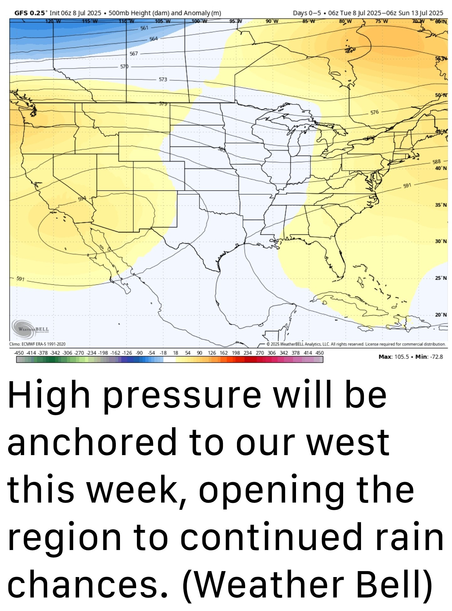 *As usual, these showers will be hit or miss - They will start out closer to the coast later this morning, and then spread inland throughout the afternoon and early evening before waning after sunset. *Some locations may pick up 1 inch of rain under stronger storms, whereas as other locations will only see light rain or dark skies.
*You've seen this story before in Houston. Most locations, on average, should pick up a few tenths of an inch of rain by the end of Wednesday. 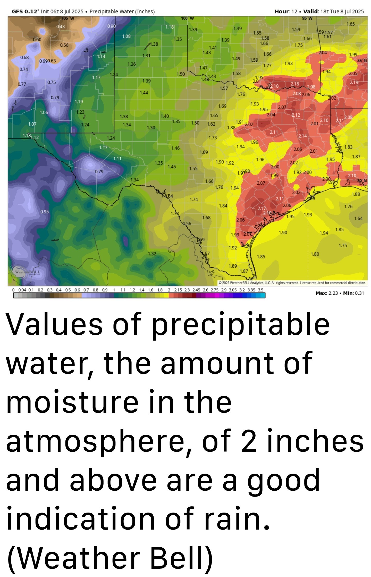 *Partly to mostly cloudy skies this afternoon, in addition to rain-cooled air, should help to limit high temperatures to the lower 90s.
*Winds, generally, will be light at 5 to 10 mph except within stronger thunderstorms.
*Lows tonight will drop into the mid-70s for most locations. WEDNESDAY - This will be a similar day to Tuesday, with rain chances above 50 percent. Again, we can expect a few thunderstorms, but mostly I think these will be light to moderate showers. Highs, again, will be in the lower 90s. ........ A year since Beryl 🌀 Conditions are a bit nicer this morning than they were one year ago today, when Hurricane Beryl made landfall down the coast from Houston. At this time, we were seeing maximum winds across the region, with gusts above hurricane force strength affecting much of the area. This caused significant tree damage and knocked power out to millions in the region. So it is not a particularly happy memory for most of us. Fortunately, our weather is much calmer 12 months later.
*Houston's pattern will continue to bring a chance of daily showers.
*For the next two days, in particular, much of the region should see rain and a bit cooler temperatures.
*We should get back into the mid-90s later this week, and into the weekend. So basically, it will feel like July in July
*These conditions, the combination of lower pressure and lots of moisture in the atmosphere, should be especially pronounced today and Wednesday.
*As a result, we should see the development of fairly widespread showers and thunderstorms.
*You've seen this story before in Houston. Most locations, on average, should pick up a few tenths of an inch of rain by the end of Wednesday.
*Winds, generally, will be light at 5 to 10 mph except within stronger thunderstorms.
*Lows tonight will drop into the mid-70s for most locations.