


Space City update - 6AM Thurs.
Space City update - 6AM Thurs.


Joined:
X days ago
# Posts:
X,XXX
Contributor Points:
X


Space City update - 6AM Thurs. We are currently in a small lull in the rain but it is short lived! Lots more to come but Matagorda County looks to be the bullseye as they look to receive 10+ inches today. From Space City Weather -- Heavy rainfall event ongoing in the Houston region, conditions should ease later today Eric Berger · Thursday, June 12, 2025 5:46 AM In brief:
*We have expanded a Stage 2 flood alert to cover the entire region today as a storm system passes through.
*The greatest likelihood of flooding appears to be to the southwest of Houston, but all areas will be vulnerable this morning. Unfolding flooding event: *As we look at the radar this morning we have one band of persistent storms over eastern Houston which has dropped as much as 3 inches of rain over Channelview, Baytown, and other locations since midnight (a flash flood warning is in effect for these locations until 7:30 am today).
*Much of the rest of the region has been spared, but additional storms loom to the west of our area, and we expect the potential for flash flooding through about noon today.
*Not all areas will be affected, certainly, but please take care driving into stronger storms, and do not attempt to drive through high water. 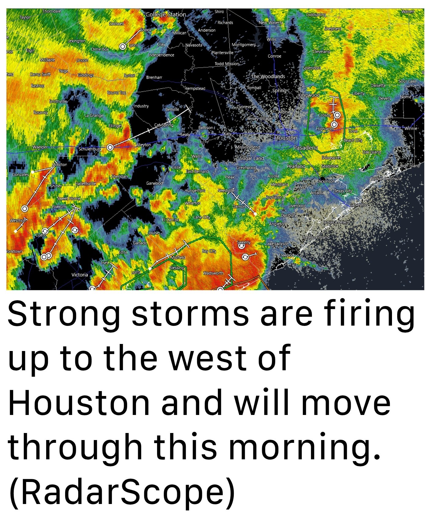 🚨 The strongest storms should move into the Houston region during a time period from around 7 am to noon, after which the heaviest rains will likely reach the coast and begin to push off shore and well to the east of Houston.
🚨 During this morning we now believe the heaviest rainfall will occur along and south of Interstate 10, and are particularly concerned about the southwest quadrant of the Houston metro area.
🚨 Much of our modeling predicts that Wharton, Brazoria, and southern Fort Bend counties are at risk of picking up 5 to 10 inches of rainfall. Heaviest rainfall excepted here : ⬇️⬇️⬇️
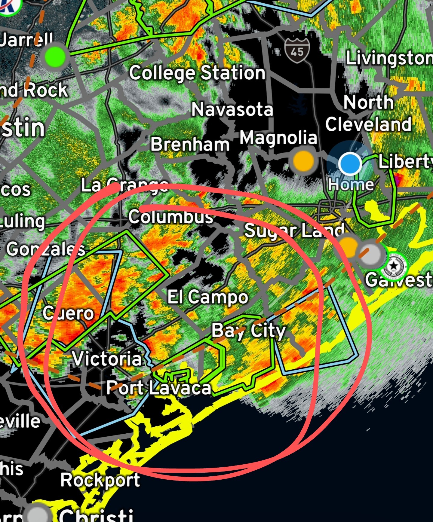 *Closer to Houston, particularly within the city limits and to the east of Interstate 45, totals should be less.
*Generally, most locations should pick up 1 to 4 inches of rainfall, but there will be the potential for higher bullseyes.
*Given that this storm system has the ability to produce high rainfall rates, streets may back up quickly and flash flooding is possible.
*For this reason, we are expanding our Stage 2 flood alert to cover the entire Houston region, which includes all surrounding counties. We should be able to drop this flood alert back to Stage 1 this afternoon. THURSDAY -- *As noted above, we are seeing an atmosphere laden with moisture interact with a potent disturbance this morning, creating favorable conditions for heavy rainfall.
*The strongest storms should end by noon, but some isolated showers could persist into this afternoon.
*As a result of the rain and cloud cover, high temperatures today should top out in the mid-80s.
*Lows tonight will drop into the 70s, with a slight chance of showers and storms. Current radar at 6AM - 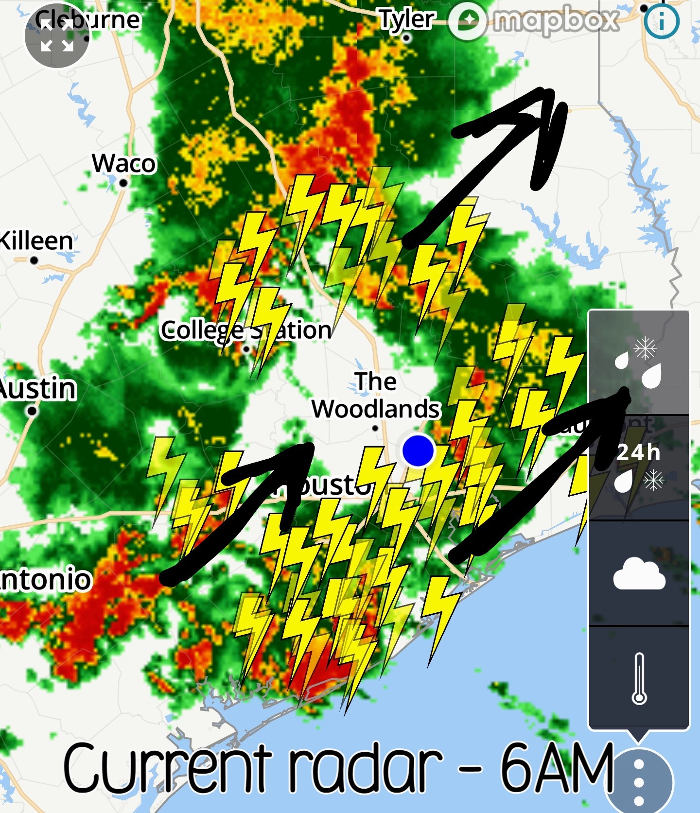 Future radar - final line moves thru around noon.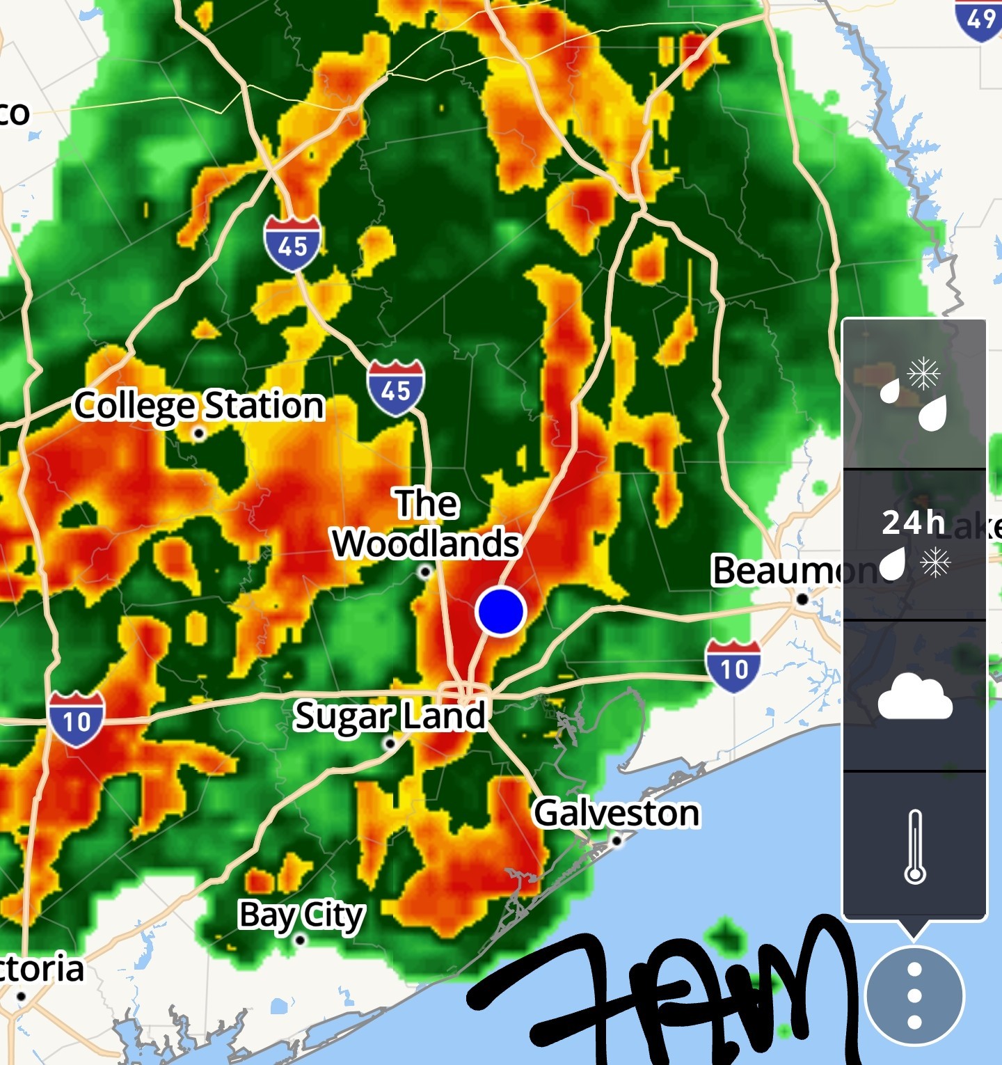
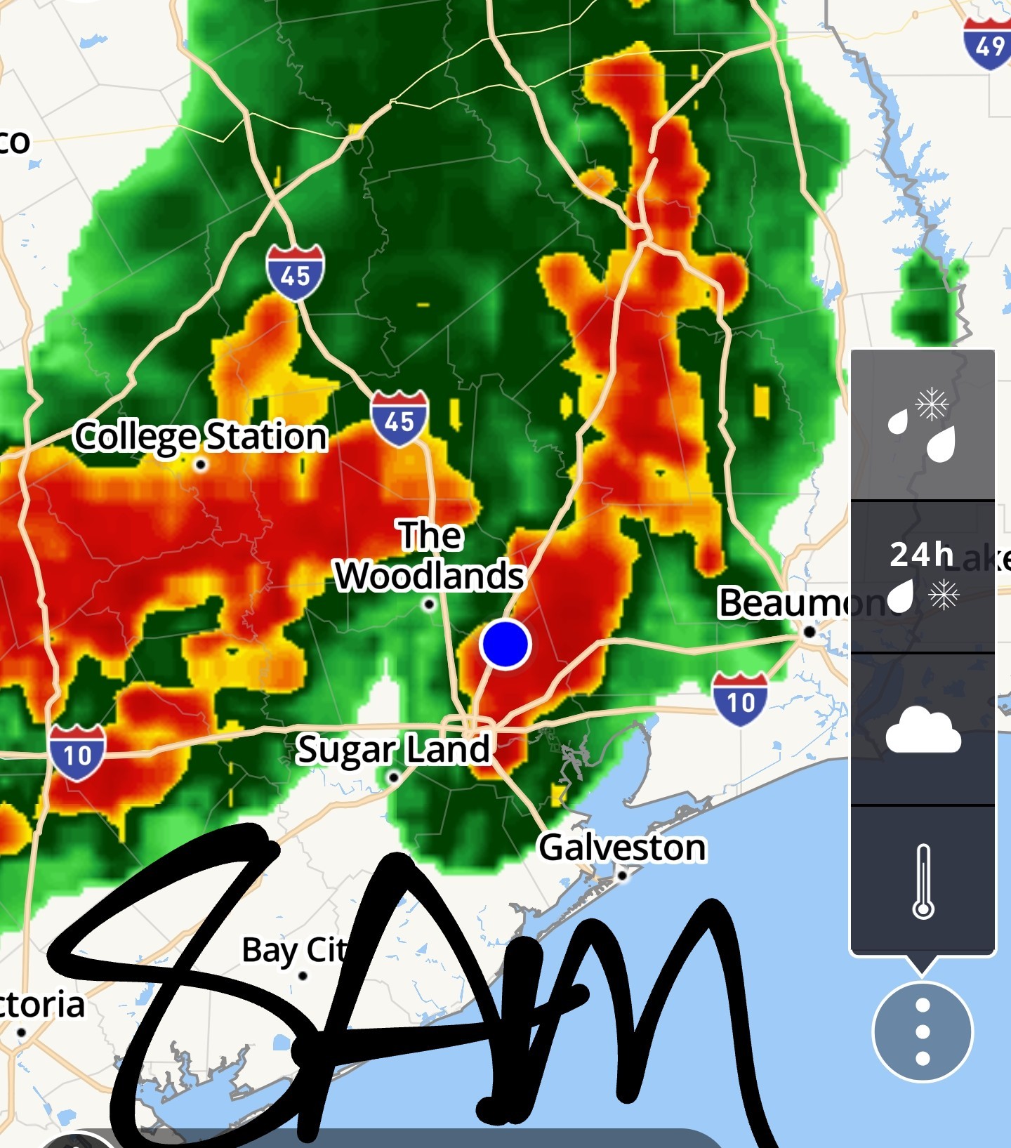
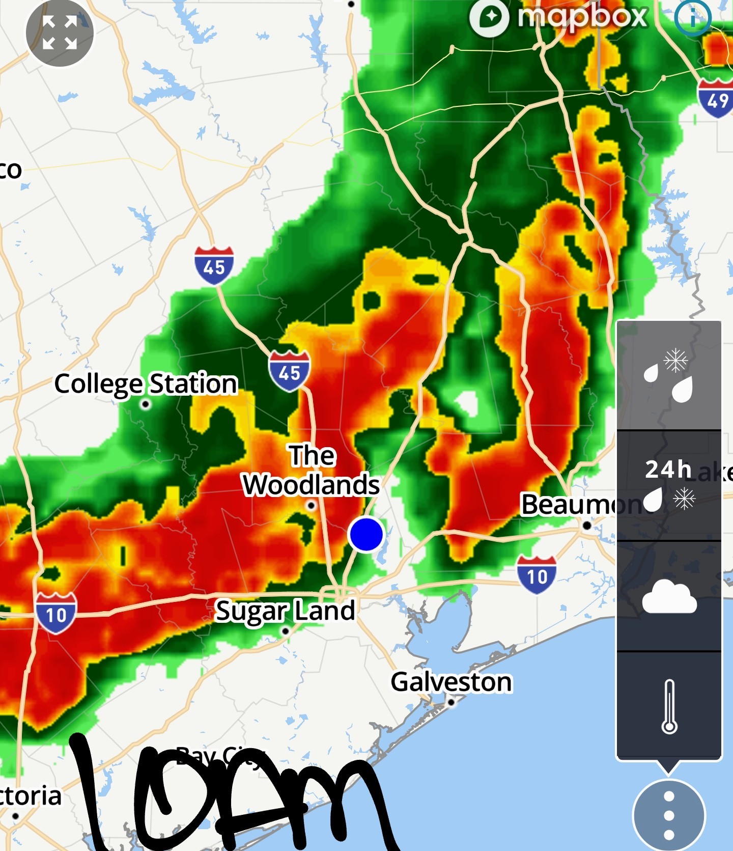
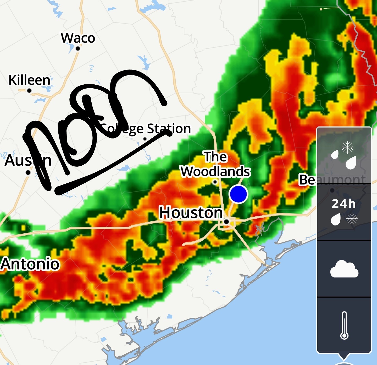


*We have expanded a Stage 2 flood alert to cover the entire region today as a storm system passes through.
*The greatest likelihood of flooding appears to be to the southwest of Houston, but all areas will be vulnerable this morning.
*Much of the rest of the region has been spared, but additional storms loom to the west of our area, and we expect the potential for flash flooding through about noon today.
*Not all areas will be affected, certainly, but please take care driving into stronger storms, and do not attempt to drive through high water.
🚨 During this morning we now believe the heaviest rainfall will occur along and south of Interstate 10, and are particularly concerned about the southwest quadrant of the Houston metro area.
🚨 Much of our modeling predicts that Wharton, Brazoria, and southern Fort Bend counties are at risk of picking up 5 to 10 inches of rainfall.
*Generally, most locations should pick up 1 to 4 inches of rainfall, but there will be the potential for higher bullseyes.
*Given that this storm system has the ability to produce high rainfall rates, streets may back up quickly and flash flooding is possible.
*For this reason, we are expanding our Stage 2 flood alert to cover the entire Houston region, which includes all surrounding counties.
*The strongest storms should end by noon, but some isolated showers could persist into this afternoon.
*As a result of the rain and cloud cover, high temperatures today should top out in the mid-80s.
*Lows tonight will drop into the 70s, with a slight chance of showers and storms.
*******************
Replies:
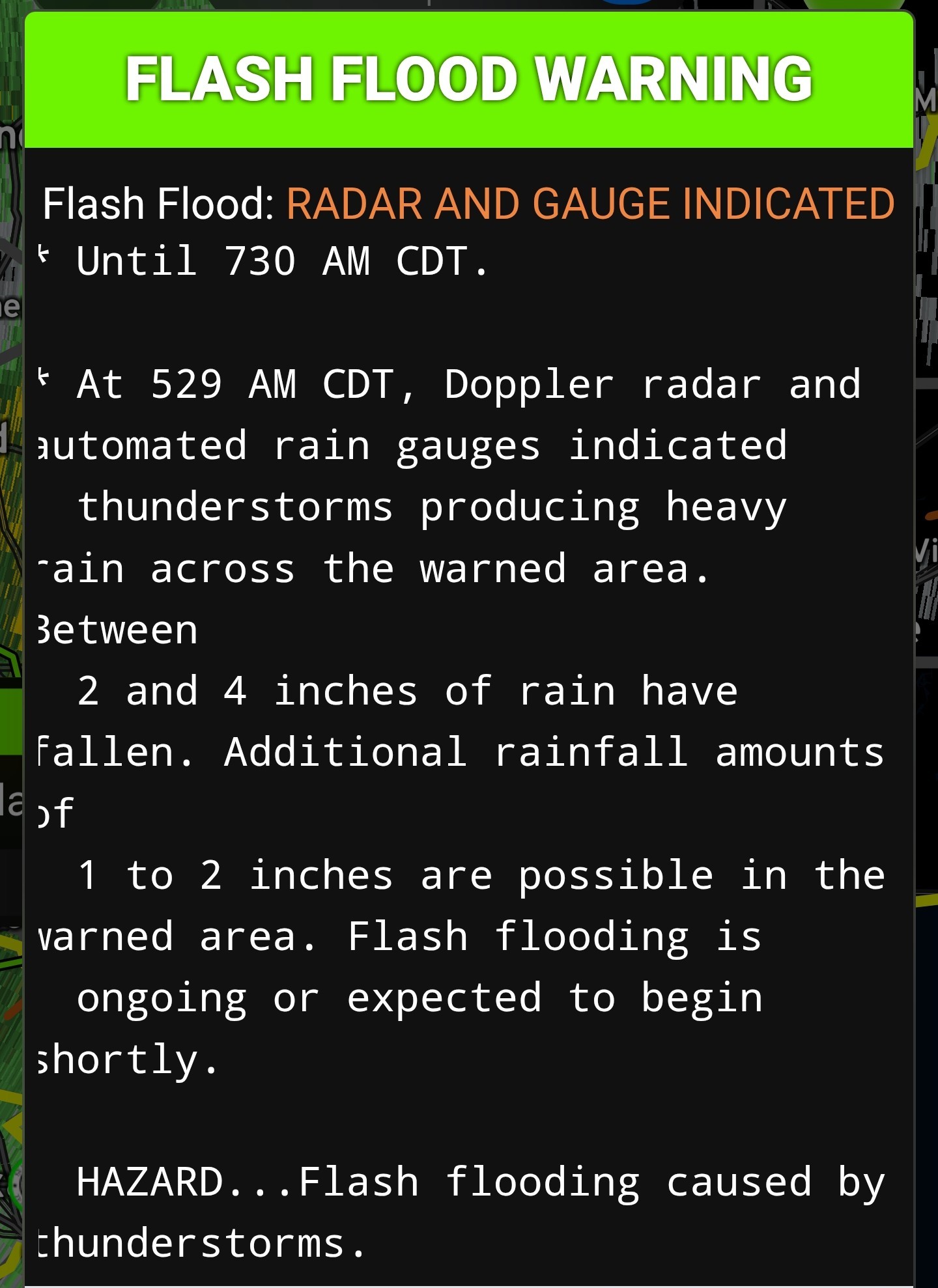
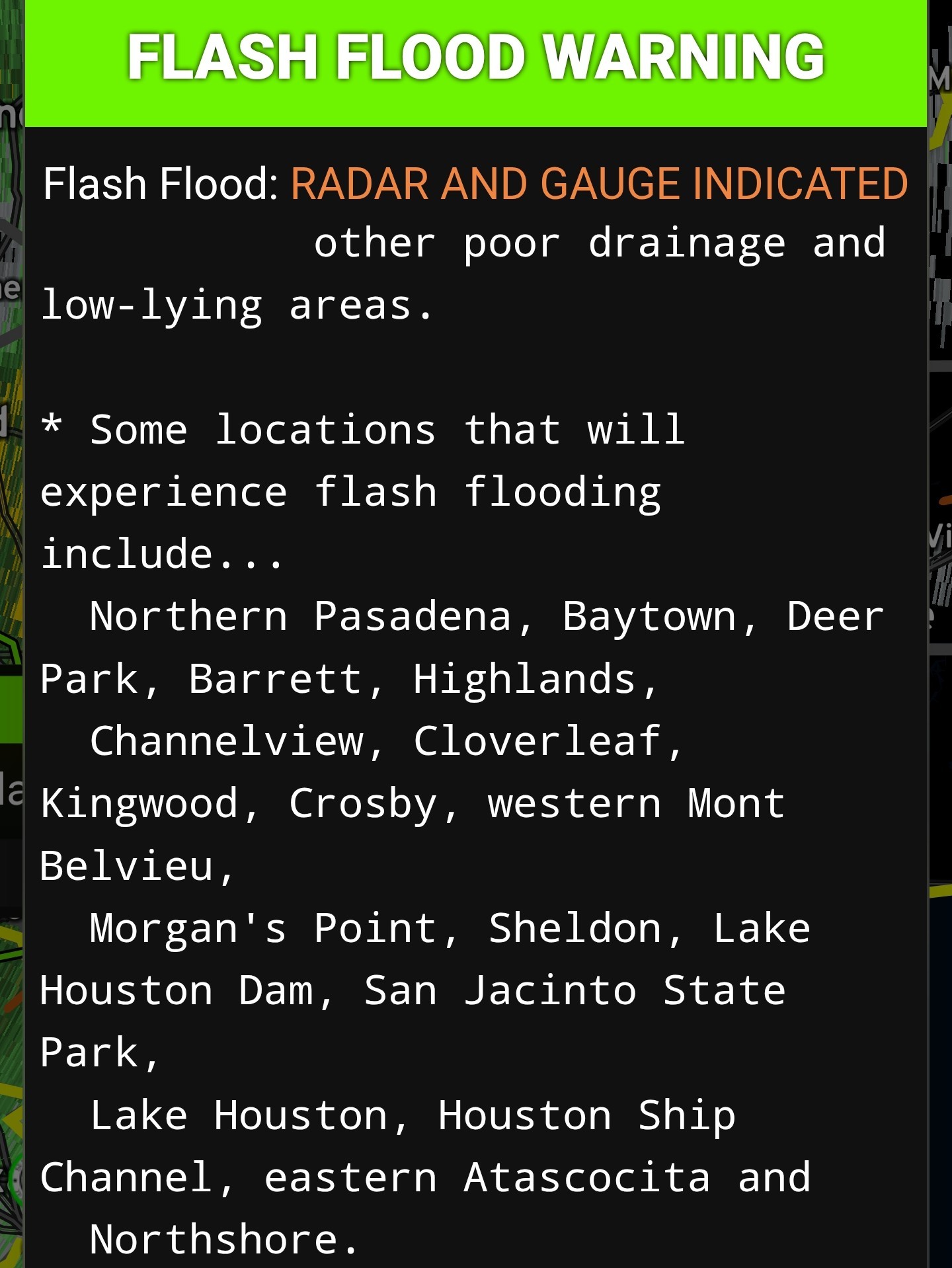 StormChaser : makes me wonder if we are in for a stormy summer. Prayers for those in the flood zones. Be safe out there folks.
Space City update - 6AM Thurs. We are currently in a small lull in the rain but it is short lived! Lots more to come but Matagorda County looks to be the bullseye as they look to receive 10+ inches today. From Space City Weather -- Heavy rainfall event ongoing in the Houston region, conditions should ease later today Eric Berger · Thursday, June 12, 2025 5:46 AM In brief: *We have expanded a Stage 2 flood alert to cover the entire region today as a storm system passes through. *The greatest likelihood of flooding appears to be to the southwest of Houston, but all areas will be vulnerable this morning. Unfolding flooding event: *As we look at the radar this morning we have one band of persistent storms over eastern Houston which has dropped as much as 3 inches of rain over Channelview, Baytown, and other locations since midnight (a flash flood warning is in effect for these locations until 7:30 am today). *Much of the rest of the region has been spared, but additional storms loom to the west of our area, and we expect the potential for flash flooding through about noon today. *Not all areas will be affected, certainly, but please take care driving into stronger storms, and do not attempt to drive through high water. 🚨 The strongest storms should move into the Houston region during a time period from around 7 am to noon, after which the heaviest rains will likely reach the coast and begin to push off shore and well to the east of Houston. 🚨 During this morning we now believe the heaviest rainfall will occur along and south of Interstate 10, and are particularly concerned about the southwest quadrant of the Houston metro area. 🚨 Much of our modeling predicts that Wharton, Brazoria, and southern Fort Bend counties are at risk of picking up 5 to 10 inches of rainfall. Heaviest rainfall excepted here : ⬇️⬇️⬇️ *Closer to Houston, particularly within the city limits and to the east of Interstate 45, totals should be less. *Generally, most locations should pick up 1 to 4 inches of rainfall, but there will be the potential for higher bullseyes. *Given that this storm system has the ability to produce high rainfall rates, streets may back up quickly and flash flooding is possible. *For this reason, we are expanding our Stage 2 flood alert to cover the entire Houston region, which includes all surrounding counties. We should be able to drop this flood alert back to Stage 1 this afternoon. THURSDAY -- *As noted above, we are seeing an atmosphere laden with moisture interact with a potent disturbance this morning, creating favorable conditions for heavy rainfall. *The strongest storms should end by noon, but some isolated showers could persist into this afternoon. *As a result of the rain and cloud cover, high temperatures today should top out in the mid-80s. *Lows tonight will drop into the 70s, with a slight chance of showers and storms. *********************** Current radar at 6AM - Future radar - final line moves thru around noon.
StormChaser : Yikes but yay! 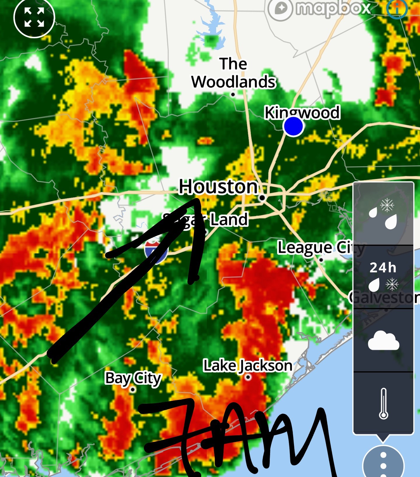
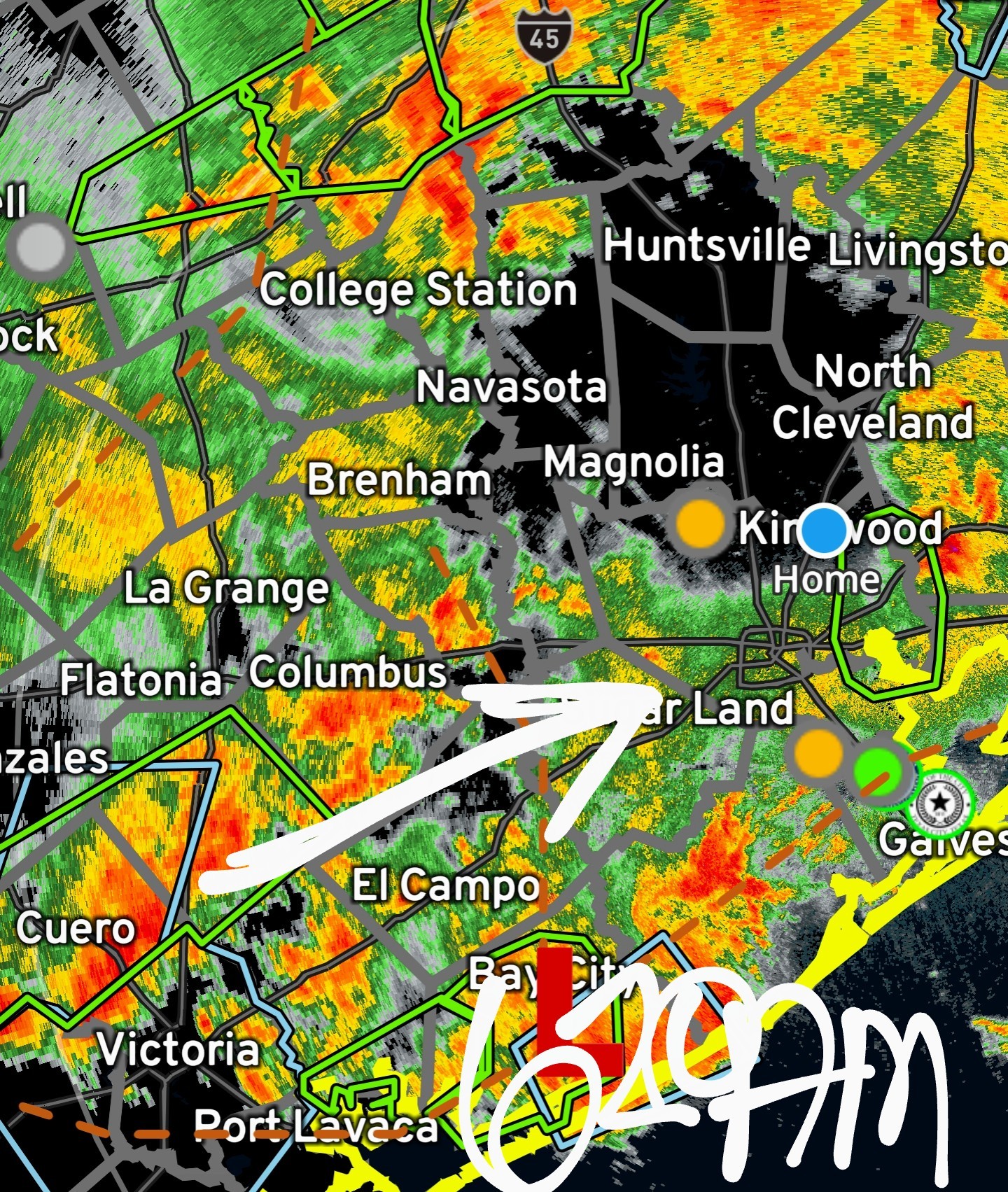
It will be interesting to see what this area does. (See black arrow on map) If it slides into Houston at this rate of movement, we're going to have flooding issues. If it skirts south of us or dissipates a bit, we won't. Timing is now between noon. Keep that in mind if you have to go out between now and then. 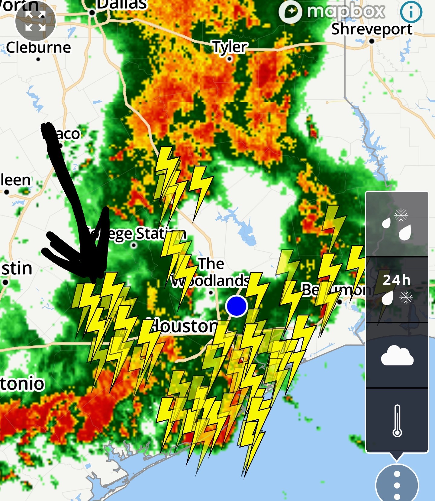
« Back to Chat
Views: 673
# Replies: 6