


Wednesday weather update
Wednesday weather update


Joined:
X days ago
# Posts:
X,XXX
Contributor Points:
X


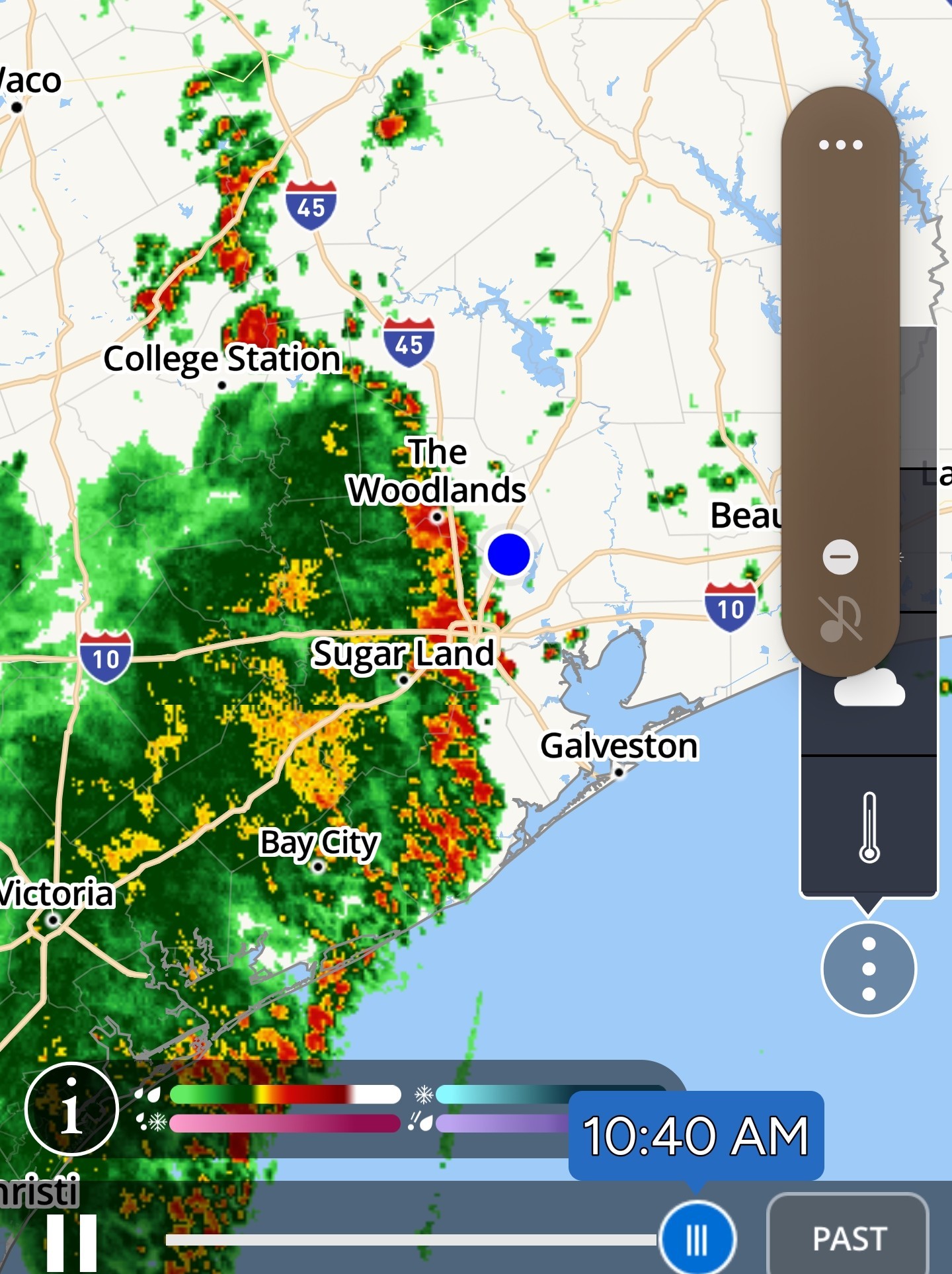
Wednesday weather update (Space City Weather update in the comments below!) ........ Nothing from Space City yet but here's the breakdown for today. Statewide radar at 645AM Storms are off to our southwest and north. 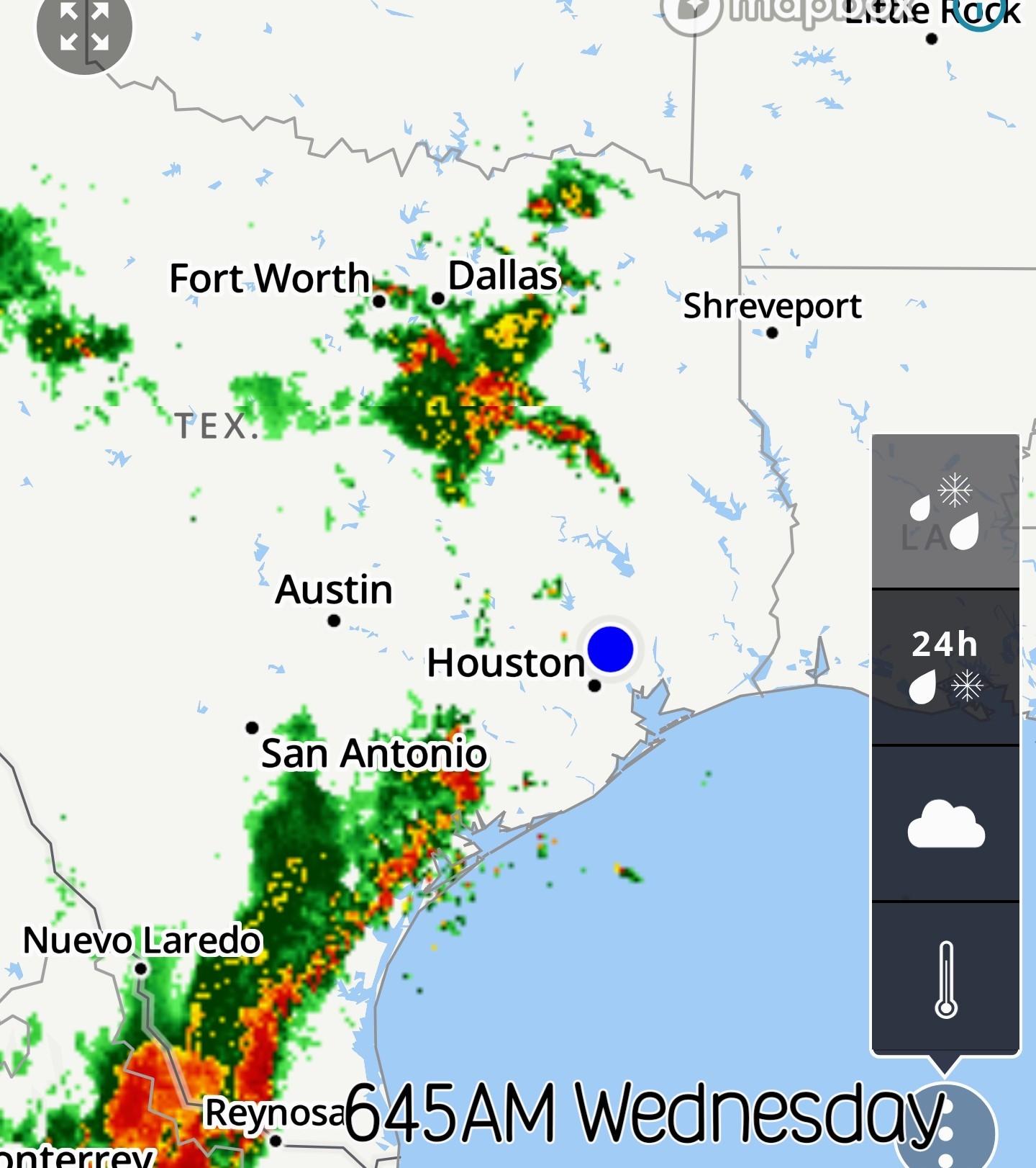 Future radar scans show heavy thunderstorms over the area at lunchtime. This could include heavy rainfall, frequent lightning, hail & high winds. Heavy rain and hail are probably our biggest threat but the current flood watch (north of here) does not include Harris County at this time.
 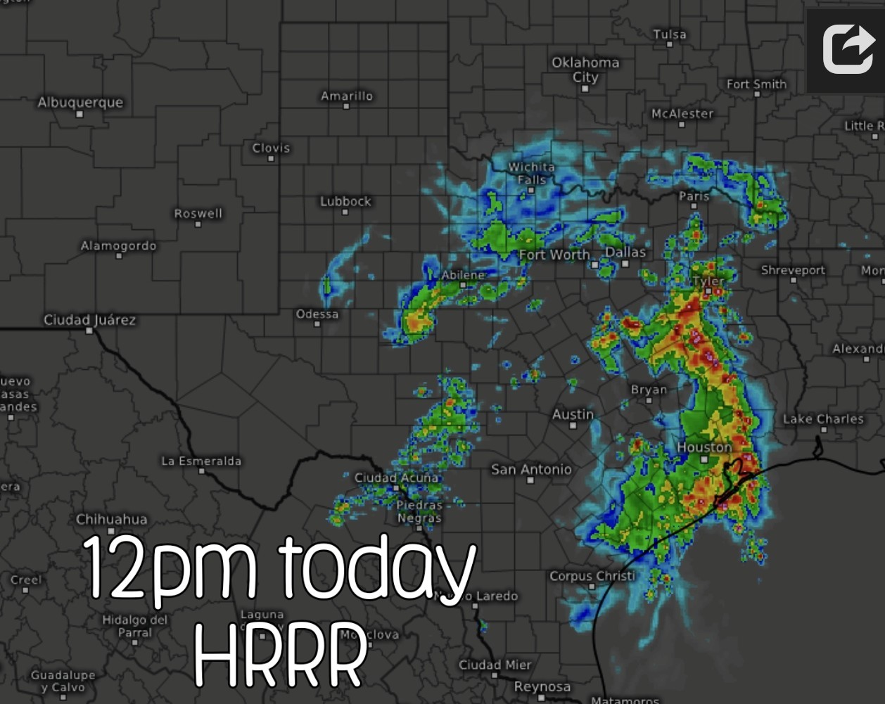 Future radar - Noon today:
 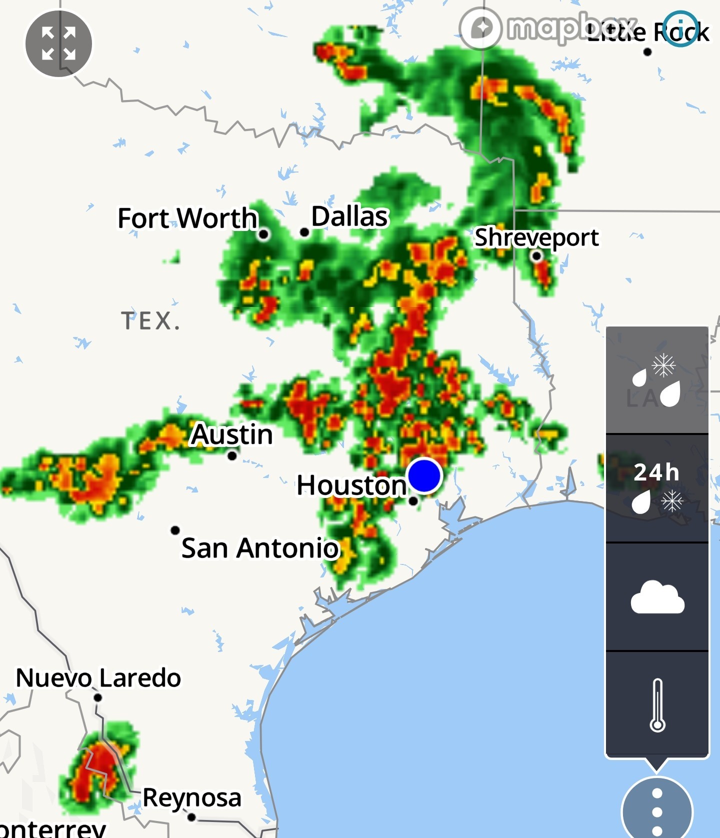 I wouldn't be surprised to see a severe thunderstorm watch issued for us later this morning. I'll update later as needed. Be safe everyone! ☔️🩷


Replies:
Wednesday weather update Nothing from Space City yet but here's the breakdown for today. Statewide radar at 645AM Storms are off to our southwest and north. Future radar scans show heavy thunderstorms over the area at lunchtime. This could include heavy rainfall, frequent lightning, hail & high winds. Heavy rain and hail are probably our biggest threat but the current flood watch (north of here) does not include Harris County at this time. Future radar - Noon today: I wouldn't be surprised to see a severe thunderstorm watch issued for us later this morning. I'll update later as needed. Be safe everyone! ☔️🩷
StormChaser : Thanks for the heads up. At this point it's becoming pretty common now that we have a warning going at least a couple times a week. Between storms and heat there is always something going. 😆
StormChaser : Thanks for sharing. I'm downtown and it has gotten gray out. I'm leaving at noon so hoping it's clear then.
Space City Weather update Heavy rainfall possible Wednesday and Thursday, sparking flood concerns across Houston metro area. Eric Berger · Wednesday, June 11, 2025 7:04 AM In brief:
*Today and Thursday should bring the region our heaviest rains yet this month, with the potential for very high rainfall rates.
*We are concerned about the potential for street flooding, and have an ongoing Stage 1 flood alert for the entire region.
*We will monitor today for the need to escalate to Stage 2. Overall pattern remains wet - *The Houston region has experienced rounds of showers and thunderstorms on Monday and Tuesday of this week, but our confidence is increasing in the heaviest and most widespread rainfall arriving today and Wednesday in the current pattern.
*It looks like the best chances for this will be during the morning hours on both days, so let's dive in deeper to the forecast. Wednesday and Thursday -- *Both of these days look to have a similar setup, and at this point probably will play out similarly.
*In the pre-dawn hours we will see a mass of storms develop to the west of the Houston metro area, and then this system will move through the city during the morning and early afternoon hours.
*In addition to the potential for heavy rainfall, especially on Wednesday there is the additional threat of damaging winds in Harris County and surrounding counties within stronger thunderstorms. 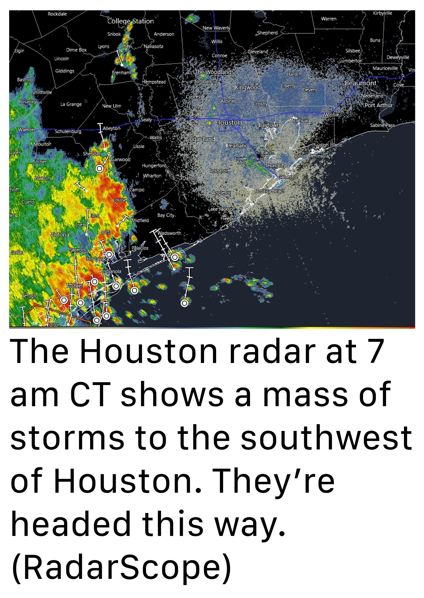 *This morning, looking at the radar, we can see a large cluster of storms to the southwest of Houston, near Matagorda Bay.
*High-resolution modeling indicates that this mass of storms will move to the northeast, pushing through the Houston region from 9 am to 3 pm.
*This is the period when we are most concerned about lightning, street flooding, and damaging winds.
*In terms of storms, our weather may turn more quiet later this afternoon and evening, but there will still be the possibility of some sporadic flare-ups. *Similarly, on Thursday, a mass of storms will likely congeal west of the Houston area after midnight and then move into the city during the morning hours.
*Whether this occur before dawn, or during the mid-morning hours, it is difficult to say right now.
*The overall threat remains the same: heavy rainfall and flooded streets, with lesser odds of damaging winds and other severe weather. *In terms of rainfall totals, they're going to vary widely.
*I believe most parts of Houston and surrounding areas will pick up 1 to 3 inches. However, in these kinds of storms in the past, at this time of year, we've seen very high rainfall rates.
*So it would not surprise me to see locations with 5+ inches of rain over the next two days. Matt and I will be watching closely for the need to escalate to Stage 2 on our flood scale. We're not there yet, but we're concerned about some of the high-end rainfall rates. We will, of course, update as needed. 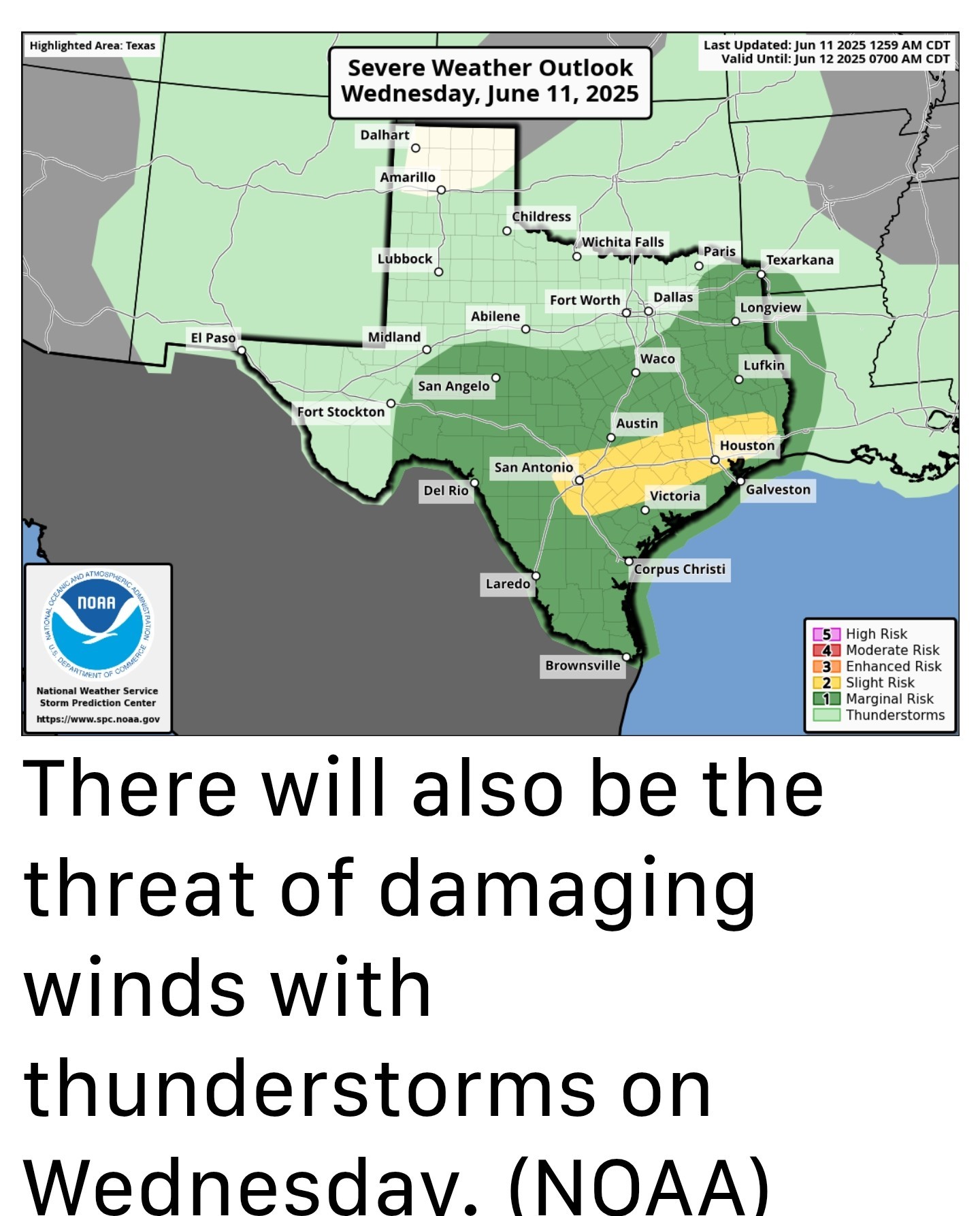 *Mostly cloudy skies and rain-cooled air should keep temperatures in check over the next two days.
*I would anticipate highs in the upper 80s to possibly 90 degrees, with lots of humidity.
*Outside of thunderstorms winds should be fairly light. Nights will be warm and muggy. Friday, Saturday, and Sunday -- *Each of these days will carry a healthy chance of rain showers, probably on the order of 50 percent or higher.
*As of now, we don't see storms being quite as organized or intense-think pop-up storms rather than large systems moving through.
*As a result, outdoor activities will probably be hit or miss.
*Days will see a mix of clouds and sunshine, and high temperatures will probably get into the lower 90s for the most part. Next week -- *The pattern described above for this weekend should persist into Tuesday or Wednesday of next week: warm, muggy, with a solid chance of showers but probably nothing on the order of flooding.
*The second half of the weekend could go two ways: clearing skies and higher temperatures, or an ongoing wet pattern.
*I just don't have enough confidence to predict one outcome or another.
*Today and Thursday should bring the region our heaviest rains yet this month, with the potential for very high rainfall rates.
*We are concerned about the potential for street flooding, and have an ongoing Stage 1 flood alert for the entire region.
*We will monitor today for the need to escalate to Stage 2.
*It looks like the best chances for this will be during the morning hours on both days, so let's dive in deeper to the forecast.
*In the pre-dawn hours we will see a mass of storms develop to the west of the Houston metro area, and then this system will move through the city during the morning and early afternoon hours.
*In addition to the potential for heavy rainfall, especially on Wednesday there is the additional threat of damaging winds in Harris County and surrounding counties within stronger thunderstorms.
*High-resolution modeling indicates that this mass of storms will move to the northeast, pushing through the Houston region from 9 am to 3 pm.
*This is the period when we are most concerned about lightning, street flooding, and damaging winds.
*In terms of storms, our weather may turn more quiet later this afternoon and evening, but there will still be the possibility of some sporadic flare-ups.
*Whether this occur before dawn, or during the mid-morning hours, it is difficult to say right now.
*The overall threat remains the same: heavy rainfall and flooded streets, with lesser odds of damaging winds and other severe weather.
*I believe most parts of Houston and surrounding areas will pick up 1 to 3 inches. However, in these kinds of storms in the past, at this time of year, we've seen very high rainfall rates.
*So it would not surprise me to see locations with 5+ inches of rain over the next two days.
*I would anticipate highs in the upper 80s to possibly 90 degrees, with lots of humidity.
*Outside of thunderstorms winds should be fairly light. Nights will be warm and muggy.
*As of now, we don't see storms being quite as organized or intense-think pop-up storms rather than large systems moving through.
*As a result, outdoor activities will probably be hit or miss.
*Days will see a mix of clouds and sunshine, and high temperatures will probably get into the lower 90s for the most part.
*The second half of the weekend could go two ways: clearing skies and higher temperatures, or an ongoing wet pattern.
*I just don't have enough confidence to predict one outcome or another.
8AM radar. Heavy storms are slowly marching this way..... Timing looks to be after 10AM. 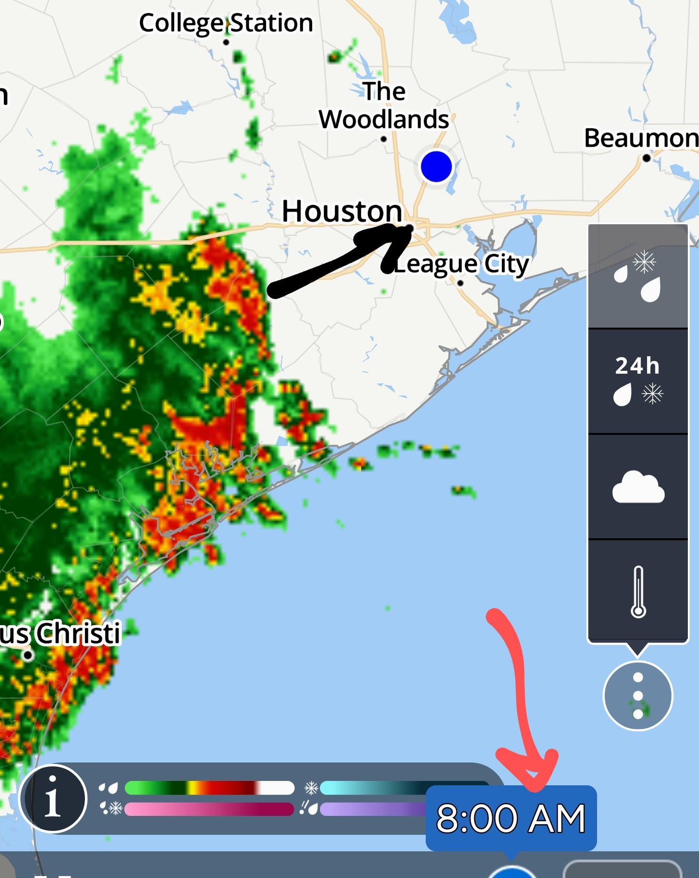

Looks like once it starts today, it may come down pretty solid for a sustained period. OTOH, our plants will love it, and we will love our water bills since they will be for less water used watering the lawn 
Whoa... I'm inside the loop right now and it's black-dark.
Wednesday weather update (Space City Weather update in the comments below!) ........ Nothing from Space City yet but here's the breakdown for today. Statewide radar at 645AM Storms are off to our southwest and north. Future radar scans show heavy thunderstorms over the area at lunchtime. This could include heavy rainfall, frequent lightning, hail & high winds. Heavy rain and hail are probably our biggest threat but the current flood watch (north of here) does not include Harris County at this time. Future radar - Noon today: I wouldn't be surprised to see a severe thunderstorm watch issued for us later this morning. I'll update later as needed. Be safe everyone! ☔️?
malpalface tipped StormChaser 100 credits for a post in this forum discussion.

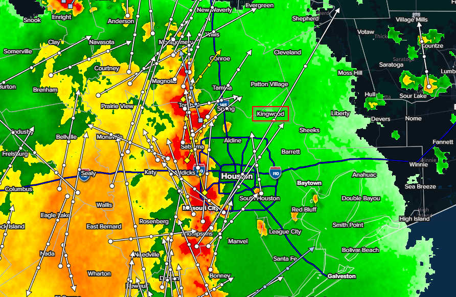
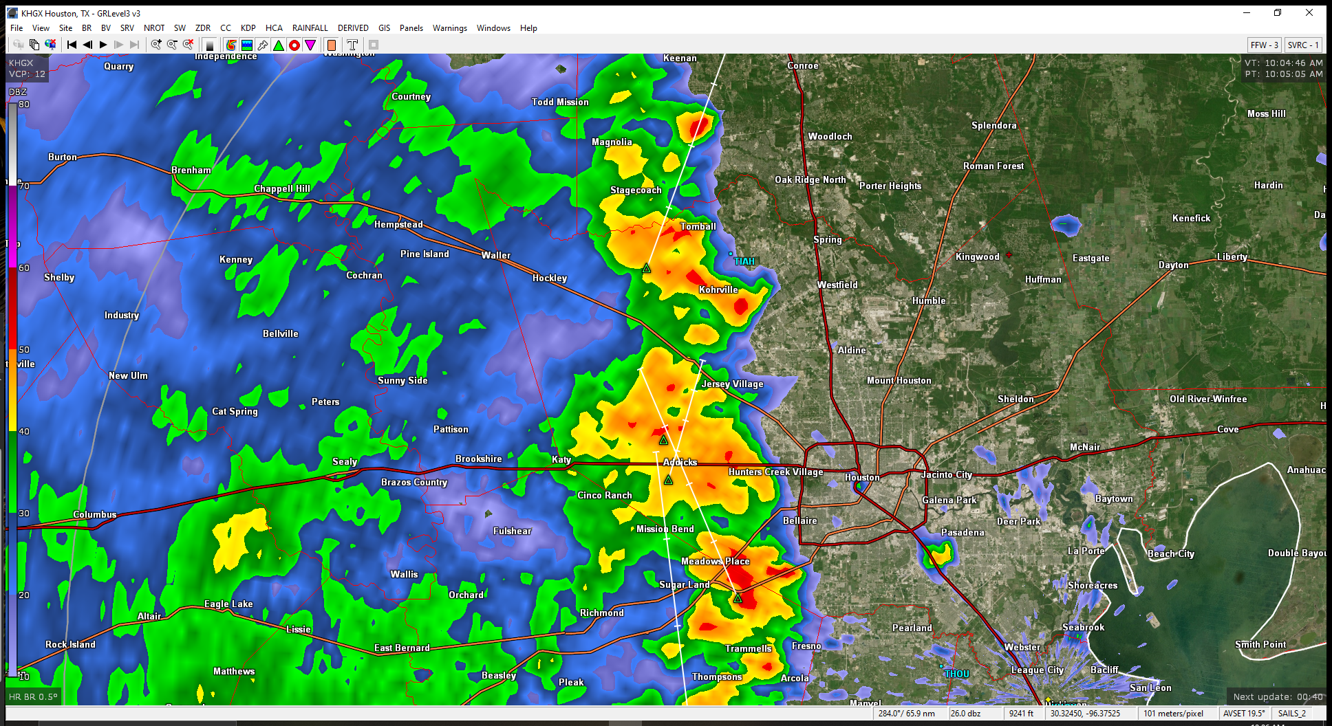
Some hail markers in parts of that leading edge.
StormChaser : Really huge, really dark cloud cover, thunder and lightning, and heavy downpours here at the IAH area. Pretty sure it's headed toward Kingwood too. Hunker down, it's coming!
« Back to Chat
Views: 1,348
# Replies: 31