


Wednesday's stormy forecast
Wednesday's stormy forecast


Joined:
X days ago
# Posts:
X,XXX
Contributor Points:
X


Wednesday's stormy forecast Long story short: its going to be a stormy Wednesday. Things should stay below severe limits but gusty winds & some isolated street flooding could be an issue during the heavier cells. From Space City Weather: Storms return to the Houston area today, as May continues to close on a noisy note. Matt Lanza · Wednesday, May 28, 2025 6:53 AM In brief:
*Scattered to numerous storms will impact the Houston area once more today.
*Severe risks, while low, are not zero.
*We'll remain unsettled heading into the late week and weekend but hopefully at a less intense pace than we've started the week with.
*Hotter weather lurks on the horizon. TODAY (WEDNESDAY) *After things calmed down yesterday, they stayed calm, thankfully, but we will not have that luxury today.
*Storms (non-severe) are already moving across Matagorda County and Wharton County this morning. 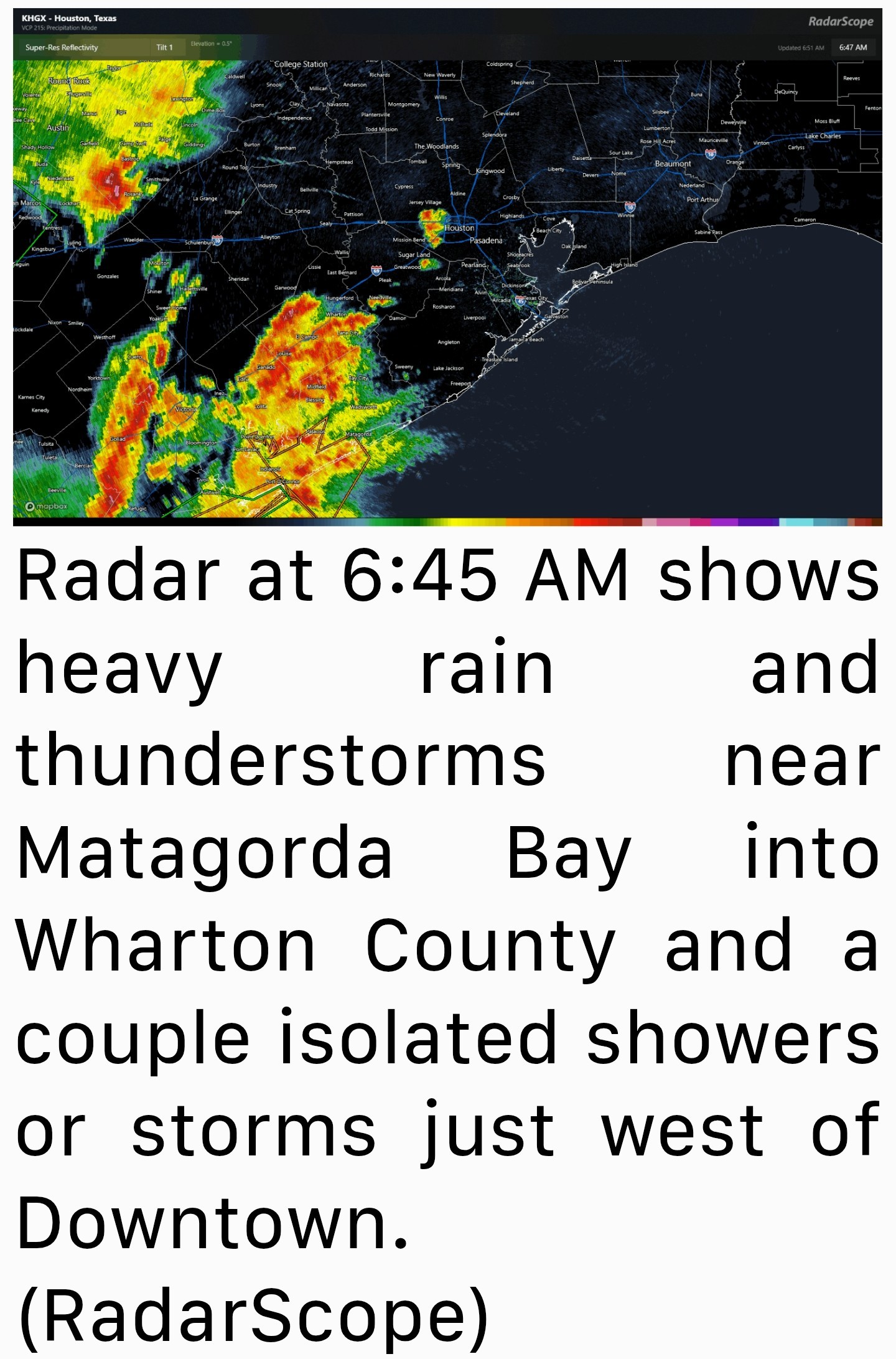 *There are also a couple isolated storms just west of Downtown.
*Over the next few hours, the activity near Matagorda Bay will slide across Brazoria and Galveston Counties.
*Some of those storms could be strong to severe with gusty winds.
*Lightning and heavy rain are a given with these storms as well.
*Elsewhere, scattered storms will pop across the rest of the area today.
*While we don't expect significant severe weather, we cannot rule out isolated severe storms.
*A severe thunderstorm watch or flood watch could be issued for our area.
**Gusty winds are the main concern today. Current radar @ 720AM 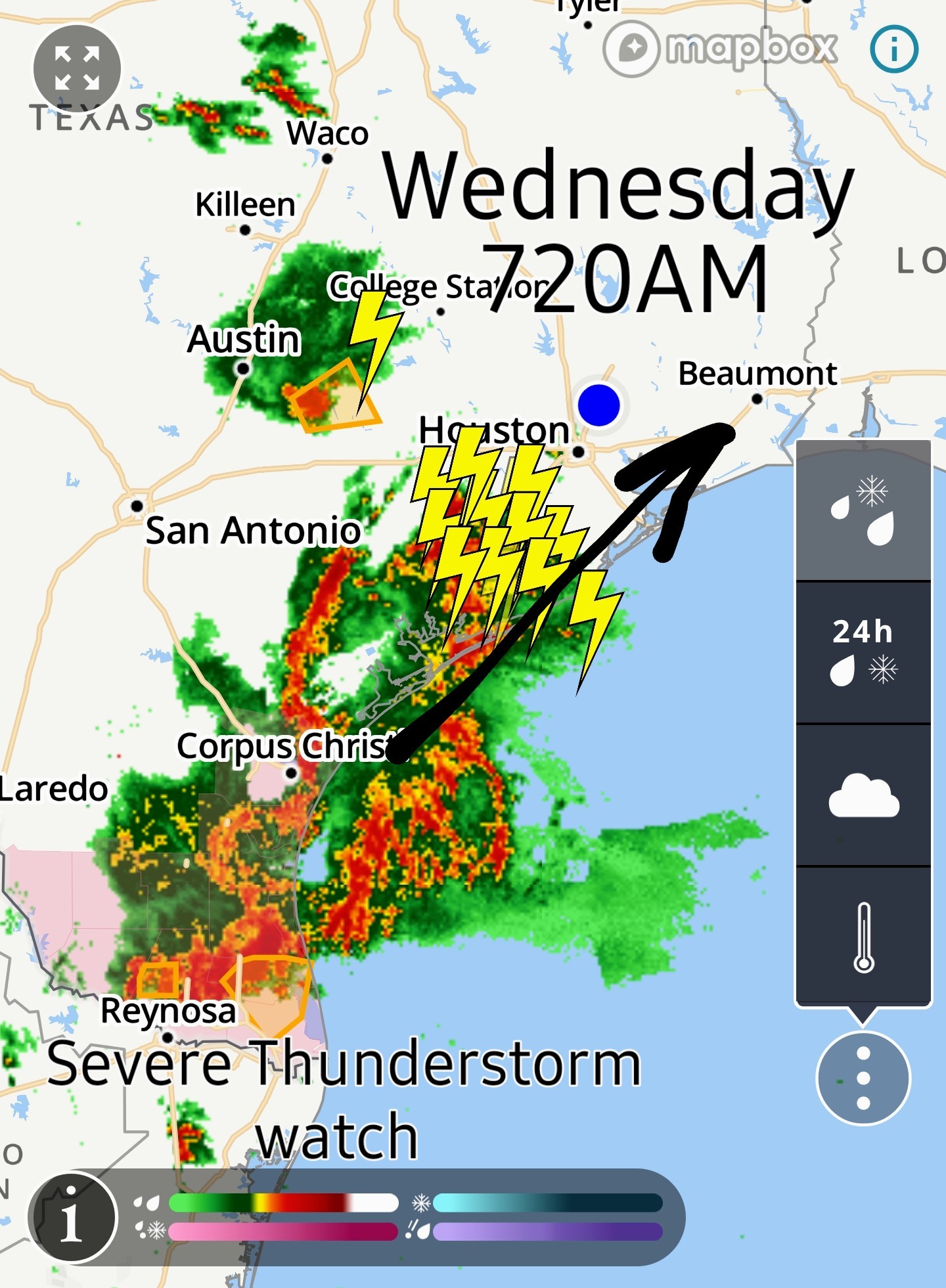 Live radar link: spacecityweather.com /wp-content/uploads/ 2025/05/a89aed28-4e8 b-4e37-9900-90e *It is possible that we see an additional cluster of storms develop with daytime heating out near College Station and the Brazos Valley.
*Those could swing through in the evening hours.
*Again -- the primary concern would be isolated gusty wind as that happens.
*Also, keep an eye out for heavy rainfall.
*These storms are putting down close to 2 inch per hour rainfall rates so this could cause some street flooding to crop up in spots.
*Nothing too, too serious as far as flooding goes but just be mindful in typically flood-prone spots.
*Temperatures will be held back in the 80s today. Stay tuned.....


******************
*Scattered to numerous storms will impact the Houston area once more today.
*Severe risks, while low, are not zero.
*We'll remain unsettled heading into the late week and weekend but hopefully at a less intense pace than we've started the week with.
*Hotter weather lurks on the horizon.
*Storms (non-severe) are already moving across Matagorda County and Wharton County this morning.
*Over the next few hours, the activity near Matagorda Bay will slide across Brazoria and Galveston Counties.
*Some of those storms could be strong to severe with gusty winds.
*Lightning and heavy rain are a given with these storms as well.
*Elsewhere, scattered storms will pop across the rest of the area today.
*While we don't expect significant severe weather, we cannot rule out isolated severe storms.
*A severe thunderstorm watch or flood watch could be issued for our area.
**Gusty winds are the main concern today.
*Those could swing through in the evening hours.
*Again -- the primary concern would be isolated gusty wind as that happens.
*Also, keep an eye out for heavy rainfall.
*These storms are putting down close to 2 inch per hour rainfall rates so this could cause some street flooding to crop up in spots.
*Nothing too, too serious as far as flooding goes but just be mindful in typically flood-prone spots.
*Temperatures will be held back in the 80s today.
Replies:
StormChaser : Well, can't complain too much when we get a normal storm day instead of the spin the chaos storm wheel and win property damage kind of day.
StormChaser : Thank you for the update. My son is driving home to Austin and trying to avoid as much weather as possible.
Stay safe everyone! I had pics of the Memorial Day flood come up on my FB feed. Right now I'm trying to remember what rain is like! Some days I miss the rain something fierce. But mostly I am grateful for all the sunshine. Monsoon Season-starts June 1. They say it will be an active one. We shall see.
Wednesday's stormy forecast Long story short: its going to be a stormy Wednesday. Things should stay below severe limits but gusty winds & some isolated street flooding could be an issue during the heavier cells. ********************** From Space City Weather: Storms return to the Houston area today, as May continues to close on a noisy note. Matt Lanza · Wednesday, May 28, 2025 6:53 AM In brief: *Scattered to numerous storms will impact the Houston area once more today. *Severe risks, while low, are not zero. *We'll remain unsettled heading into the late week and weekend but hopefully at a less intense pace than we've started the week with. *Hotter weather lurks on the horizon. TODAY (WEDNESDAY) *After things calmed down yesterday, they stayed calm, thankfully, but we will not have that luxury today. *Storms (non-severe) are already moving across Matagorda County and Wharton County this morning. *There are also a couple isolated storms just west of Downtown. *Over the next few hours, the activity near Matagorda Bay will slide across Brazoria and Galveston Counties. *Some of those storms could be strong to severe with gusty winds. *Lightning and heavy rain are a given with these storms as well. *Elsewhere, scattered storms will pop across the rest of the area today. *While we don't expect significant severe weather, we cannot rule out isolated severe storms. *A severe thunderstorm watch or flood watch could be issued for our area. **Gusty winds are the main concern today. Current radar 720AM Live radar link: spacecityweather.com /wp-content/uploads/ 2025/05/a89aed28-4e8 b-4e37-9900-90e *It is possible that we see an additional cluster of storms develop with daytime heating out near College Station and the Brazos Valley. *Those could swing through in the evening hours. *Again -- the primary concern would be isolated gusty wind as that happens. *Also, keep an eye out for heavy rainfall. *These storms are putting down close to 2 inch per hour rainfall rates so this could cause some street flooding to crop up in spots. *Nothing too, too serious as far as flooding goes but just be mindful in typically flood-prone spots. *Temperatures will be held back in the 80s today. Stay tuned.....
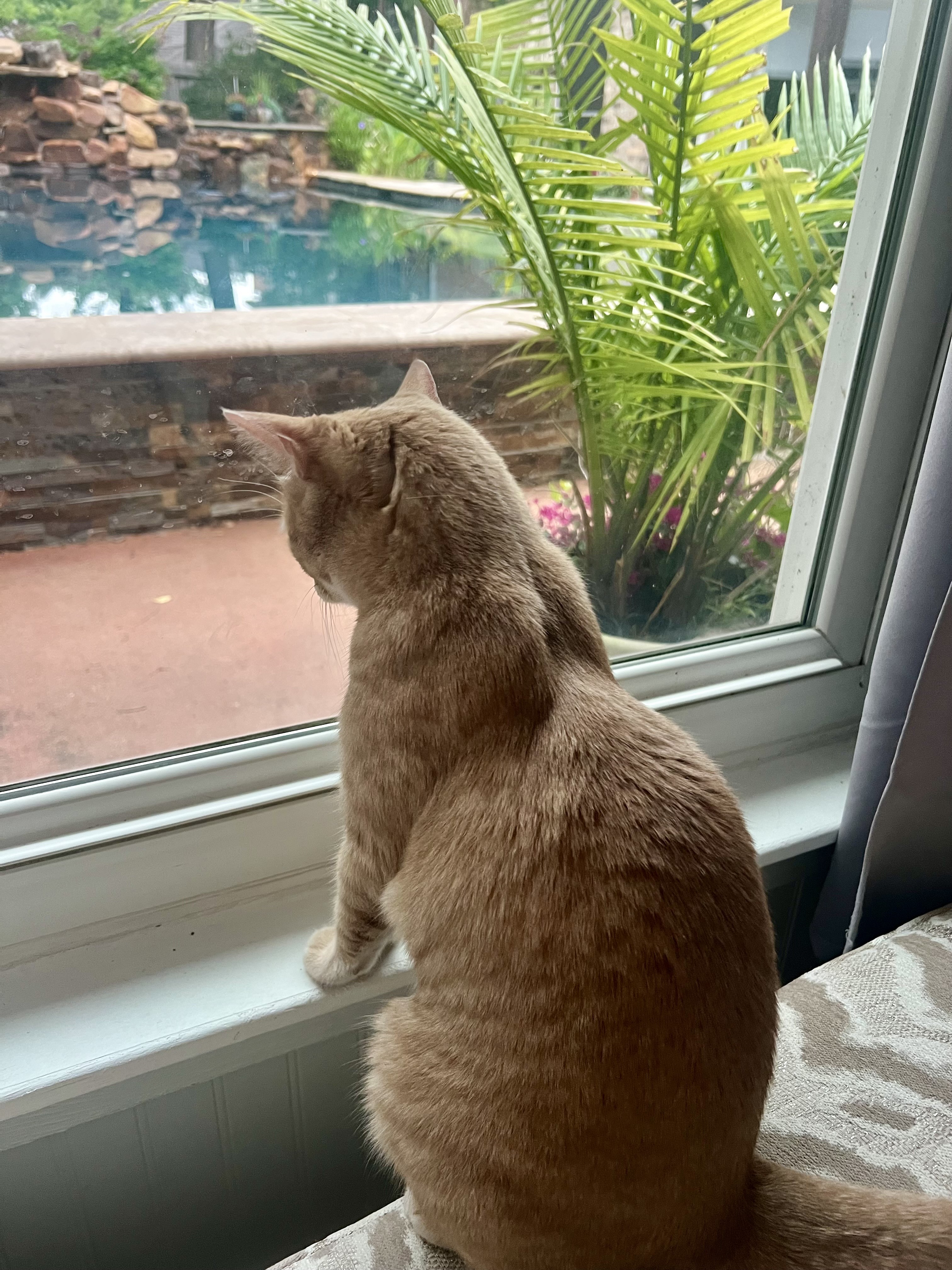 StormChaser : Tessa and I are right here in the sunroom, waiting for the showers to begin!
StormChaser : Thank you for the update. My son is driving home to Austin and trying to avoid as much weather as possible.
bigla : Oh goodness... he needs to just take it slow and pull over if it gets too bad.
StormChaser : Tessa and I are right here in the sunroom, waiting for the showers to begin!
Ruger5 : Won't have to wait long. I just heard thunder and I have my window open in my office and hearing "pitter, patter" now.
9:15AM radar The heaviest is to our south but we're about to get some heavy rainfall for sure. 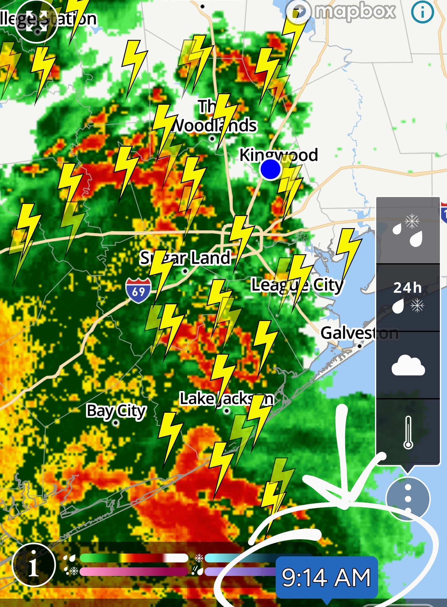
StormChaser : Thank you for the update. My son is driving home to Austin and trying to avoid as much weather as possible.
bigla : Austin to Houston won't be too bad.
bigla : Austin to Houston won't be too bad. Corpus to Houston? Now that would be ugly today! He'll be good. ❤️
StormChaser : How about my trip to HEB that I need to make?
Flood advisory until 11:45am. 1-2" of rain an hour will impact the following locations: *Pasadena.
*Pearland.
*Sugarland.
*Deer Park.
*West U.
*Astrodome.
*Midtown.
*Third Ward.
*Pearland.
*Sugarland.
*Deer Park.
*West U.
*Astrodome.
*Midtown.
*Third Ward.
Flood advisory until 11:45am. 1-2" of rain an hour will impact the following locations: *Pasadena. *Pearland. *Sugarland. *Deer Park. *West U. *Astrodome. *Midtown. *Third Ward.
StormChaser : Glad that Kingwood is not included. I didn't have power for 10 hours yesterday. It just really makes for a long day when that happens and you feel so isolated.
I didn't have power for 10 hours yesterday. It just really makes for a long day when that happens and you feel so isolated.
cbear : Aww I'm sorry. ZMAN just did a set up that's not a $12,000 Generac like most.  Buffaloglenn too? 🤔
« Back to Chat
Views: 994
# Replies: 22