


Rainy days ahead
Rainy days ahead


Joined:
X days ago
# Posts:
X,XXX
Contributor Points:
X


Rainy days ahead From Space City Weather: A quiet day after Monday night's storms, but expect more rain this week. Eric Berger · Tuesday, May 27, 2025 6:37 AM In brief: *Houston rocked and rolled on Monday night as a storm system rumbled through, but in its wake we're seeing calmer and cooler weather this morning.
*The reprieve will probably last for 12 to 24 hours before widespread showers return on Wednesday and possibly Thursday. MONDAY NIGHT'S FIREWORKS: *As expected, a line of storms roared through the area overnight.
*Most parts of the Houston region received a good soaking of 1 to 2 inches of rainfall.
*In addition to the front, there were straight-line wind gusts of up to 40 or 50 mph in some locations as the storms blew in.
*There are a few scattered power outages in the Houston area, but the stronger cells went well north of the city, where electricity issues are more widespread this morning. **You may have had an issue loading Space City Weather last night, and for that I apologize. We had website issues unrelated to the storm, but they should be fixed now. Thank you for your patience. 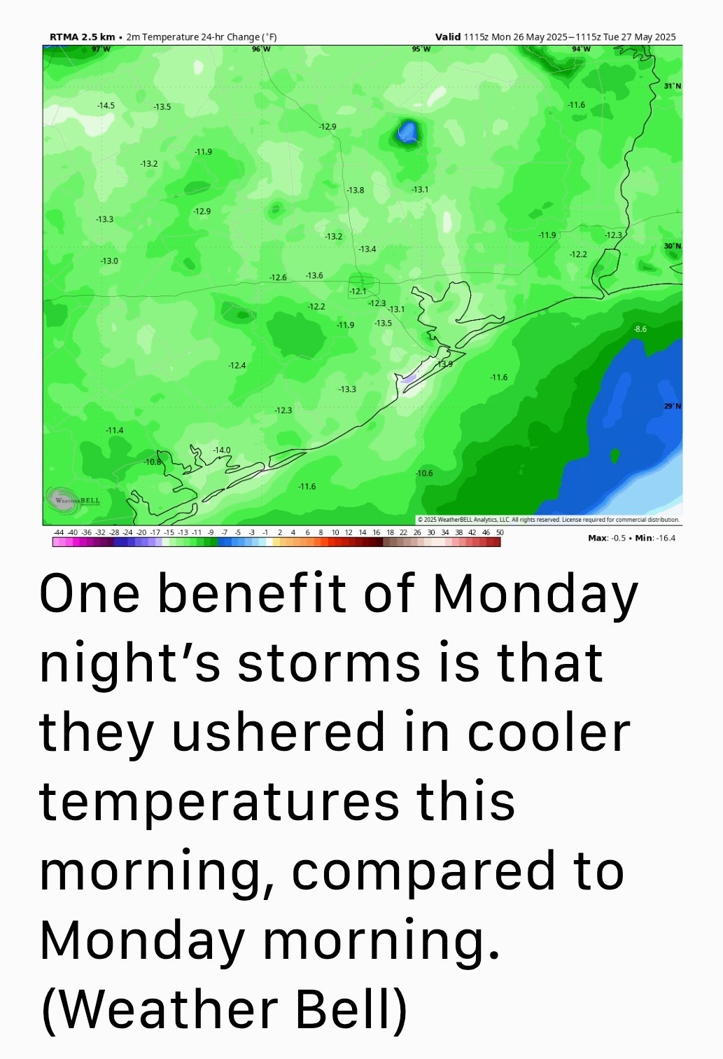 TUESDAY: *Light rainfall is lingering near the coast this morning but these showers should end by mid-morning.
*Following Monday night's storms, the atmosphere is pretty well worked over, and I expect a fairly quiet day in terms of showers and thunderstorms.
*Most of the area should see partly sunny skies and highs around 90 degrees today as a result.
*We might see a few scattered showers pop up late this afternoon or evening but generally expect calm weather today and tonight.
*Lows tonight will only drop into the mid-70s. WEDNESDAY AND THURSDAY: *Our overall pattern will remain unsettled through at least Thursday, and therefore we can expect both of these days to produce a healthy chance of showers and possibly some thunderstorms.
*At this time, the likelihood of severe weather is lower than what the region experienced on Monday night but I'm not ruling anything out, especially on Wednesday.
*I expect most locations to pick up an additional 0.5 to 2 inches of rainfall through Thursday.
*High temperatures will be in the vicinity of the upper 80s with warm and muggy nights. 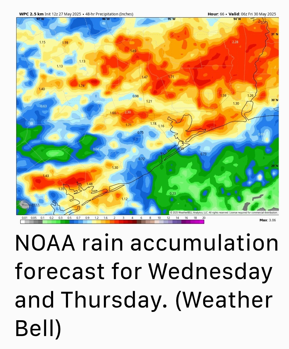 FRIDAY: *A weak front will approach the area on Friday and this may spark an additional chance of rainfall.
*However, at this time, any showers look to be mostly light.
*Rain chances will likely ebb during the afternoon and evening hours as drier air slowly filters in.
*Look for highs in the upper 80s on Friday, with partly sunny skies, and lows dropping to around 70 degrees. SATURDAY & SUNDAY: *Our weather this weekend will depend on how the front, stalled near the coast, waffles around.
*My best guess is that we'll see partly sunny skies, highs of around 90 degrees, and a slight chance (maybe 20 percent on Saturday and 30 percent on Sunday) of showers and thunderstorms. We'll see. NEXT WEEK: *Most of next week looks hotter and sunnier, with highs likely in the lower 90s and low rain chances. So, pretty normal for early June, most likely. spacecityweather.com /a-quiet-day-after-m onday-nights-storms- but-expect-more
*The reprieve will probably last for 12 to 24 hours before widespread showers return on Wednesday and possibly Thursday.
*Most parts of the Houston region received a good soaking of 1 to 2 inches of rainfall.
*In addition to the front, there were straight-line wind gusts of up to 40 or 50 mph in some locations as the storms blew in.
*There are a few scattered power outages in the Houston area, but the stronger cells went well north of the city, where electricity issues are more widespread this morning.
*Following Monday night's storms, the atmosphere is pretty well worked over, and I expect a fairly quiet day in terms of showers and thunderstorms.
*Most of the area should see partly sunny skies and highs around 90 degrees today as a result.
*We might see a few scattered showers pop up late this afternoon or evening but generally expect calm weather today and tonight.
*Lows tonight will only drop into the mid-70s.
*At this time, the likelihood of severe weather is lower than what the region experienced on Monday night but I'm not ruling anything out, especially on Wednesday.
*I expect most locations to pick up an additional 0.5 to 2 inches of rainfall through Thursday.
*High temperatures will be in the vicinity of the upper 80s with warm and muggy nights.
*However, at this time, any showers look to be mostly light.
*Rain chances will likely ebb during the afternoon and evening hours as drier air slowly filters in.
*Look for highs in the upper 80s on Friday, with partly sunny skies, and lows dropping to around 70 degrees.
*My best guess is that we'll see partly sunny skies, highs of around 90 degrees, and a slight chance (maybe 20 percent on Saturday and 30 percent on Sunday) of showers and thunderstorms.