


Monday radar - 6AM
Monday radar - 6AM


Joined:
X days ago
# Posts:
X,XXX
Contributor Points:
X


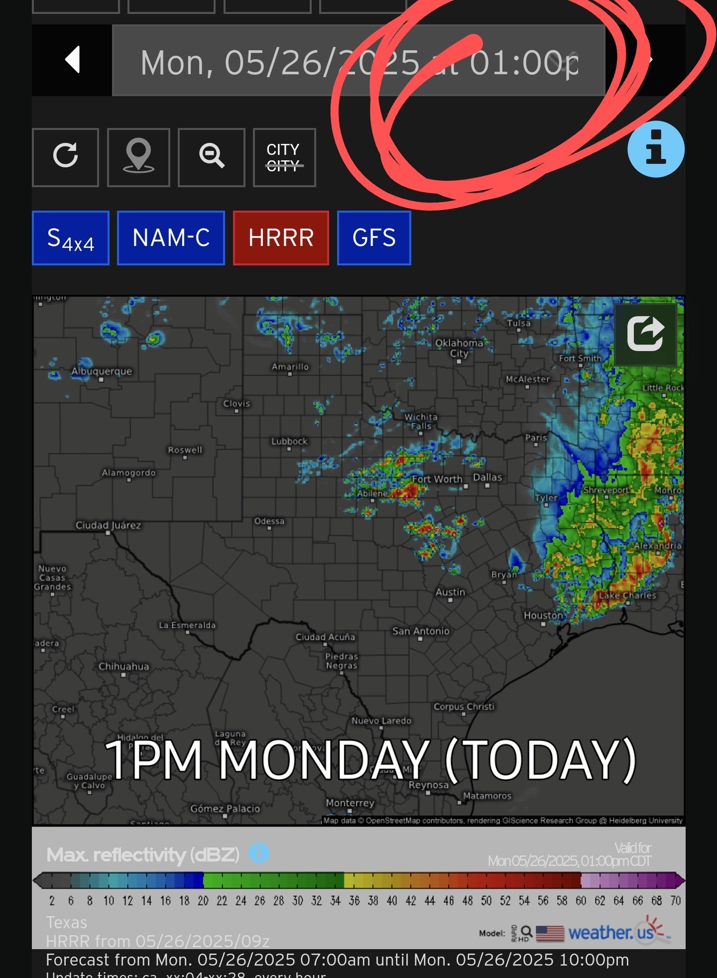
Monday radar - 6AM 6AM radar shows a nasty line of storms currently north of Houston. This line stretches from Waco thru Tyler and into Arkansas & Louisiana. 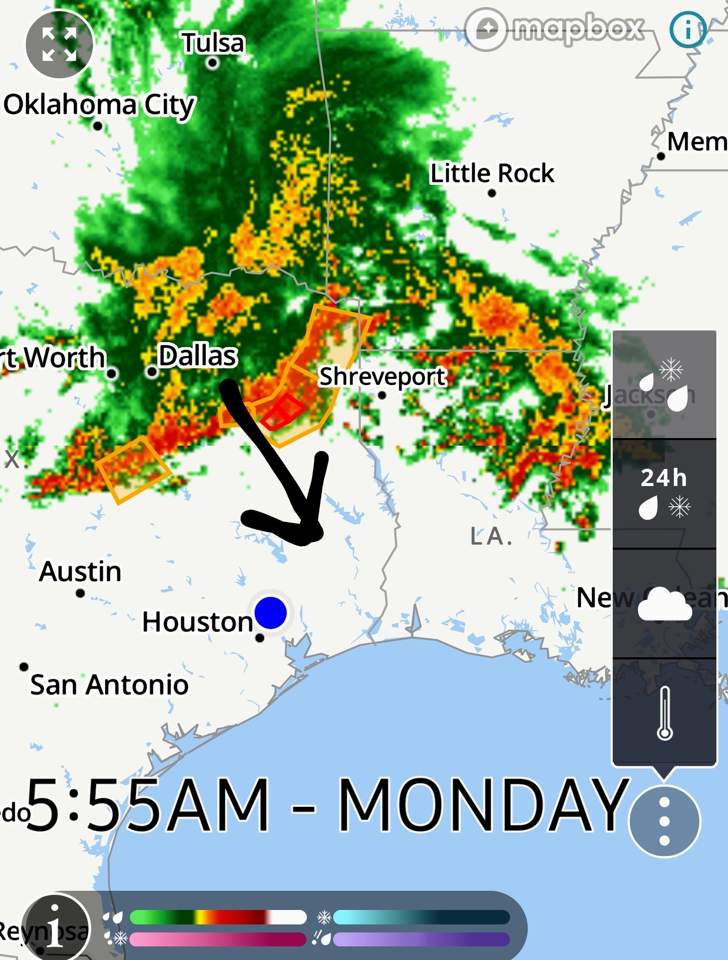 This line is moving south but the question is: ➡️ Will it hold together & make it to Houston? ✳️ Unfortunately, as of 6AM, The HRRR shows the line breaking apart just north of us as it shifts into Louisiana. ✳️1pm HRRR forecast model:
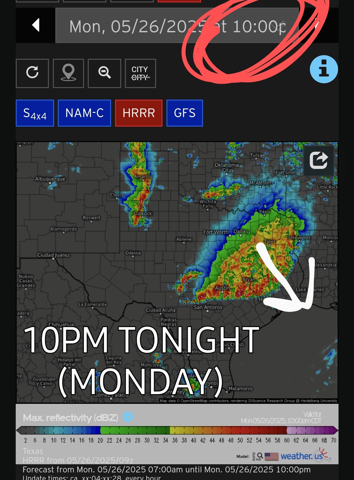
  🚨 BUT -- The HRRR at 10pm tonight shows a large area of showers and thunderstorms moving into Houston and that looks more promising than the line to our north this AM. ✳️10pm HRRR future forecast model:
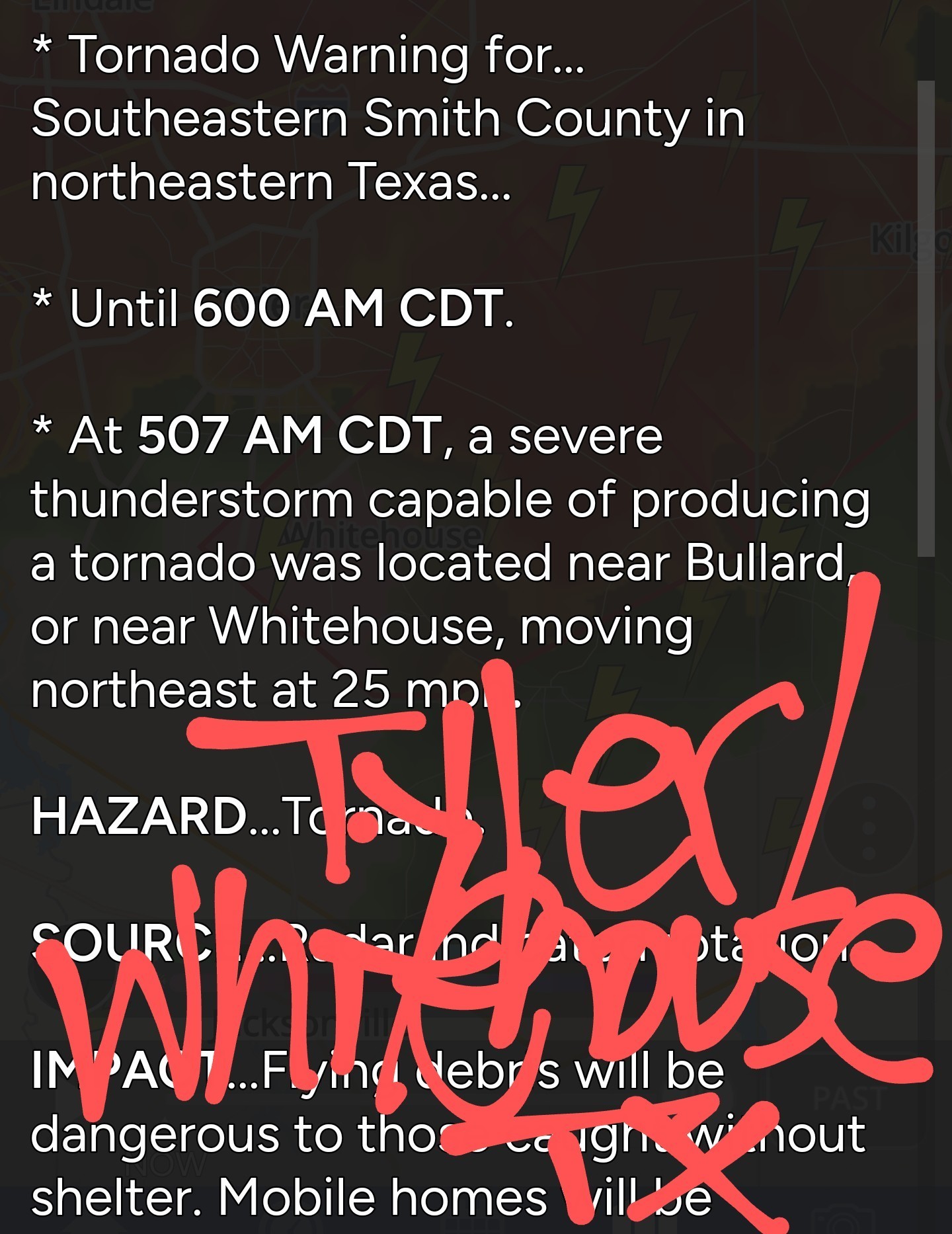
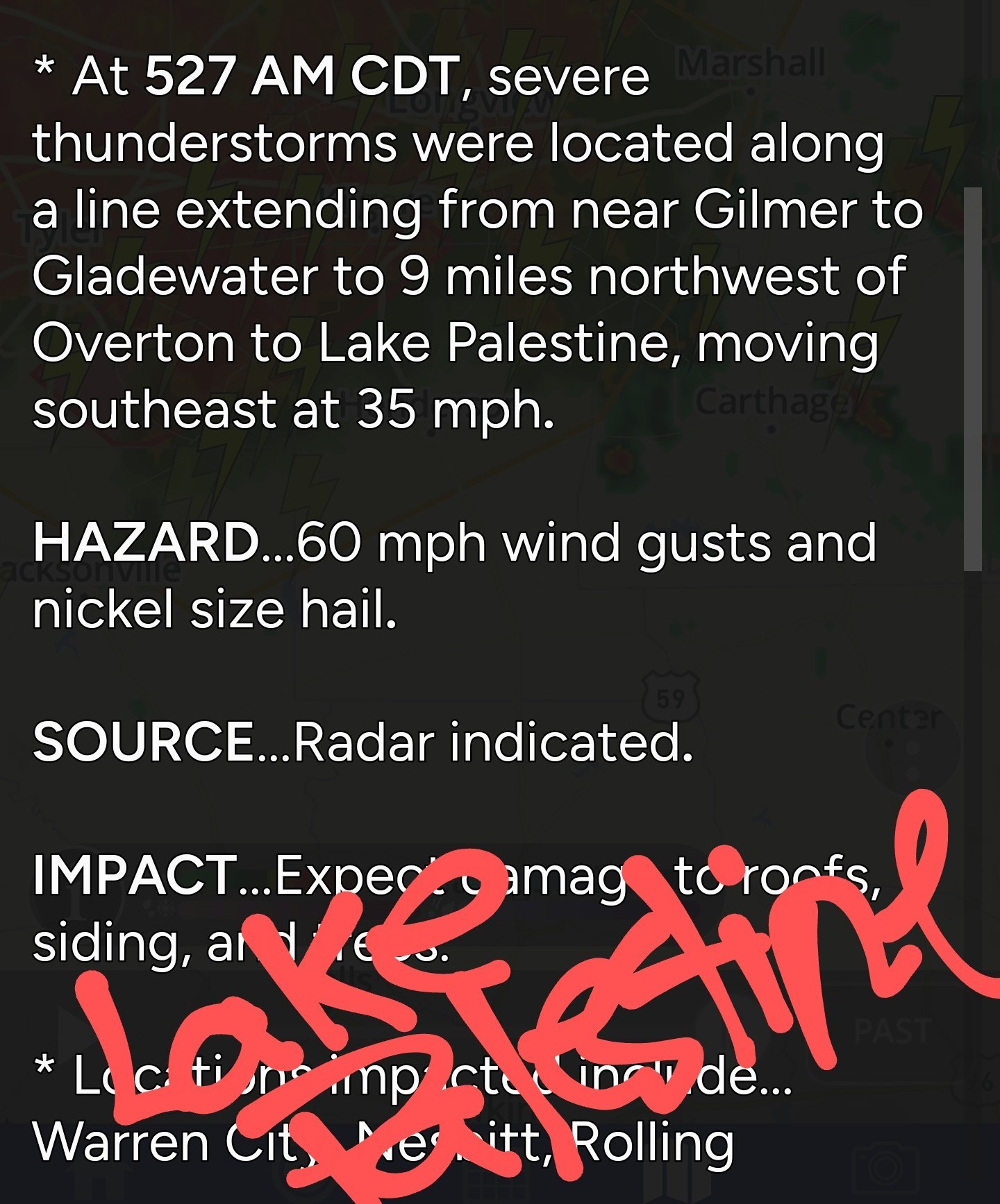
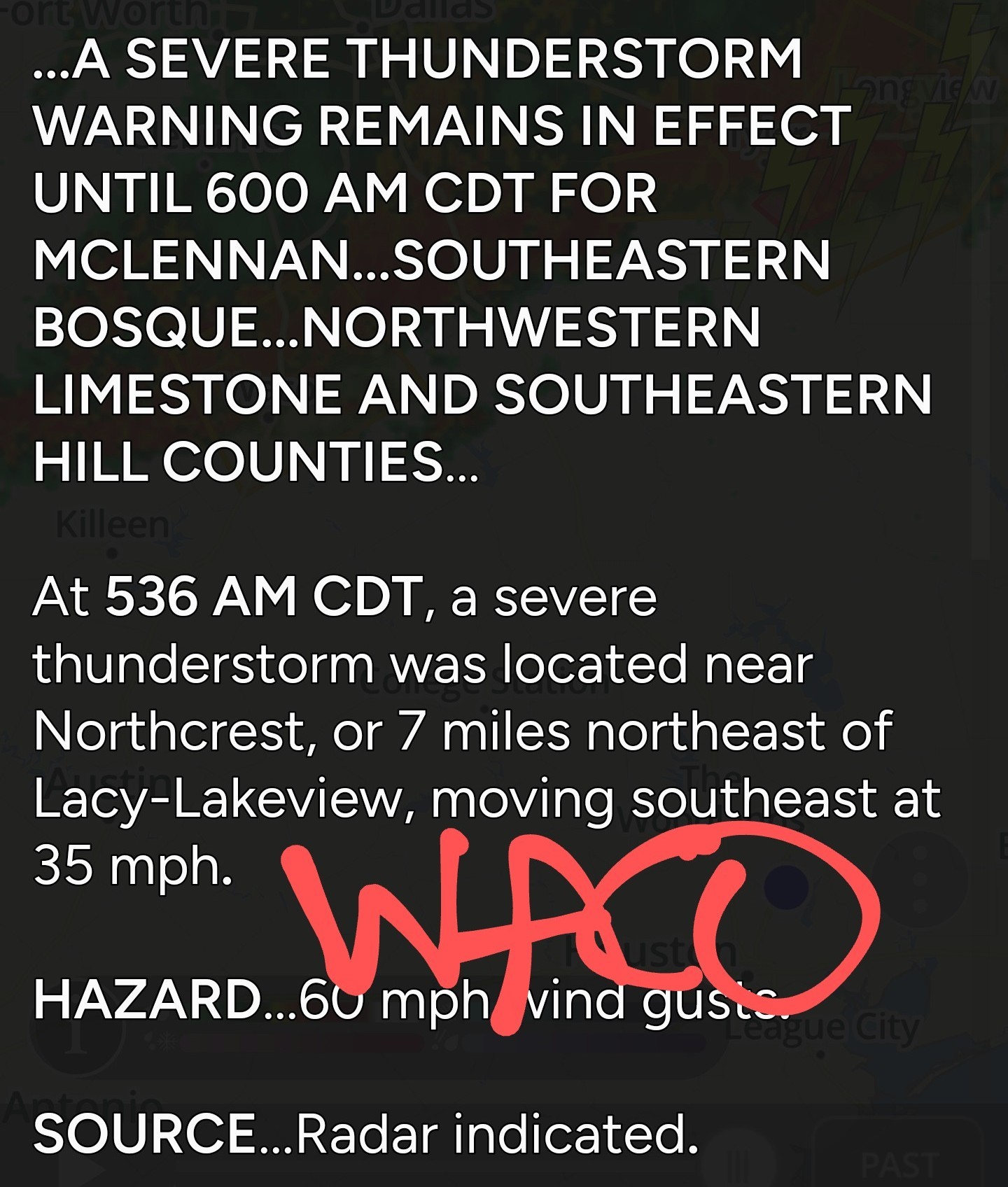
  ✳️Current severe weather warnings @ 6AM: It is currently TORNADO and SEVERE THUNDERSTORM warned (See pics below - Tyler, Lake Palestine and Waco)
 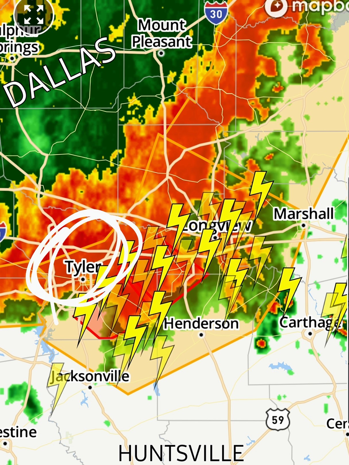 🚨 Tornado warning - Whitehouse TX:
  🚨 Severe Thunderstorm Warning - Lake Palestine TX:
  🚨 Severe Thunderstorm Warning - Waco TX:
 SO- we should see some storms today. (Not necessarily severe) This evening is looking a lot more promising than this morning/early afternoon - but we'll see about that. I'll check back in later! 💚💚💚


**********************
Replies:
thank you for sharing this - I had no idea these storms were to the north. Will it ever let up - seems it's severe weather threats almost everyday!
StormChaser: I'm in Huntsville and it's partly cloudy now. Hopefully any rain will hold off until later in the evening, after 7pm.
Headed to dog park to get in a few miles. May drive thru and wash my car...should help us get some rain!
Current radar: 8:30AM The line is still chugging this way. No warnings on it currently, which is good. The newest HRRR run has the line holding together and coming thru Harris County around lunch time. We'll see. 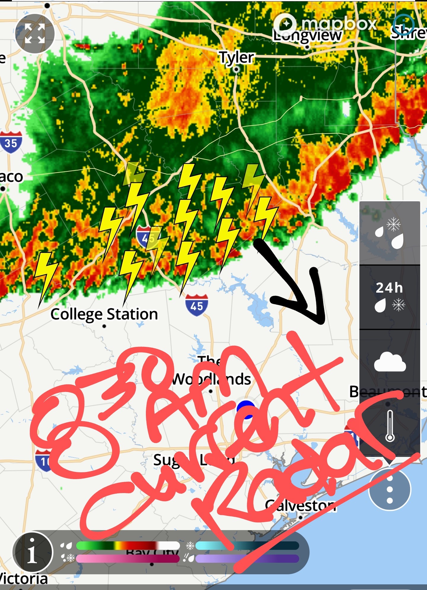
Special Weather Statement At 829 AM CDT, Doppler radar was tracking strong thunderstorms along a line extending from 14 miles west of Trinity to 8 miles northeast of Thorndale. Movement was southeast at 20 mph. HAZARD...Wind gusts up to 50 mph and pea size hail. SOURCE...Radar indicated. IMPACT...Gusty winds could knock down tree limbs and blow around unsecured objects. Minor hail damage to vegetation is possible. Locations impacted include... College Station, Bryan, Huntsville, Madisonville, Snook, Riverside, Bedias, Kurten, Wixon Valley, Kyle Field, Bryan Utilities Lake, Iola, Crabbs Prairie, North Zulch, Wellborn, and Carlos. PRECAUTIONARY/PREPAREDNESS ACTIONS...if outdoors, consider seeking shelter inside a building.
I washed my filthy car yesterday. No clue how it got so grimy. That should help with our rain chances.
Monday radar - 6AM 6AM radar shows a nasty line of storms currently north of Houston. This line stretches from Waco thru Tyler and into Arkansas & Louisiana. This line is moving south but the question is: ➡️ Will it hold together & make it to Houston? ✳️ Unfortunately, as of 6AM, The HRRR shows the line breaking apart just north of us as it shifts into Louisiana. ✳️1pm HRRR forecast model: 🚨 BUT -- The HRRR at 10pm tonight shows a large area of showers and thunderstorms moving into Houston and that looks more promising than the line to our north this AM. ✳️10pm HRRR future forecast model: ************************** ✳️Current severe weather warnings 6AM: It is currently TORNADO and SEVERE THUNDERSTORM warned (See pics below - Tyler, Lake Palestine and Waco) 🚨 Tornado warning - Whitehouse TX: 🚨 Severe Thunderstorm Warning - Lake Palestine TX: 🚨 Severe Thunderstorm Warning - Waco TX: SO- we should see some storms today. (Not necessarily severe) This evening is looking a lot more promising than this morning/early afternoon - but we'll see about that. I'll check back in later! 💚💚💚
 StormChaser : oh wait wait - breaks apart you say😫😫😫
I washed my filthy car yesterday. No clue how it got so grimy. That should help with our rain chances.
Annie : Yes dear, you did your part!!
I would say with the hot temperatures that it would aid in holding together😕
Rained for 30 minutes in Huntsville. Fingers crossed, the rest of the day is clear, at least until I get home.
Noon radar : Steady rain coming down in Trailwood. 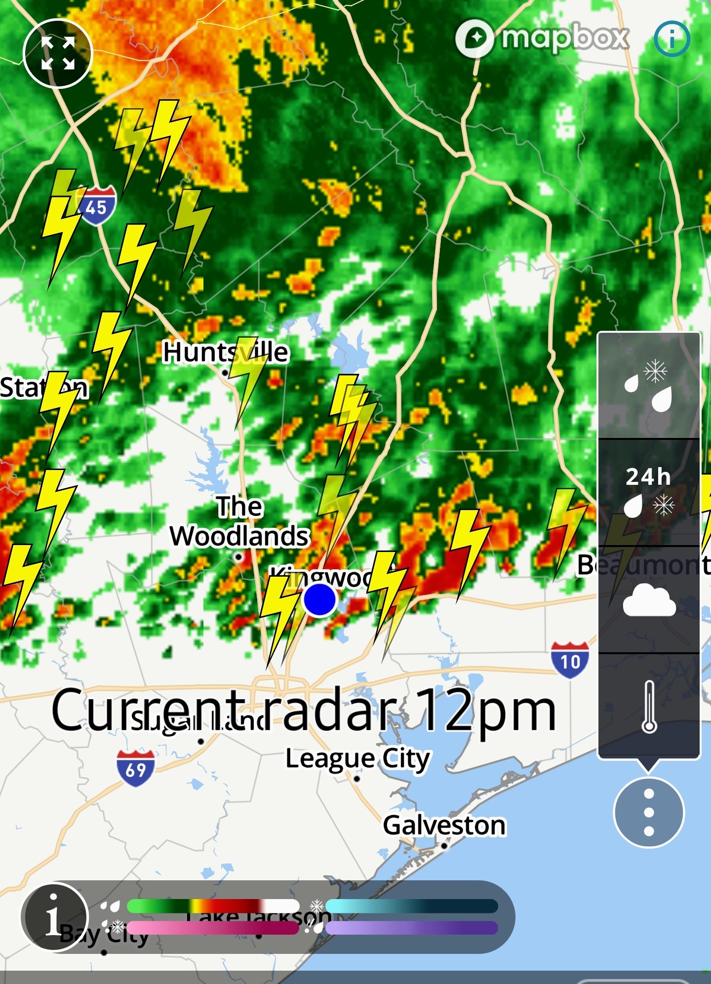
The arrow you drew is spot on. It looks like it's beginning to subside some and there was actually just a little bit of sun out. Thank you!
StormChaser : We got a couple rounds of much needed rain. Now the sun is shining.
Hope you are having a good weekend.
« Back to Chat
Views: 619
# Replies: 15