


Special weather statement
Special weather statement


Joined:
X days ago
# Posts:
X,XXX
Contributor Points:
X


Special weather statement Strong storms headed our way. Nothing severe at your point but 40mph winds are expected in these cells. Heaviest cell looks to stay just to our west but the line is headed this direction. Btw it's a "cool" front that will make today pleasant before it backs up over us tomorrow as a......warm front. 🤦♀️ So enjoy the 24 hours semi cooler temps. Issued By:
Houston/Galveston - TX, US, National Weather Service. 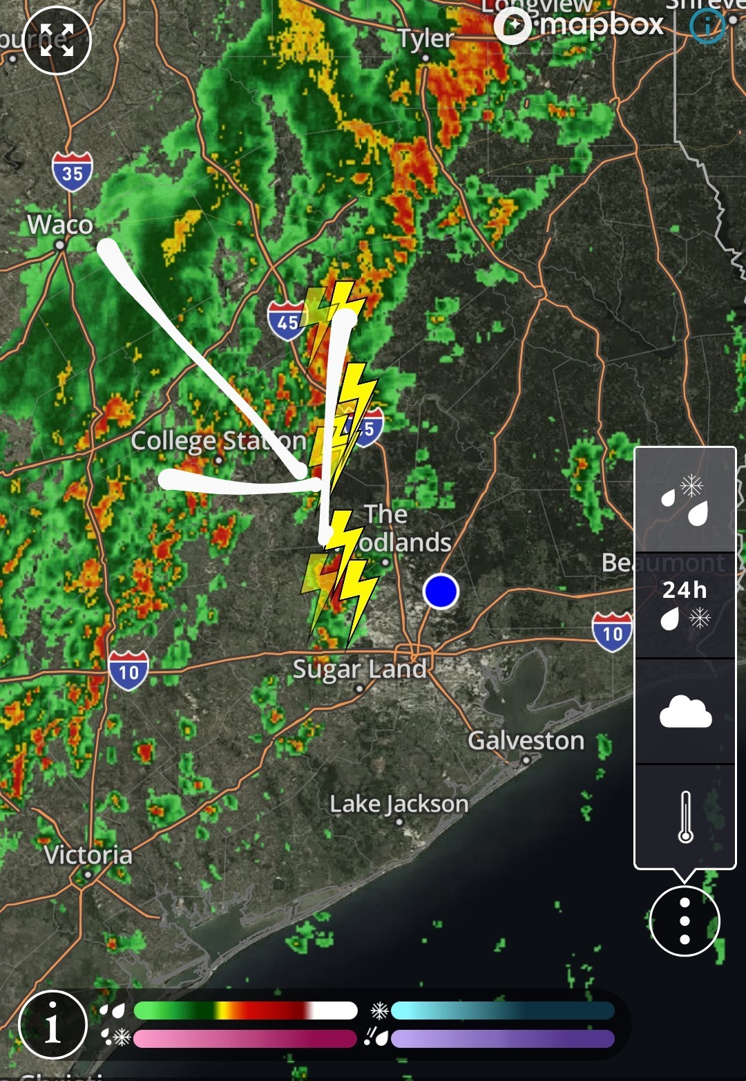 Affected Areas:
Inland Harris County. Description:
GUSTY SHOWERS & THUNDERSTORMS WILL IMPACT SOUTHERN MONTGOMERY CO, NORTHERN HARRIS COUNTY & SOUTHEASTERN WALLER THROUGH 215 AM CST... At 148 AM CST, Doppler radar was tracking gusty storms near Katy, moving northeast at 25 mph. HAZARD...Wind gusts up to 40 mph. SOURCE...Radar indicated. IMPACT...Gusty winds could knock down tree limbs and blow around unsecured objects. Locations impacted include... Katy, Tomball, Jersey Village, Willowbrook, Cypress, and Hooks Airport, Bush IAH . PRECAUTIONARY/PREPAREDNESS ACTIONS... If outdoors, consider seeking shelter inside a building. MAX HAIL SIZE...0.00 IN; MAX WIND GUST...40 MPH


Houston/Galveston - TX, US, National Weather Service.
Inland Harris County.
GUSTY SHOWERS & THUNDERSTORMS WILL IMPACT SOUTHERN MONTGOMERY CO, NORTHERN HARRIS COUNTY & SOUTHEASTERN WALLER THROUGH 215 AM CST...
Discussion Summary:
Special Weather Statement: Strong storms with 40mph winds expected in Harris County, TX, leading to potential hazards and gusty showers and thunderstorms.
Special Weather Statement: Strong storms with 40mph winds expected in Harris County, TX, leading to potential hazards and gusty showers and thunderstorms.
Discussion Insights:
Ask a question about this discussion and an AI bot will try to give an answer.
Ask a question about this discussion and an AI bot will try to give an answer.
Replies:

|
FYI The line looks to come thru here around 5am.


Special weather statement Strong storms headed our way. Nothing severe at your point but 40mph winds are expected in these cells. Heaviest cell looks to stay just to our west but the line is headed this direction. Btw it's a "cool" front that will make today pleasant before it backs up over us tomorrow as a......warm front. ?♀️ So enjoy the 24 hours semi cooler temps. Issued By:
Houston/Galveston - TX, US, National Weather Service. Affected Areas:
Inland Harris County. Description:
GUSTY SHOWERS & THUNDERSTORMS WILL IMPACT SOUTHERN MONTGOMERY CO, NORTHERN HARRIS COUNTY & SOUTHEASTERN WALLER THROUGH 215 AM CST... At 148 AM CST, Doppler radar was tracking gusty storms near Katy, moving northeast at 25 mph. HAZARD...Wind gusts up to 40 mph. SOURCE...Radar indicated. IMPACT...Gusty winds could knock down tree limbs and blow around unsecured objects. Locations impacted include... Katy, Tomball, Jersey Village, Willowbrook, Cypress, and Hooks Airport, Bush IAH . PRECAUTIONARY/PREPAREDNESS ACTIONS... If outdoors, consider seeking shelter inside a building. MAX HAIL SIZE...0.00 IN; MAX WIND GUST...40 MPH
Houston/Galveston - TX, US, National Weather Service.
Inland Harris County.
GUSTY SHOWERS & THUNDERSTORMS WILL IMPACT SOUTHERN MONTGOMERY CO, NORTHERN HARRIS COUNTY & SOUTHEASTERN WALLER THROUGH 215 AM CST...
 Jeepinbear tipped StormChaser 100 credits for a post in this forum discussion.
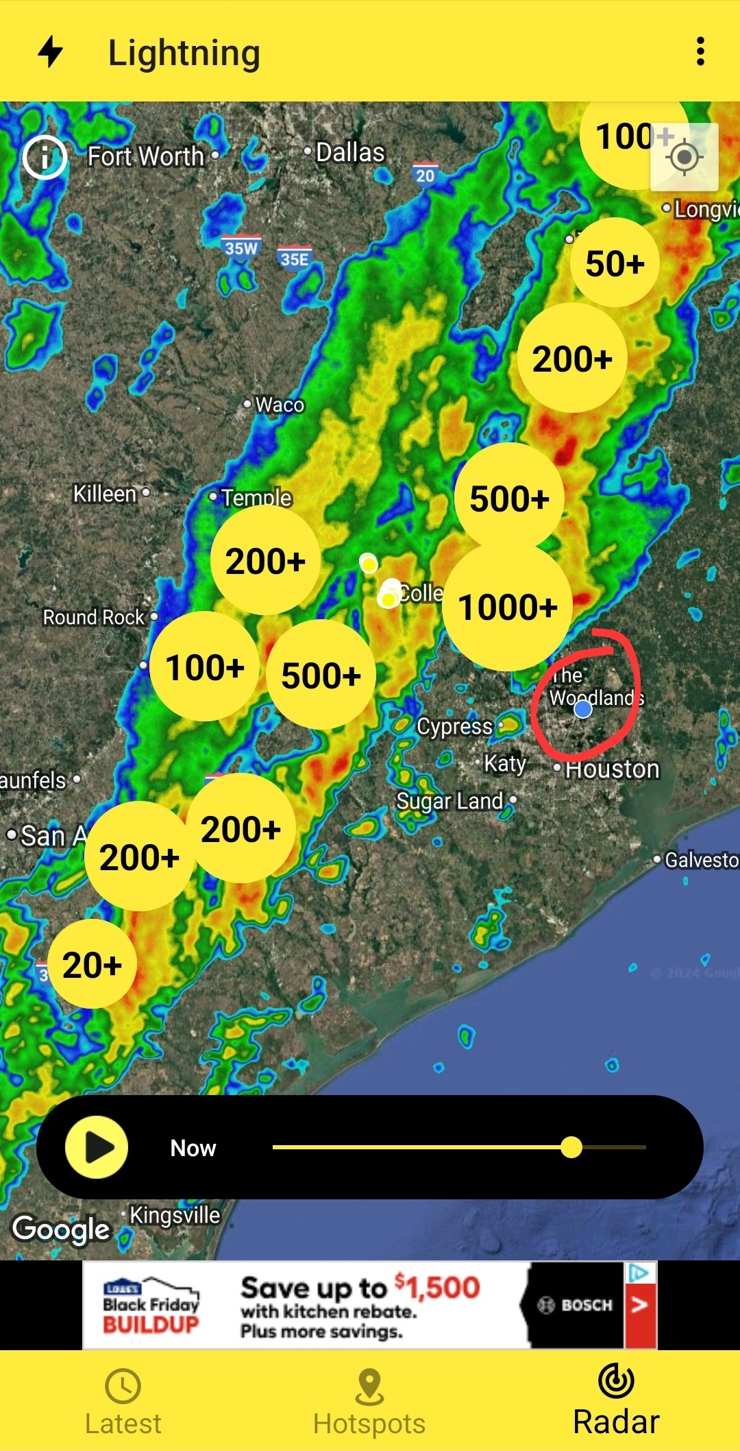
Preparing us for the coming Hurricane?....
Special weather statement Strong storms headed our way. Nothing severe at your point but 40mph winds are expected in these cells. Heaviest cell looks to stay just to our west but the line is headed this direction. Btw it's a "cool" front that will make today pleasant before it backs up over us tomorrow as a......warm front. ?♀️ So enjoy the 24 hours semi cooler temps. Issued By:
Houston/Galveston - TX, US, National Weather Service. Affected Areas:
Inland Harris County. Description:
GUSTY SHOWERS & THUNDERSTORMS WILL IMPACT SOUTHERN MONTGOMERY CO, NORTHERN HARRIS COUNTY & SOUTHEASTERN WALLER THROUGH 215 AM CST... At 148 AM CST, Doppler radar was tracking gusty storms near Katy, moving northeast at 25 mph. HAZARD...Wind gusts up to 40 mph. SOURCE...Radar indicated. IMPACT...Gusty winds could knock down tree limbs and blow around unsecured objects. Locations impacted include... Katy, Tomball, Jersey Village, Willowbrook, Cypress, and Hooks Airport, Bush IAH . PRECAUTIONARY/PREPAREDNESS ACTIONS... If outdoors, consider seeking shelter inside a building. MAX HAIL SIZE...0.00 IN; MAX WIND GUST...40 MPH
Houston/Galveston - TX, US, National Weather Service.
Inland Harris County.
GUSTY SHOWERS & THUNDERSTORMS WILL IMPACT SOUTHERN MONTGOMERY CO, NORTHERN HARRIS COUNTY & SOUTHEASTERN WALLER THROUGH 215 AM CST...
 JandS89 tipped StormChaser 100 credits for a post in this forum discussion.
« Back to Chat
Views: 726
# Replies: 9