


Afternoon/evening storms possible
Afternoon/evening storms possible

This discussion has been locked.

Joined:
X days ago
# Posts:
X,XXX
Contributor Points:
X


Afternoon/evening storms possible Thunderstorm Chances For Monday Afternoon And Evening Look A Little Bit Higher Eric Berger · Monday, July 1, 2024 4:11 PM In brief:
*As a boundary pushes in from East Texas, the potential for storms is a little bit higher today than expected.
*However, while the line of storms currently on the radar is impressive, it's not clear whether this system will hold together all the way into Houston. *In this morning's post I mentioned there was "a bit of intrigue" regarding storm chances on Monday afternoon as a boundary pressed into the area from the east.
*As of 4 pm CT this boundary is clearly visible on radar, having moved from Louisiana into East Texas, and now slowly creeping toward the Houston metro area. 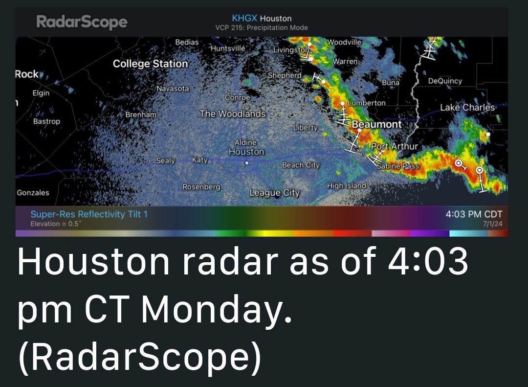 *To be frank, our high-resolution modeling guidance has completely missed the boat on this storm development today, and I don't have a great answer as to what happens later this afternoon and evening.
*My best guess is that this boundary will continue to slide west, but as the storms approach and move into the Houston area they will weaken.
*Given the ample daytime heating over the next couple of hours, it is also possible the storms hold together and some sort of line pushes through between now and 9 pm CT. *With this post I simply wanted to call attention to the possibility that showers and thunderstorms may be a little bit more widespread this evening than previously expected. (We have no flooding concerns, regardless).
*OR - Maybe the storms will fizzle out as they move into a slightly less favorable environment. In any case, expect the unexpected this evening.


*As a boundary pushes in from East Texas, the potential for storms is a little bit higher today than expected.
*However, while the line of storms currently on the radar is impressive, it's not clear whether this system will hold together all the way into Houston.
*As of 4 pm CT this boundary is clearly visible on radar, having moved from Louisiana into East Texas, and now slowly creeping toward the Houston metro area.
*My best guess is that this boundary will continue to slide west, but as the storms approach and move into the Houston area they will weaken.
*Given the ample daytime heating over the next couple of hours, it is also possible the storms hold together and some sort of line pushes through between now and 9 pm CT.
*OR - Maybe the storms will fizzle out as they move into a slightly less favorable environment.
Discussion Summary:
Increased Thunderstorm Chances for Monday Evening in Houston as Boundary Approaches
Increased Thunderstorm Chances for Monday Evening in Houston as Boundary Approaches
Discussion Insights:
Ask a question about this discussion and an AI bot will try to give an answer.
Ask a question about this discussion and an AI bot will try to give an answer.
Replies:

|
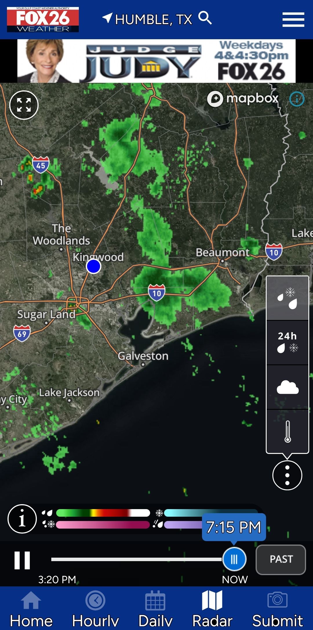
Fox26 radar. They have these storms fizzling out before they get here so the models are not in agreement on this. 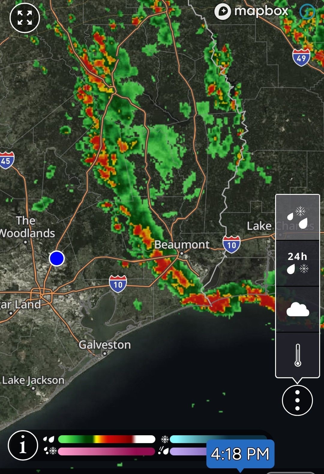
Come on clouds and rain! We need a break from this extreme heat.


I want rain, my sod isn't happy I was gone. I don't think it got watered each day like i asked  bit it also likes mother nature's water better than COH water
Afternoon/evening storms possible Thunderstorm Chances For Monday Afternoon And Evening Look A Little Bit Higher Eric Berger · Monday, July 1, 2024 4:11 PM In brief:
*As a boundary pushes in from East Texas, the potential for storms is a little bit higher today than expected.
*However, while the line of storms currently on the radar is impressive, it's not clear whether this system will hold together all the way into Houston. *In this morning's post I mentioned there was "a bit of intrigue" regarding storm chances on Monday afternoon as a boundary pressed into the area from the east.
*As of 4 pm CT this boundary is clearly visible on radar, having moved from Louisiana into East Texas, and now slowly creeping toward the Houston metro area. *To be frank, our high-resolution modeling guidance has completely missed the boat on this storm development today, and I don't have a great answer as to what happens later this afternoon and evening.
*My best guess is that this boundary will continue to slide west, but as the storms approach and move into the Houston area they will weaken.
*Given the ample daytime heating over the next couple of hours, it is also possible the storms hold together and some sort of line pushes through between now and 9 pm CT. *With this post I simply wanted to call attention to the possibility that showers and thunderstorms may be a little bit more widespread this evening than previously expected. (We have no flooding concerns, regardless).
*OR - Maybe the storms will fizzle out as they move into a slightly less favorable environment. In any case, expect the unexpected this evening.
*As a boundary pushes in from East Texas, the potential for storms is a little bit higher today than expected.
*However, while the line of storms currently on the radar is impressive, it's not clear whether this system will hold together all the way into Houston.
*As of 4 pm CT this boundary is clearly visible on radar, having moved from Louisiana into East Texas, and now slowly creeping toward the Houston metro area.
*My best guess is that this boundary will continue to slide west, but as the storms approach and move into the Houston area they will weaken.
*Given the ample daytime heating over the next couple of hours, it is also possible the storms hold together and some sort of line pushes through between now and 9 pm CT.
*OR - Maybe the storms will fizzle out as they move into a slightly less favorable environment.
 Jeepinbear tipped StormChaser 100 credits for a post in this forum discussion.
|
|
5pm radar Rain has weakened some big it's not done just yet. 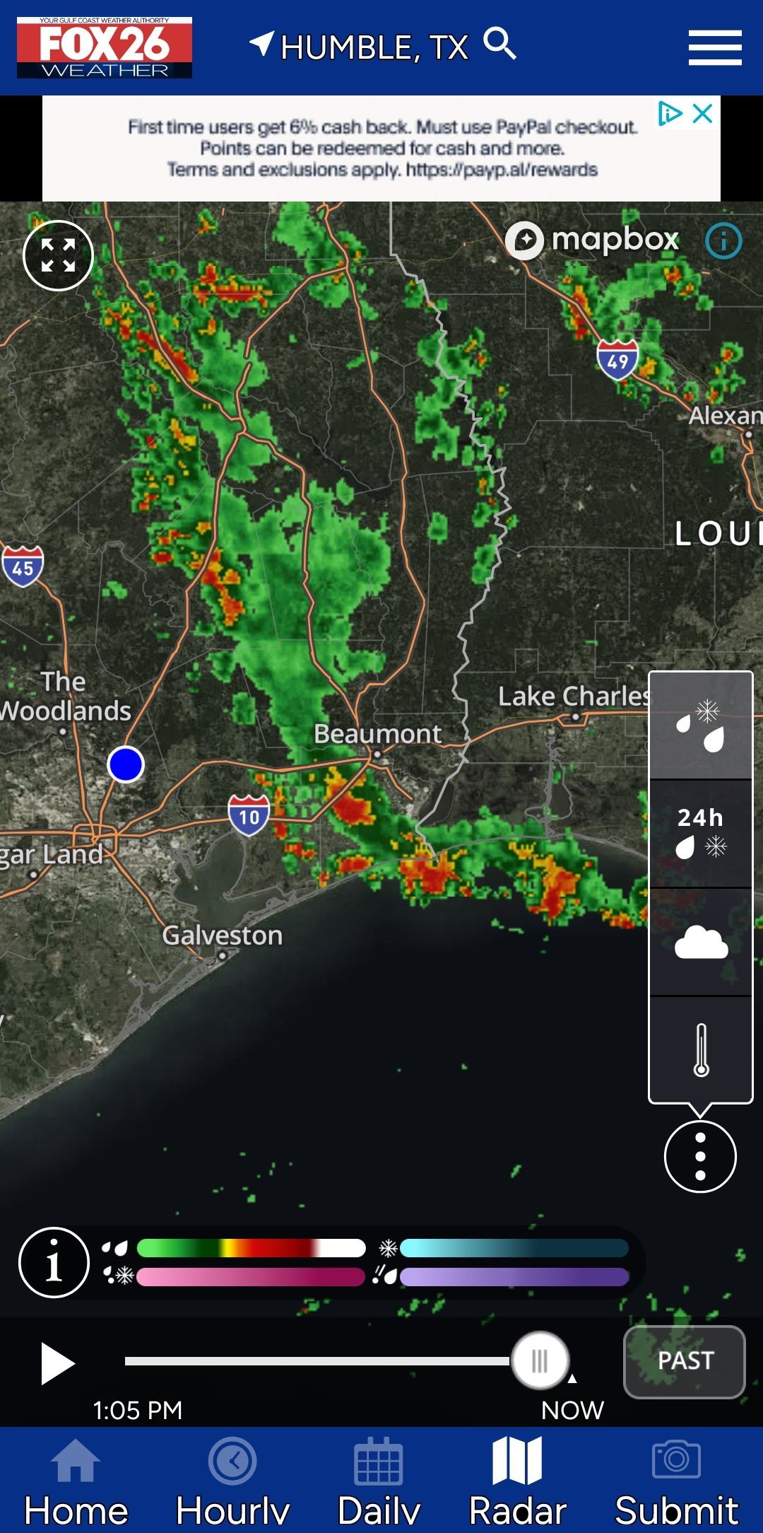
Good. The unmetered water ended now I think so I'm relying on the rain to water the grass.
This discussion has been locked.
« Back to ChatViews: 1,106
# Replies: 15