


Weekend forecast (severe storms possible)
Weekend forecast (severe storms possible)


Joined:
X days ago
# Posts:
X,XXX
Contributor Points:
X


Weekend forecast (severe storms possible) *Beautiful conditions continue today (Friday)
*Severe weather possible Saturday afternoon and overnight into early Sunday AM.
*We won't get out of the 50s on Sunday or the 40s on Monday with rainy, blustery conditions.
*A chilly week ahead with more rain in the forecast by Thursday. .............. From Space City Weather: Doorbusting deals on more winter-like weather possible by Sunday and especially Monday in Houston. Matt Lanza · Friday, November 28, 2025 8:57 AM In brief:
*Scattered showers and thunderstorms return to Houston on Saturday with a low-end (marginal, 1/5) severe weather risk.
*Any severe weather will be isolated.
*Much colder weather will follow Sunday with highs in the 50s.
*Periods of rain and temperatures in the 40s (!) on Monday.
*Nicer weather after Monday. I hope you all had a wonderful Thanksgiving, and a special thank you to those who were working during the holiday. We can speak graciously of our colleagues at the National Weather Service office or those on TV. But we know many others were needed at work too. So, thank you. TODAY (FRIDAY) - *Quiet weather is with us for one more day.
*Look for clouds to perhaps increase through the afternoon or evening hours as we begin to transition back to a warmer air mass ahead of tomorrow's next front and storm system. SATURDAY - 👉 Alright, the headline for Saturday is that the entire area is under a marginal risk (1/5) for severe storms. 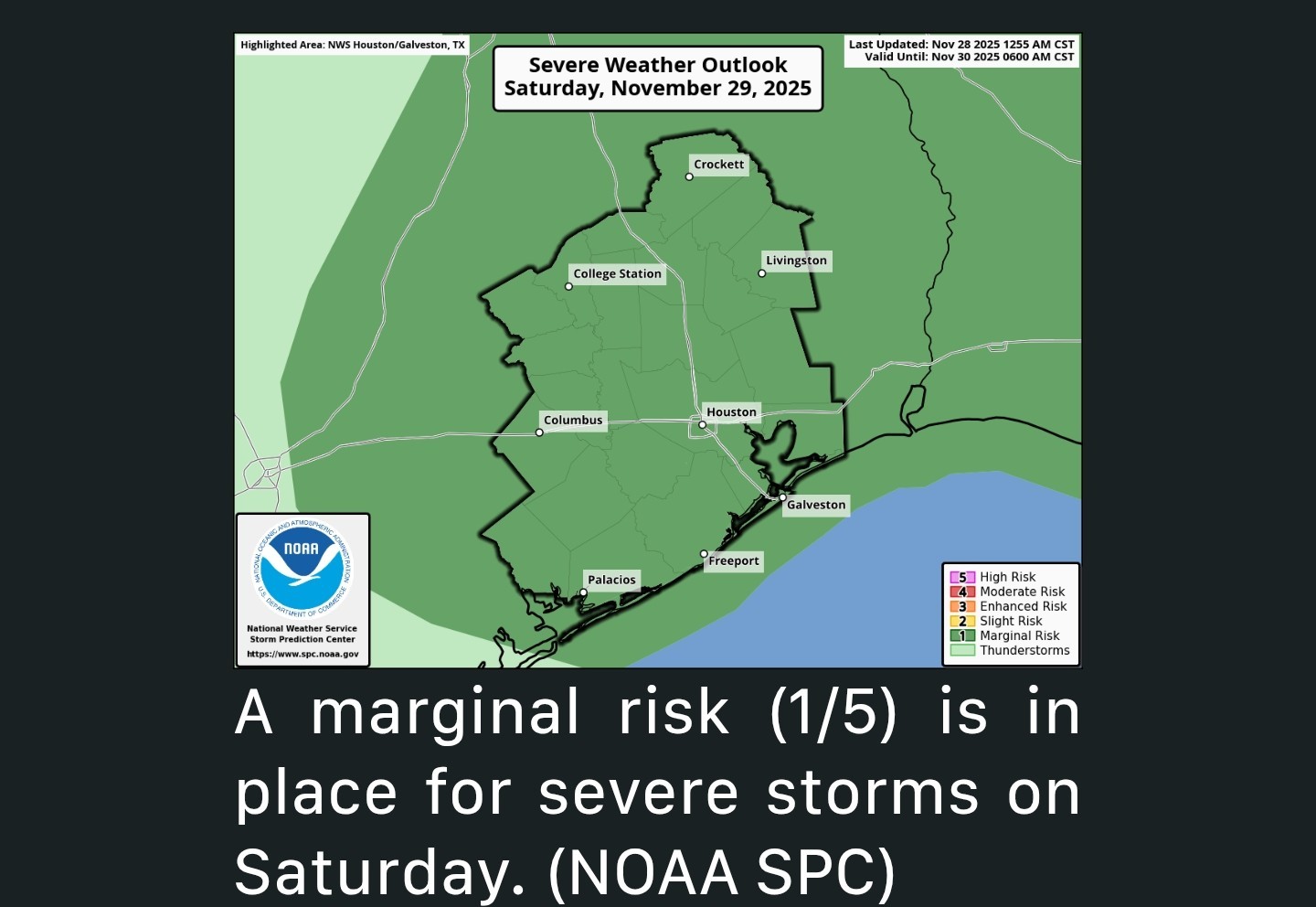 👉 Back on Monday, we were in a slight risk (2/5), so the setup this time around is a tinge less impressive. Just want to benchmark this. That said, here's how it should play out. ⚡️ SATURDAY MORNING:
*If you have plans in the morning hours tomorrow, a few showers, drizzle, or sprinkles are possible - nothing worse than that.
*The morning hours looks fine. ⚡️ SATURDAY AFTERNOON:
*Showers will become more scattered, especially north and west of Downtown Houston, with an isolated strong to severe storm possible after 2-3 PM or so.
*All modes of severe weather (strong winds, hail, isolated tornadoes) are in play Saturday but none looks especially likely.
*In most cases, storms will be benign with just thunder, lightning, and heavy downpours, but one or two could push severe levels. ⚡️ SATURDAY EVENING:
*Isolated strong to severe storms will continue to be possible north and west of Houston.
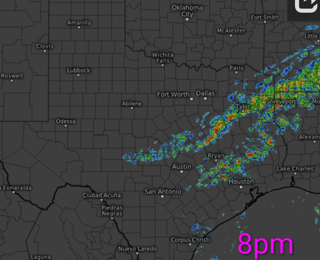
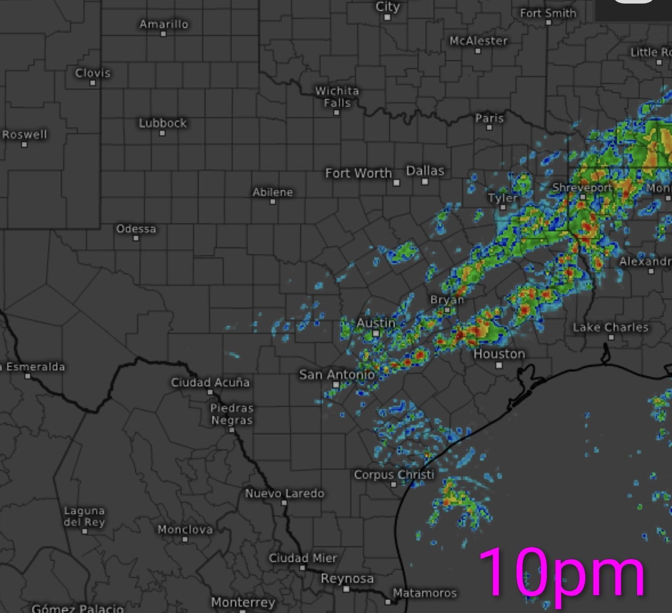
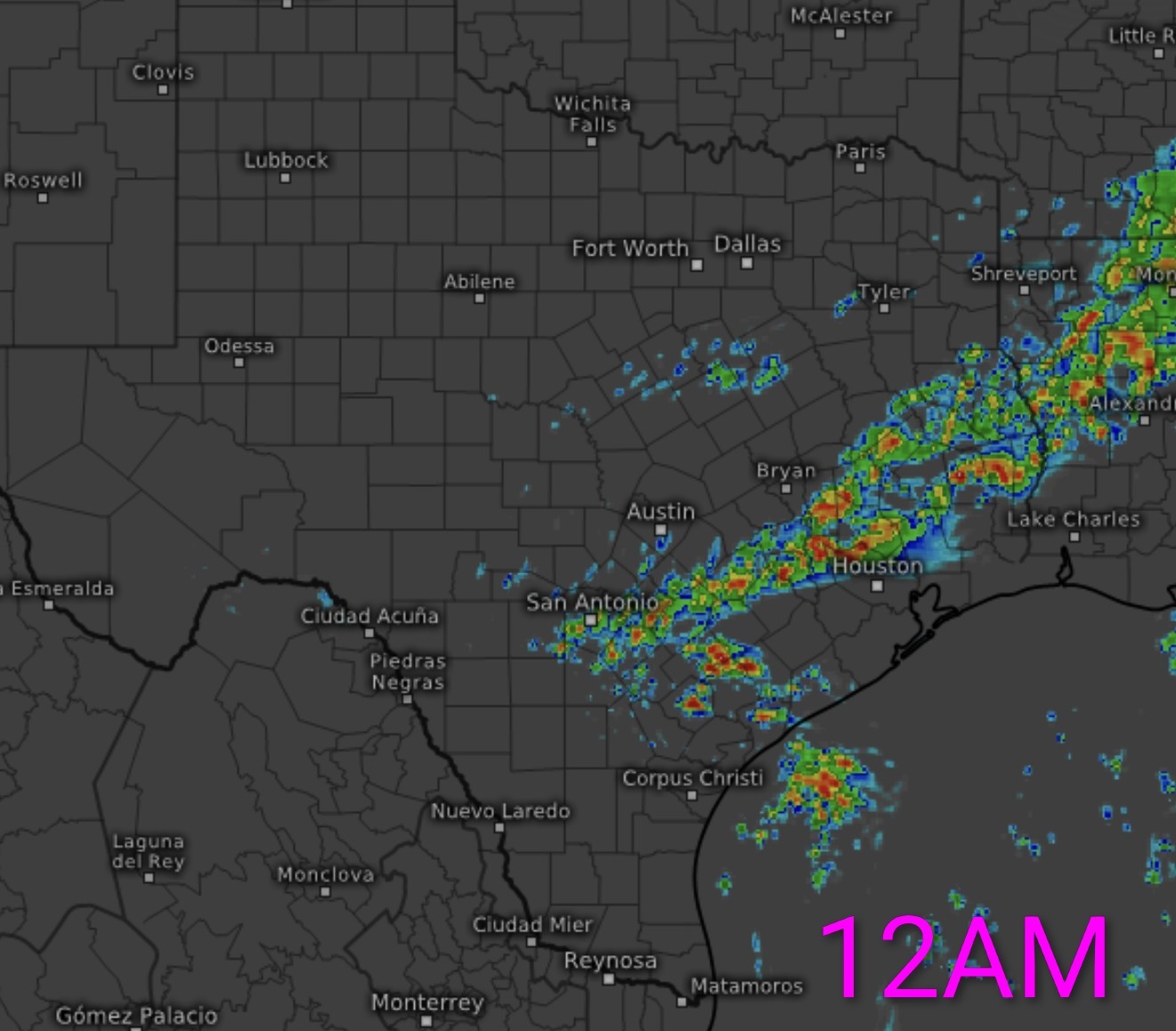
*A squall line of widespread, moderate thunderstorms should develop and track south and east after 8 to 10 PM, reaching the coast by about 2 to 3 AM.
*Within this line of storms could be some gusty winds to 40 mph or so. (I think this is especially true around Galveston Bay or on the Island)
*The risk of tornadoes or hail should back off.
*After 3 AM, the line of storms should push offshore and conditions will improve.
*Gusty north winds will follow, with gusts at times of 30 to 35 mph or even a little stronger on the coast. 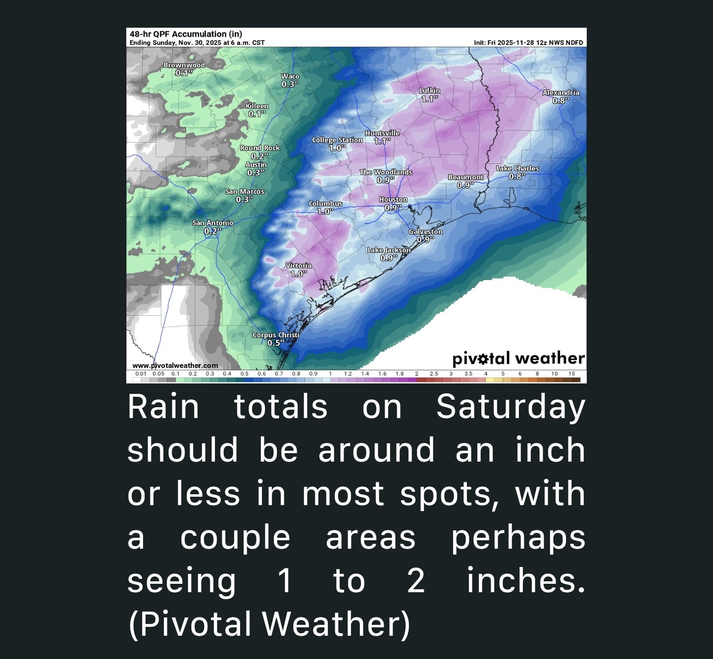 SUNDAY - *We'll close the weekend on a bit of a chilly, raw note.
*Look for clouds to dominate, though I'll hold out hope for at least a little sunshine in a few spots....Maybe.
*Temperatures will be steady in the low-50s.
*IF we see some sun, we could pop into the mid-50s. MONDAY - *Our next storm system glides in Sunday night, delivering a wintry-type day Monday.
*Expect chilly temperatures, mostly in the 40s Monday.
*Some places may be lucky to get above 45 degrees.
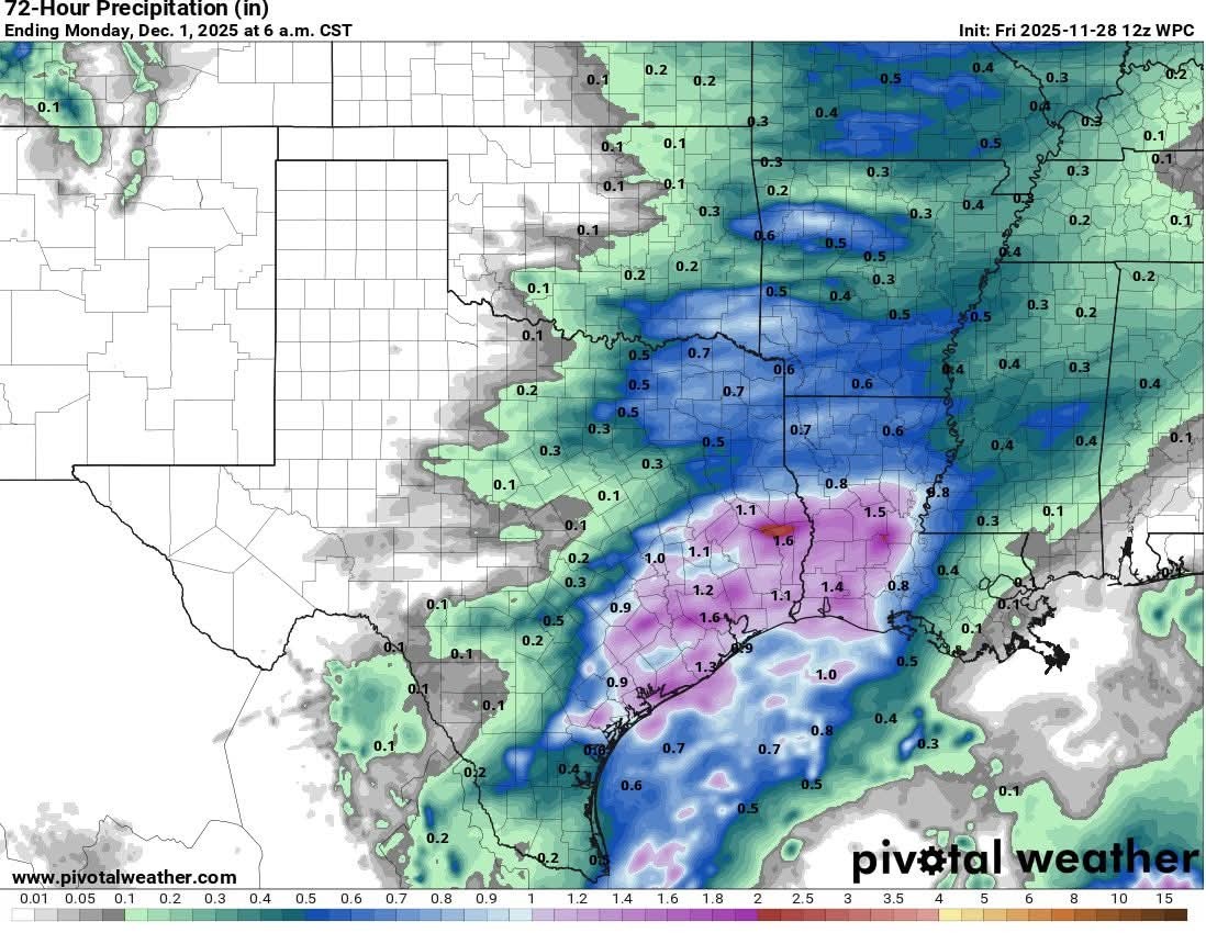
*Look for periods of rain, showers, and probably even a couple rumbles of thunder around the area. 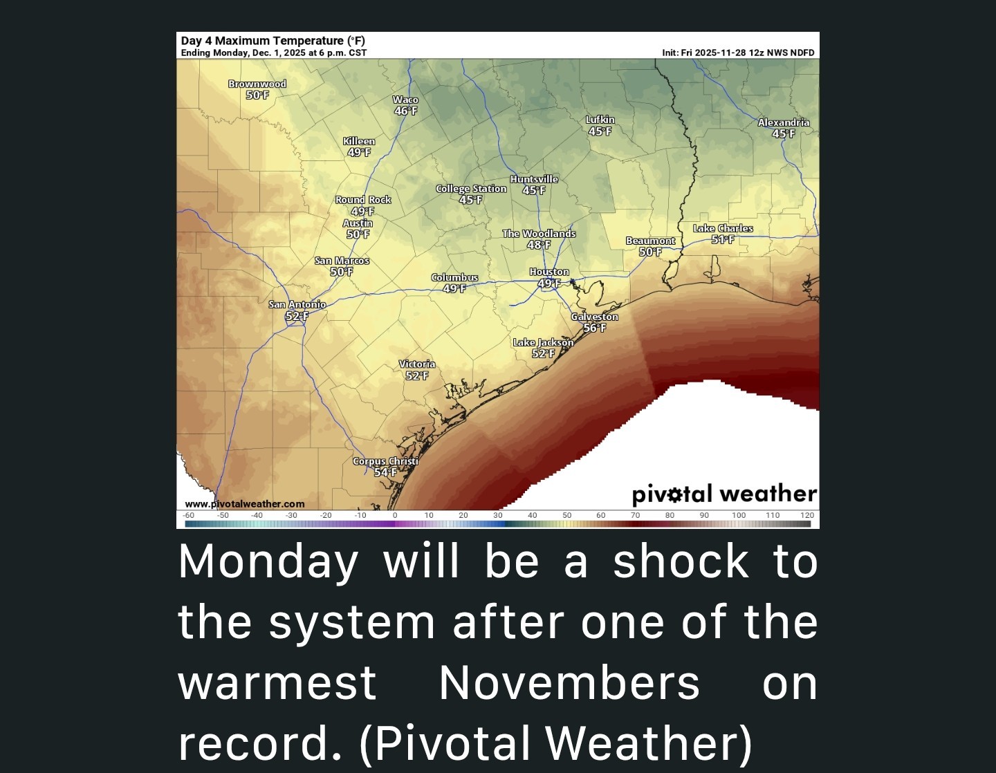 *Rain totals are a little less confident of a forecast, as these types of setups tend to favor the coastal areas, where perhaps 1 inch or more of rain is possible.
*However, some model guidance does include higher totals inland as well.
*For now, I would expect a quarter to half-inch on average with pockets of the area likely seeing 1 inch or more. AFTER MONDAY - *Quieter weather follows Monday, with our next chance of rain perhaps Thursday or Friday.
*Tuesday and Wednesday morning will see lows in the 30s and low-40s, so it'll be chilly.
*Highs will be in the 50s on Wednesday and back into the 60s on Thursday and Friday.


buffaloglenn, CatalinaKitKat and LittleTexas + 3 more reacted *Severe weather possible Saturday afternoon and overnight into early Sunday AM.
*We won't get out of the 50s on Sunday or the 40s on Monday with rainy, blustery conditions.
*A chilly week ahead with more rain in the forecast by Thursday.
*Scattered showers and thunderstorms return to Houston on Saturday with a low-end (marginal, 1/5) severe weather risk.
*Any severe weather will be isolated.
*Much colder weather will follow Sunday with highs in the 50s.
*Periods of rain and temperatures in the 40s (!) on Monday.
*Nicer weather after Monday.
*Look for clouds to perhaps increase through the afternoon or evening hours as we begin to transition back to a warmer air mass ahead of tomorrow's next front and storm system.
*If you have plans in the morning hours tomorrow, a few showers, drizzle, or sprinkles are possible - nothing worse than that.
*The morning hours looks fine.
*Showers will become more scattered, especially north and west of Downtown Houston, with an isolated strong to severe storm possible after 2-3 PM or so.
*All modes of severe weather (strong winds, hail, isolated tornadoes) are in play Saturday but none looks especially likely.
*In most cases, storms will be benign with just thunder, lightning, and heavy downpours, but one or two could push severe levels.
*Isolated strong to severe storms will continue to be possible north and west of Houston.
*A squall line of widespread, moderate thunderstorms should develop and track south and east after 8 to 10 PM, reaching the coast by about 2 to 3 AM.
*Within this line of storms could be some gusty winds to 40 mph or so. (I think this is especially true around Galveston Bay or on the Island)
*The risk of tornadoes or hail should back off.
*After 3 AM, the line of storms should push offshore and conditions will improve.
*Gusty north winds will follow, with gusts at times of 30 to 35 mph or even a little stronger on the coast.
*Look for clouds to dominate, though I'll hold out hope for at least a little sunshine in a few spots....Maybe.
*Temperatures will be steady in the low-50s.
*IF we see some sun, we could pop into the mid-50s.
*Expect chilly temperatures, mostly in the 40s Monday.
*Some places may be lucky to get above 45 degrees.
*Look for periods of rain, showers, and probably even a couple rumbles of thunder around the area.
*However, some model guidance does include higher totals inland as well.
*For now, I would expect a quarter to half-inch on average with pockets of the area likely seeing 1 inch or more.
*Tuesday and Wednesday morning will see lows in the 30s and low-40s, so it'll be chilly.
*Highs will be in the 50s on Wednesday and back into the 60s on Thursday and Friday.
Replies:
TOMORROW'S TORNADO AREA: Storms will be possible across much of east Texas tomorrow as a cold front associated with the winter storm up north pushes through. Most of the storms will be sub severe but deeper moisture being pulled northward and some stronger wind shear will make a random tornado or two possible across southeast portions of the state, including Houston once again. It's a lower end setup, but still a chance so I must mention it! 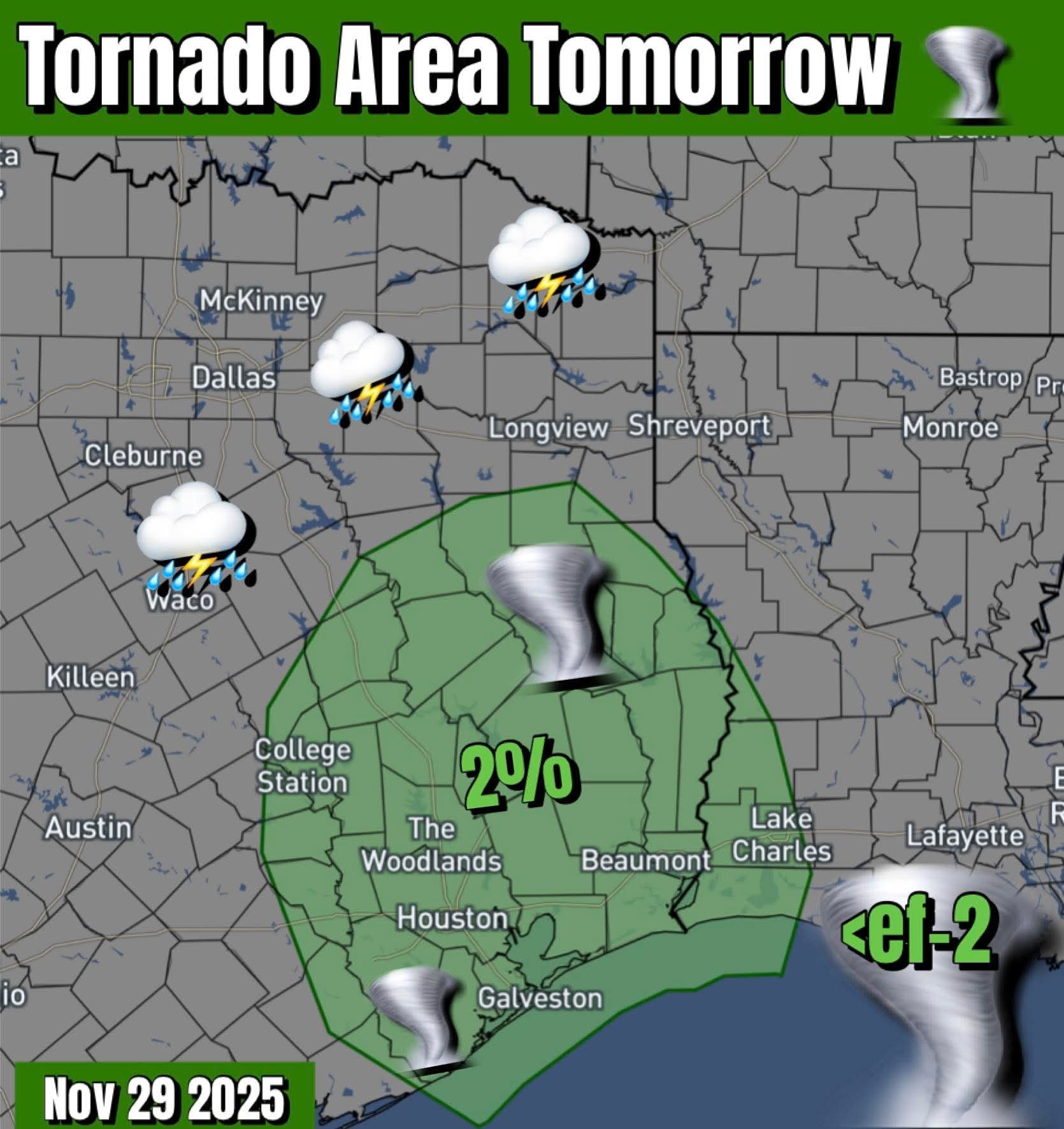
luv2eatsushi and buffaloglenn reacted
Bump. 😁 I'll post the AM update from Space City Weather when they do. For now, here is a timeline of today's forecasted storms: 👉 SATURDAY MORNING: If you have plans in the morning hours tomorrow, a few showers, drizzle, or sprinkles are possible - nothing worse than that. The morning hours looks fine. 👉 SATURDAY AFTERNOON: Showers will become more scattered, especially north and west of Downtown Houston, with an isolated strong to severe storm possible after 2-3 PM or so. All modes of severe weather (strong winds, hail, isolated tornadoes) are in play Saturday but none looks especially likely. In most cases, storms will be benign with just thunder, lightning, and heavy downpours, but one or two could push severe levels. 👉 SATURDAY EVENING: Isolated strong to severe storms will continue to be possible north and west of Houston. A squall line of widespread, moderate thunderstorms should develop and track south and east after 8 to 10 PM, reaching the coast by about 2 to 3 AM. Within this line of storms could be some gusty winds to 40 mph or so. (I think this is especially true around Galveston Bay or on the Island) The risk of tornadoes or hail should back off. After 3 AM, the line of storms should push offshore and conditions will improve. Gusty north winds will follow, with gusts at times of 30 to 35 mph or even a little stronger on the coast.
Wingsofwonder, luv2eatsushi and peppermintstick + 2 more reacted
StormChaser : Thanks my friend. Forecast changes are frequent. You do a fantastic job keeping us updated. We appreciate you.
Bump. ? I'll post the AM update from Space City Weather when they do. For now, here is a timeline of today's forecasted storms: ? SATURDAY MORNING: If you have plans in the morning hours tomorrow, a few showers, drizzle, or sprinkles are possible - nothing worse than that. The morning hours looks fine. ? SATURDAY AFTERNOON: Showers will become more scattered, especially north and west of Downtown Houston, with an isolated strong to severe storm possible after 2-3 PM or so. All modes of severe weather (strong winds, hail, isolated tornadoes) are in play Saturday but none looks especially likely. In most cases, storms will be benign with just thunder, lightning, and heavy downpours, but one or two could push severe levels. ? SATURDAY EVENING: Isolated strong to severe storms will continue to be possible north and west of Houston. A squall line of widespread, moderate thunderstorms should develop and track south and east after 8 to 10 PM, reaching the coast by about 2 to 3 AM. Within this line of storms could be some gusty winds to 40 mph or so. (I think this is especially true around Galveston Bay or on the Island) The risk of tornadoes or hail should back off. After 3 AM, the line of storms should push offshore and conditions will improve. Gusty north winds will follow, with gusts at times of 30 to 35 mph or even a little stronger on the coast.
Kittle tipped StormChaser 100 credits for a post in this forum discussion.
StormChaser : Thanks my friend. Forecast changes are frequent. You do a fantastic job keeping us updated. We appreciate you.
Kittle : Thank you! And thank you for the coins. 🩷
StormChaser : You are so kind to keep us all informed. ❤️❤️
Thank you
 StormChaser :
 Thanks for keeping me weather informed. I have to be out today & tonight.
From Jeff Lidner: - 11-28-25 @ 10:40am - Another storm system will impact the area Saturday into Sunday Thunderstorms with a couple of isolated severe storms (60mph winds or 1 inch diameter hail) will be possible along with an isolated tornado. Nearly all of the region is included in a level 1 out of 5 risk…low but not zero. Heavy rain will also be possible, but any flood threat is low given the progressive nature. ⏰️ Timing: A few showers possible Saturday morning with increasing coverage Saturday afternoon. The worst of the weather is most likely 6:00pm Saturday through 2:00am Sunday. Severe weather probabilities are shown below: 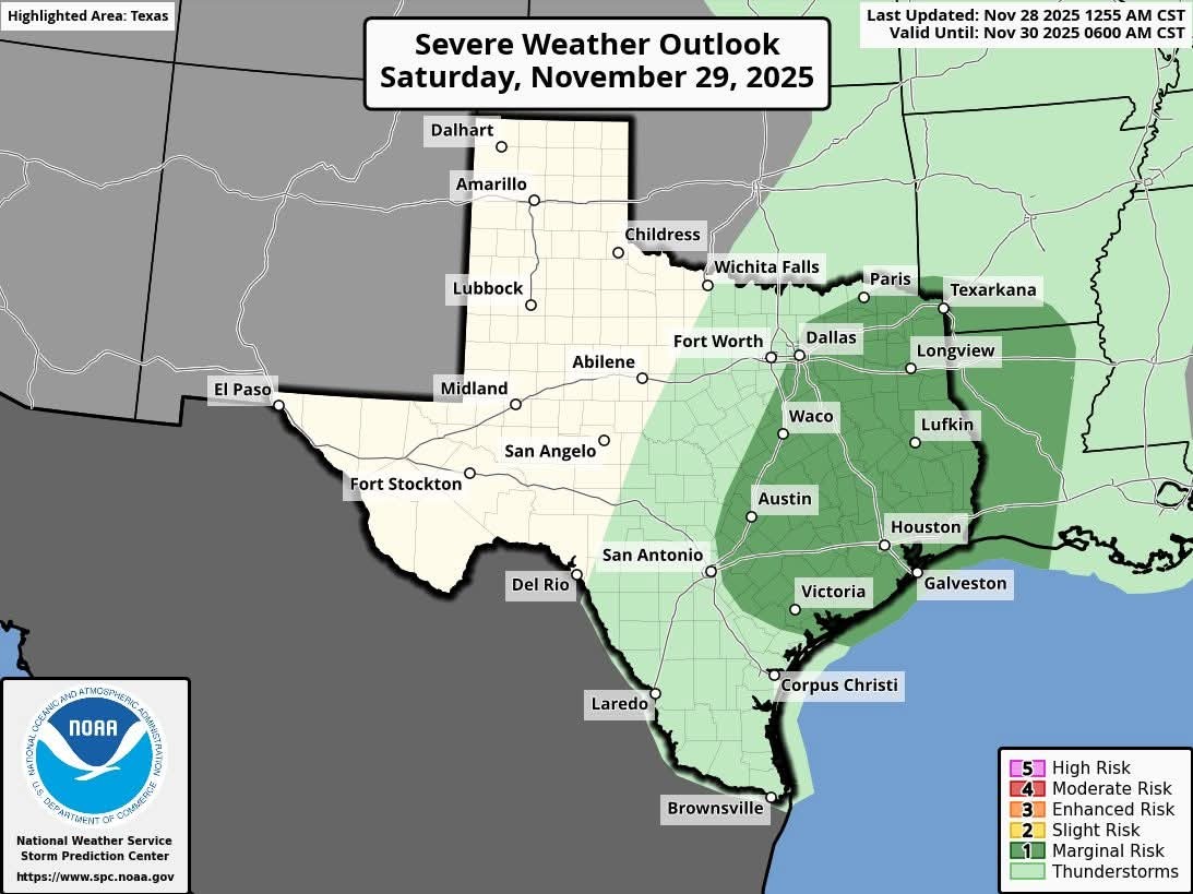
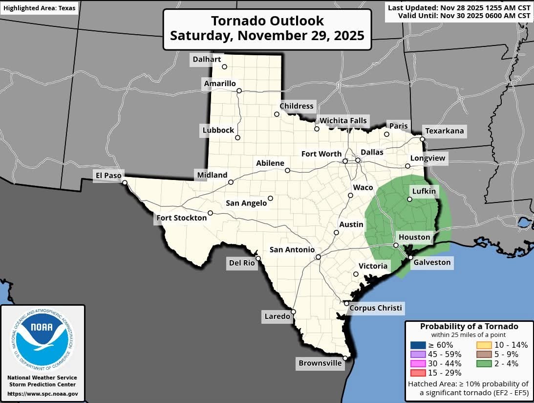
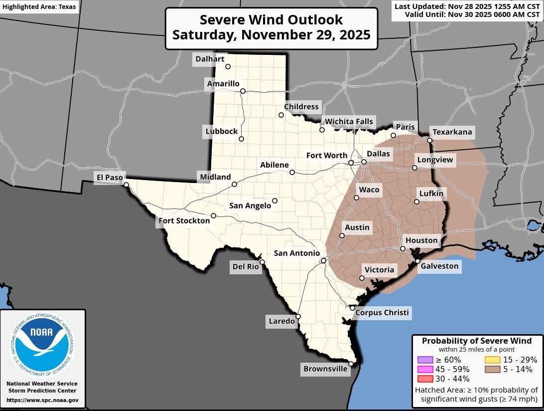
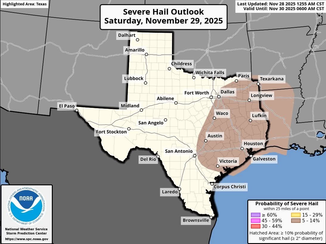
peppermintstick and SteveT reacted
**I wish you had an app that would send alerts straight to my cell**.
Wingsofwonder : Links:
weathertextalert.com /
2.
bit.ly/4fRMhFS
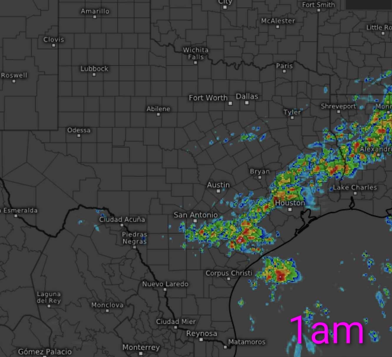
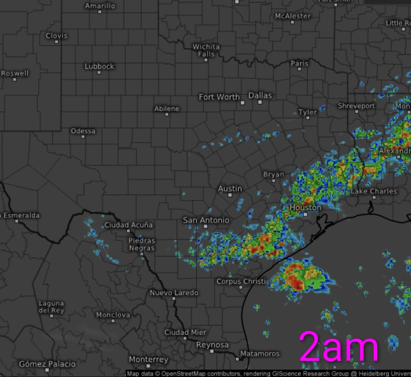
7 day rain totals! Looks like we'll actually see some decent accumulations. Today through Monday & Wednesday through Friday evening have high rain chances. 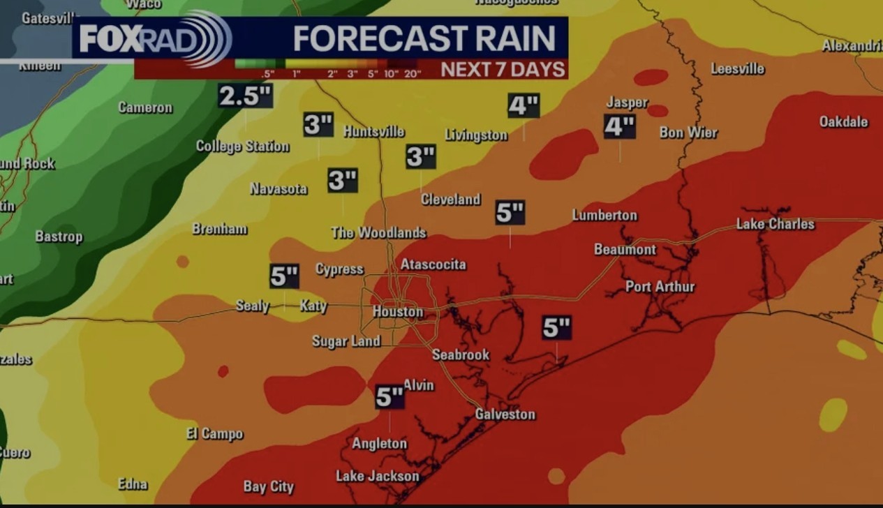
peppermintstick, RolloTomaso and cbear reacted
7 day rain totals! Looks like we'll actually see some decent accumulations. Today through Monday & Wednesday through Friday evening have high rain chances.
 StormChaser :
 « Back to Chat
Views: 1,055
# Replies: 26