


Will it or won't it?
Will it or won't it?


Joined:
X days ago
# Posts:
X,XXX
Contributor Points:
X


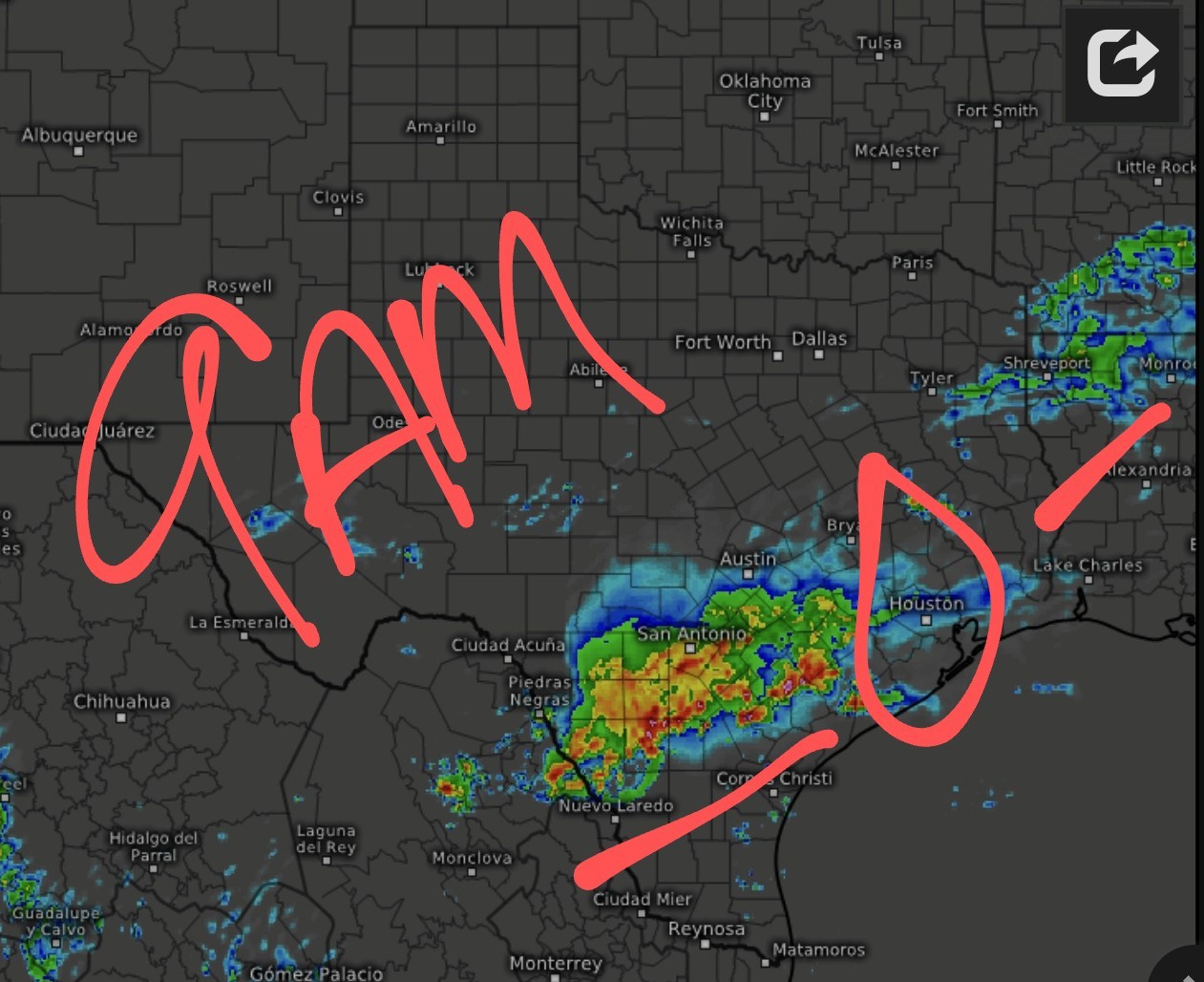
Will it or won't it? Will it or won't it? I need to start taking bets on these lines and whether they make it here or not. 😆🤦♀️ Future radar shows this line parting like the Red Sea - sooo yeah. 😔 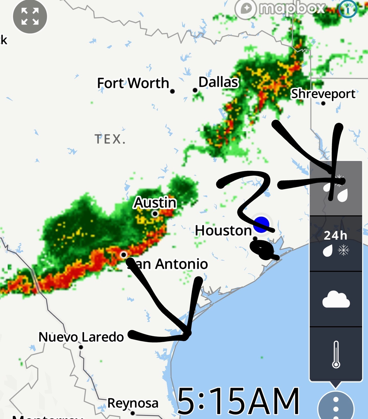 Also, the 9AM HRRR agrees that this breaks up before it gets here --
  BUT -- The HRRR for this afternoon does show a chance of rain after noon, around 2pm. We'll see if that actually happens or not. ☔️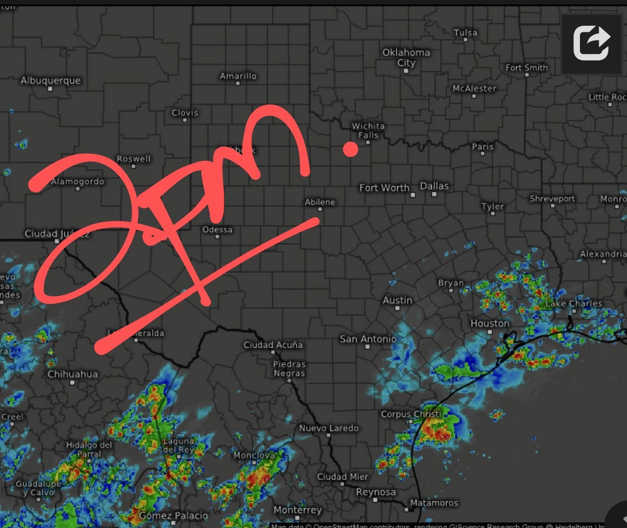


Replies:
@SetecAstronomy :
No it is not. But I did get to go out to lunch because the grass could not be cut. I always see the bright side of life 😉
No it is not. But I did get to go out to lunch because the grass could not be cut. I always see the bright side of life 😉
720AM -- I think the line will make it to Houston - BUT - I think the broken part is what will go thru Houston. 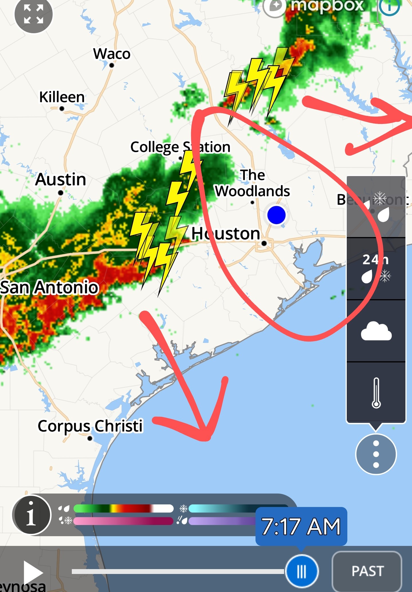
I'm so exhausted of all the storms and storm threats - please let's have some sunshine!! :-). That line better break apart - I have to go to far west Houston at 8:30 and I hate driving in a storm. Prayers
Friday morning rain and thunder headed to the Houston area. Matt Lanza · Friday, May 30, 2025 7:21 AM In brief:
*A cluster of non-severe storms will impact southern parts of the Houston area primarily this morning.
*A few additional storms could fire, especially east of I-45 or at the coast later today.
*We're also keeping tabs on a chance of storms Sunday, followed by standard June fare next week. Today -- *Another active radar this morning. It feels like it's been this way a few times this week!
*Anyway, there is a complex of non-severe thunderstorms moving into the Sealy and Prairie View areas now.
*That will head into the rest of the Houston area, especially along and south of I-10 over the next few hours. 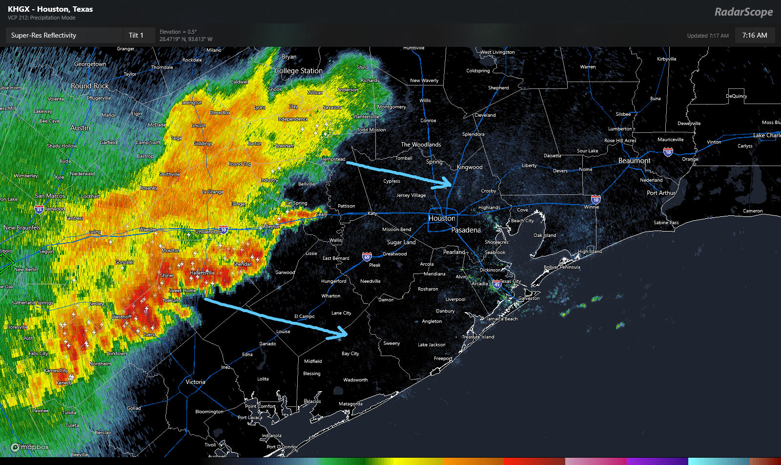 *At this point, the storms are not severe, but they are producing heavy rain and lightning, especially the southern part of the line, which is pushing through Shiner and moving toward El Campo.
*Other than the aforementioned rain and lightning, we don't think these storms will cause significant problems. *What happens next? *Models suggest this cluster of storms will weaken further as it approaches Houston.
*On the periphery, new storms may develop heading into afternoon. One or two of those storms could be on the stronger side, especially east of I-45 or along the coast.
*Outside of thunderstorms, expect some cloud cover at times.
*It'll be warm with highs in the upper-80s.
*A cluster of non-severe storms will impact southern parts of the Houston area primarily this morning.
*A few additional storms could fire, especially east of I-45 or at the coast later today.
*We're also keeping tabs on a chance of storms Sunday, followed by standard June fare next week.
*Anyway, there is a complex of non-severe thunderstorms moving into the Sealy and Prairie View areas now.
*That will head into the rest of the Houston area, especially along and south of I-10 over the next few hours.
*Other than the aforementioned rain and lightning, we don't think these storms will cause significant problems.
*On the periphery, new storms may develop heading into afternoon. One or two of those storms could be on the stronger side, especially east of I-45 or along the coast.
*Outside of thunderstorms, expect some cloud cover at times.
*It'll be warm with highs in the upper-80s.
850AM Storms have missed us  We might see some thunderstorms this afternoon so I'll update later on that if needed.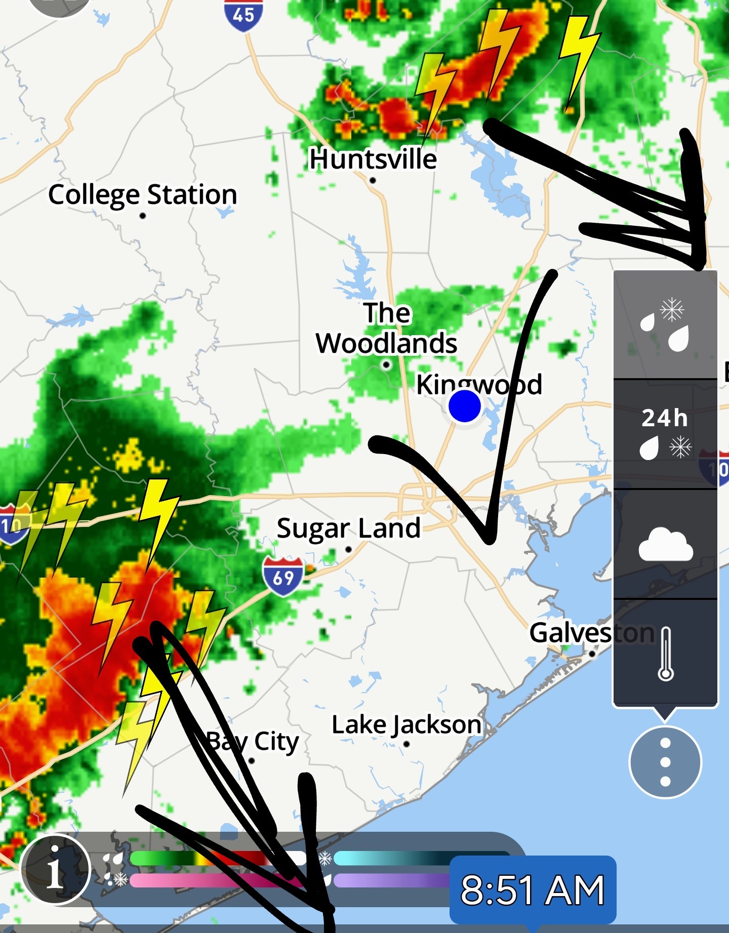
Will it or won't it? Will it or won't it? I need to start taking bets on these lines and whether they make it here or not. 😆🤦♀️ Future radar shows this line parting like the Red Sea - sooo yeah. 😔 Also, the 9AM HRRR agrees that this breaks up before it gets here -- BUT -- The HRRR for this afternoon does show a chance of rain after noon, around 2pm. We'll see if that actually happens or not. ☔️
StormChaser : For what it's worth..Fox 26 futurecast shows rain in our area around noon. Then we know what comes next....drought. Houston has evolved it seems into a drought, flood, repeat cycle that last few years. IMO. 
Well looks like I jumped the gun, I cancelled my appt across town this morning. This insane weather has my storm anxiety on high alert.
StormChaser : It's pretty dark and raining here in the IAH area. Nothing too severe, just a good soaking, don't know if it's headed toward KW, though.
« Back to Chat
Views: 525
# Replies: 18