


Removed By Request.
Removed By Request.

This discussion has been locked.

Joined:
X days ago
# Posts:
X,XXX
Contributor Points:
X


Discussion Insights:
Ask a question about this discussion and an AI bot will try to give an answer.
Ask a question about this discussion and an AI bot will try to give an answer.
Replies:


|

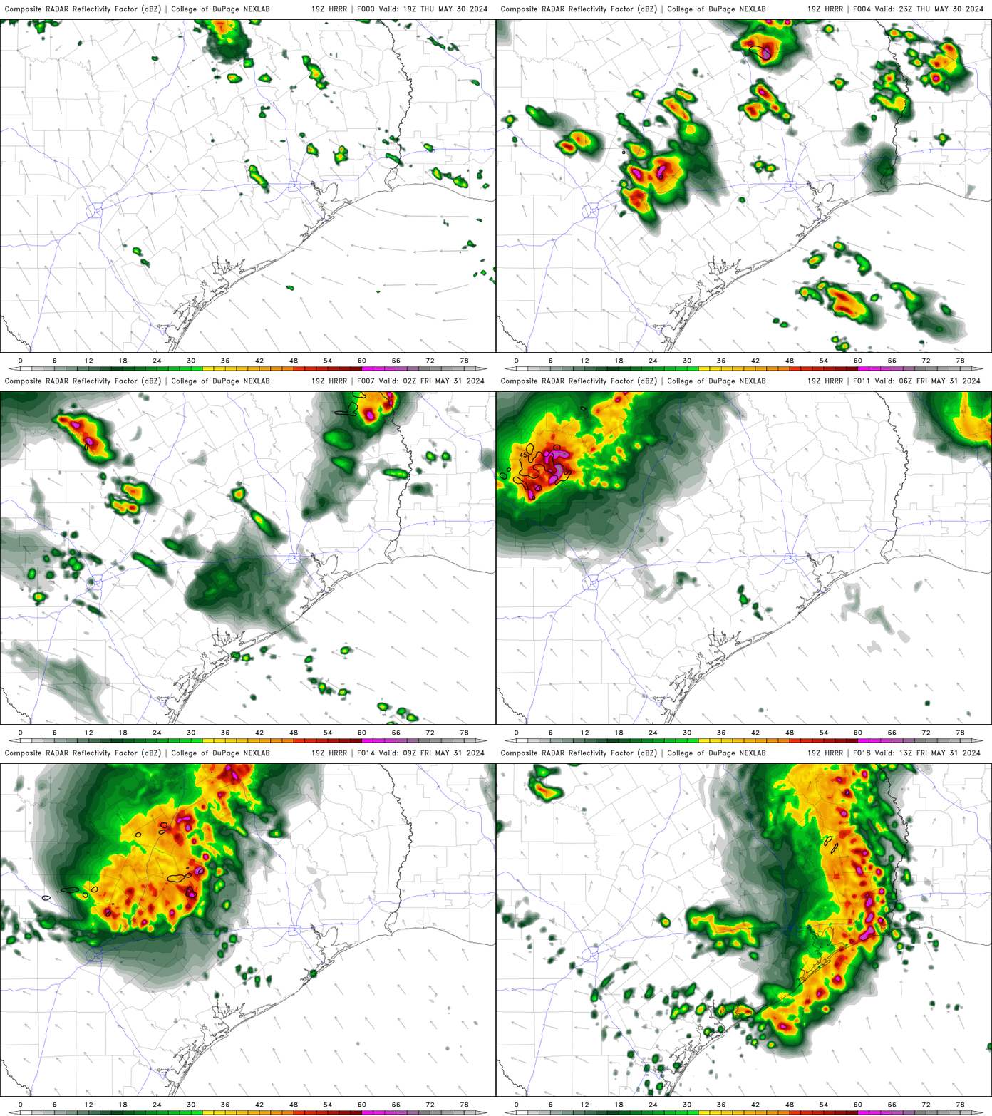
Weather update - Thur. noon I'll update this thread if storms form, which they should anytime between now and sunset. After todays possible storms we just need to get through tomorrow to get past the worst of this entire system! From Space City Weather: Stormy Pattern Continues Into The Weekend, With Friday Looking Like The Most Active Day. Eric Berger · Thursday, May 30, 2024 7:04 AM IN BRIEF: *In the absence of high pressure, Houston's atmosphere remains open to the passing of shortwave disturbances over the coming days. *At this point, Friday looks like it could see the most organized showers and thunderstorms with the greatest chance of: -Damaging winds (in excess of 50mph) -Hail. (Up to ping pong size) -Heavy rainfall. ***** UPDATE ON TODAY: THURSDAY *Skies will be partly sunny today, with high temperatures in the upper 80s. *Like on Wednesday, this daytime heating should lead to the development of showers and thunderstorms during the period of 3 to 9 pm. *Some of these could become severe. *At this time, I think chances are better along and north of Interstate 10 rather than closer to the coast. *Lows tonight will be in the upper 70s. FRIDAY *It looks like a more organized round of storms will move into the Houston area on Friday morning, likely sweeping into Houston around sunrise, give or take. *This system will offer the best chance of severe weather, including: -Damaging winds. -Large Hail. *Depending on the severity of this system, there may be a second round of storms with daytime heating in the afternoon. (I.e. if the morning storms are weaker, there will be a better chance of a second round later in the day). âž¡ï¸ Bottom line: If you need to be out and about tomorrow morning, be weather aware. *I would guess that most of Houston see an additional 1 to 2 inches of rain through Friday. *My concern is for higher bullseyes in stronger thunderstorms. *At this point, Friday evening looks to see a break in the showers. *Daytime highs will be in the upper 80s. WEEKEND: *Our atmosphere will remain unsettled into the weekend, especially for Saturday.
 StormChaser : I have to wonder what summer will look like after this soggy May?

Anyone know a weather page where you can see the future forecast radar? Click2Houston has changed their weather page...grrr.
This discussion has been locked.
« Back to ChatViews: 1,491
# Replies: 16