


Tuesday weather update - Space City
Tuesday weather update - Space City


Joined:
X days ago
# Posts:
X,XXX
Contributor Points:
X


Tuesday weather update - Space City Next round of stormy weather starts after 12 today with heaviest chances between 3 & 7pm. Houston faces ongoing potential for showers and thunderstorms daily through the weekend. Eric Berger · Tuesday, June 10, 2025 6:43 AM In brief:
*The rest of this week will see the potential for storms in the Houston region.
*As of right now, WEDNESDAY looks to have the most widespread activity.
*Due to the possibility of heavy rainfall, strong thunderstorms & the cumulative effect of multiple rounds of rainfall, we have put a Stage 1 flood alert in place for this week. UNSETTLED PATTERN: *As we've been discussing on the site, Houston remains in a pattern where the absence of high pressure leaves us open to passing atmospheric disturbances.
*We will continue to see these systems sweep through our region every 18 to 24 hours or so, bringing a chance of widespread showers and thunderstorms.
*Not everyone is going to get hit with storms every day but the threat of heavy rainfall and lightning is going to be part of our weather story at least through the weekend. *We can count on daily rain chances of 50 percent, or higher, through Sunday.
*Due to the potential for isolated flooding with each round of showers, and the cumulative effect of all this by the weekend, we have put a Stage 1 flood alert into place until further notice.
*This is to cover the potential for (mostly minor) street flooding issues. TUESDAY -- *The radar is quiet this morning, and I expect things to likely remain quiet until around noon.
*However, after that there is about a 50 percent chance of showers and thunderstorms, with perhaps the best chances in the central Houston area and to the far north of the metro region: i.e. Conroe and points north.
*Skies will otherwise be partly sunny with highs in the low-to mid-90s.
*Actual highs will depend on the timing and coverage of the rainfall.
*Winds will generally be light, except in thunderstorms.
*Lows tonight will be in the upper 70s with a slight chance of rain. ........ REST OF THE WEEK -- WEDNESDAY -- *High resolution models are indicating that a particularly potent disturbance will sweep through on Wednesday.
*I'd put those rain chances in the 70 or 80 percent ballpark, with a slight risk for excessive rainfall.
*The timing is tricky, but right now the most impactful rains and thunderstorms are likely to fall during the middle of the day.
*Highs will probably top out in the vicinity of 90 degrees. 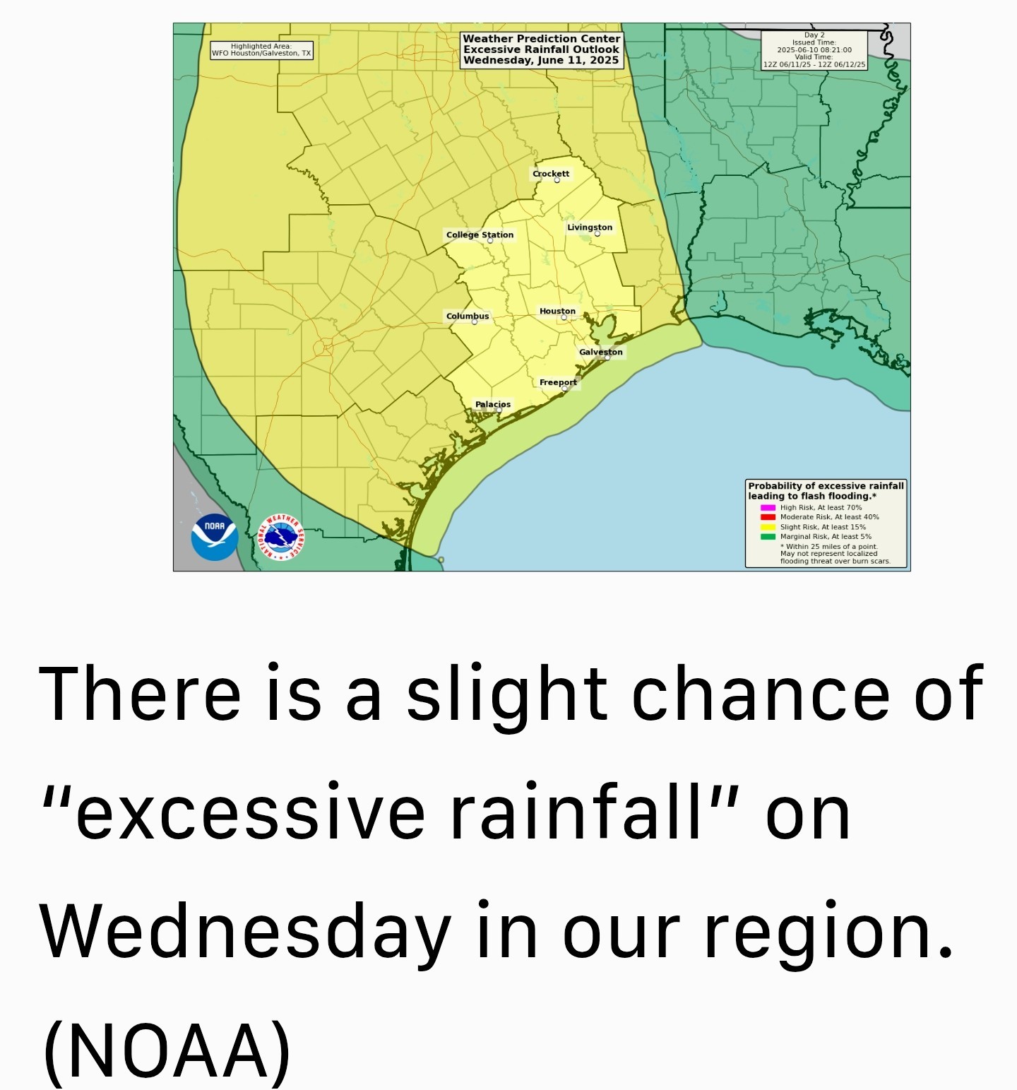 THURSDAY, FRIDAY, SATURDAY, and SUNDAY -- *Overall, the pattern is not likely to change much over the second half of the week and into the weekend.
*Days will be partly cloudy with highs in the vicinity of 90 to 93 degrees & plenty of humidity.
*Each day will bring perhaps a 50 to 70 percent chance of rain, with isolated, strong thunderstorms.
*If you have outdoor plans, there's a chance you can squeeze them in, as it certainly will not be wall-to-wall rain but you probably want to have a backup plan. 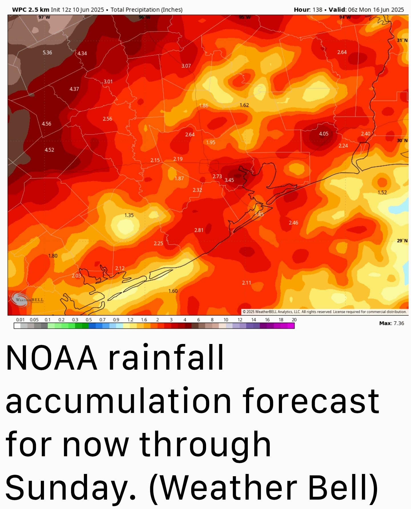 NEXT WEEK -- This overall pattern now seems likely to extend into the middle of next week - perhaps through about Tuesday or Wednesday - before we see more sunshine and warmer temperatures, along with a diminution in rain chances.

*The rest of this week will see the potential for storms in the Houston region.
*As of right now, WEDNESDAY looks to have the most widespread activity.
*Due to the possibility of heavy rainfall, strong thunderstorms & the cumulative effect of multiple rounds of rainfall, we have put a Stage 1 flood alert in place for this week.
*We will continue to see these systems sweep through our region every 18 to 24 hours or so, bringing a chance of widespread showers and thunderstorms.
*Not everyone is going to get hit with storms every day but the threat of heavy rainfall and lightning is going to be part of our weather story at least through the weekend.
*Due to the potential for isolated flooding with each round of showers, and the cumulative effect of all this by the weekend, we have put a Stage 1 flood alert into place until further notice.
*This is to cover the potential for (mostly minor) street flooding issues.
*However, after that there is about a 50 percent chance of showers and thunderstorms, with perhaps the best chances in the central Houston area and to the far north of the metro region: i.e. Conroe and points north.
*Skies will otherwise be partly sunny with highs in the low-to mid-90s.
*Actual highs will depend on the timing and coverage of the rainfall.
*Winds will generally be light, except in thunderstorms.
*Lows tonight will be in the upper 70s with a slight chance of rain.
*I'd put those rain chances in the 70 or 80 percent ballpark, with a slight risk for excessive rainfall.
*The timing is tricky, but right now the most impactful rains and thunderstorms are likely to fall during the middle of the day.
*Highs will probably top out in the vicinity of 90 degrees.
*Days will be partly cloudy with highs in the vicinity of 90 to 93 degrees & plenty of humidity.
*Each day will bring perhaps a 50 to 70 percent chance of rain, with isolated, strong thunderstorms.
*If you have outdoor plans, there's a chance you can squeeze them in, as it certainly will not be wall-to-wall rain but you probably want to have a backup plan.
Replies:
StormChaser : Thank you! Headed to work tomorrow morning. Hope I get out before the weather arrives.
StormChaser : Hope I get out before the weather arrives.
bigla : It should. Here is the future model for 5am tomorrow morning. By looking at that, I'd say storms shouldn't reach us until probably mid morning. 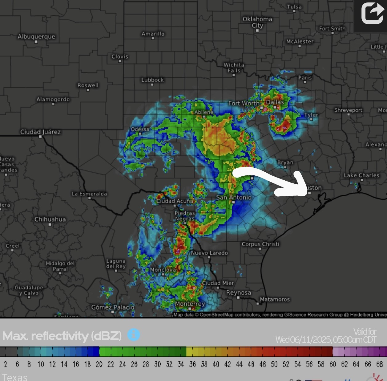
StormChaser : No, no, no! My flight is at 10am!
bigla : Models change, of course. It could be more towards lunchtime so no worries. « Back to Chat
Views: 570
# Replies: 4