


Severe Thunderstorm watch
Severe Thunderstorm watch


Joined:
X days ago
# Posts:
X,XXX
Contributor Points:
X


Severe Thunderstorm watch Severe Thunderstorm watch until 10pm tonight. *Our atmosphere is prime for severe weather - Like Austin last week. We definitely need to keep an eye on the alerts as they come in. (I'll post them as they do 🚨 I'm thinking 3pm-8pm will be very busy for us. 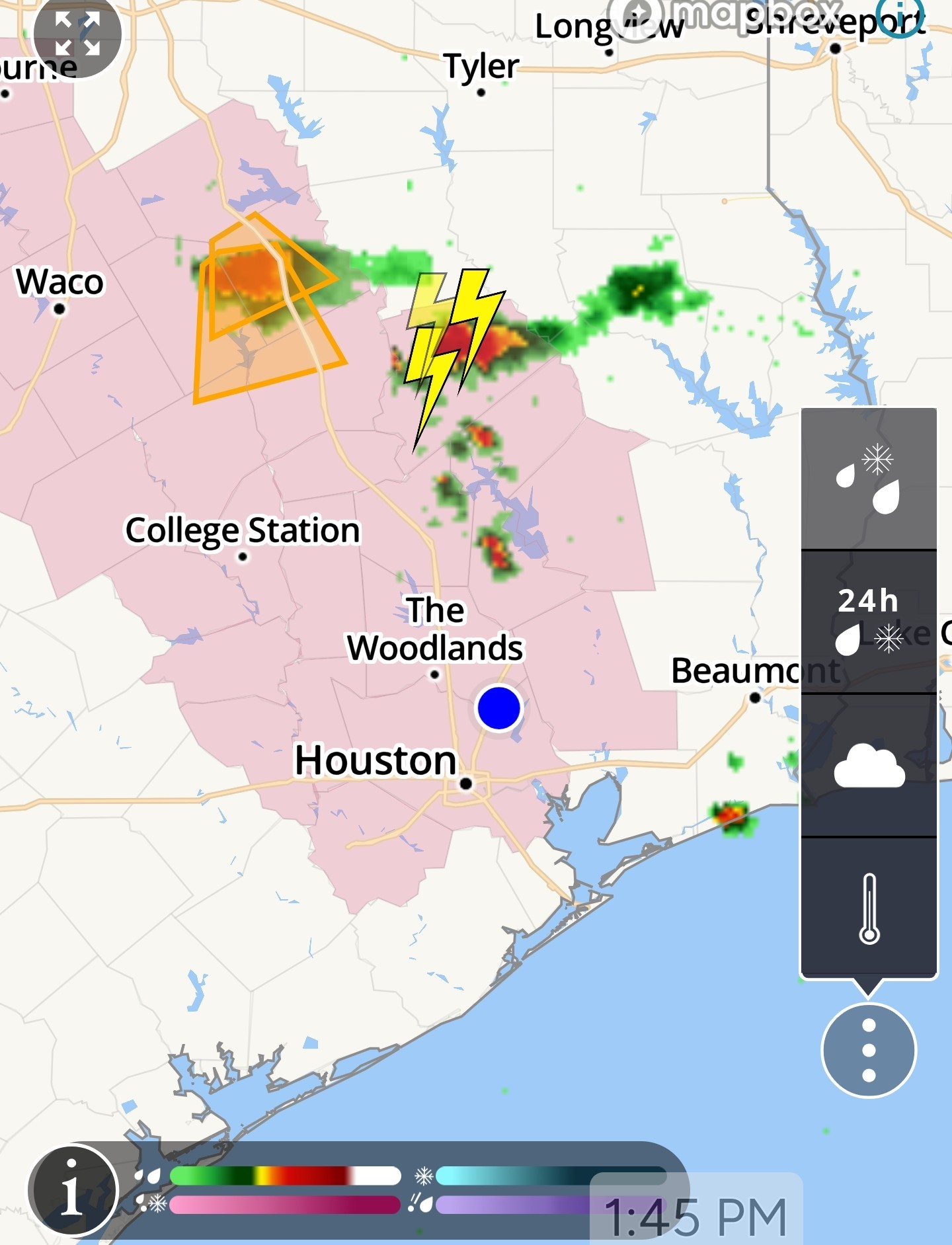
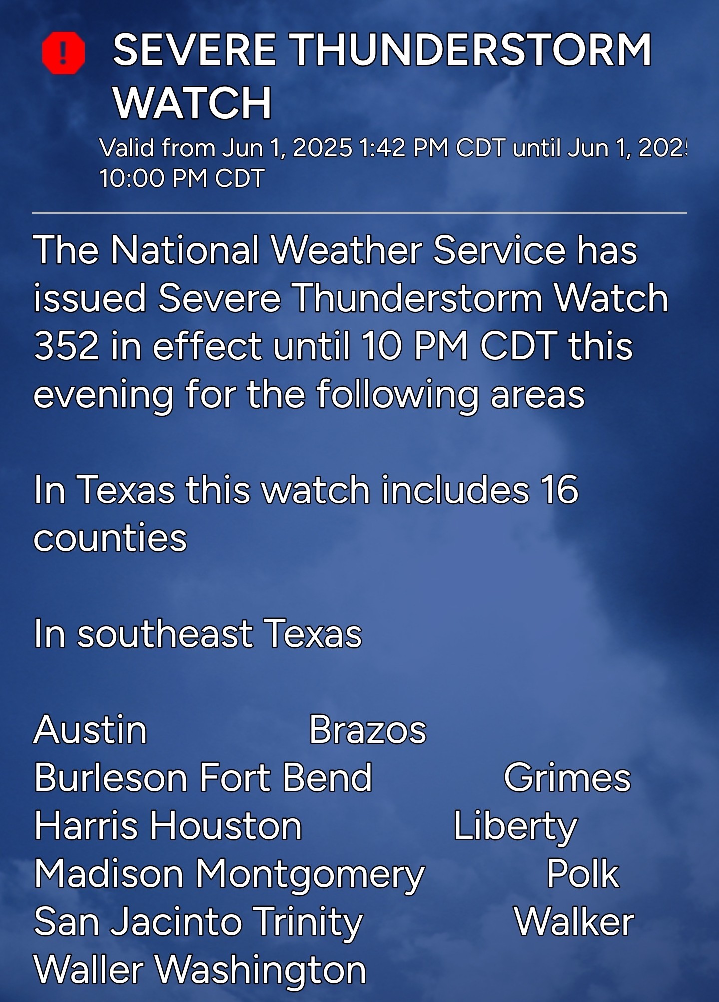
 Severe Thunderstorm Watch issued June 1 at 1:42PM CDT until June 1 at 10:00PM CDT by NWS Houston/Galveston TX The National Weather Service has issued Severe Thunderstorm Watch
352 in effect until 10 PM CDT this evening for the following
areas In Texas this watch includes 16 counties In southeast Texas Austin Brazos Burleson
Fort Bend Grimes Harris
Houston Liberty Madison
Montgomery Polk San Jacinto
Trinity Walker Waller
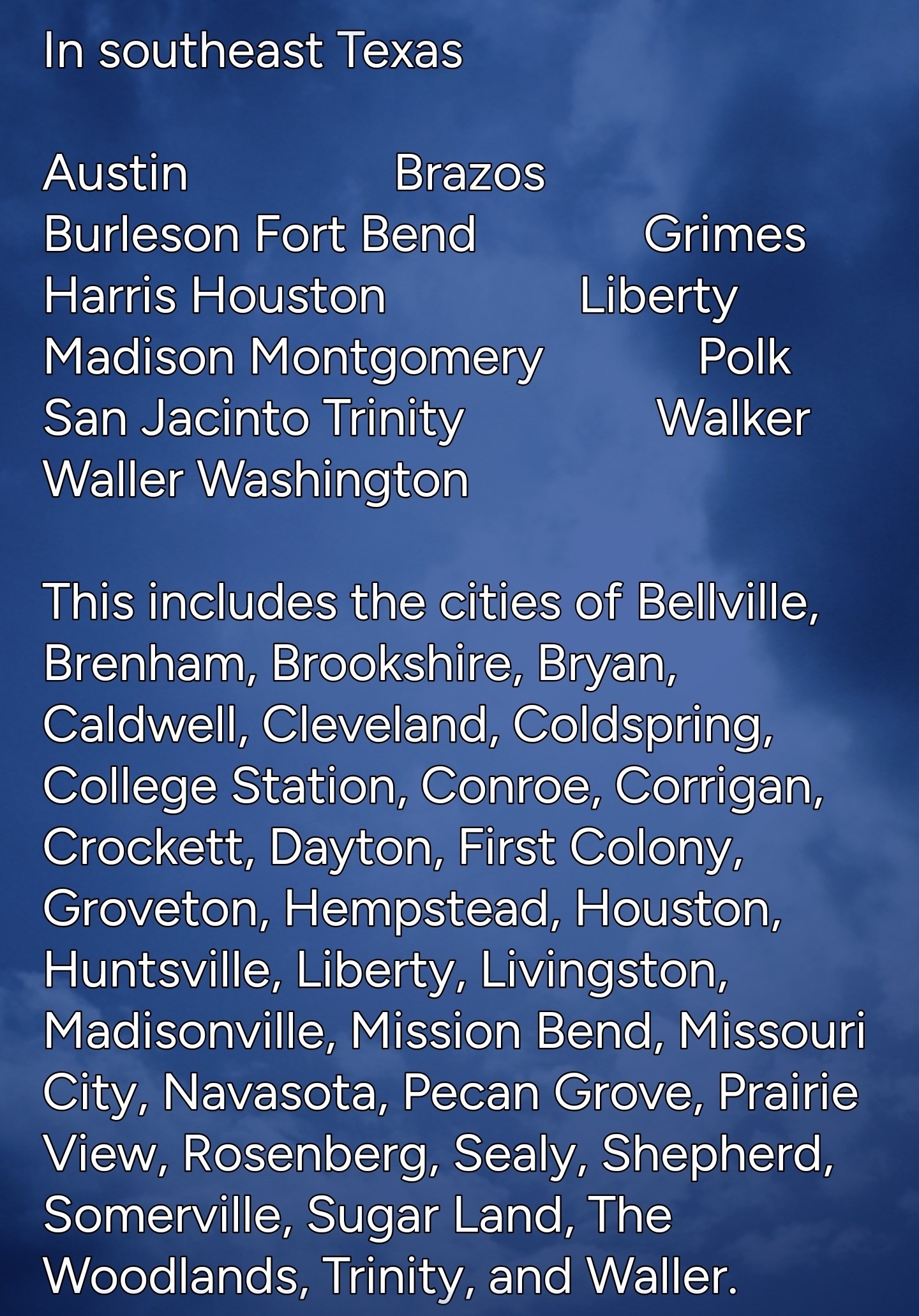
Washington This includes the cities of Bellville, Brenham, Brookshire,
Bryan, Caldwell, Cleveland, Coldspring, College Station, Conroe,
Corrigan, Crockett, Dayton, First Colony, Groveton, Hempstead,
Houston, Huntsville, Liberty, Livingston, Madisonville,
Mission Bend, Missouri City, Navasota, Pecan Grove, Prairie View,
Rosenberg, Sealy, Shepherd, Somerville, Sugar Land,
The Woodlands, Trinity, and Waller.


352 in effect until 10 PM CDT this evening for the following
areas
Fort Bend Grimes Harris
Houston Liberty Madison
Montgomery Polk San Jacinto
Trinity Walker Waller
Washington
Bryan, Caldwell, Cleveland, Coldspring, College Station, Conroe,
Corrigan, Crockett, Dayton, First Colony, Groveton, Hempstead,
Houston, Huntsville, Liberty, Livingston, Madisonville,
Mission Bend, Missouri City, Navasota, Pecan Grove, Prairie View,
Rosenberg, Sealy, Shepherd, Somerville, Sugar Land,
The Woodlands, Trinity, and Waller.
Replies:
Satellite is starting to wake up. Moist stratus from the Gulf is forming into Stratocumulus. Sprinkle some afternoon heating, and we could get a nice storm making it.
Severe Thunderstorm watch Severe Thunderstorm watch until 10pm tonight. *Our atmosphere is prime for severe weather - Like Austin last week. We definitely need to keep an eye on the alerts as they come in. (I'll post them as they do 🚨 I'm thinking 3pm-8pm will be very busy for us. Severe Thunderstorm Watch issued June 1 at 1:42PM CDT until June 1 at 10:00PM CDT by NWS Houston/Galveston TX The National Weather Service has issued Severe Thunderstorm Watch 352 in effect until 10 PM CDT this evening for the following areas In Texas this watch includes 16 counties In southeast Texas Austin Brazos Burleson Fort Bend Grimes Harris Houston Liberty Madison Montgomery Polk San Jacinto Trinity Walker Waller Washington This includes the cities of Bellville, Brenham, Brookshire, Bryan, Caldwell, Cleveland, Coldspring, College Station, Conroe, Corrigan, Crockett, Dayton, First Colony, Groveton, Hempstead, Houston, Huntsville, Liberty, Livingston, Madisonville, Mission Bend, Missouri City, Navasota, Pecan Grove, Prairie View, Rosenberg, Sealy, Shepherd, Somerville, Sugar Land, The Woodlands, Trinity, and Waller.
StormChaser : Time to charge the phone. Make coffee and put in frig for tomorrow in case we have no power. I know the drill so here I go.
SEVERE THUNDERSTORM WARNING has been issued for Trinity, San Jacinto, Walker, Polk until 6/01 3:45PM: Stay safe! bit.ly/3KWTLIX 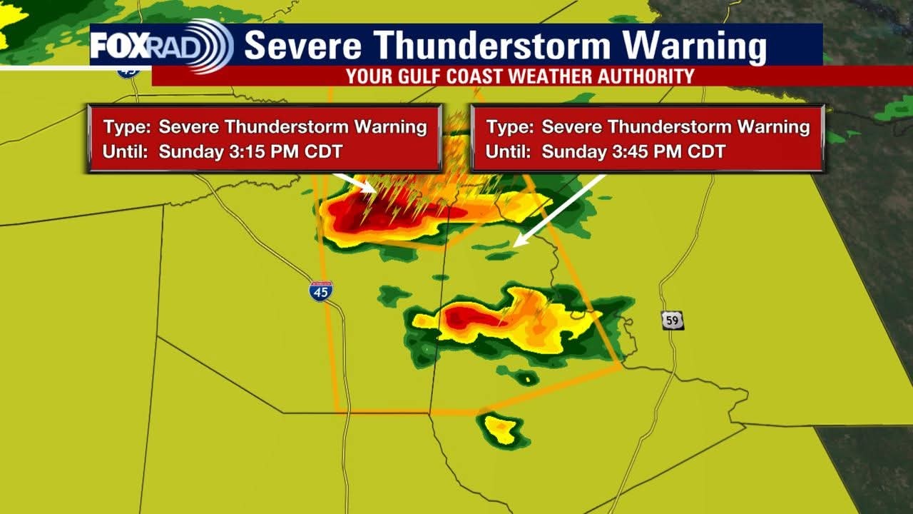 .......... Slow4x4 : For sure. The PM heating that started has primed the atmosphere.
Satellite is starting to wake up. Moist stratus from the Gulf is forming into Stratocumulus. Sprinkle some afternoon heating, and we could get a nice storm making it.
Slow4x4 : For sure. The PM heating that started has primed the atmosphere.
Severe Thunderstorm Warning Hail: 1.00" (Quarter‑Size)
Wind: 60MPH+ Severe Thunderstorm Warning National Weather Service Houston/Galveston TX 308 PM CDT Sun Jun 1 2025 The National Weather Service in League City has issued a * Severe Thunderstorm Warning for... Southwestern Trinity County in southeastern Texas... Northwestern San Jacinto County in southeastern Texas...West central Polk County in southeastern Texas...Eastern Walker County in southeastern Texas... * Until 345 PM CDT. * At 308 PM CDT, a severe thunderstorm was located over Riverside, or 13 miles northeast of Huntsville, moving south at 30 mph. HAZARD...60 mph wind gusts and quarter size hail. SOURCE...Radar indicated. IMPACT...Hail damage to vehicles is expected. Expect wind damage to roofs, siding, and trees. * Locations impacted include... Eastern Huntsville, Trinity, New Waverly, Coldspring, Point Blank, Riverside, Sebastopol, Huntsville State Park, Oakhurst, and Evergreen. PRECAUTIONARY/PREPAREDNESS ACTIONS... For your protection move to an interior room on the lowest floor of a building. Torrential rainfall is occurring with this storm, and may lead to flash flooding. Do not drive your vehicle through flooded roadways.
Wind: 60MPH+
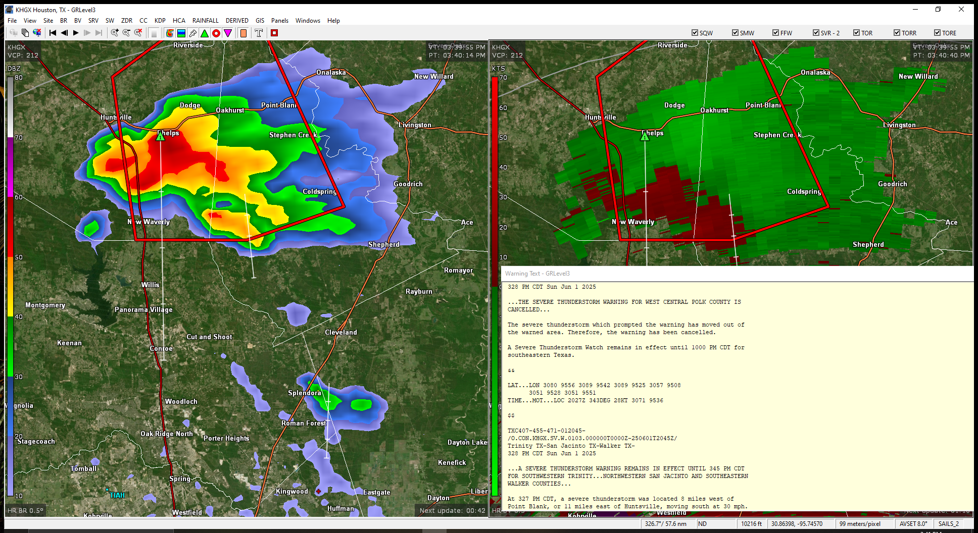
StormChaser: looks like its just riding 45
jonesjones12 : Right now, its gonna go just to our west. (Down I45) 👍 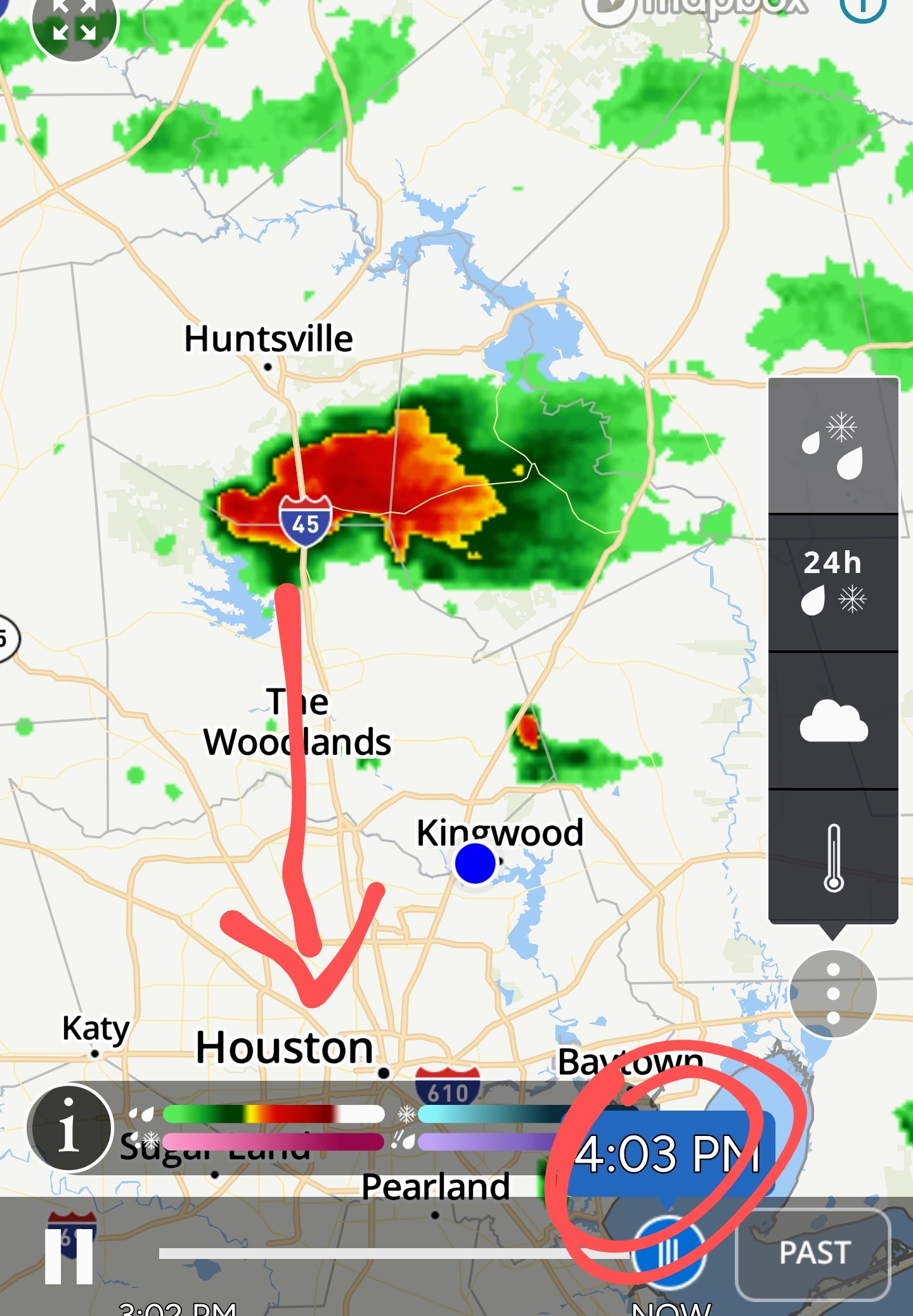
Severe Thunderstorm Warning 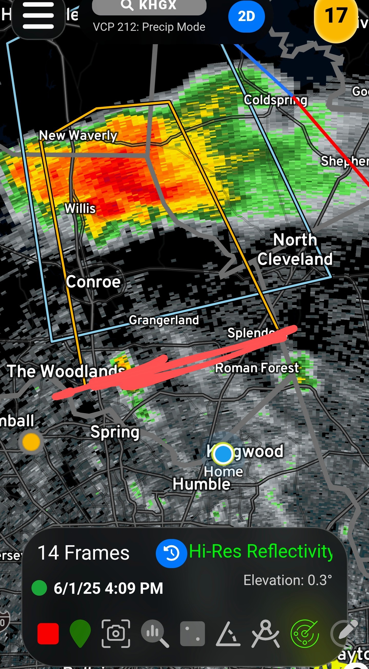 Hail: 0.75"Wind: 60MPH Severe Thunderstorm Warning National Weather Service Houston/Galveston TX 407 PM CDT Sun Jun 1 2025 The National Weather Service in League City has issued a * Severe Thunderstorm Warning for... Central Montgomery County in southeastern Texas... Southwestern San Jacinto County in southeastern Texas... Southeastern Walker County in southeastern Texas... * Until 430 PM CDT. * At 406 PM CDT, a severe thunderstorm was located near Willis, moving south at 25 mph. HAZARD...60 mph wind gusts and penny size hail.
SOURCE...Radar indicated. IMPACT...Expect damage to roofs, siding, and trees. * Locations impacted include... Conroe, Willis, The Woodlands, Oak Ridge North, Panorama Village, Shenandoah, Splendora, Cut And Shoot, New Waverly, Woodloch, The Woodlands Pavillion, and Chateau Woods. PRECAUTIONARY/PREPAREDNESS ACTIONS... For your protection move to an interior room on the lowest floor of a building
SOURCE...Radar indicated.
« Back to Chat
Views: 5,112
# Replies: 41