


Tornado watch
Tornado watch


Joined:
X days ago
# Posts:
X,XXX
Contributor Points:
X


Tornado watch 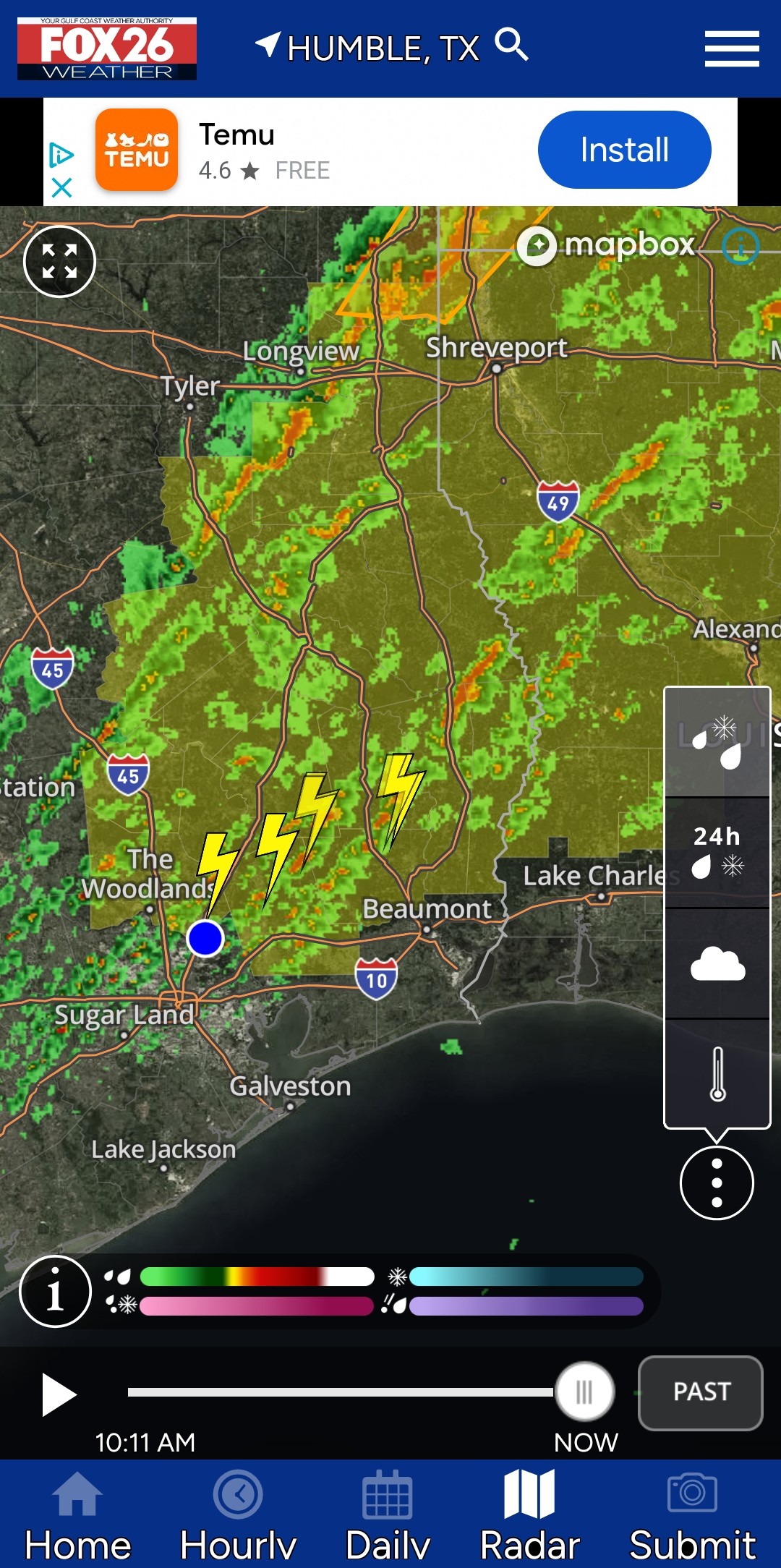 URGENT - IMMEDIATE BROADCAST REQUESTED
Tornado Watch Number 1
NWS Storm Prediction Center Norman OK
1025 AM CST Sun Jan 5 2025 The NWS Storm Prediction Center has issued a * Tornado Watch for portions of
Southern Arkansas
Western and Northern Louisiana
East and Southeast Texas * Effective this Sunday morning and evening from 1025 AM until
600 PM CST. * Primary threats include...
A few tornadoes likely with a couple intense tornadoes possible
Scattered damaging winds likely with isolated significant gusts
to 75 mph possible
Isolated large hail events to 1.5 inches in diameter possible SUMMARY...Thunderstorms are forecast to intensify and increase in
coverage across the Watch area. A few semi-discrete storms are
expected to develop ahead of the main band of storms. The storms
developing ahead of the thunderstorm line will pose a risk for a few
tornadoes, including the possibility for a couple of strong
tornadoes. Damaging gusts will also be possible with the more
intense portions of a squall line expected to develop and move east
across the Watch area. The tornado watch area is approximately along and 80 statute miles
east and west of a line from 45 miles northwest of Monticello AR to
70 miles east southeast of Huntsville TX. For a complete depiction
of the watch see the associated watch outline update (WOUS64 KWNS
WOU1). PRECAUTIONARY/PREPAREDNESS ACTIONS... REMEMBER...A Tornado Watch means conditions are favorable for
tornadoes and severe thunderstorms in and close to the watch
area. Persons in these areas should be on the lookout for
threatening weather conditions and listen for later statements
and possible warnings. && AVIATION...Tornadoes and a few severe thunderstorms with hail
surface and aloft to 1.5 inches. Extreme turbulence and surface wind
gusts to 65 knots. A few cumulonimbi with maximum tops to 450.


Tornado Watch Number 1
NWS Storm Prediction Center Norman OK
1025 AM CST Sun Jan 5 2025
Southern Arkansas
Western and Northern Louisiana
East and Southeast Texas
600 PM CST.
A few tornadoes likely with a couple intense tornadoes possible
Scattered damaging winds likely with isolated significant gusts
to 75 mph possible
Isolated large hail events to 1.5 inches in diameter possible
coverage across the Watch area. A few semi-discrete storms are
expected to develop ahead of the main band of storms. The storms
developing ahead of the thunderstorm line will pose a risk for a few
tornadoes, including the possibility for a couple of strong
tornadoes. Damaging gusts will also be possible with the more
intense portions of a squall line expected to develop and move east
across the Watch area.
east and west of a line from 45 miles northwest of Monticello AR to
70 miles east southeast of Huntsville TX. For a complete depiction
of the watch see the associated watch outline update (WOUS64 KWNS
WOU1).
tornadoes and severe thunderstorms in and close to the watch
area. Persons in these areas should be on the lookout for
threatening weather conditions and listen for later statements
and possible warnings.
surface and aloft to 1.5 inches. Extreme turbulence and surface wind
gusts to 65 knots. A few cumulonimbi with maximum tops to 450.
Discussion Summary:
"Urgent Tornado Watch Issued for Southern Arkansas, Northern Louisiana, and East/Southeast Texas with Potential for Severe Storms and Tornadoes"
"Urgent Tornado Watch Issued for Southern Arkansas, Northern Louisiana, and East/Southeast Texas with Potential for Severe Storms and Tornadoes"
Discussion Insights:
Ask a question about this discussion and an AI bot will try to give an answer.
Ask a question about this discussion and an AI bot will try to give an answer.
Replies:

StormChaser : That's some good info! Generator was tested this morning and ready to go!
jrjtex : but did you bolt it down? 

|
So far, all the action has been well to our northeast. 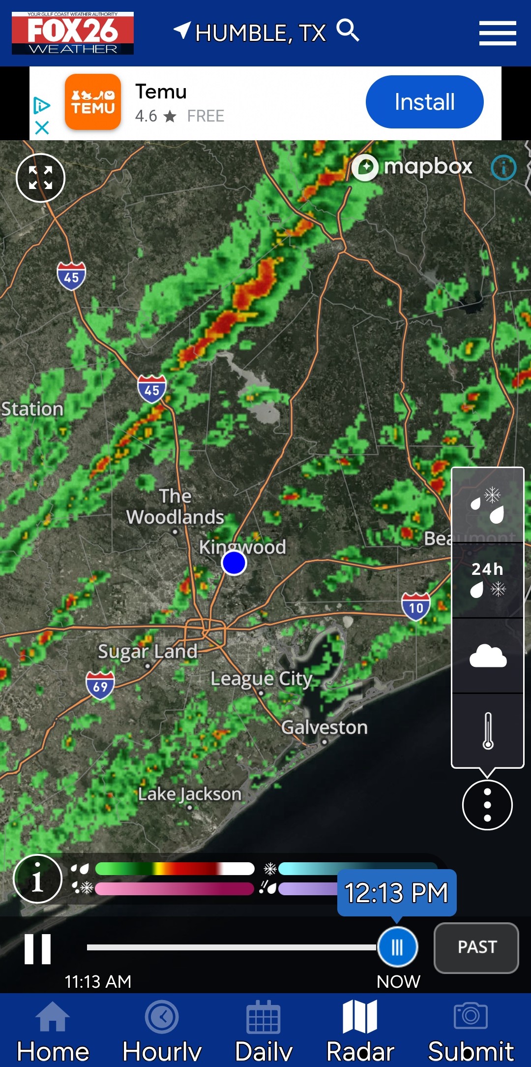
|
|
So far, all the action has been well to our northeast.
StormChaser : Sorry for them but...glad for us.
|
|
Here comes the front. All severe weather is well to our northeast so expect run of the mill showers & storms when the front passes us in the next 1-3 hours. Temperature by 10pm tonight: 40°
Temperature by 7am tomorrow: 29° with a high in the mid 40s tomorrow. Est 6 hours below 32 this evening. 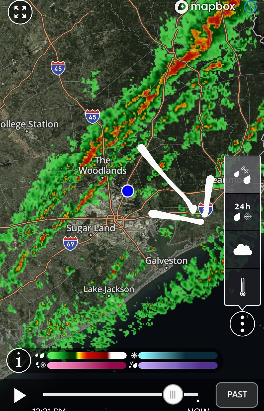
Temperature by 7am tomorrow: 29° with a high in the mid 40s tomorrow.
Here comes the front. All severe weather is well to our northeast so expect run of the mill showers & storms when the front passes us in the next 1-3 hours. Temperature by 10pm tonight: 40° Temperature by 7am tomorrow: 29° with a high in the mid 40s.
StormChaser : I'm looking forward to my run in the morning. 29 with wind chill is way better than 70 and 100% humidity.
|
|
StormChaser : I'm looking forward to my run in the morning. 29 with wind chill is way better than 70 and 100% humidity.
buffaloglenn : 🥶🥶🥶🥶🥶
|
|
StormChaser : I'm looking forward to my run in the morning. 29 with wind chill is way better than 70 and 100% humidity.
buffaloglenn : a lot easier to run when the testicles are tucked away
buffaloglenn : a lot easier to run when the testicles are tucked away
mm4731 : Exactly - less wind resistance. 

« Back to Chat
Views: 1,706
# Replies: 19