


Severe Thunderstorm watch
Severe Thunderstorm watch


Joined:
X days ago
# Posts:
X,XXX
Contributor Points:
X


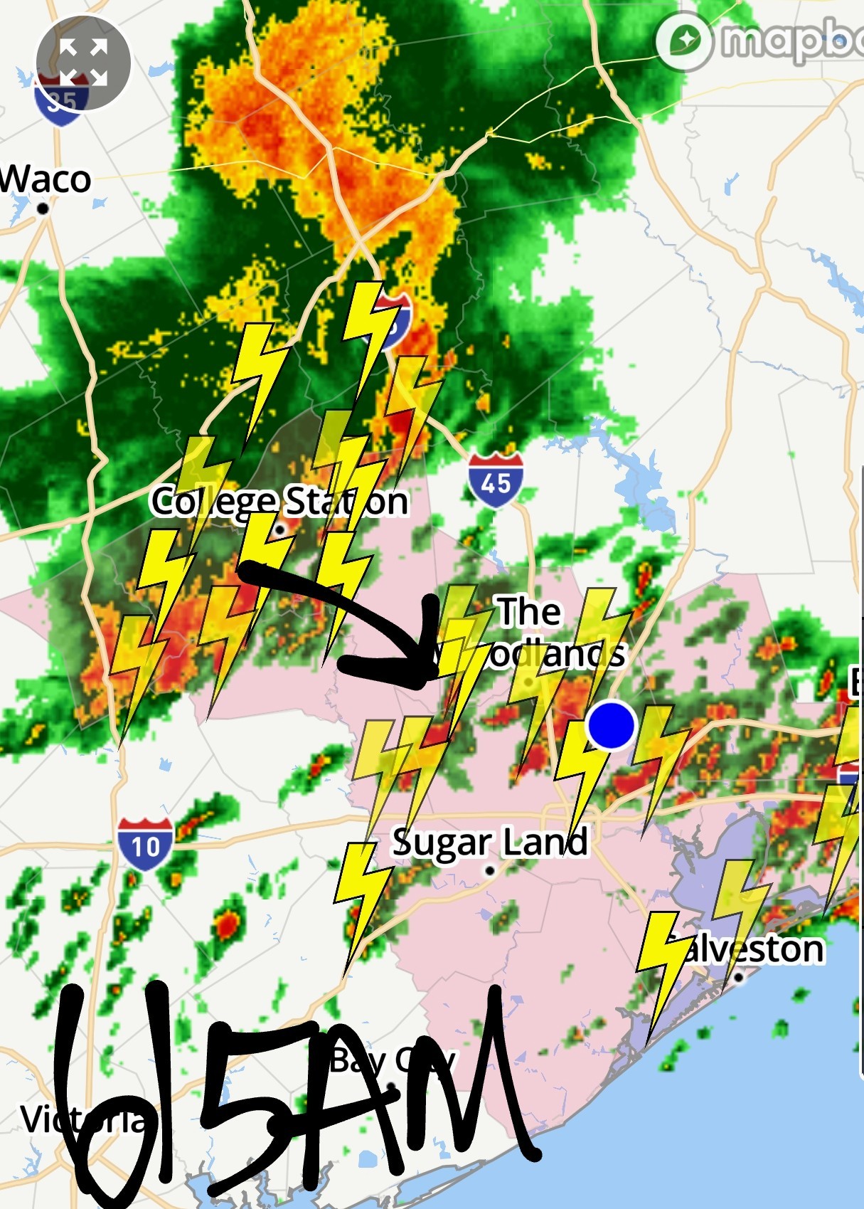
Severe Thunderstorm watch I've been awake 5 minutes but we're under a severe thunderstorm watch for this cluster of storms headed this way. Gusty winds and hail possible 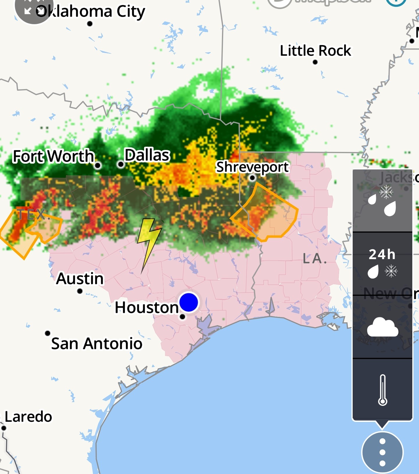 An early wake-up call from thunderstorms is possible on Monday in parts of the Houston area Matt Lanza · Sunday, June 8, 2025 9:59 PM In brief: Thunderstorms impacting the Dallas-Fort Worth Metroplex and Abilene may hold together overnight and arrive in Houston near sunrise, bringing thunder, lightning, and locally heavy rain to parts of the area. We're barging into your Sunday evening briefly to just offer a heads up that thunderstorms may arrive in the Houston area on Monday morning. In North Texas, there's a pretty potent severe weather risk tonight. We've seen gigantic hail in the area between the Caprock and the Metroplex. Those storms are now kind of congealing into a complex of thunderstorms that will continue to arc east and southeast, possibly arriving in Southeast Texas by Monday morning. While we are not under severe weather risk tonight, there is a marginal risk posted for Monday (level 1/5) for Houston. These storms could hold together a bit as they approach. While we do not expect gigantic hail or extreme winds like they've seen in some spots up north, we could see some frequent lightning, gusty winds, and heavy downpours. The HRRR model depicted above shows storms arriving right around 6 AM before dissipating by 8-9 AM. Don't focus on specifics but rather the overall picture which shows a gradually weakening line of storms moving in. The most likely area to see organized thunderstorms is north of I-10 and west of I-45, but it's possible that many of us see at least some rain or thunder by mid-morning Monday. Conditions would then calm down a bit Monday afternoon. Bottom line: Don't be shocked if you've got kids or pets running in a little before wake-up time tomorrow. We'd currently rate this about a 6 out of 10 on the excitable dog scale, with perhaps some higher values up toward Navasota or Huntsville or Conroe. Eric will have more in the morning.


Replies:
StormChaser : Good morning. Thanks again for the alert. You are the best! Rain please without hail and strong winds!
Current radar @ 330AM 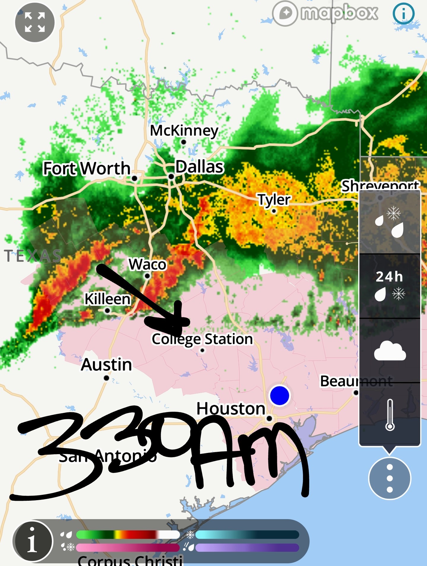 HRRR forecast models for 8AM: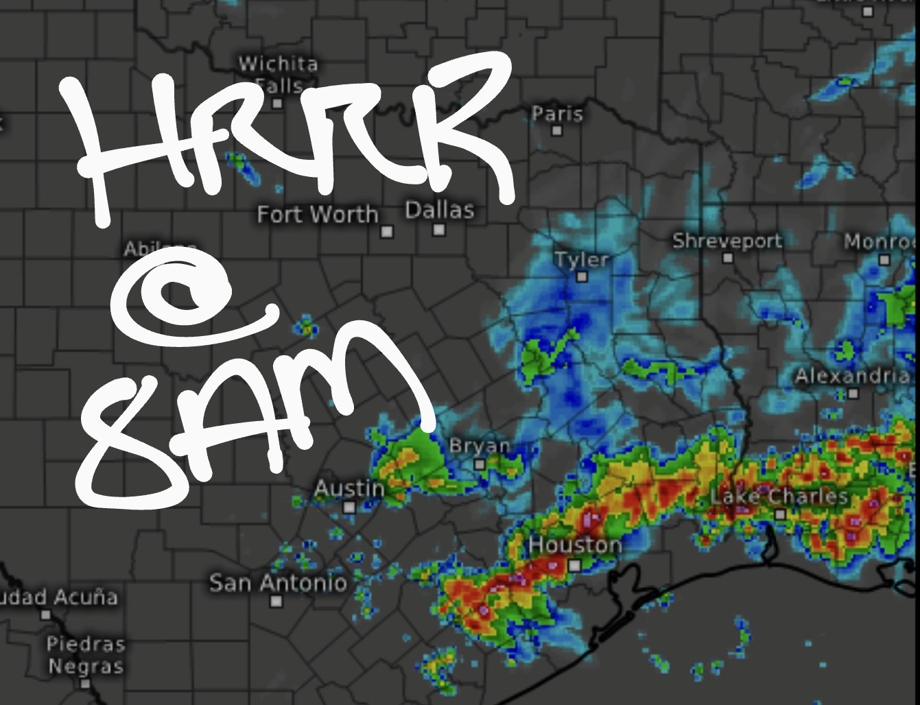
StormChaser : I have to head to Galveston around 8:30 this morning. You think I will get past before the weather hits?
StormChaser : I have to head to Galveston around 8:30 this morning. You think I will get past before the weather hits?
Donnawisdom : HRRR models show it coming thru Harris County around 8am.
- - - - - - - -
>> StormChaser : I have to head to Galveston around 8:30 this morning. You think I will get past before the weather hits?
Donnawisdom : HRRR models show it coming thru Harris County around 8am.Donnawisdom tipped StormChaser 100 credits for a post in this forum discussion.
StormChaser : You are the best. I had a bad feeling this morning. Just decided to get up and check things out. Glad I did.
Donnawisdom StormChaser : I bet the roads are going to be rough. I have no where to be today luckily and have been doing chores all night. Couldn't sleep so decided to be productive. Looks like I'm ahead of anything if we lose power.
Gosh, I watched all the storms pound the Panhandle and N Texas last night. My weather anxiety is on high!! And we have to travel north for 8 hours today! ughhhh.
Ok here's a bit of a breakdown. Area 1 are some spotty showers and thunderstorms popping up in our area right now. Area 2 is a strong line coming in from the Austin area. Area 1 & Area 2 are expected to combine over our humid atmosphere and spark a line of storms. (The red line I drew) Will this all pan out? Maybe. . 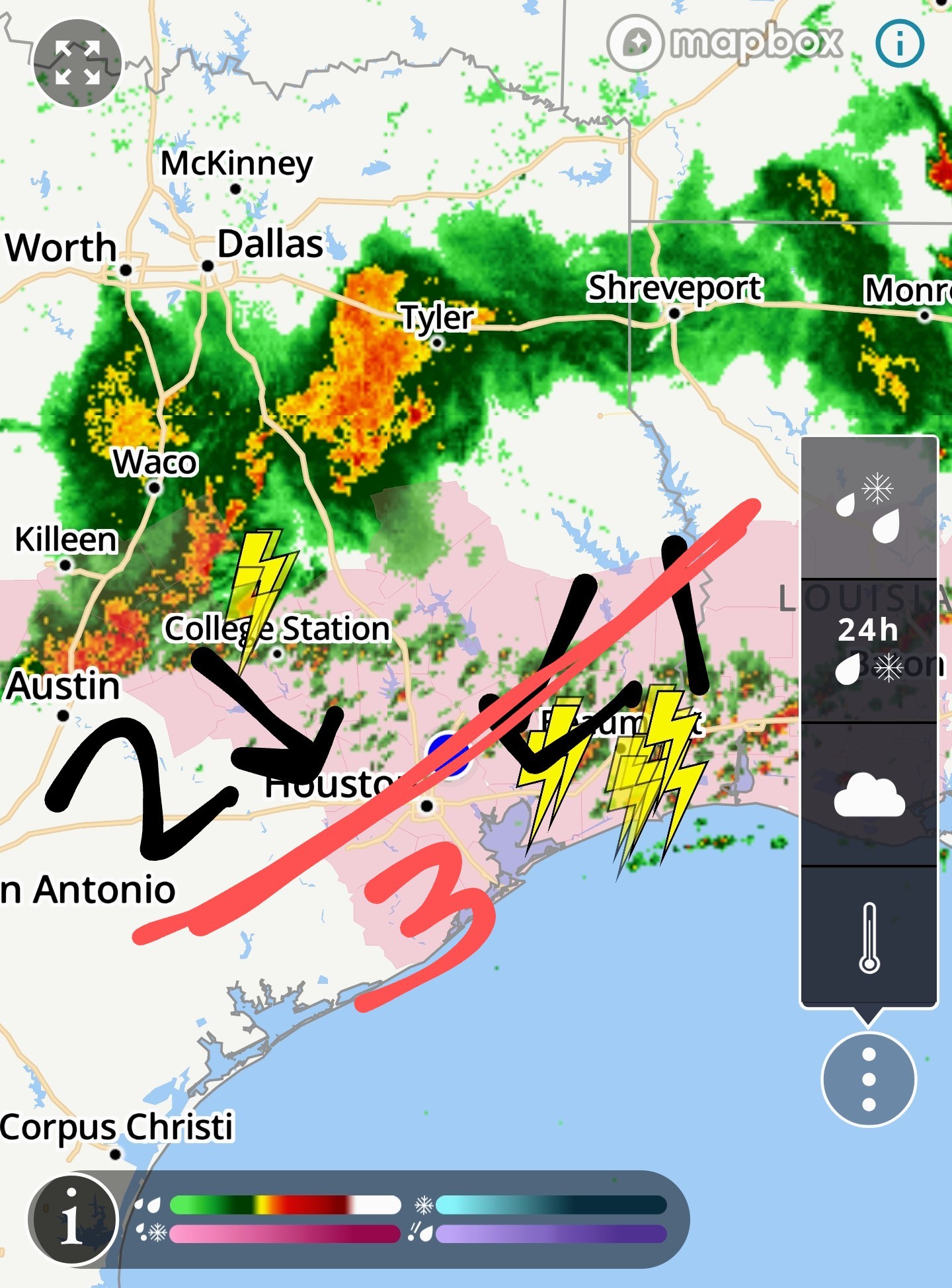
Heavy scattered showers have picked up all over the area ahead of a line coming in from Austin. 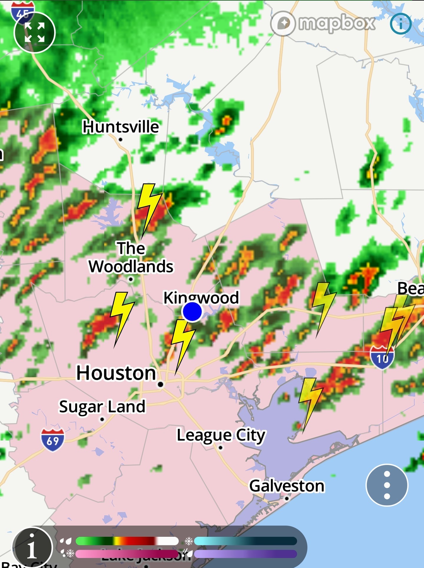 Current radar shows the line heading this way:
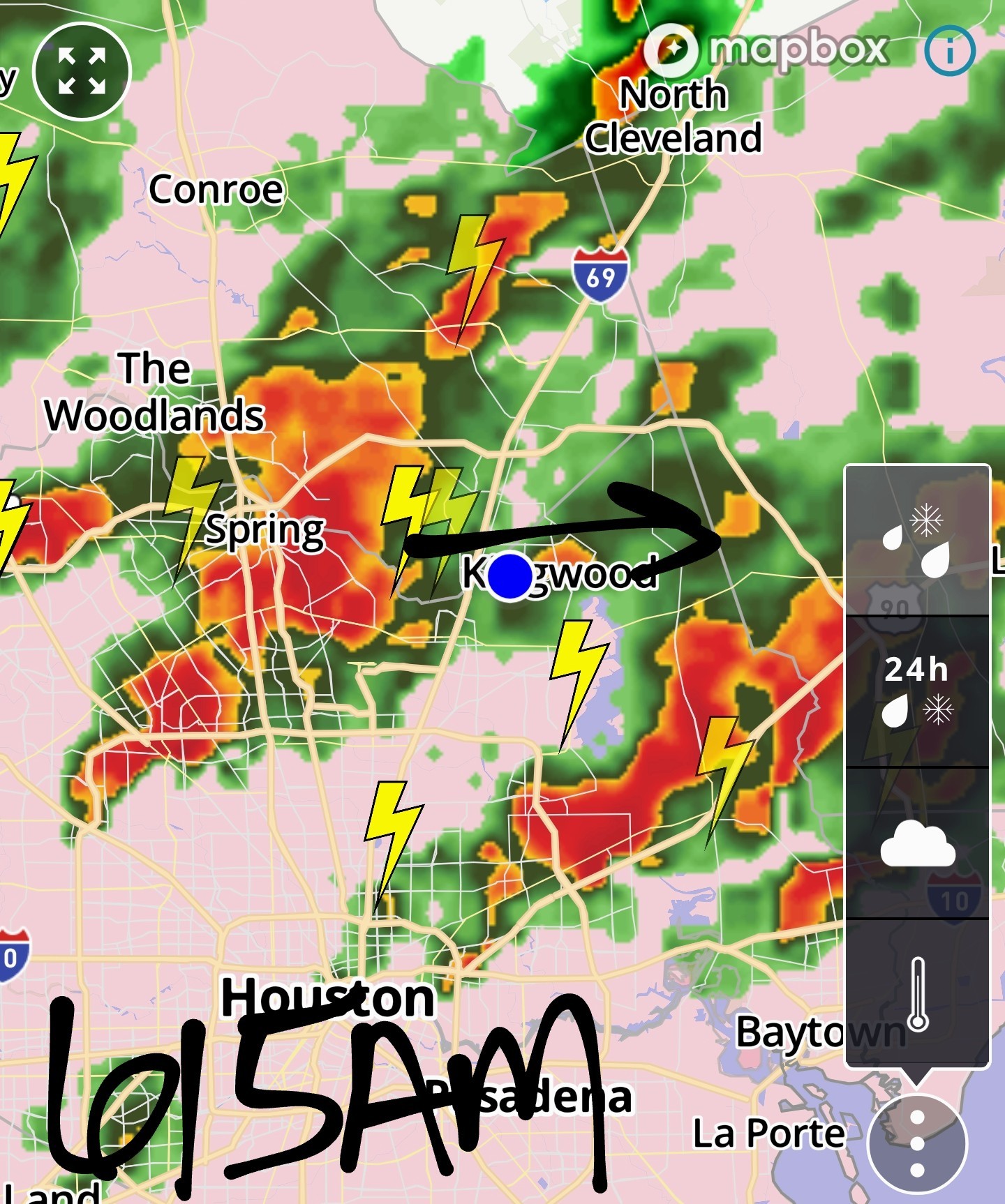
 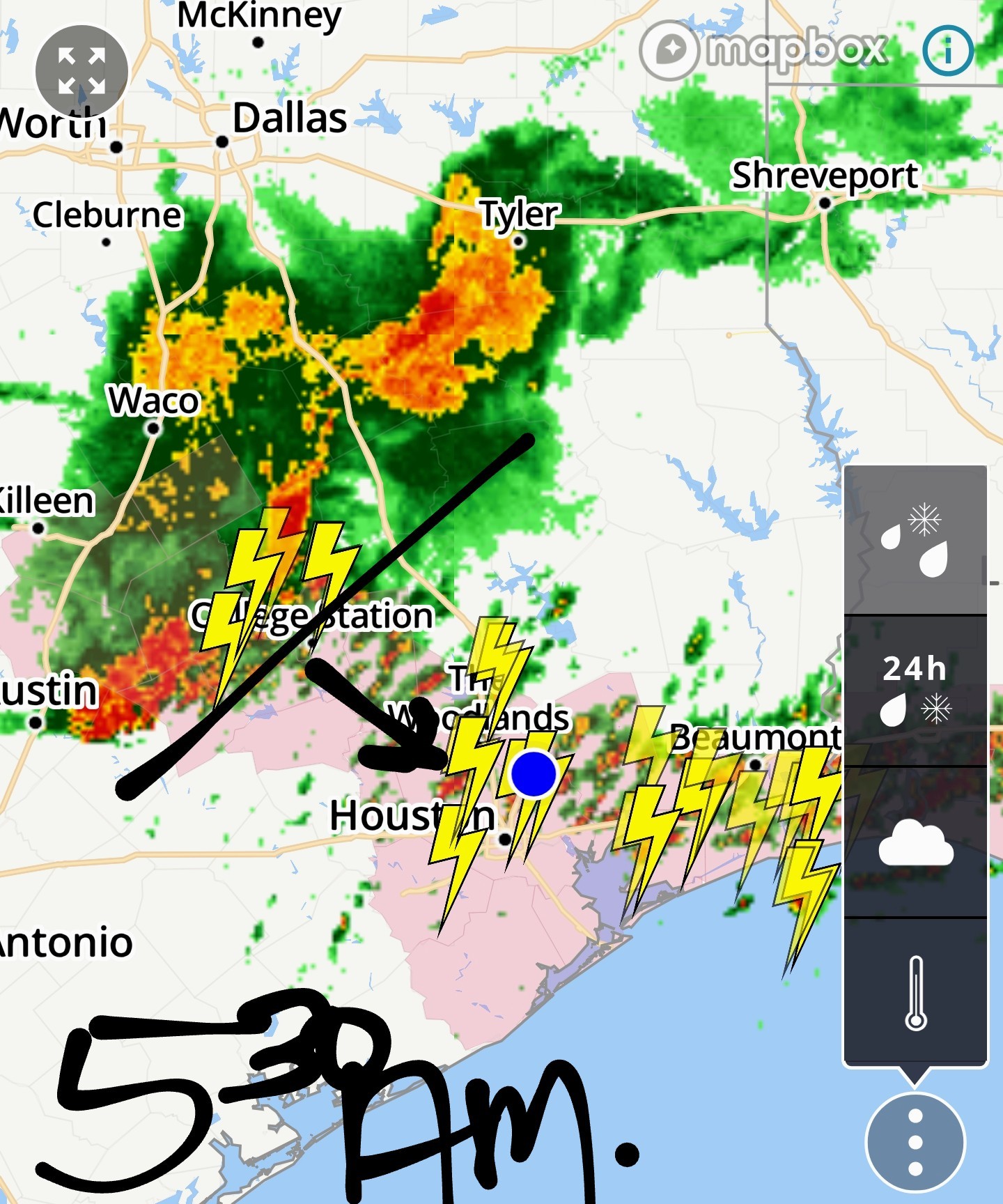 Parts of the severe thunderstorm watch were canceled, but not for us. It remains until at least 7am. Heavy rainfall, gusty winds, frequent rainfall, and hail are all possible this morning until the line moves thru.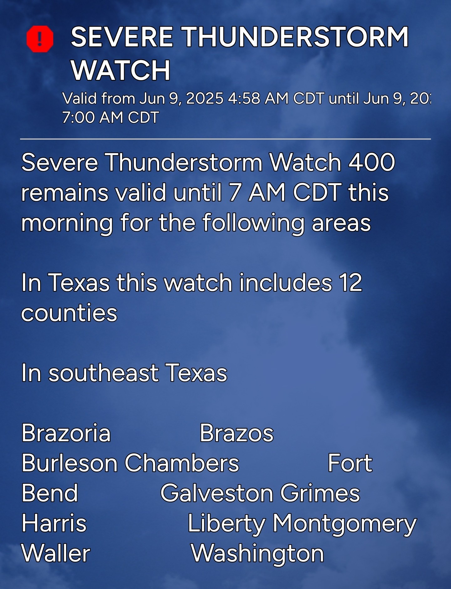
« Back to Chat
Views: 1,314
# Replies: 18