


Tuesday forecast (Space City 7am update)
Tuesday forecast (Space City 7am update)


Joined:
X days ago
# Posts:
X,XXX
Contributor Points:
X


Tuesday forecast 🚨 Space City 7am update posted below in the comments. It goes over some specific timing for the area. ....... Good (early) morning. 🥱💤 It's only 4am but I can't sleep so I'm up looking at weather models. 🙃 Here's a look at today, which could become pretty dicey by mid-morning! Current radar across Texas: Impressive 👍 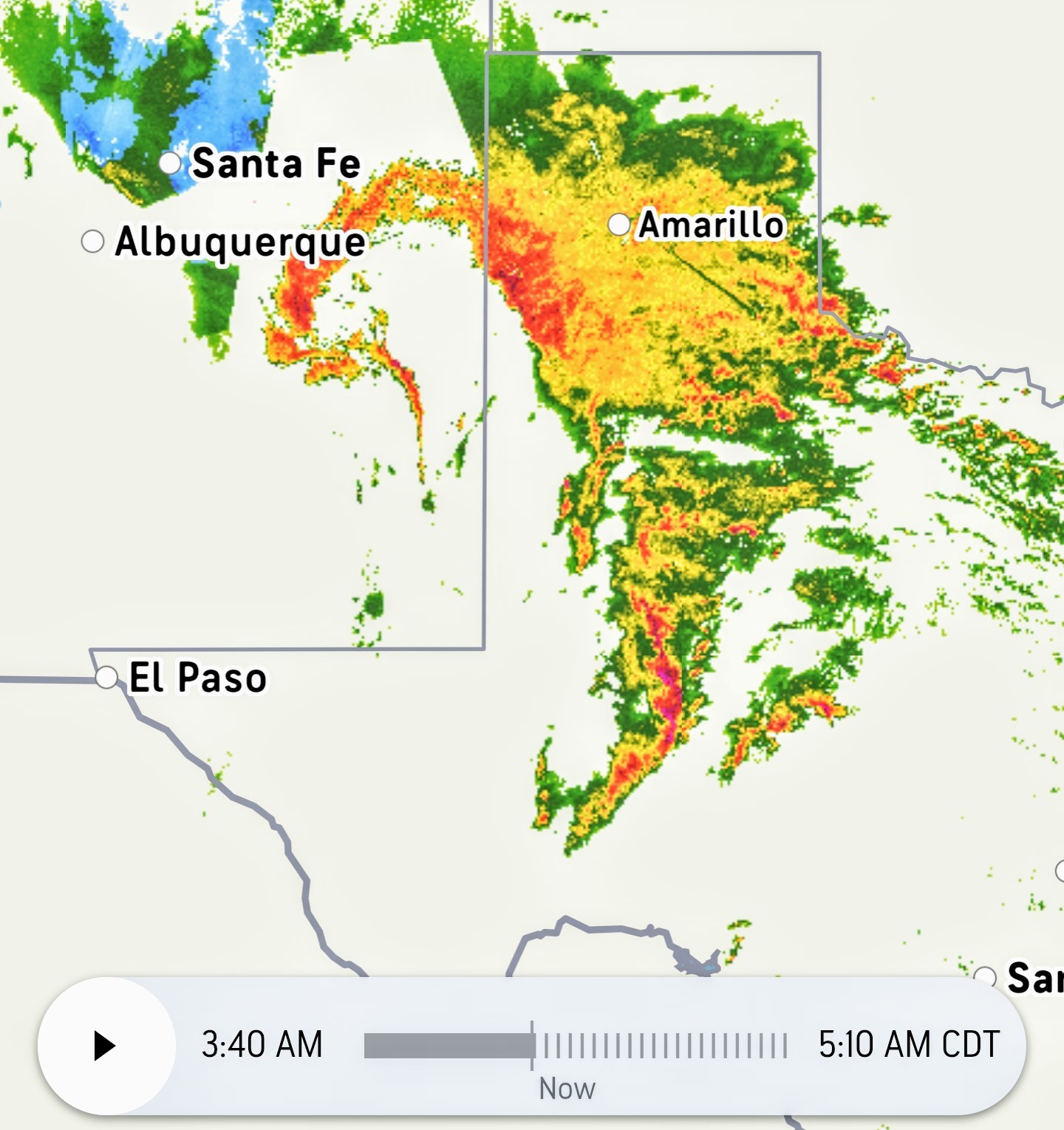 HRRR future scans: ❇️ 11AM:
 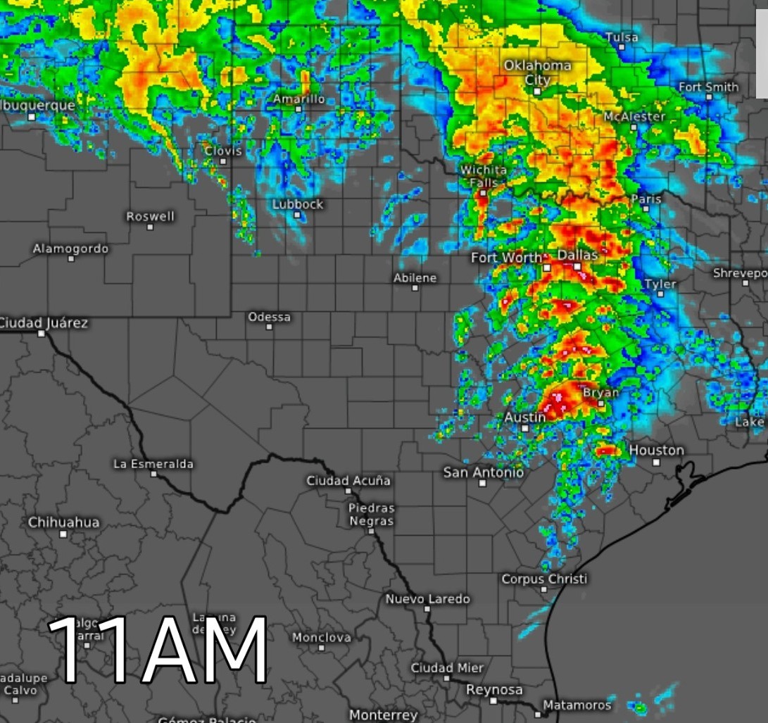 ❇️ Noon:
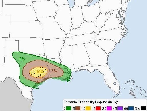
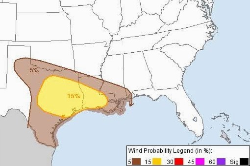
 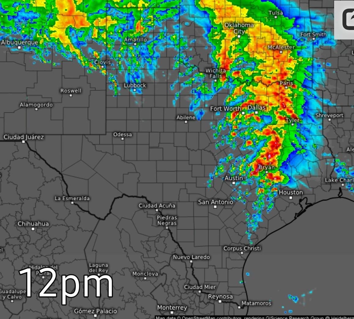 ➡️ I expect several watches to be issued before all this comes thru including a severe thunderstorm watch and a tornado watch. A flood watch is also possible. (Watches are already posted in west Texas) ➡️ I think our biggest threat today is going to be hail & street flooding due to the intensity of these storms, our already saturated grounds and the slow movement of the system. Upgraded 3/5 outlook for SE TX:
 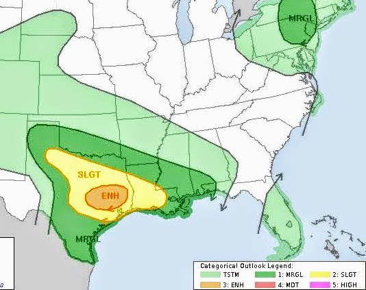 Tornado chances:
  Wind probability:
  ➡️ Current watches; 🔴 Red is severe thunderstorm watch
🟡 Yellow is tornado watch. 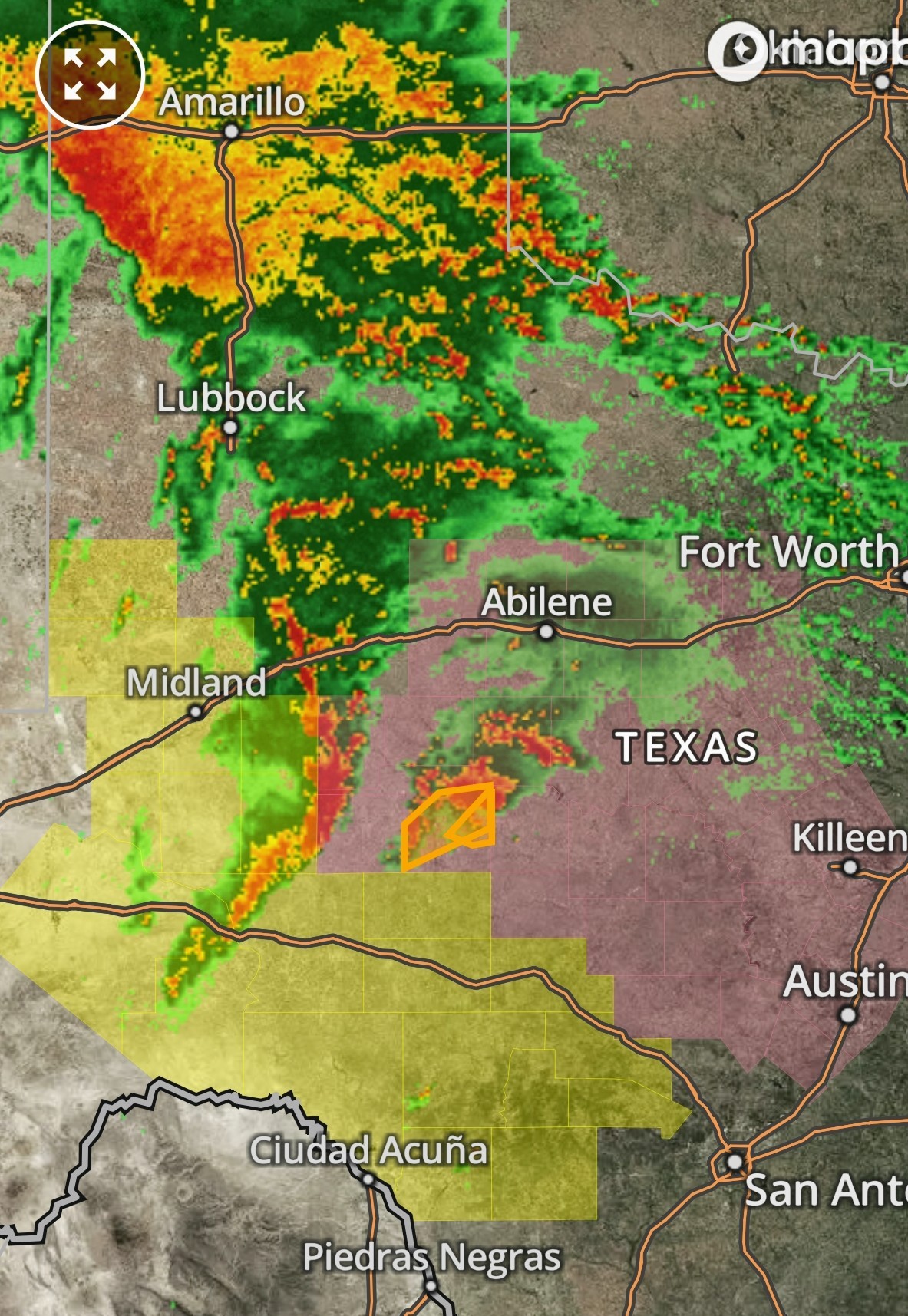 ............. TIMING BY SPACE CITY: ❇️ Round one:
*By late Tuesday morning a line of storms, very likely with severe storms embedded, will be nearing the College Station area.
*This line should move into Montgomery County and points north by around noon, affecting the I-45 corridor (I'm concerned about areas including The Woodlands, Conroe, and Huntsville).
*At this time, we think most of these storms will be along and north of Interstate 10, but again we cannot rule out impacts further south, and closer to the coast. ❇️ Round two:
*Conditions may then calm down for a few hours this afternoon and early evening.
*However, by around sunset, I expect another line of storms to approach the Houston region from the northwest.
*I expect these to advance into the Houston metro area between 8 pm and midnight, but they may peter out before reaching the coast. ...... ❇️ I will try and keep the weather threads contained to 1 big thread today instead of a bunch of little ones. I will make sure the main weather topic is highlighted to find easily. I'll check back in later this morning. Stay safe today everyone! ⚡️


🟡 Yellow is tornado watch.
*By late Tuesday morning a line of storms, very likely with severe storms embedded, will be nearing the College Station area.
*This line should move into Montgomery County and points north by around noon, affecting the I-45 corridor (I'm concerned about areas including The Woodlands, Conroe, and Huntsville).
*At this time, we think most of these storms will be along and north of Interstate 10, but again we cannot rule out impacts further south, and closer to the coast.
*Conditions may then calm down for a few hours this afternoon and early evening.
*However, by around sunset, I expect another line of storms to approach the Houston region from the northwest.
*I expect these to advance into the Houston metro area between 8 pm and midnight, but they may peter out before reaching the coast.
Replies:
StormChaser : Thank you! Hopefully you can get some sleep. It's gonna be a couple of active weather days.

|
StormChaser : I am just hoping it is not as bad as they say it could be. This time of year, these storms make me really nervous especially when I am away from home.
|
|
StormChaser How are things looking later afternoon? Roughly 3:30-5ish?
Annie : 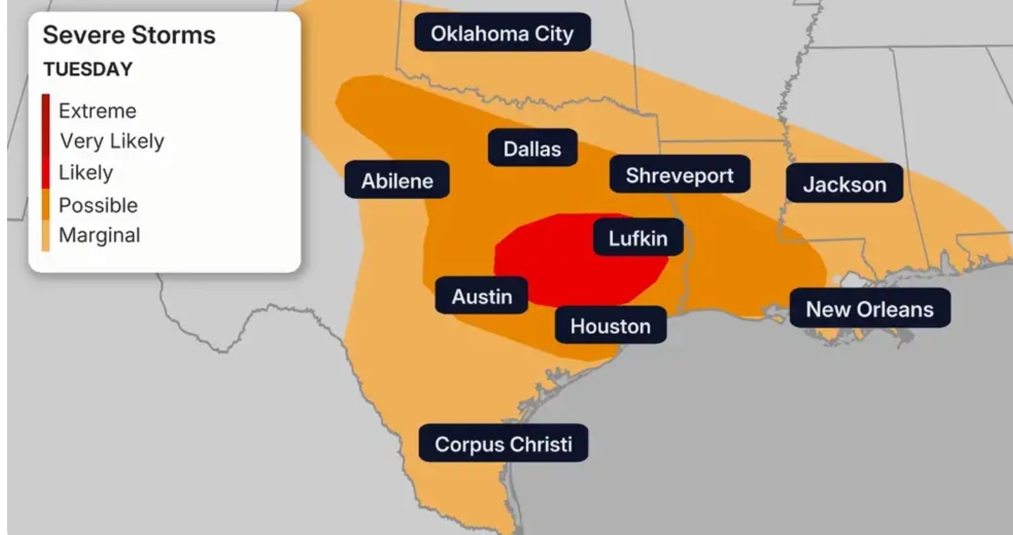
|
|
Jeff Lindner just posted this and he also agrees that the greatest severe threat will be north of metro Houston. How far north? Time will tell as the morning going on and models come more into agreement. ........ 5-6-25 Significant severe weather day north of I-10 with potential for all severe hazards including tornadoes. Risk Parameters N of I-10 today:
Tornado: 10-14% chances with 25 miles of a point (10% probability of EF2 or greater tornado) Damaging Winds: 15-30% chances with 25 miles of a point Large Hail: 15-30% chances with 25 miles of a point.
Timing: mid morning to late afternoon Heavy rainfall and flash flooding also possible north of HWY 105. Highest risk threat will generally be north of the Houston metro. Have ways to receive warnings. 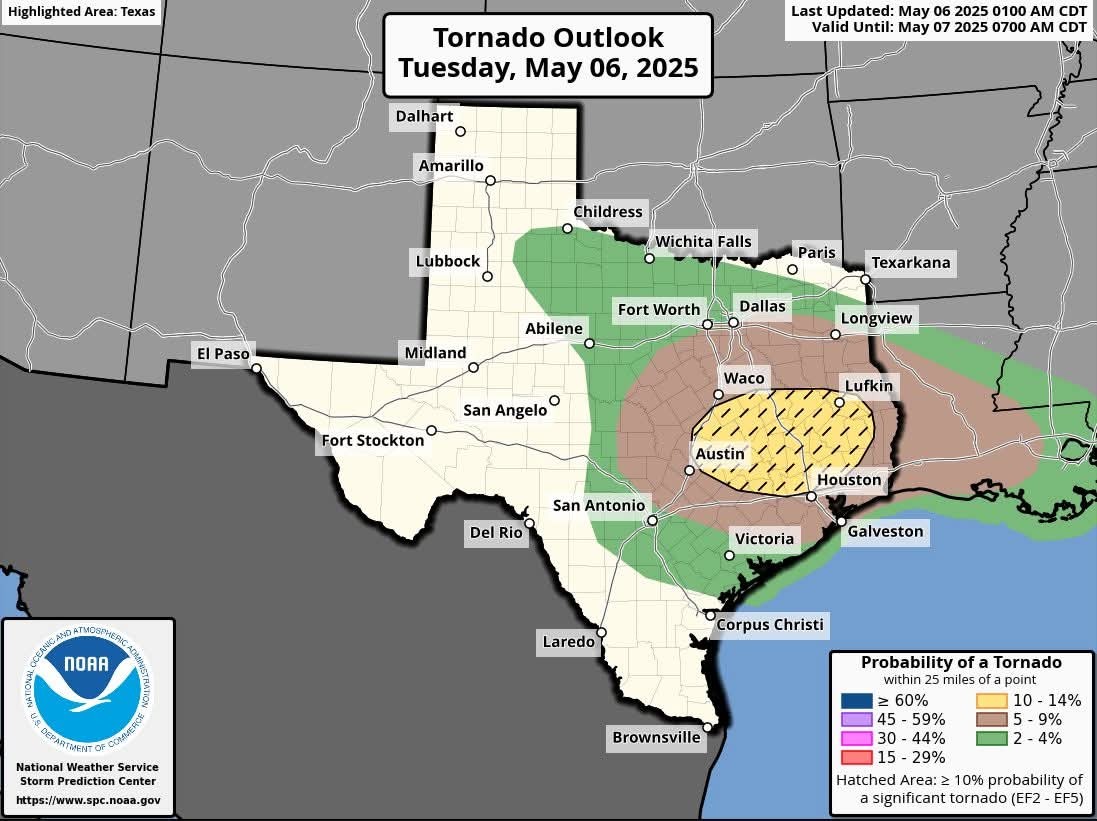
Tornado: 10-14% chances with 25 miles of a point (10% probability of EF2 or greater tornado)
Timing: mid morning to late afternoon
StormChaser : thank you for the information. I hope you're feeling better and are able to sneak in a nap today.
|
|
Space City Weather Waves of severe weather possible today and Wednesday, including tornadoes, in the Houston region Eric Berger · Tuesday, May 6, 2025 6:27 AM In brief:
*Today's post discusses our storm expectations for the next two days, with at least three distinct waves of severe weather possible for various parts of the Houston metro area.
*The bottom line is that it is important to remain weather aware through Wednesday. STORMY PATTERN ⚡️ *A sharp disturbance in the upper atmosphere will provide lift needed to support unsettled weather from today through Wednesday across the Houston region.
*Areas along and north of Interstate 10 will be most favored for severe storms today, but we cannot rule out strong thunderstorms anywhere in the region. *Among the risks we are tracking: ❇️ HEAVY RAINFALL with high rates. Most of the greater Houston area is likely to receive 1 to 2 inches of rain, but there will be greater totals in some locations, and rain will be falling quickly enough to back up streets. For this reason we have put a Stage 1 flood alert in place through Wednesday evening. ❇️ TORNADOES. The atmosphere, with plenty of instability as well as available energy (CAPE), will be capable of forming tornadoes. If they form, they could become fairly powerful tornadoes given the atmospheric conditions. ❇️ LARGE HAIL. With previous storms we have already seen quarter-sized hail of late, and the atmosphere will be capable of supporting more large hail over the next two days. ❇️ DAMAGING WINDS. Within stronger thunderstorms there will be the potential for damaging, straight-line winds. If possible, batten down loose outdoor items that don't have much heft. 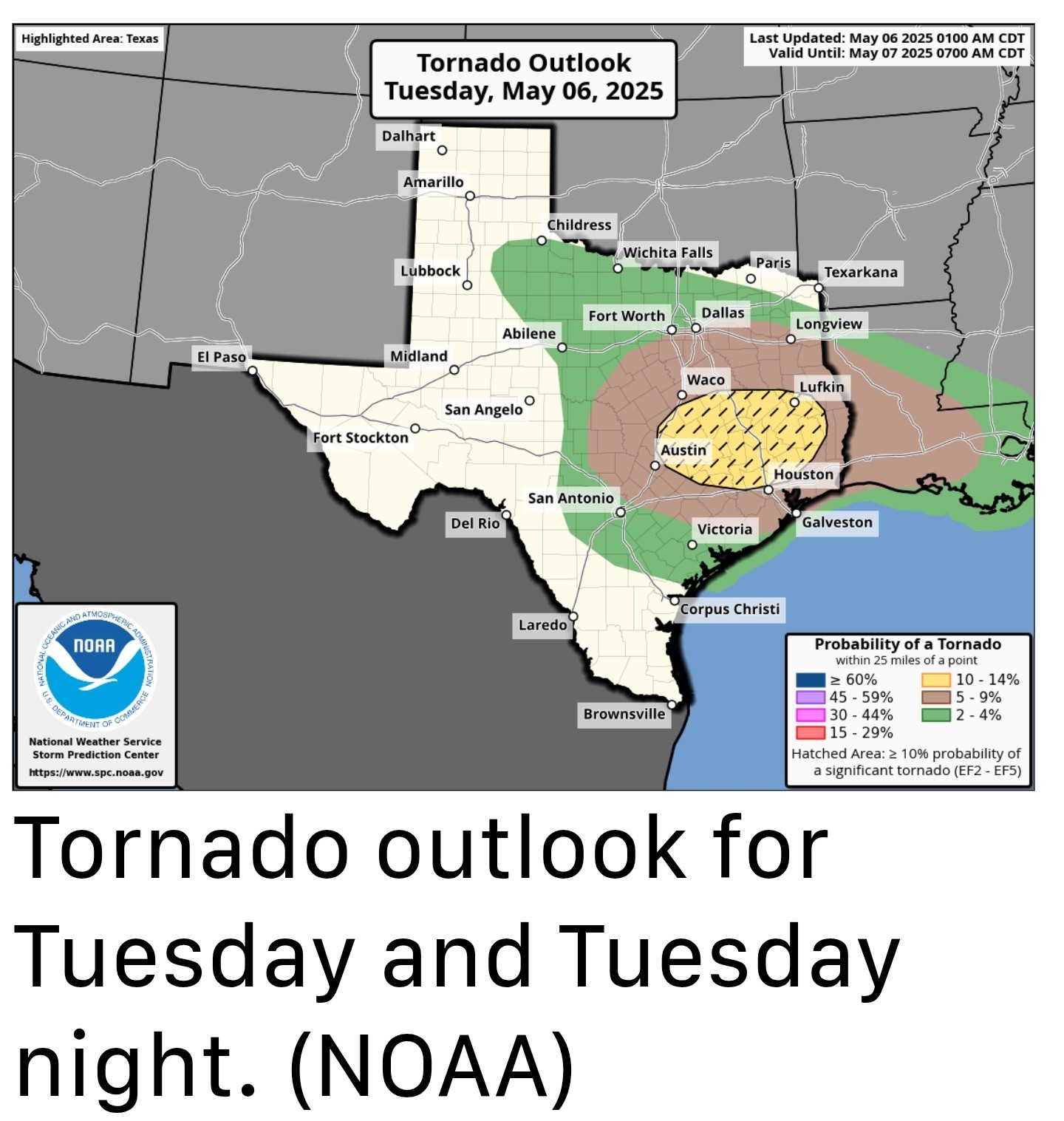 TIMING OF STORMS: *Your best weapon for timing storms over the next two days will be a good radar app (RadarScope is one we like) to determine conditions nearby your location.
*However, generally, we expect a fairly calm morning.
*After that we should see at least three waves of storms: ❇️ Round one:
*By late Tuesday morning a line of storms, very likely with severe storms embedded, will be nearing the College Station area.
*This line should move into Montgomery County and points north by around noon, affecting the I-45 corridor (I'm concerned about areas including The Woodlands, Conroe, and Huntsville).
*At this time, we think most of these storms will be along and north of Interstate 10, but again we cannot rule out impacts further south, and closer to the coast. ❇️ Round two:
*Conditions may then calm down for a few hours this afternoon and early evening.
*However, by around sunset, I expect another line of storms to approach the Houston region from the northwest.
*I expect these to advance into the Houston metro area between 8 pm and midnight, but they may peter out before reaching the coast. 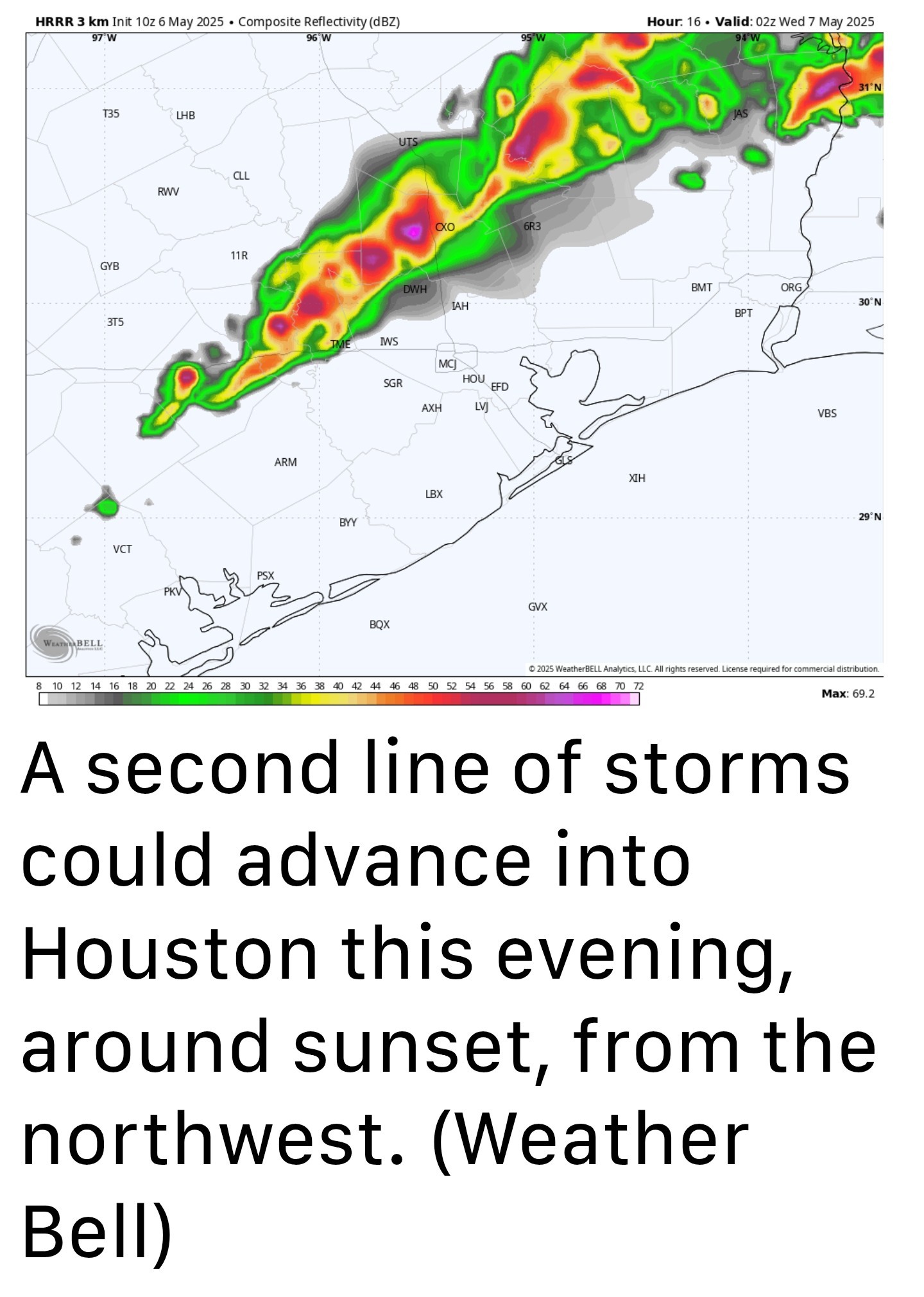 ❇️ Round three:
*If you live near the coast you may be wondering, are we not going to see anything from all of this mess?
*Well, it's possible that areas south of Interstate 10 will not see much action on Tuesday.
*However, most of our guidance shows another round of storms developing to the southwest of the region and advancing into the city.
*It appears as though these storms will reach the southern portion of the Houston metro area early on Wednesday morning, spreading into much of the metro area.
*Again, these storms also have the potential to produce severe weather and could make for a messy commute on Wednesday morning. After this, we may see additional rounds of development later on Wednesday, but nothing quite as severe. We shall see. TUES AND WED TEMPS: *Temperatures on both days should be in the low- to mid-80s, with partly to mostly cloudy skies.
*Even when there aren't storms, on Tuesday in particular, there will be a fairly pronounced southerly wind with gusts up to 25 mph or so.
*Nights will be warm. THURS AND FRI TEMPS: *Although likely not severe, the rains may linger into Thursday as a weak front pushes into the area.
*Expect partly sunny skies on Thursday, with highs in the mid-80s, and mostly sunny skies on Friday with a high of around 80 degrees.
*With slightly drier air, we should see nighttime temps drop into the 60s.
*Today's post discusses our storm expectations for the next two days, with at least three distinct waves of severe weather possible for various parts of the Houston metro area.
*The bottom line is that it is important to remain weather aware through Wednesday.
*Areas along and north of Interstate 10 will be most favored for severe storms today, but we cannot rule out strong thunderstorms anywhere in the region.
*However, generally, we expect a fairly calm morning.
*After that we should see at least three waves of storms:
*By late Tuesday morning a line of storms, very likely with severe storms embedded, will be nearing the College Station area.
*This line should move into Montgomery County and points north by around noon, affecting the I-45 corridor (I'm concerned about areas including The Woodlands, Conroe, and Huntsville).
*At this time, we think most of these storms will be along and north of Interstate 10, but again we cannot rule out impacts further south, and closer to the coast.
*Conditions may then calm down for a few hours this afternoon and early evening.
*However, by around sunset, I expect another line of storms to approach the Houston region from the northwest.
*I expect these to advance into the Houston metro area between 8 pm and midnight, but they may peter out before reaching the coast.
*If you live near the coast you may be wondering, are we not going to see anything from all of this mess?
*Well, it's possible that areas south of Interstate 10 will not see much action on Tuesday.
*However, most of our guidance shows another round of storms developing to the southwest of the region and advancing into the city.
*It appears as though these storms will reach the southern portion of the Houston metro area early on Wednesday morning, spreading into much of the metro area.
*Again, these storms also have the potential to produce severe weather and could make for a messy commute on Wednesday morning.
*Even when there aren't storms, on Tuesday in particular, there will be a fairly pronounced southerly wind with gusts up to 25 mph or so.
*Nights will be warm.
*Expect partly sunny skies on Thursday, with highs in the mid-80s, and mostly sunny skies on Friday with a high of around 80 degrees.
*With slightly drier air, we should see nighttime temps drop into the 60s.
I've gotta drive home from work on I-45 from Dallas to home today, leaving Dallas around 1PM. Looks like it's going to be an interesting ride. Dang.
Thank you for keeping us informed about these weather events. Your reports are very detailed moreso than regular weather newscaster. We appreciate your dedication to keeping us updated.
Weathergirl5 : Same! I feel like I have storm/street flooding PTSD from last year and the year before and the year before lol
StormChaser : Thank you! I'm wondering if I should work from home this afternoon.... I have "PTSD" from prior years getting stuck trying to get home from work. Everyone stay safe today!
|
|
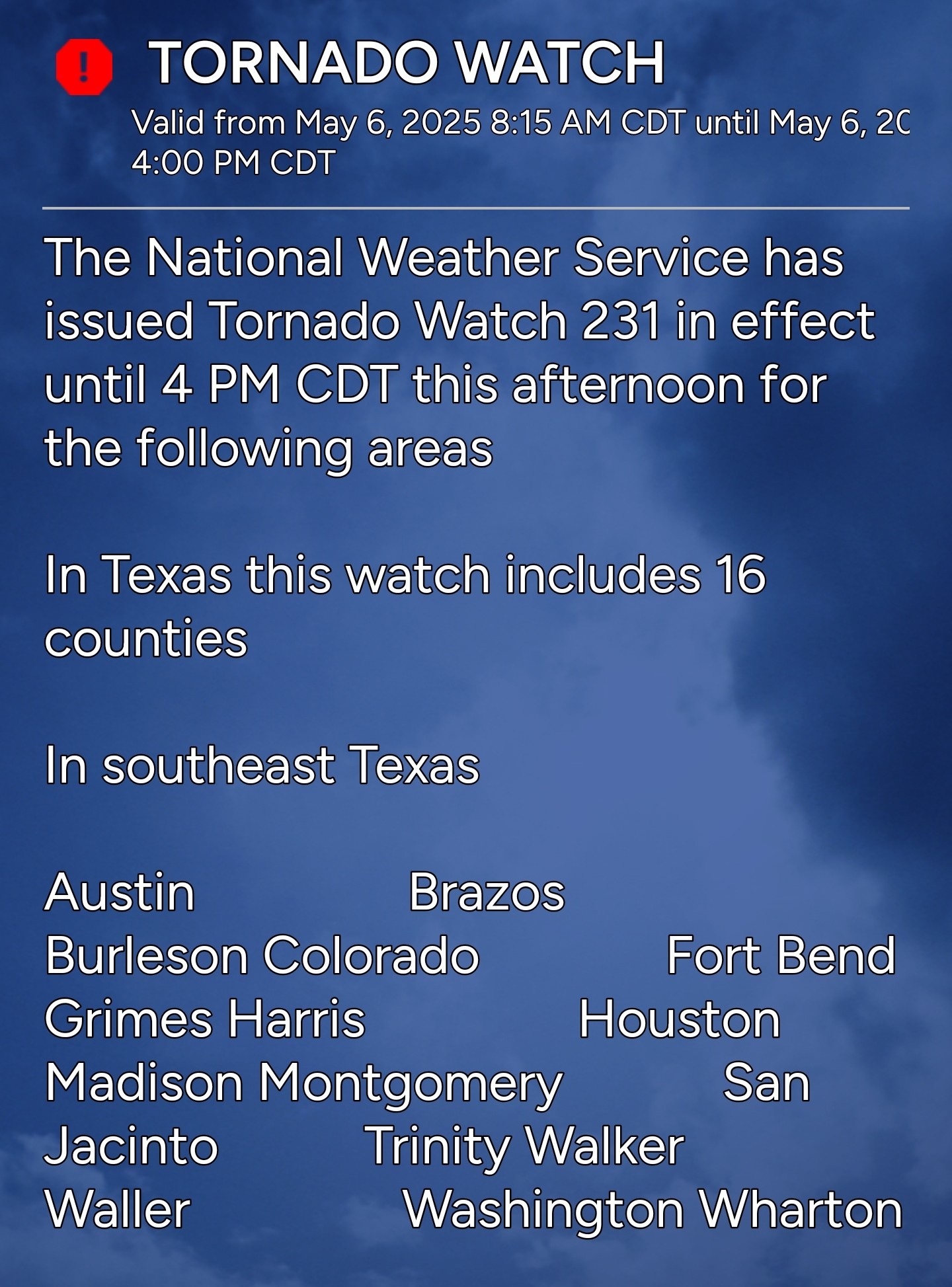
Tornado watch until 4pm, including Harris county. 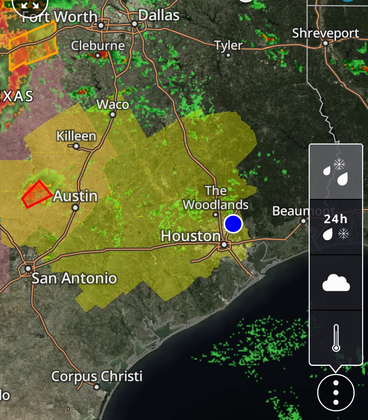
« Back to Chat
Views: 1,696
# Replies: 44